

Surf Forecasts:

Ikei Island surf forecast from 3 Aug 2026:
- Best quality surf: Thursday 6 Aug, 9AM (local time) - 16ft (5.0m), 18s period, E swell with cross-shore winds.
- Most powerful swell: Friday 7 Aug, 6PM (local time) - 39ft (12.0m), 13s period, NW swell with 50,119 kJ wave energy.
- Next surfable swell (1★+): Thursday 6 Aug, 9AM (local time) - 16ft (5.0m), 18s period with E swell.
Best Forecast Surf Conditions for Ikei Island this week:
The surf forecast for Ikei Island over the next 16 days: The first swell (rated 1 star or higher) is forecast to arrive on Thursday (Aug 06) at 9AM. The primary swell is predicted to be 5.0m and 18s period with a secondary swell of 2.3m and 7s. The wind is predicted to be cross-shore as the swell arrives.
The most powerful waves expected at Ikei Island in the next 16 days are 12.0m 13s and forecast to arrive on Friday (Aug 07) at 6PM. Winds are predicted to be cross-offshore at the time the swell arrives. The largest open ocean swell (not directed at the beach) is 14.0m 14s period and expected on Saturday (Aug 08) at 3PM.
| Wave Type | Time (JST) & Date | Wave Height & Period |
|---|---|---|
| Next good surf (1 star+) | 9AM (Thu 6th Aug) | 16ft (5.0m) 18s |
| Best Surf | 9AM (Thu 6th Aug) | 16ft (5.0m) 18s |
| Most Powerful | 6PM (Fri 7th Aug) | 39ft (12.0m) 13s |
Table - best surf conditions forecast for Ikei Island over the next 16 days.
The Lowdown
Alright folks, Rusty here. Let’s have a look at what’s coming up for Ikei Island. This is a reef break, fairly consistent, and it needs an east-northeast swell to really line up. The water is sitting at 86.7°, which is a touch warmer than normal for this time of year, so you’ll be comfortable in boardies or a light spring suit.
The first part of the week is a write-off, to be honest. Monday the 3rd and Tuesday the 4th have some swell, around 3.9ft to 5.9ft from the east, with a very long period of 15 to 17 seconds. That’s serious groundswell energy, but the wind is cross-on, making it choppy and messy. The combined energy is moderate to strong (655 to 1952), but the conditions just aren’t there for a good session.
Wednesday the 5th and the early part of Thursday the 6th get a lot bigger. We’re looking at 8.2ft to 16.4ft of east swell, with periods up to 18 seconds. The energy numbers are huge (4456 to 16486), but the wind is cross-shore and strong. For a reef setup, this is going to be a washing machine. The swell is too big for most, and the wind will ruin it. This is really only for experts, and even then, it’s going to be a battle. Honestly, with the wind and size, it’s looking more like a kiteboarding day than a paddling day.
Then we get a proper storm on Friday the 7th. The wind swings northwest and goes absolutely nuts – 56 mph to 71 mph, with storm force gusts. The swell jumps to 26.2ft to 36.1ft, with a period of 12 to 13 seconds, and the energy is off the charts (27910 to 47309). The wind is cross-offshore, so it’s clean, but the size is completely out of control for paddle surfing. This is a day to watch from the beach, if you can stand up.
The second week is a sad story. From Saturday the 8th all the way through to Tuesday the 18th, the surf is mostly tiny or non-existent. On Saturday the 8th, the swell drops to 2.0ft, and the wind goes light offshore, but the energy is weak (174). It’s surfable, but very ordinary. The only real highlight is Thursday the 13th. The swell is only 3.0ft, with a period of 12 seconds, and the energy is low (203), but the wind is completely glassy. That’s a rare window of clean, small waves. It’s not going to be a day of barrels, but if you’ve got a log or a funboard, you’ll have a peaceful session.
The rest of the second week is a mix of onshore wind and tiny swell, with energy readings under 400. It’s a long stretch of flat to poor conditions. The best call in the whole 16-day window is that Thursday the 13th. It’s the only true standout, and it’s only for the patient surfer with low expectations.
Stay safe, and don’t get caught out by that big storm.
Short Range ForecastModerate rain (total 19mm), heaviest on Mon night. Warm (max 31°C on Mon morning, min 28°C on Mon night). Winds increasing (light winds from the NE on Mon morning, fresh winds from the N by Wed night). | Days 4-6 Weather SummaryHeavy rain (total 506mm), heaviest during Sat night. Warm (max 30°C on Thu morning, min 28°C on Thu afternoon). Winds increasing (light winds from the NW on Fri night, extremely windy from the S by Sat night). | ||||||||||||||||||||
Monday 3 | Tuesday 4 | Wednesday 5 | Thursday 6 | Friday 7 | Saturday 8 | Sunday 9 | |||||||||||||||
AM | PM | Night | AM | PM | Night | AM | PM | Night | AM | PM | Night | AM | PM | Night | AM | PM | Night | AM | PM | Night | |
Swell Height Map |  |  |  | 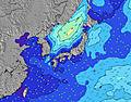 | 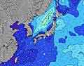 | 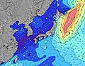 | 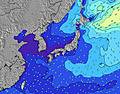 | ||||||||||||||
Wave Height (m) Direction Period (s) | E 15 | E 16 | E 16 | E 17 | E 17 | E 17 | E 18 | E 18 | E 18 | E 18 | E 18 | E 18 | NNW 12 | NNW 13 | NE 12 | ENE 14 | SSW 14 | SSW 14 | ENE 15 | E 14 | E 13 |
Wave Graph | |||||||||||||||||||||
648 | 843 | 1115 | 1722 | 1929 | 2879 | 4428 | 5172 | 11848 | 15908 | 16709 | 18619 | 17163 | 42263 | 850 | 134 | 0 | 0 | 42 | 34 | 168 | |
Wind (km/h) | |||||||||||||||||||||
Wind State on-shore cross-onshore cross-shore cross-offshore off-shore glassy | cross-on | cross-on | cross-on | cross-on | on | on | cross-on | cross-on | cross-on | cross | cross | cross | cross-off | cross-off | cross | off | cross-off | cross | cross-off | cross-off | cross-off |
High Tide | 9:10AM1.79m | 9:44PM1.81m | 9:55AM1.68m | 10:16PM1.79m | 10:50AM1.55m | 10:55PM1.75m | 12:06PM1.42m | 11:46PM1.70m | 1:55PM1.37m | 00:58AM1.67m | 3:47PM1.44m | 2:26AM1.69m | 4:59PM1.57m | ||||||||
Low Tide | 3:24PM0.43m | 3:53AM0.57m | 3:58PM0.58m | 4:42AM0.56m | 4:37PM0.75m | 5:43AM0.56m | 5:27PM0.93m | 7:01AM0.54m | 6:43PM1.08m | 8:32AM0.47m | 8:32PM1.14m | 9:52AM0.33m | 10:03PM1.09m | ||||||||
5:52 | — | — | 5:54 | — | — | 5:54 | — | — | 5:54 | — | — | 5:54 | — | — | 5:56 | — | — | 5:56 | — | — | |
— | 7:14 | — | — | 7:13 | — | — | 7:13 | — | — | 7:12 | — | — | 7:10 | — | — | 7:09 | — | — | 7:09 | — | |
mm | — | — | 6 | 4 | 3 | 2 | 2 | 2 | — | 1 | 3 | 15 | 60 | 142 | 23 | 2 | 5 | 255 | 147 | 48 | 13 |
Temp °C | 31 | 31 | 28 | 31 | 30 | 29 | 30 | 30 | 29 | 30 | 30 | 28 | 29 | 29 | 29 | 30 | 30 | 29 | 28 | 28 | 30 |
Feels °C | 34 | 34 | 31 | 34 | 33 | 32 | 32 | 31 | 31 | 28 | 28 | 24 | 20 | 16 | 20 | 35 | 29 | 16 | 9 | 15 | 23 |
Swell 1 Height (m) Direction Period (s) | E 15 | E 16 | E 16 | E 17 | E 17 | E 17 | E 18 | E 18 | E 18 | E 18 | E 18 | E 18 | ENE 17 | NE 14 | ENE 12 | ENE 14 | — | — | WSW 15 | WSW 15 | W 15 |
648 | 843 | 1115 | 1722 | 1929 | 2879 | 4428 | 5172 | 11848 | 15908 | 16709 | 18619 | 10747 | 5046 | 426 | 40 | — | — | 12634 | 9697 | 6271 | |
Swell 2 Height (m) Direction Period (s) | SSE 7 | SSE 7 | S 7 | SSE 8 | SE 8 | SE 8 | SSE 8 | S 7 | — | — | — | — | — | — | NE 12 | ENE 14 | — | — | ENE 15 | ENE 10 | E 13 |
5 | 10 | 8 | 20 | 23 | 20 | 32 | 17 | — | — | — | — | — | — | 850 | 134 | — | — | 42 | 33 | 168 | |
Swell 3 Height (m) Direction Period (s) | ESE 9 | ESE 8 | SE 8 | SE 10 | — | — | — | — | — | — | — | — | — | — | NE 16 | — | — | — | ENE 15 | E 14 | ENE 10 |
7 | 7 | 11 | 4 | — | — | — | — | — | — | — | — | — | — | 118 | — | — | — | 42 | 34 | 77 | |
Wind waves Height (m) Direction Period (s) | W 7 | W 7 | N 4 | — | — | — | SE 8 | NE 6 | — | N 7 | N 8 | N 10 | NNW 12 | NNW 13 | WNW 12 | SW 12 | SSW 14 | SSW 14 | S 12 | S 12 | S 12 |
1 | 1 | 10 | — | — | — | 28 | 92 | — | 578 | 1159 | 3753 | 17163 | 42263 | 26652 | 35888 | 73836 | 50917 | 15023 | 8567 | 8719 | |
Nearest Offshore or Glassy | |||||||||||||||||||||
Distance (km) | 17 | 17 | 627 | 24 | 24 | 23 | 24 | 635 | 635 | 1340 | 758 | 635 | 817 | 787 | 758 | 0 | 758 | 758 | 1195 | 758 | 758 |
Best forecast wave conditions in Okinawa | |||||||||||||||||||||
Best forecast wave conditions in Japan | |||||||||||||||||||||
Header Global | |||||||||||||||||||||
- Map Icons:
 Break
Break Live Wave Height (m)
 Live Wind Speed (km/h)
 Surf Rating (10 Max)
 Ocean Swells (m)
- Wind Speed (km/h)
Latest Updates


FREE! Surf-Forecast.com widget for your website
The surf report / weather widget below is available to embed on third party websites free of charge and provides a summary of our Ikei Island surf forecast. Simply grab the html code snippet that we provide and paste it into your own site. You can choose your preferred language and metric/imperial units for the surf forecast feed to suit users of your site. Click here to get the code.
Information about the Ikei Island Surf forecast
The above surf forecast table for Ikei Island provides essential information for determining whether the surfing conditions will be good over the next 16 days. A general guide to surfing at Ikei Island can be found by selecting the local surf guide option on the grey menu. Our Ikei Island surf forecast is unique since it includes wave energy (power) that defines the real feel of the surf rather than just the height or the period. If you surf the same spot (Ikei Island) regularly then make a mental note of the wave energy from the surf forecast table each time you go. Very soon you may start to choose your surf days based on the wave energy alone combined with our forecast of favourable offshore wind conditions. Our star ratings will help here and of course you will also find the usual wave height and period predictions on our surf forecasts as well as a full break down of the swell components under our advanced users option (to reveal that, click the little Einstein character under the tide times).
Further information to help with frequently asked questions about our surf forecast for Ikei Island may be found under the help tab on the top menu and also by moving your mouse over the question marks on the surf forecast table itself. Please always bear in mind that the forecast is for near-shore open water and local factors at each surf break influence the actual breaking wave height, such as the beach / reef profile, water depths offshore and shelter.
Ikei Island is 14 km (9 miles) from Gushikawa. If you plan a holiday in Okinawa, look for hotels and other accommodation in Gushikawa. Gushikawa has rooms for a wide range of budgets as well as car hire and transport links.
 Nearest