

Surf Forecasts:

4 Mile Beach and Point surf forecast from 30 Jul 2026:
- Best quality surf: Wednesday 5 Aug, 10PM (local time) - 4.5ft (1.4m), 8s period, S swell with cross-offshore winds.
- Most powerful swell: Wednesday 5 Aug, 7AM (local time) - 6.5ft (2.0m), 8s period, S swell with 559 kJ wave energy.
- Next surfable swell (1★+): Friday 31 Jul, 10AM (local time) - 3.5ft (1.1m), 8s period with SSE swell.
Best Forecast Surf Conditions for 4 Mile Beach and Point this week:
The surf forecast for 4 Mile Beach and Point over the next 16 days: The first swell (rated 1 star or higher) is forecast to arrive on Friday (Jul 31) at 10AM. The primary swell is predicted to be 1.1m and 8s period with a secondary swell of 0.4m and 13s. The wind is predicted to be offshore as the swell arrives.
The most powerful waves expected at 4 Mile Beach and Point in the next 16 days are 2.0m 8s and forecast to arrive on Wednesday (Aug 05) at 7AM. Winds are predicted to be cross-shore at the time the swell arrives. The largest open ocean swell (not directed at the beach) is 1.1m 4s period and expected on Tuesday (Aug 04) at 10AM.
| Wave Type | Time (AEST) & Date | Wave Height & Period |
|---|---|---|
| Next good surf (1 star+) | 10AM (Fri 31st Jul) | 3.5ft (1.1m) 8s |
| Best Surf | 10PM (Wed 5th Aug) | 4.5ft (1.4m) 8s |
| Most Powerful | 7AM (Wed 5th Aug) | 6.5ft (2.0m) 8s |
Table - best surf conditions forecast for 4 Mile Beach and Point over the next 16 days.
The Lowdown
G’day, Rusty here. We’ve got a 16-day window for 4 Mile Beach and Point, and honestly, we’re looking at a bit of a slow start with a few standouts sprinkled through. The water’s sitting at 58°F right now, a touch warmer than normal for this time of year, so you won’t need a full winter wetsuit if you’ve got a spring suit handy.
Friday morning, 31 July, is where it kicks off. This spot is a beach, reef, and point setup, exposed to the east, and we’ve got a clean 4ft swell rolling in from the SSE with an 8-second period. The wind’s light offshore from the west, glassy conditions, and the combined energy is a solid moderate 205 – it’s a nice little session to ease into the weekend. Crowds are a possibility here, so get in early.
Saturday morning, 1 August, is the first real standout. Swell bumps up a touch to 4ft from the SE, but the period jumps to 12 seconds – that’s proper groundswell energy. Winds are light offshore from the WNW, keeping it clean, and the combined energy hits 302. This is going to give you some decent shape, especially on the point, with longer waits between sets. It’s still a friendly size for intermediates.
Sunday morning, 2 August, drops off a bit with 3ft from the SE and a 12-second period, but it’s clean with cross-offshore winds. The energy is moderate at 219, so it’s worth a paddle if you’re keen for a mellow session.
Now, we hit a rough patch from Monday, 3 August, through to Wednesday, 5 August. The swell gets small, the wind turns messy, and there’s even light rain. Tuesday afternoon, 4 August, sees a jump to 6ft from the south, but the period is a short 6 seconds and the wind is cross-shore – it’s a bit of a chop fest. Wednesday morning, 5 August, pushes 7ft from the south with 8-second period, but again, cross-wind and light rain. This is more kite-surfing territory than paddle surfing, if you ask me.
Thursday morning, 6 August, is a breath of fresh air. We’ve got 4ft from the SE, 8-second period, and the wind drops to glassy from the WSW. Combined energy is 200, and it’s clean. That’s a solid session for those who can wait it out.
Friday morning, 7 August, is glassy again with clean 3ft from the ESE, but it’s ordinary – small and a bit weak. Saturday, 8 August, stays small with a 4ft northerly swell, but the period is a short 5 seconds, so it’s not doing much.
Sunday, 9 August, sees a pulse: 6ft from the north with a 6-second period, clean in the morning with cross-offshore wind. The energy is moderate at 270. It’s a bit raw for beginners, but still workable for intermediates. The afternoon gets a bit messier with 7ft.
Monday, 10 August, and Tuesday, 11 August, are mostly a write-off – small, crossed-up, or windy. Wednesday, 12 August, is a nice surprise: morning brings 4ft from the south with an 8-second period, clean cross-offshore wind, and energy at 317 – that’s a good one. The afternoon goes glassy with 3ft from the east and a 12-second period, energy at 247 – smooth, long-period lines. Thursday, 13 August, keeps it clean with 3ft from the east, 12-second period, and gentle offshore wind in the afternoon.
Friday, 14 August, and Saturday, 15 August, fade out. Small, weak, and not worth the drive. The best on offer is Saturday morning, 1 August, and Wednesday morning, 12 August – both have clean conditions, decent groundswell, and solid energy.
Rusty.
Short Range ForecastMostly dry. Very mild (max 16°C on Sun morning, min 5°C on Sat night). Wind will be generally light. | Days 4-6 Weather SummaryHeavy rain (total 34mm), heaviest during Mon night. Very mild (max 15°C on Mon morning, min 8°C on Tue afternoon). Wind will be generally light. | ||||||||||||||||||||
Friday 31 | Saturday 1 | Sunday 2 | Monday 3 | Tuesday 4 | Wednesday 5 | Thursday 6 | |||||||||||||||
AM | PM | Night | AM | PM | Night | AM | PM | Night | AM | PM | Night | AM | PM | Night | AM | PM | Night | AM | PM | Night | |
Swell Height Map |  |  |  | 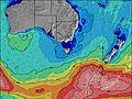 | 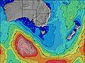 | 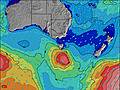 | 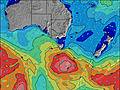 | ||||||||||||||
Wave Height (m) Direction Period (s) | SSE 8 | SSE 7 | SE 11 | SE 12 | SE 12 | SE 12 | SE 12 | SE 11 | NNE 7 | NE 7 | NNE 7 | NNE 7 | NNE 7 | S 6 | S 8 | S 8 | SSE 8 | SSE 8 | SE 8 | ESE 8 | ESE 8 |
Wave Graph | |||||||||||||||||||||
151 | 76 | 233 | 293 | 303 | 272 | 158 | 99 | 41 | 44 | 62 | 62 | 33 | 228 | 374 | 513 | 393 | 261 | 169 | 162 | 120 | |
Wind (km/h) | |||||||||||||||||||||
Wind State on-shore cross-onshore cross-shore cross-offshore off-shore glassy | off | cross-on | off | off | cross-off | cross-off | cross-off | cross-off | off | glassy | on | cross | on | cross | cross-off | cross | cross | cross-off | glassy | cross | cross-off |
High Tide | 9:05PM1.24m | 10:28AM0.94m | 9:47PM1.19m | 11:04AM0.99m | 10:32PM1.13m | 11:41AM1.04m | 11:23PM1.06m | 12:20PM1.09m | 00:23AM0.98m | 1:04PM1.15m | 1:33AM0.92m | 1:53PM1.21m | 2:50AM0.88m | ||||||||
Low Tide | 2:52PM0.55m | 4:06AM0.18m | 3:40PM0.53m | 4:39AM0.21m | 4:32PM0.52m | 5:13AM0.25m | 5:29PM0.49m | 5:50AM0.30m | 6:32PM0.44m | 6:30AM0.36m | 7:38PM0.38m | 7:16AM0.42m | 8:47PM0.30m | ||||||||
7:16 | — | — | 7:16 | — | — | 7:15 | — | — | 7:13 | — | — | 7:11 | — | — | 7:11 | — | — | 7:09 | — | — | |
— | 5:08 | — | — | 5:09 | — | — | 5:10 | — | — | 5:12 | — | — | 5:13 | — | — | 5:14 | — | — | 5:15 | — | |
mm | — | — | — | — | — | — | — | — | — | — | 1 | 24 | 3 | — | 1 | 2 | 2 | 1 | — | — | — |
Temp °C | 14 | 13 | 8 | 15 | 14 | 7 | 16 | 14 | 7 | 15 | 14 | 11 | 12 | 12 | 12 | 12 | 12 | 11 | 16 | 14 | 9 |
Feels °C | 11 | 10 | 5 | 12 | 11 | 4 | 11 | 10 | 4 | 12 | 11 | 6 | 10 | 10 | 9 | 9 | 10 | 9 | 14 | 11 | 7 |
Swell 1 Height (m) Direction Period (s) | SSE 8 | SSE 7 | SE 11 | SE 12 | SE 12 | SE 12 | SE 12 | SE 11 | NNE 7 | NE 7 | NNE 7 | NNE 7 | NNE 7 | NNE 7 | NE 7 | ENE 14 | ENE 13 | SSE 8 | SE 8 | ESE 8 | ESE 8 |
151 | 76 | 233 | 293 | 303 | 272 | 158 | 99 | 41 | 44 | 62 | 62 | 33 | 19 | 7 | 18 | 18 | 261 | 169 | 162 | 120 | |
Swell 2 Height (m) Direction Period (s) | SE 13 | SE 9 | N 3 | S 12 | SSE 17 | SSE 18 | SSE 17 | SSE 16 | SE 11 | SE 11 | SE 10 | SE 13 | ESE 5 | SE 13 | ENE 15 | NE 7 | NE 7 | ENE 13 | SSE 8 | SSE 8 | SSE 8 |
44 | 36 | 1 | 3 | 29 | 60 | 55 | 52 | 40 | 18 | 17 | 27 | 5 | 7 | 21 | 2 | 2 | 17 | 24 | 24 | 13 | |
Swell 3 Height (m) Direction Period (s) | SSE 10 | ESE 13 | S 12 | S 18 | S 13 | NE 19 | E 18 | E 18 | SE 12 | SE 14 | ESE 14 | E 5 | ESE 13 | ENE 15 | SE 13 | NE 10 | S 19 | NE 10 | NE 13 | NE 12 | S 18 |
10 | 17 | 3 | 6 | 13 | 14 | 6 | 6 | 40 | 31 | 18 | 2 | 17 | 21 | 6 | 4 | 7 | 4 | 7 | 6 | 6 | |
Wind waves Height (m) Direction Period (s) | — | N 2 | NNW 3 | NNW 3 | NNW 4 | NNW 4 | NNW 4 | N 4 | NW 3 | — | — | SSW 3 | S 4 | S 6 | S 8 | S 8 | SSE 8 | — | — | — | — |
— | 1 | 1 | 1 | 10 | 21 | 21 | 21 | 2 | — | — | 4 | 44 | 228 | 374 | 513 | 393 | — | — | — | — | |
Nearest Offshore or Glassy | |||||||||||||||||||||
Distance (km) | 80 | 80 | 80 | 65 | 35 | 35 | 35 | 141 | 35 | 80 | 80 | 261 | 261 | 493 | 261 | 164 | 65 | 65 | 35 | 80 | 35 |
Best forecast wave conditions in East Coast of Tasmania | |||||||||||||||||||||
Best forecast wave conditions in Australia | |||||||||||||||||||||
Header Global | |||||||||||||||||||||
- Map Icons:
 Break
Break Live Wave Height (m)
 Live Wind Speed (km/h)
 Surf Rating (10 Max)
 Ocean Swells (m)
- Wind Speed (km/h)
Latest Updates


FREE! Surf-Forecast.com widget for your website
The surf report / weather widget below is available to embed on third party websites free of charge and provides a summary of our 4 Mile Beach and Point surf forecast. Simply grab the html code snippet that we provide and paste it into your own site. You can choose your preferred language and metric/imperial units for the surf forecast feed to suit users of your site. Click here to get the code.
Information about the 4 Mile Beach and Point Surf forecast
The above surf forecast table for 4 Mile Beach and Point provides essential information for determining whether the surfing conditions will be good over the next 16 days. A general guide to surfing at 4 Mile Beach and Point can be found by selecting the local surf guide option on the grey menu. Our 4 Mile Beach and Point surf forecast is unique since it includes wave energy (power) that defines the real feel of the surf rather than just the height or the period. If you surf the same spot (4 Mile Beach and Point) regularly then make a mental note of the wave energy from the surf forecast table each time you go. Very soon you may start to choose your surf days based on the wave energy alone combined with our forecast of favourable offshore wind conditions. Our star ratings will help here and of course you will also find the usual wave height and period predictions on our surf forecasts as well as a full break down of the swell components under our advanced users option (to reveal that, click the little Einstein character under the tide times).
Further information to help with frequently asked questions about our surf forecast for 4 Mile Beach and Point may be found under the help tab on the top menu and also by moving your mouse over the question marks on the surf forecast table itself. Please always bear in mind that the forecast is for near-shore open water and local factors at each surf break influence the actual breaking wave height, such as the beach / reef profile, water depths offshore and shelter.
Are you planning a holiday in East Coast of Tasmania? If you are looking for accommodation near 4 Mile Beach and Point, camping, hotels and holiday cottages in East Coast of Tasmania, consider staying in Launceston which is 96 km (60 miles) away.
 Nearest