

Surf Forecasts:

1st Street Jetty surf forecast from 26 Jul 2026:
- Best quality surf: Sunday 26 Jul, 5AM (local time) - 1.5ft (0.5m), 8s period, ESE swell with cross-offshore winds.
- Most powerful swell: Monday 27 Jul, 5PM (local time) - 3ft (0.9m), 7s period, SE swell with 79 kJ wave energy.
- Next surfable swell (1★+): Sunday 26 Jul, 5AM (local time) - 1.5ft (0.5m), 8s period with ESE swell.
Best Forecast Surf Conditions for 1st Street Jetty this week:
The surf forecast for 1st Street Jetty over the next 16 days: The first swell (rated 1 star or higher) is forecast to arrive on Sunday (Jul 26) at 5AM. The primary swell is predicted to be 0.5m and 8s period with a secondary swell of 0.5m and 5s. The wind is predicted to be cross-offshore as the swell arrives.
The most powerful waves expected at 1st Street Jetty in the next 16 days are 0.9m 7s and forecast to arrive on Monday (Jul 27) at 5PM. Winds are predicted to be cross-onshore at the time the swell arrives. The largest open ocean swell (not directed at the beach) is 0.7m 4s period and expected on Tuesday (Jul 28) at 5PM.
| Wave Type | Time (EDT) & Date | Wave Height & Period |
|---|---|---|
| Next good surf (1 star+) | 5AM (Sun 26th Jul) | 1.5ft (0.5m) 8s |
| Best Surf | 5AM (Sun 26th Jul) | 1.5ft (0.5m) 8s |
| Most Powerful | 5PM (Mon 27th Jul) | 3ft (0.9m) 7s |
Table - best surf conditions forecast for 1st Street Jetty over the next 16 days.
The Lowdown
Alright, this is Rusty, and I’ve got the lowdown on the local surf for the next couple of weeks. Let’s be real with you.
Right off the bat, I’ve got to be honest: the 16-day window is looking pretty grim for 1st Street Jetty. There’s a long, dry spell starting now. We’re talking about a stretch of nearly two weeks where the surf is basically a no-go. The first hint of anything even remotely surfable doesn’t pop up until the morning of Friday, July 31st, and even then, it’s weak.
The whole setup here is a beach and jetty deal, exposed to the ESE. The swell is coming in from that direction, but it’s tiny—just 2ft to 3ft most days, with a short, weak period of 6-8 seconds. The combined energy is laughable, mostly under 100, which is weak. There’s a slight bump on Monday the 10th of August with a 5ft swell from the east and a combined energy of 200 (moderate), but the wind is cross-onshore and the whole thing is still flagged as "poor surf conditions." That’s a hard pass.
The real standout, if you can even call it that, is the morning of Friday, July 31st. The wind is light and cross-offshore from the NNW, which is clean. The swell is 2ft from the NE with a period of 7 seconds, and the combined energy is only 65 (weak). The report says "surfable waves but very ordinary conditions" and scores a 1. It’s ankle-to-knee high, clean, but don’t expect any power. For a beginner, this is your best bet in the whole window. The water temp is about average for the time of year, so nothing weird there.
The next morning, Saturday, August 1st, also has a clean window with a light cross-offshore SSW wind and 2ft from the SE, but it’s just as weak. After that, it’s back to the doldrums with onshore winds and chop.
Look, this is a stretch where the surf is just not cooperating. The forecasts can change, but right now, you’re better off going for a paddle or a swim. There’s nothing here to get excited about for a surfer.
Rusty
Short Range ForecastModerate rain (total 12mm), heaviest on Mon afternoon. Warm (max 29°C on Tue afternoon, min 21°C on Sat night). Wind will be generally light. | Days 5-7 Weather SummaryModerate rain (total 16mm), heaviest on Tue night. Warm (max 28°C on Wed afternoon, min 22°C on Tue night). Wind will be generally light. | ||||||||||||||||||
Sunday 26 | Monday 27 | Tuesday 28 | Wednesday 29 | Thursday 30 | Friday 31 | ||||||||||||||
Night | AM | PM | Night | AM | PM | Night | AM | PM | Night | AM | PM | Night | AM | PM | Night | AM | PM | Night | |
Swell Height Map |  | 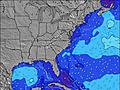 | 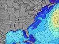 | 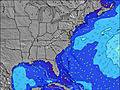 | 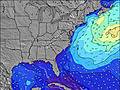 | 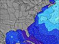 | 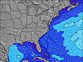 | ||||||||||||
Wave Height (m) Direction Period (s) | E 7 | ESE 8 | ESE 8 | ESE 8 | ESE 8 | SE 7 | ESE 8 | ESE 8 | ESE 8 | SSE 6 | SE 7 | SE 7 | SE 8 | SE 8 | SE 8 | NE 7 | NE 7 | ENE 7 | NE 7 |
Wave Graph | |||||||||||||||||||
53 | 35 | 35 | 23 | 22 | 79 | 19 | 21 | 21 | 55 | 54 | 25 | 36 | 38 | 40 | 65 | 44 | 34 | 23 | |
Wind (km/h) | |||||||||||||||||||
Wind State on-shore cross-onshore cross-shore cross-offshore off-shore glassy | cross | cross | on | cross | cross | cross-on | cross-off | cross | cross-off | cross-off | cross-off | cross | off | cross-off | cross | off | cross-off | on | cross-off |
High Tide | 6:19AM0.80m | 6:43PM1.12m | 7:08AM0.84m | 7:25PM1.15m | 7:50AM0.88m | 8:03PM1.18m | 8:27AM0.93m | 8:38PM1.20m | 9:02AM0.97m | 9:13PM1.19m | 9:39AM1.01m | 9:49PM1.17m | |||||||
Low Tide | 00:37AM0.21m | 12:01PM0.20m | 1:21AM0.17m | 12:52PM0.18m | 1:57AM0.13m | 1:36PM0.15m | 2:28AM0.09m | 2:14PM0.13m | 2:58AM0.06m | 2:51PM0.12m | 3:29AM0.04m | 3:30PM0.12m | 4:04AM0.03m | ||||||
— | 6:03 | — | — | 6:05 | — | — | 6:05 | — | — | 6:05 | — | — | 6:07 | — | — | 6:07 | — | — | |
8:15 | — | 8:15 | — | — | 8:15 | — | — | 8:14 | — | — | 8:13 | — | — | 8:12 | — | — | 8:10 | — | |
mm | — | — | — | — | — | 6 | 4 | — | 2 | 16 | — | — | — | — | — | — | — | — | — |
Temp °C | 22 | 23 | 24 | 23 | 24 | 26 | 25 | 26 | 29 | 24 | 25 | 28 | 26 | 24 | 27 | 26 | 26 | 28 | 26 |
Feels °C | 24 | 23 | 23 | 22 | 25 | 27 | 27 | 28 | 30 | 25 | 25 | 29 | 28 | 24 | 26 | 27 | 27 | 27 | 27 |
Swell 1 Height (m) Direction Period (s) | E 7 | ESE 8 | ESE 8 | ESE 8 | ESE 8 | NE 6 | ESE 8 | ESE 8 | ESE 8 | SSE 6 | SE 7 | SE 7 | SE 8 | SE 8 | SE 8 | NE 7 | NE 7 | ENE 7 | NE 7 |
53 | 35 | 35 | 23 | 22 | 9 | 19 | 21 | 21 | 55 | 54 | 25 | 36 | 38 | 40 | 65 | 44 | 34 | 23 | |
Swell 2 Height (m) Direction Period (s) | ENE 5 | — | NE 5 | ENE 6 | ENE 6 | NE 6 | NE 6 | ENE 6 | ENE 6 | NE 6 | E 9 | ENE 9 | NE 5 | NE 7 | SSE 7 | SE 8 | SE 8 | SE 7 | SE 8 |
18 | — | 14 | 12 | 13 | 18 | 9 | 3 | 3 | 1 | 6 | 8 | 10 | 16 | 21 | 23 | 21 | 19 | 16 | |
Swell 3 Height (m) Direction Period (s) | — | — | — | — | — | — | S 6 | — | — | — | NE 6 | E 6 | E 9 | W 3 | — | SE 8 | — | E 9 | — |
— | — | — | — | — | — | 1 | — | — | — | 1 | 1 | 2 | 1 | — | 24 | — | 2 | — | |
Wind waves Height (m) Direction Period (s) | — | NE 6 | — | — | — | SE 7 | S 4 | S 3 | S 4 | SW 4 | N 3 | N 4 | — | — | NE 7 | — | — | SE 3 | SE 4 |
— | 15 | — | — | — | 79 | 10 | 5 | 13 | 7 | 8 | 7 | — | — | 28 | — | — | 2 | 3 | |
Nearest Offshore or Glassy | |||||||||||||||||||
Distance (km) | 178 | 243 | 178 | 79 | 637 | 1244 | 136 | 723 | 1261 | 2 | 243 | 243 | 2 | 136 | 215 | 2 | 2 | 174 | 2 |
Best forecast wave conditions in Virginia | |||||||||||||||||||
Best forecast wave conditions in United States | |||||||||||||||||||
Header Global | |||||||||||||||||||
- Map Icons:
 Break
Break Live Wave Height (m)
 Live Wind Speed (km/h)
 Surf Rating (10 Max)
 Ocean Swells (m)
- Wind Speed (km/h)


FREE! Surf-Forecast.com widget for your website
The surf report / weather widget below is available to embed on third party websites free of charge and provides a summary of our 1st Street Jetty surf forecast. Simply grab the html code snippet that we provide and paste it into your own site. You can choose your preferred language and metric/imperial units for the surf forecast feed to suit users of your site. Click here to get the code.
Information about the 1st Street Jetty Surf forecast
The above surf forecast table for 1st Street Jetty provides essential information for determining whether the surfing conditions will be good over the next 16 days. A general guide to surfing at 1st Street Jetty can be found by selecting the local surf guide option on the grey menu. Our 1st Street Jetty surf forecast is unique since it includes wave energy (power) that defines the real feel of the surf rather than just the height or the period. If you surf the same spot (1st Street Jetty) regularly then make a mental note of the wave energy from the surf forecast table each time you go. Very soon you may start to choose your surf days based on the wave energy alone combined with our forecast of favourable offshore wind conditions. Our star ratings will help here and of course you will also find the usual wave height and period predictions on our surf forecasts as well as a full break down of the swell components under our advanced users option (to reveal that, click the little Einstein character under the tide times).
Further information to help with frequently asked questions about our surf forecast for 1st Street Jetty may be found under the help tab on the top menu and also by moving your mouse over the question marks on the surf forecast table itself. Please always bear in mind that the forecast is for near-shore open water and local factors at each surf break influence the actual breaking wave height, such as the beach / reef profile, water depths offshore and shelter.
1st Street Jetty is 6 km (4 miles) from the city of Virginia Beach. If you plan a vacation in Virginia, look for hotels and other accommodation in Virginia Beach. Virginia Beach has rooms for a wide range of budgets as well as car hire and transport links.
 Nearest