

Surf Forecasts:

Crystal Beach surf forecast from 3 Aug 2026:
- Most powerful swell: Thursday 6 Aug, 8AM (local time) - 0.5ft (0.2m), 2s period, SSW swell with 1 kJ wave energy.
Best Forecast Surf Conditions for Crystal Beach this week:
The most powerful waves expected at Crystal Beach in the next 16 days are 0.2m 2s and forecast to arrive on Thursday (Aug 06) at 8AM. Winds are predicted to be cross-onshore at the time the swell arrives. The largest open ocean swell (not directed at the beach) is 1.0m 5s period and expected on Monday (Aug 03) at 2AM.
| Wave Type | Time (EDT) & Date | Wave Height & Period |
|---|---|---|
| Next good surf (1 star+) | - | - |
| Best Surf | - | - |
| Most Powerful | 8AM (Thu 6th Aug) | 0.5ft (0.2m) 2s |
Table - best surf conditions forecast for Crystal Beach over the next 16 days.
The Lowdown
Alright folks, Rusty here. Grab a coffee, because this is one of those outlooks where we’ve gotta be patient.
The Overall Picture
Right, let’s cut to the chase. If you’re looking at the next 16 days, I’m sorry to say it, but we’ve got a long, dry spell on the cards. From now through the entire forecast period, there’s essentially nothing doing. The swell is flat, and while the winds look clean at times, you can’t surf a flat ocean. This is a frustrating stretch of weather, with no real energy in the water.
The Full Breakdown
Let’s start from the beginning. Monday the 3rd of August rolls in, and we’ve got a zero on the energy meter. You’re looking at some clouds and a cross-off breeze from the NNW at 12 mph, but there’s no swell to speak of. The afternoon is clear with a light WNW breeze at 6 mph, but still, no waves. This pattern of flat conditions and poor surf continues straight through Tuesday, Wednesday, and into Thursday.
On Thursday the 6th of August, we finally see a tiny pulse of life. A weak swell from the SW, a miserable 1 ft on the morning, with a period of just 3 seconds. The combined energy is a pathetic 1. That’s not surf, that’s a ripple. It’s accompanied by a clean sky but a 9 mph onshore wind from the SW, so it’s messy, small, and not worth peeling yourself off the couch.
The rest of that week and into the next offers nothing. We get a few fleeting moments of clean conditions, like the morning of Thursday the 13th of August, when it’s glassy as glass with an ENE breeze at 3 mph. But again, there’s no swell. Zero. The same story repeats on the morning of Monday the 17th of August, with glassy conditions and a 3 mph SW breeze, but the energy is still a flat zero.
The Only Potential Highlight
If you’re desperate for a paddle, the only break on the cards here is Crystal Beach. It’s a point break, exposed to the SW, and it’s rated as inconsistent. In this forecast, it’s not just inconsistent, it’s non-existent. The water temperature is about average for the time of year, which is a small comfort when you’re staring at a flat ocean.
The Reality Check
To be honest, this is a 16-day blank. There are no standouts, no hidden gems, no last-minute swell that’s going to save the week. If you’re a kite surfer, the light winds and flat water might be of interest, but for paddle surfing, it’s a total loss. For an area like this, a blank run is more normal than you’d think. It tends not to stay poor for long, and forecasts can change, but right now, the outlook is grim.
Stay positive, check back in a few days, and maybe watch a surf movie instead.
Rusty.
Short Range ForecastModerate rain (total 13mm), heaviest on Sun night. Warm (max 28°C on Wed afternoon, min 18°C on Mon night). Wind will be generally light. | Days 5-7 Weather SummaryLight rain (total 9mm), mostly falling on Fri morning. Warm (max 28°C on Thu afternoon, min 22°C on Fri night). Wind will be generally light. | ||||||||||||||||||
Monday 3 | Tuesday 4 | Wednesday 5 | Thursday 6 | Friday 7 | Saturday 8 | ||||||||||||||
Night | AM | PM | Night | AM | PM | Night | AM | PM | Night | AM | PM | Night | AM | PM | Night | AM | PM | Night | |
Swell Height Map | 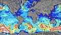 | 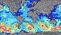 | 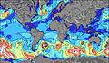 | 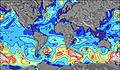 | 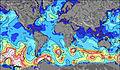 | 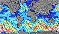 | 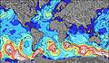 | ||||||||||||
Wave Height (m) Direction Period (s) | NNE 5 | NNE 4 | — | — | — | — | — | — | — | — | SW 3 | WSW 3 | — | WSW 3 | WSW 3 | — | — | WSW 3 | — |
Wave Graph | |||||||||||||||||||
0 | 0 | 0 | 0 | 0 | 0 | 0 | 0 | 0 | 0 | 1 | 1 | 0 | 1 | 1 | 0 | 0 | 1 | 0 | |
Wind (km/h) | |||||||||||||||||||
Wind State on-shore cross-onshore cross-shore cross-offshore off-shore glassy | cross-off | cross-off | cross | glassy | on | cross-on | cross-on | on | on | cross-on | on | on | cross-on | on | on | on | on | on | cross-on |
High Tide | |||||||||||||||||||
Low Tide | |||||||||||||||||||
— | 6:09 | — | — | 6:09 | — | — | 6:11 | — | — | 6:11 | — | — | 6:13 | — | — | 6:13 | — | — | |
8:36 | — | 8:35 | — | — | 8:34 | — | — | 8:31 | — | — | 8:30 | — | — | 8:30 | — | — | 8:28 | — | |
mm | 13 | — | — | — | — | — | — | — | — | — | — | — | 1 | 5 | 3 | — | — | — | — |
Temp °C | 22 | 22 | 26 | 24 | 23 | 26 | 24 | 26 | 28 | 26 | 27 | 28 | 26 | 23 | 25 | 24 | 25 | 27 | 25 |
Feels °C | 24 | 20 | 25 | 24 | 23 | 26 | 24 | 27 | 30 | 29 | 29 | 29 | 28 | 25 | 26 | 26 | 27 | 29 | 27 |
Swell 1 Height (m) Direction Period (s) | E 4 | — | — | — | — | — | — | — | — | — | — | — | — | — | — | — | — | — | — |
2 | — | — | — | — | — | — | — | — | — | — | — | — | — | — | — | — | — | — | |
Swell 2 Height (m) Direction Period (s) | — | — | — | — | — | — | — | — | — | — | — | — | — | — | — | — | — | — | — |
— | — | — | — | — | — | — | — | — | — | — | — | — | — | — | — | — | — | — | |
Swell 3 Height (m) Direction Period (s) | — | — | — | — | — | — | — | — | — | — | — | — | — | — | — | — | — | — | — |
— | — | — | — | — | — | — | — | — | — | — | — | — | — | — | — | — | — | — | |
Wind waves Height (m) Direction Period (s) | NNE 5 | NNE 4 | — | — | — | — | — | — | — | — | SW 3 | WSW 3 | — | WSW 3 | WSW 3 | — | — | WSW 3 | — |
40 | 4 | — | — | — | — | — | — | — | — | 1 | 1 | — | 1 | 1 | — | — | 1 | — | |
Nearest Offshore or Glassy | |||||||||||||||||||
Distance (km) | 581 | 1455 | 253 | 504 | 539 | 630 | 621 | 565 | 510 | 501 | 501 | 630 | 501 | 507 | 630 | 507 | 507 | 564 | 507 |
Best forecast wave conditions in Lake Erie - Canada | |||||||||||||||||||
Best forecast wave conditions in Canada | |||||||||||||||||||
Header Global | |||||||||||||||||||
- Map Icons:
 Break
Break Live Wave Height (m)
 Live Wind Speed (km/h)
 Surf Rating (10 Max)
 Ocean Swells (m)
- Wind Speed (km/h)
Latest Updates


FREE! Surf-Forecast.com widget for your website
The surf report / weather widget below is available to embed on third party websites free of charge and provides a summary of our Crystal Beach surf forecast. Simply grab the html code snippet that we provide and paste it into your own site. You can choose your preferred language and metric/imperial units for the surf forecast feed to suit users of your site. Click here to get the code.
Information about the Crystal Beach Surf forecast
The above surf forecast table for Crystal Beach provides essential information for determining whether the surfing conditions will be good over the next 16 days. A general guide to surfing at Crystal Beach can be found by selecting the local surf guide option on the grey menu. Our Crystal Beach surf forecast is unique since it includes wave energy (power) that defines the real feel of the surf rather than just the height or the period. If you surf the same spot (Crystal Beach) regularly then make a mental note of the wave energy from the surf forecast table each time you go. Very soon you may start to choose your surf days based on the wave energy alone combined with our forecast of favourable offshore wind conditions. Our star ratings will help here and of course you will also find the usual wave height and period predictions on our surf forecasts as well as a full break down of the swell components under our advanced users option (to reveal that, click the little Einstein character under the tide times).
Further information to help with frequently asked questions about our surf forecast for Crystal Beach may be found under the help tab on the top menu and also by moving your mouse over the question marks on the surf forecast table itself. Please always bear in mind that the forecast is for near-shore open water and local factors at each surf break influence the actual breaking wave height, such as the beach / reef profile, water depths offshore and shelter.
Crystal Beach is 13 km (8 miles) from Port Colborne. If you plan a holiday in Lake Erie - Canada, look for hotels and other accommodation in Port Colborne. Port Colborne has rooms for a wide range of budgets as well as car hire and transport links.
 Nearest