

Surf Forecasts:

How big are the waves at Farol today (02 Aug):
- Afternoon surf: Afternoon surf (02 Aug, local time) - 3.5ft (1.1m), 7s period with ESE swell.
- Evening surf: Evening surf (02 Aug, local time) - 3.5ft (1.1m), 7s period with ESE swell.
The current surf forecast for Farol at 5PM is: 1.1m 7s primary swell from a East-southeast direction and 0.2m 8s secondary swell from a North-northeast direction (forecast issued at 02:00pm August 02). An open ocean swell of 0.1m 14s is not directed at the surf break. The wind direction is predicted to be cross-shore.
| Time (-03) & Date | Wave Height | Wave Period |
|---|---|---|
| Morning (02 Aug) | - | - |
| Afternoon (02 Aug) | 3.5ft (1.1m) | 7s |
| Evening (02 Aug) | 3.5ft (1.1m) | 7s |
Table - waves today at Farol. (Swell directed towards the surf break)
Short Range ForecastHeavy rain (total 29mm), heaviest during Tue afternoon. Warm (max 26°C on Mon morning, min 22°C on Sun night). Wind will be generally light. | ||||||||||||||||||||
Sun 2 | Monday 3 | Tuesday 4 | ||||||||||||||||||
12 PM | 3 PM | 6 PM | 9 PM | 12 AM | 3 AM | 6 AM | 9 AM | 12 PM | 3 PM | 6 PM | 9 PM | 12 AM | 3 AM | 6 AM | 9 AM | 12 PM | 3 PM | 6 PM | 9 PM | |
Swell Height Map |  |  |  |  |  |  | 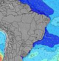 |  | ||||||||||||
Wave Height (m) Direction Period (s) | ESE 7 | ESE 7 | ESE 7 | ESE 7 | ESE 7 | E 7 | E 7 | E 7 | E 7 | ESE 7 | ESE 7 | ESE 7 | ESE 7 | ESE 8 | ESE 8 | ESE 8 | E 8 | E 8 | ESE 8 | ESE 8 |
Wave Graph | ||||||||||||||||||||
121 | 108 | 111 | 121 | 91 | 88 | 86 | 86 | 106 | 177 | 214 | 242 | 280 | 288 | 355 | 382 | 198 | 241 | 454 | 435 | |
Wind (km/h) | ||||||||||||||||||||
Wind State on-shore cross-onshore cross-shore cross-offshore off-shore glassy | cross | cross | cross | cross | cross-off | cross-off | cross-off | cross | cross-on | cross-on | cross-on | cross-on | cross-on | cross | cross | cross-on | cross-on | cross-on | cross-on | cross |
High Tide | 6:32PM2.05m | 6:45AM2.13m | 7:11PM1.99m | 7:28AM2.02m | 7:57PM1.91m | |||||||||||||||
Low Tide | 12:22PM0.25m | 00:32AM0.37m | 12:59PM0.32m | 1:13AM0.43m | 1:41PM0.41m | |||||||||||||||
— | — | — | — | — | 5:30 | — | — | — | — | — | — | — | 5:30 | — | — | — | — | — | — | |
— | 5:21 | — | — | — | — | — | — | — | 5:21 | — | — | — | — | — | — | — | 5:21 | — | — | |
mm | — | — | — | — | 1 | 1 | — | — | 1 | 1 | 1 | 1 | 2 | 2 | 3 | 3 | 3 | 4 | 3 | 2 |
Temp °C | 26 | 25 | 24 | 24 | 23 | 22 | 22 | 24 | 26 | 26 | 25 | 25 | 25 | 24 | 23 | 25 | 26 | 25 | 25 | 25 |
Feels °C | 24 | 23 | 24 | 25 | 24 | 23 | 23 | 24 | 26 | 26 | 26 | 26 | 27 | 25 | 25 | 25 | 26 | 25 | 25 | 26 |
Swell 1 Height (m) Direction Period (s) | NNE 8 | NNE 8 | NNE 8 | NE 8 | ESE 7 | E 7 | E 7 | E 7 | E 7 | E 7 | E 7 | E 7 | E 7 | E 8 | E 8 | E 8 | NE 9 | NE 9 | E 8 | E 8 |
7 | 7 | 6 | 3 | 91 | 88 | 86 | 86 | 106 | 103 | 106 | 127 | 156 | 160 | 193 | 193 | 13 | 13 | 284 | 247 | |
Swell 2 Height (m) Direction Period (s) | S 15 | NNE 8 | S 14 | NNE 8 | NE 8 | NNE 8 | NE 8 | NNE 8 | NE 8 | NNE 11 | NE 10 | NE 10 | NE 10 | NE 10 | NE 9 | NE 9 | SE 14 | SE 14 | NE 9 | NE 9 |
4 | 7 | 4 | 6 | 3 | 6 | 3 | 6 | 3 | 12 | 16 | 16 | 16 | 16 | 14 | 13 | 8 | 7 | 14 | 13 | |
Swell 3 Height (m) Direction Period (s) | S 11 | S 15 | S 11 | S 14 | S 13 | S 13 | S 13 | NE 11 | NE 11 | NE 11 | N 12 | S 12 | N 7 | N 7 | — | S 14 | N 10 | N 10 | SE 13 | SE 13 |
3 | 4 | 2 | 4 | 4 | 3 | 3 | 5 | 5 | 4 | 3 | 3 | 4 | 4 | — | 4 | 2 | 2 | 7 | 7 | |
Wind waves Height (m) Direction Period (s) | ESE 7 | ESE 7 | ESE 7 | ESE 7 | — | S 2 | S 2 | SSE 3 | — | ESE 7 | ESE 7 | ESE 7 | ESE 7 | ESE 8 | ESE 8 | ESE 8 | E 8 | E 8 | ESE 8 | ESE 8 |
121 | 108 | 111 | 121 | — | 1 | 1 | 2 | — | 177 | 214 | 242 | 280 | 288 | 355 | 382 | 198 | 241 | 454 | 435 | |
Nearest Offshore or Glassy | ||||||||||||||||||||
Distance (km) | 7 | 1475 | 1560 | 999 | 976 | 63 | 0 | 0 | 0 | 63 | 1560 | 1990 | 6 | 6 | 6 | 6 | 6 | 1475 | 1560 | 1560 |
Best forecast wave conditions in Rio Grande Do Norte | ||||||||||||||||||||
Best forecast wave conditions in Brazil | ||||||||||||||||||||
Header Global | ||||||||||||||||||||
- Map Icons:
 Break
Break Live Wave Height (m)
 Live Wind Speed (km/h)
 Surf Rating (10 Max)
 Ocean Swells (m)
- Wind Speed (km/h)
Latest Updates


FREE! Surf-Forecast.com widget for your website
The surf report / weather widget below is available to embed on third party websites free of charge and provides a summary of our Farol surf forecast. Simply grab the html code snippet that we provide and paste it into your own site. You can choose your preferred language and metric/imperial units for the surf forecast feed to suit users of your site. Click here to get the code.
 Nearest