

Surf Forecasts:

El Huaico surf forecast from 2 Aug 2026:
- Best quality surf: Thursday 6 Aug, 7PM (local time) - 5ft (1.6m), 16s period, SW swell with cross-offshore winds.
- Most powerful swell: Thursday 6 Aug, 7PM (local time) - 5ft (1.6m), 16s period, SW swell with 1,314 kJ wave energy.
- Next surfable swell (1★+): Monday 3 Aug, 7AM (local time) - 4.5ft (1.3m), 7s period with S swell.
Best Forecast Surf Conditions for El Huaico this week:
The surf forecast for El Huaico over the next 16 days: The first swell (rated 1 star or higher) is forecast to arrive on Monday (Aug 03) at 7AM. The primary swell is predicted to be 1.3m and 7s period with a secondary swell of 0.6m and 13s. The wind is predicted to be glassy as the swell arrives.
The most powerful waves expected at El Huaico in the next 16 days are 1.6m 16s and forecast to arrive on Thursday (Aug 06) at 7PM. Winds are predicted to be cross-offshore at the time the swell arrives. The largest open ocean swell (not directed at the beach) is 0.1m 10s period and expected on Friday (Aug 07) at 1AM.
| Wave Type | Time (-05) & Date | Wave Height & Period |
|---|---|---|
| Next good surf (1 star+) | 7AM (Mon 3rd Aug) | 4.5ft (1.3m) 7s |
| Best Surf | 7PM (Thu 6th Aug) | 5ft (1.6m) 16s |
| Most Powerful | 7PM (Thu 6th Aug) | 5ft (1.6m) 16s |
Table - best surf conditions forecast for El Huaico over the next 16 days.
The Lowdown
Alright folks, Rusty here. Let’s take a look at what’s coming up for El Huaico over the next couple of weeks.
Right off the bat, we’ve got a mixed bag. The swell is coming in from the South, but the wind is a persistent cross-onshore, and that’s keeping things from really firing. The water is running at 71°, which is a full 9° warmer than normal for this time of year – that’s very unusual, and it’s nice to not need a thick wetsuit.
The first week is pretty average. Through the first few days, we’re seeing swell around 3ft to 5ft, but the period is short, mostly 7 to 8 seconds, so the waves are a bit weak and crumbly. The combined swell energy is moderate, sitting around 430 to 564 (moderate), but it’s not enough to overcome the wind. Sunday the 2nd and Monday the 3rd are just marginal, and Tuesday the 4th is the same story. The wind is light, which is good, but it’s cross-on, so the surface is a little messy.
Wednesday the 5th starts to show a little promise. The swell picks up period to 13 seconds, and the combined energy climbs to 675 (moderate), and the wind switches to a straight cross-shore in the afternoon. That’s the best we’ll see for a few days, with clean 4ft waves coming from the SW. It’s not a standout, but it’s a window.
The real change comes on Monday the 10th of August. The swell jumps to 7ft, and the combined energy rockets to 1507 (strong). The wind is still cross-shore, but the period is a solid 10 seconds. This is a big step up in power, but at 7ft, it’s getting into the territory where it’s more for the experienced crew. The wave quality is still just marginal, though.
But the standout in this whole forecast is Tuesday the 11th of August. We’ve got a 8ft SSW swell with a very long period of 15 seconds. The combined energy is a massive 2127 (very strong). This is a proper groundswell. The wind is light, and variable, shifting from the WNW in the morning to a light cross-on by afternoon. That’s as good as it gets for El Huaico. The only caveat is that with a 15-second period, the waves will be powerful and prone to jacking up quickly. It’s a reef break, which handles that kind of energy well, but it’s definitely for experts only. This is the standout session.
After that, the swell eases back. Wednesday the 12th through Friday the 14th still have solid 6ft to 6ft S swell, with combined energy around 1000-1300 (strong), but the wind is a gentle cross-onshore, keeping the surface a bit choppy.
The final weekend, the 15th and 16th, drops back to 3ft to 5ft, with a nice cross-shore wind on the 15th. The 17th of August, the last day, sees another pulse of 6ft SW swell with a 16-second period, and combined energy of 1623 (strong), with a favorable cross-shore wind. That’s another promising one, but it’s far out, so less certain.
Overall, if you’re an expert, Tuesday the 11th is the one to circle. The rest of the window is a mix of marginal conditions and smaller swell. Don’t expect too much on the small days.
Rusty.
Short Range ForecastMostly dry. Warm (max 22°C on Tue morning, min 18°C on Sun night). Wind will be generally light. | Days 4-6 Weather SummaryMostly dry. Warm (max 22°C on Wed morning, min 18°C on Wed night). Wind will be generally light. | ||||||||||||||||||||
Sunday 2 | Monday 3 | Tuesday 4 | Wednesday 5 | Thursday 6 | Friday 7 | Saturday 8 | |||||||||||||||
AM | PM | Night | AM | PM | Night | AM | PM | Night | AM | PM | Night | AM | PM | Night | AM | PM | Night | AM | PM | Night | |
Swell Height Map | 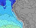 | 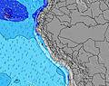 | 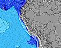 | 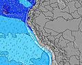 | 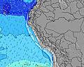 | 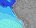 | 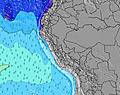 | ||||||||||||||
Wave Height (m) Direction Period (s) | S 7 | S 8 | S 7 | S 7 | SSW 11 | S 8 | SW 12 | S 8 | SW 13 | SW 13 | SW 12 | SW 12 | SW 17 | SW 16 | SW 16 | SW 14 | SW 14 | SW 13 | SW 13 | SW 13 | S 8 |
Wave Graph | |||||||||||||||||||||
212 | 217 | 177 | 178 | 183 | 221 | 297 | 206 | 543 | 473 | 437 | 403 | 587 | 653 | 1179 | 911 | 736 | 511 | 369 | 316 | 295 | |
Wind (km/h) | |||||||||||||||||||||
Wind State on-shore cross-onshore cross-shore cross-offshore off-shore glassy | cross-on | cross-on | cross | cross-on | cross-on | cross | cross-on | cross-on | cross | cross-on | cross-on | cross | cross | cross | cross | cross-on | cross | cross-off | on | cross-on | glassy |
High Tide | 8:26PM0.59m | 8:33AM0.82m | 9:18PM0.61m | 9:01AM0.76m | 10:19PM0.64m | 9:34AM0.69m | 11:31PM0.67m | 10:20AM0.62m | 00:52AM0.72m | 11:25AM0.56m | 2:08AM0.79m | 12:52PM0.52m | 3:13AM0.87m | ||||||||
Low Tide | 2:49PM0.26m | 1:55AM0.28m | 3:16PM0.24m | 2:39AM0.35m | 3:48PM0.22m | 3:37AM0.41m | 4:28PM0.20m | 5:06AM0.46m | 5:22PM0.18m | 7:14AM0.47m | 6:29PM0.15m | 8:57AM0.43m | 7:40PM0.12m | ||||||||
6:26 | — | — | 6:24 | — | — | 6:24 | — | — | 6:24 | — | — | 6:24 | — | — | 6:24 | — | — | 6:22 | — | — | |
— | 6:00 | — | — | 6:00 | — | — | 6:00 | — | — | 6:00 | — | — | 6:00 | — | — | 6:00 | — | — | 6:00 | — | |
mm | — | — | — | — | — | — | — | — | — | — | — | — | — | — | — | — | — | — | — | — | — |
Temp °C | 20 | 20 | 19 | 21 | 20 | 19 | 22 | 21 | 19 | 22 | 21 | 19 | 21 | 21 | 19 | 21 | 20 | 18 | 21 | 20 | 18 |
Feels °C | 21 | 20 | 20 | 20 | 20 | 20 | 22 | 21 | 20 | 22 | 21 | 20 | 20 | 21 | 19 | 21 | 20 | 18 | 20 | 20 | 18 |
Swell 1 Height (m) Direction Period (s) | SW 10 | SW 13 | SW 13 | S 7 | S 7 | S 8 | S 8 | S 8 | SW 13 | SW 13 | SW 12 | SW 12 | SW 12 | SW 16 | SW 16 | SW 14 | SW 14 | SW 13 | S 8 | S 8 | S 8 |
122 | 208 | 138 | 178 | 156 | 221 | 227 | 206 | 543 | 473 | 437 | 403 | 361 | 653 | 1179 | 911 | 736 | 511 | 163 | 172 | 295 | |
Swell 2 Height (m) Direction Period (s) | SW 14 | SW 10 | SW 9 | SW 13 | SSW 11 | S 11 | SW 12 | SW 12 | S 7 | S 7 | S 8 | S 8 | SW 17 | SW 12 | NW 10 | S 8 | S 7 | S 7 | SW 13 | SW 13 | SW 12 |
96 | 76 | 71 | 158 | 183 | 93 | 297 | 190 | 131 | 103 | 111 | 93 | 587 | 319 | 4 | 97 | 94 | 131 | 369 | 316 | 205 | |
Swell 3 Height (m) Direction Period (s) | SW 13 | S 15 | SSW 13 | SSW 12 | SW 12 | SSW 14 | S 12 | SW 14 | SSW 12 | SW 19 | SW 19 | SW 18 | S 8 | S 8 | NW 10 | NW 10 | NW 11 | W 11 | SSW 18 | SW 17 | SW 16 |
83 | 4 | 67 | 111 | 122 | 121 | 11 | 194 | 45 | 94 | 183 | 255 | 93 | 74 | 4 | 4 | 5 | 2 | 31 | 47 | 127 | |
Wind waves Height (m) Direction Period (s) | S 7 | S 8 | S 7 | — | — | — | — | — | — | — | — | — | — | — | S 8 | — | — | — | — | — | — |
212 | 217 | 177 | — | — | — | — | — | — | — | — | — | — | — | 80 | — | — | — | — | — | — | |
Nearest Offshore or Glassy | |||||||||||||||||||||
Distance (km) | 25 | 25 | 6 | 25 | 25 | 1 | 25 | 25 | 6 | 25 | 25 | 6 | 25 | 6 | 3 | 25 | 25 | 0 | 35 | 25 | 0 |
Best forecast wave conditions in Lima | |||||||||||||||||||||
Best forecast wave conditions in Peru | |||||||||||||||||||||
Header Global | |||||||||||||||||||||
- Map Icons:
 Break
Break Live Wave Height (m)
 Live Wind Speed (km/h)
 Surf Rating (10 Max)
 Ocean Swells (m)
- Wind Speed (km/h)
Latest Updates


FREE! Surf-Forecast.com widget for your website
The surf report / weather widget below is available to embed on third party websites free of charge and provides a summary of our El Huaico surf forecast. Simply grab the html code snippet that we provide and paste it into your own site. You can choose your preferred language and metric/imperial units for the surf forecast feed to suit users of your site. Click here to get the code.
Information about the El Huaico Surf forecast
The above surf forecast table for El Huaico provides essential information for determining whether the surfing conditions will be good over the next 16 days. A general guide to surfing at El Huaico can be found by selecting the local surf guide option on the grey menu. Our El Huaico surf forecast is unique since it includes wave energy (power) that defines the real feel of the surf rather than just the height or the period. If you surf the same spot (El Huaico) regularly then make a mental note of the wave energy from the surf forecast table each time you go. Very soon you may start to choose your surf days based on the wave energy alone combined with our forecast of favourable offshore wind conditions. Our star ratings will help here and of course you will also find the usual wave height and period predictions on our surf forecasts as well as a full break down of the swell components under our advanced users option (to reveal that, click the little Einstein character under the tide times).
Further information to help with frequently asked questions about our surf forecast for El Huaico may be found under the help tab on the top menu and also by moving your mouse over the question marks on the surf forecast table itself. Please always bear in mind that the forecast is for near-shore open water and local factors at each surf break influence the actual breaking wave height, such as the beach / reef profile, water depths offshore and shelter.
El Huaico is 35 km (22 miles) from the very large city of Mala. If you plan a holiday in Lima, look for hotels and other accommodation in Mala. Mala has rooms for a wide range of budgets as well as cheap car hire and transport links.
 Nearest