

Surf Forecasts:

Christies Reef surf forecast from 2 Aug 2026:
- Most powerful swell: Saturday 8 Aug, 9PM (local time) - 5.5ft (1.7m), 6s period, NNW swell with 188 kJ wave energy.
Best Forecast Surf Conditions for Christies Reef this week:
The most powerful waves expected at Christies Reef in the next 16 days are 1.7m 6s and forecast to arrive on Saturday (Aug 08) at 9PM. Winds are predicted to be cross-onshore at the time the swell arrives. The largest open ocean swell (not directed at the beach) is 3.5m 8s period and expected on Sunday (Aug 09) at 6AM.
| Wave Type | Time (ACST) & Date | Wave Height & Period |
|---|---|---|
| Next good surf (1 star+) | - | - |
| Best Surf | - | - |
| Most Powerful | 9PM (Sat 8th Aug) | 5.5ft (1.7m) 6s |
Table - best surf conditions forecast for Christies Reef over the next 16 days.
The Lowdown
G’day, Rusty here. Look, I’ve got to be straight with you – this outlook for Christies Reef is a tough one. We’re looking at a real dry spell for the next two weeks, with only a flicker of something rideable right at the tail end. The finder shows no good surf recommendations for the entire 16-day window, and I can see why.
Right off the bat, from Sunday the 2nd through to Tuesday the 11th of August, it’s a write-off. There’s tiny swell, poor winds, and just about every session is labelled “poor surf conditions.” The wave energy is weak, barely cracking two-digit numbers (like 64 on Sunday morning, dropping to 11 or even 0 most days). The water temp is 57° – that’s about 2° cooler than usual for this time of year, so it’s a bit nippy but nothing wild.
Wednesday the 12th and Thursday the 13th? Same story – no swell, just clean but flat conditions. Friday the 14th brings strong onshore gales, so that’s a complete no-go. Saturday the 15th and Sunday the 16th are a mess of choppy, cross-onshore slop with tiny 3-3 ft swell. Not worth suiting up.
Here’s the one moment that *almost* gets interesting. On Tuesday the 11th of August, there’s a morning and afternoon window. Tuesday morning is glassy, and while the swell is small at 5 ft from the WNW with a 5-second period, the wave energy jumps to 124. But the comment still says “poor surf conditions.” By Tuesday afternoon, the swell picks up to 6 ft from the WNW, period 6 seconds, and energy hits 201 – that’s moderate energy. The wind goes glassy, and the wave comment finally says “surfable waves but very ordinary conditions.” That’s the only day with a score of 1 out of 10. It’s a standout only because everything else is a zero. The swell is 6 ft, so it’s pushing into the too-big-for-beginners zone, and the short period means it’ll be a bit dumpy and disorganised. But with glassy conditions, a capable intermediate might get a few lumpy ones if they’re desperate.
After that, from Wednesday the 12th onward, it’s back to tiny or no swell, cross-off or cross-shore winds, and zero energy.
Bottom line: if you’re hanging out for a surf at Christies Reef, this is a 16-day dud. The only half-decent chance is on Tuesday the 11th of August in the afternoon, and even then, it’s ordinary. For a spot that’s already inconsistent and sheltered, this kind of blank run is pretty normal for the area. Forecasts can change though – it tends not to stay this poor forever.
Rusty.
Short Range ForecastSome drizzle, heaviest during Sun afternoon. Very mild (max 13°C on Sun afternoon, min 8°C on Tue night). Winds decreasing (fresh winds from the NNW on Sun morning, calm by Tue afternoon). | Days 4-6 Weather SummaryLight rain (total 2mm), mostly falling on Fri night. Very mild (max 16°C on Fri morning, min 9°C on Wed morning). Winds increasing (calm on Thu afternoon, fresh winds from the N by Fri night). | ||||||||||||||||||||
Sunday 2 | Monday 3 | Tuesday 4 | Wednesday 5 | Thursday 6 | Friday 7 | Saturday 8 | |||||||||||||||
AM | PM | Night | AM | PM | Night | AM | PM | Night | AM | PM | Night | AM | PM | Night | AM | PM | Night | AM | PM | Night | |
Swell Height Map | 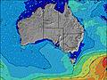 | 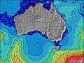 | 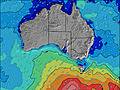 | 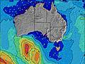 | 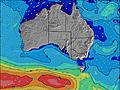 | 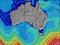 | 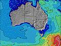 | ||||||||||||||
Wave Height (m) Direction Period (s) | NNW 5 | WNW 5 | W 6 | WSW 5 | WSW 4 | WSW 4 | WSW 8 | WSW 8 | WSW 8 | W 7 | NNW 3 | W 7 | W 5 | — | S 18 | SW 15 | SW 15 | N 4 | N 5 | N 5 | WNW 6 |
Wave Graph | |||||||||||||||||||||
59 | 46 | 125 | 48 | 20 | 17 | 6 | 0 | 6 | 0 | 2 | 0 | 0 | 0 | 6 | 9 | 9 | 12 | 129 | 104 | 173 | |
Wind (km/h) | |||||||||||||||||||||
Wind State on-shore cross-onshore cross-shore cross-offshore off-shore glassy | cross | cross-on | on | cross-on | cross-on | cross-on | cross-on | on | cross-off | cross-off | cross-on | cross-off | cross-off | glassy | cross-off | cross-off | cross-on | cross-off | cross | cross | on |
High Tide | 6:13PM2.23m | 6:39AM1.97m | 6:38PM2.14m | 7:03AM2.05m | 7:04PM1.98m | 7:32AM2.07m | 7:30PM1.74m | 8:05AM2.01m | 7:51PM1.45m | 8:44AM1.88m | 7:41PM1.15m | 9:43AM1.69m | |||||||||
Low Tide | 12:01PM0.53m | 00:33AM0.34m | 12:30PM0.50m | 00:52AM0.38m | 1:04PM0.52m | 1:12AM0.43m | 1:41PM0.61m | 1:31AM0.50m | 2:26PM0.77m | 1:45AM0.60m | 3:31PM0.97m | 1:37AM0.69m | 11:57PM0.69m | ||||||||
7:09 | — | — | 7:09 | — | — | 7:09 | — | — | 7:07 | — | — | 7:07 | — | — | 7:05 | — | — | 7:05 | — | — | |
— | 5:34 | — | — | 5:35 | — | — | 5:35 | — | — | 5:36 | — | — | 5:37 | — | — | 5:37 | — | — | 5:37 | — | |
mm | — | 1 | — | — | — | — | — | — | — | — | — | — | — | — | — | — | — | 2 | 7 | — | 8 |
Temp °C | 12 | 13 | 12 | 12 | 12 | 11 | 11 | 11 | 9 | 11 | 11 | 11 | 12 | 13 | 13 | 16 | 16 | 14 | 10 | 12 | 13 |
Feels °C | 5 | 7 | 6 | 7 | 7 | 7 | 8 | 8 | 6 | 7 | 8 | 9 | 9 | 11 | 10 | 11 | 12 | 9 | 3 | 5 | 7 |
Swell 1 Height (m) Direction Period (s) | W 8 | N 5 | S 18 | SW 9 | WSW 9 | WSW 8 | WSW 5 | WSW 8 | WSW 8 | W 7 | W 7 | W 7 | W 5 | — | SW 10 | SW 9 | SW 10 | SW 10 | SW 9 | WSW 8 | SW 14 |
1 | 10 | 6 | 20 | 15 | 7 | 4 | 12 | 6 | 4 | 1 | 1 | 1 | — | 4 | 3 | 4 | 4 | 3 | 11 | 8 | |
Swell 2 Height (m) Direction Period (s) | S 16 | S 15 | — | — | — | — | WSW 8 | — | — | — | — | — | — | — | — | SW 15 | SW 15 | S 16 | S 16 | W 5 | — |
5 | 4 | — | — | — | — | 6 | — | — | — | — | — | — | — | — | 9 | 9 | 5 | 5 | 2 | — | |
Swell 3 Height (m) Direction Period (s) | — | — | — | — | — | — | SW 11 | — | — | — | — | — | — | — | S 18 | — | — | — | — | S 15 | — |
— | — | — | — | — | — | 5 | — | — | — | — | — | — | — | 6 | — | — | — | — | 4 | — | |
Wind waves Height (m) Direction Period (s) | NNW 5 | WNW 5 | W 6 | WSW 5 | WSW 4 | WSW 4 | — | — | — | — | NNW 3 | — | — | — | — | N 3 | N 3 | N 4 | N 5 | N 5 | WNW 6 |
59 | 46 | 125 | 48 | 20 | 17 | — | — | — | — | 2 | — | — | — | — | 5 | 4 | 12 | 129 | 104 | 173 | |
Nearest Offshore or Glassy | |||||||||||||||||||||
Distance (km) | 547 | 547 | 451 | 610 | 610 | 129 | 129 | 135 | 48 | 48 | 48 | 48 | 48 | 48 | 48 | 48 | 48 | 48 | 620 | 563 | 1049 |
Best forecast wave conditions in Adelaide | |||||||||||||||||||||
Best forecast wave conditions in Australia | |||||||||||||||||||||
Header Global | |||||||||||||||||||||
- Map Icons:
 Break
Break Live Wave Height (m)
 Live Wind Speed (km/h)
 Surf Rating (10 Max)
 Ocean Swells (m)
- Wind Speed (km/h)
Latest Updates


FREE! Surf-Forecast.com widget for your website
The surf report / weather widget below is available to embed on third party websites free of charge and provides a summary of our Christies Reef surf forecast. Simply grab the html code snippet that we provide and paste it into your own site. You can choose your preferred language and metric/imperial units for the surf forecast feed to suit users of your site. Click here to get the code.
Information about the Christies Reef Surf forecast
The above surf forecast table for Christies Reef provides essential information for determining whether the surfing conditions will be good over the next 16 days. A general guide to surfing at Christies Reef can be found by selecting the local surf guide option on the grey menu. Our Christies Reef surf forecast is unique since it includes wave energy (power) that defines the real feel of the surf rather than just the height or the period. If you surf the same spot (Christies Reef) regularly then make a mental note of the wave energy from the surf forecast table each time you go. Very soon you may start to choose your surf days based on the wave energy alone combined with our forecast of favourable offshore wind conditions. Our star ratings will help here and of course you will also find the usual wave height and period predictions on our surf forecasts as well as a full break down of the swell components under our advanced users option (to reveal that, click the little Einstein character under the tide times).
Further information to help with frequently asked questions about our surf forecast for Christies Reef may be found under the help tab on the top menu and also by moving your mouse over the question marks on the surf forecast table itself. Please always bear in mind that the forecast is for near-shore open water and local factors at each surf break influence the actual breaking wave height, such as the beach / reef profile, water depths offshore and shelter.
Christies Reef is 4 km (2 miles) from the very large city of Morphett Vale. If you plan a holiday in Adelaide, look for hotels and other accommodation in Morphett Vale. Morphett Vale has rooms for a wide range of budgets as well as cheap car hire and transport links.
 Nearest