

Surf Forecasts:

Chicama - El Point surf forecast from 11 Jul 2026:
- Best quality surf: Friday 17 Jul, 7AM (local time) - 4.5ft (1.3m), 13s period, SW swell with cross-offshore winds.
- Most powerful swell: Friday 17 Jul, 1AM (local time) - 4.5ft (1.3m), 13s period, SW swell with 543 kJ wave energy.
- Next surfable swell (1★+): Sunday 12 Jul, 1AM (local time) - 3.5ft (1.0m), 14s period with SW swell.
Best Forecast Surf Conditions for Chicama - El Point this week:
The surf forecast for Chicama - El Point over the next 16 days: The first swell (rated 1 star or higher) is forecast to arrive on Sunday (Jul 12) at 1AM. The primary swell is predicted to be 1.0m and 14s period with a secondary swell of 0.7m and 7s. The wind is predicted to be cross-offshore as the swell arrives.
The most powerful waves expected at Chicama - El Point in the next 16 days are 1.3m 13s and forecast to arrive on Friday (Jul 17) at 1AM. Winds are predicted to be cross-shore at the time the swell arrives. The largest open ocean swell (not directed at the beach) is 0.1m 10s period and expected on Friday (Jul 17) at 4PM.
| Wave Type | Time (-05) & Date | Wave Height & Period |
|---|---|---|
| Next good surf (1 star+) | 1AM (Sun 12th Jul) | 3.5ft (1.0m) 14s |
| Best Surf | 7AM (Fri 17th Jul) | 4.5ft (1.3m) 13s |
| Most Powerful | 1AM (Fri 17th Jul) | 4.5ft (1.3m) 13s |
Table - best surf conditions forecast for Chicama - El Point over the next 16 days.
G’day, I’m Rusty. Let’s talk about what’s on offer for a spot you’ve probably heard of—Chicama - El Point. Now, I gotta be straight with you: the next couple of weeks are a bit of a mixed bag, and there’s not a whole lot of pure magic in the immediate forecast. The real standout doesn’t show up until we’re looking at the second week, so we’ll have to work through some so-so conditions first.
The forecast starts on Friday, July 10, into the weekend, and honestly, it’s a struggle. We’ve got a moderate SW swell running around 3.3 ft to 3.6 ft, with a period of 13 to 14 seconds. There’s some reasonable energy there—about 613 (moderate) on Friday afternoon—but the wind is a persistent cross or cross-onshore from the S or SSW, blowing at 15 to 16 mph. That’s putting a chop on the surface and making it feel messy. The water temp is sitting at 68.9°, which is much warmer than usual for this time of year—over 3.6° above normal—so you’ll be comfortable in a shorty, but the surf quality is poor. Saturday and Sunday (July 11-12) are the same story: chest-high waves, but with that onshore wind, it’s a bit of a struggle. The morning of Sunday, July 12, has a slight air and very light wind, but still cross-on, so it’s marginal at best.
The first full week—Monday, July 13 through Thursday, July 16—doesn’t change much. Swell holds around 3.3 ft to 3.9 ft from the SW, period sticking at 12 to 14 seconds. The combined energy sits between 428 and 527 (moderate). The wind stays mostly cross or cross-onshore from the S, between 6 and 16 mph. There are a few windows of lighter wind—like Wednesday morning, July 15, with a slight air and cross-shore—but it’s still light cross-shore with ripples. The surf is marginal, not clean, and the tide or conditions seem to be robbing it of any real quality. If you’re desperate to get wet, you could paddle out, but it’s not going to be a session to write home about.
Now, here’s where we get a bit of hope. The swell starts to build from Sunday, July 19, into Monday, July 20. That Monday morning, July 20, we’re looking at 4.9 ft from the SW, period 12 seconds, and the combined energy jumps to 689 (strong). The wind is still cross from the SSE at 16 mph, so it’s lumpy, but there’s more push. The best window in the whole 16-day stretch, though, is Tuesday, July 21. The morning of Tuesday, July 21 has a gentle 9 mph S cross-shore, with a 5.2 ft SW swell at 13 seconds, and the combined energy is 894 (strong). That’s the biggest, most consistent swell we see, and the wind is only a gentle breeze—still cross-shore, but with only a slight cross-chop. It’s the best on offer: 5.2 ft of SW groundswell, with a period of 13 seconds, and the lightest wind of the bigger days. This is your window. The water is still warm, the crowds at Chicama - El Point can be rare, so you might have plenty of room. It’s a point break, so that long-period groundswell will wrap in nicely. Just keep in mind, the swell is over 5 ft, so it’s getting a bit meaty for beginners—more suited to intermediate and above.
After that, the swell drops back a bit. Wednesday, July 22, we see a shift to shorter period (8 seconds) and smaller size (3.9 ft), which is a step down in quality. The energy drops to 384 (weak). By Thursday, July 23, the period recovers to 9-10 seconds, but the wind is back up to 12 mph cross-shore, making it choppy again.
The last weekend, July 24-25, we get a weird one. A very long-period SW swell—22 seconds on Friday morning, July 24, and 20 seconds on Saturday morning, July 25—but the wave height is tiny: 1.6 ft to 2.0 ft. The combined energy is 467 to 651 (moderate to strong), but with such a small wave height, it’s going to be a long wait between sets. The wind is light cross-on or cross-shore on Saturday morning, July 25, with a slight air, so it’s glassy, but it’s just not enough wave to ride. The afternoons of those days are back to cross-onshore wind and choppy, 3.9 ft S swell.
So, in summary: the first week is a write-off with messy, onshore winds and marginal swell. The solid window is Monday, July 20 through Tuesday, July 21, with Tuesday, July 21 being the standout—5.2 ft SW groundswell, gentle cross-shore wind, and strong energy. After that, it fades. The very long-period groundswell on July 24-25 is promising but too
Short Range ForecastMostly dry. Warm (max 22°C on Fri afternoon, min 19°C on Fri night). Wind will be generally light. | Days 5-7 Weather SummaryMostly dry. Warm (max 22°C on Mon afternoon, min 20°C on Mon night). Wind will be generally light. | ||||||||||||||||||||
Fri 10 | Saturday 11 | Sunday 12 | Monday 13 | Tuesday 14 | Wednesday 15 | Thursday 16 | |||||||||||||||
PM | Night | AM | PM | Night | AM | PM | Night | AM | PM | Night | AM | PM | Night | AM | PM | Night | AM | PM | Night | AM | |
Swell Height Map |  | 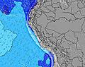 | 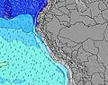 | 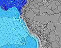 | 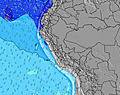 | 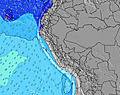 | 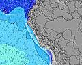 | 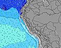 | |||||||||||||
Wave Height (m) Direction Period (s) | SW 14 | SW 14 | SW 13 | SW 13 | SW 14 | SW 14 | SW 14 | SW 13 | SW 13 | SW 13 | SW 14 | SW 14 | SW 13 | SW 13 | SW 13 | SW 13 | SW 13 | SW 13 | SW 12 | SW 13 | SW 13 |
Wave Graph | |||||||||||||||||||||
528 | 499 | 335 | 325 | 393 | 336 | 379 | 290 | 336 | 386 | 251 | 453 | 249 | 392 | 444 | 495 | 488 | 473 | 437 | 543 | 479 | |
Wind (km/h) | |||||||||||||||||||||
Wind State on-shore cross-onshore cross-shore cross-offshore off-shore glassy | cross | cross | cross-on | cross-on | cross-off | cross-on | cross-on | cross | cross-on | cross-on | cross | cross | cross-on | cross | cross | cross | cross | cross | cross | cross | cross-on |
High Tide | 1:43AM1.16m | 1:12PM1.10m | 2:43AM1.26m | 2:15PM1.12m | 3:39AM1.36m | 3:14PM1.14m | 4:30AM1.45m | 4:10PM1.17m | 5:19AM1.50m | 5:03PM1.17m | 6:06AM1.51m | 5:55PM1.16m | 6:50AM1.49m | ||||||||
Low Tide | 6:54PM0.22m | 7:42AM0.58m | 7:56PM0.13m | 8:53AM0.51m | 8:53PM0.05m | 9:52AM0.44m | 9:47PM-0.01m | 10:46AM0.38m | 10:37PM-0.04m | 11:36AM0.34m | 11:25PM-0.03m | 12:24PM0.32m | 00:11AM0.03m | ||||||||
— | — | 6:31 | — | — | 6:31 | — | — | 6:31 | — | — | 6:31 | — | — | 6:31 | — | — | 6:31 | — | — | 6:31 | |
6:14 | — | — | 6:14 | — | — | 6:14 | — | — | 6:14 | — | — | 6:14 | — | — | 6:15 | — | — | 6:15 | — | 6:15 | |
mm | — | — | — | — | — | — | — | — | — | — | — | — | — | — | — | — | — | — | — | — | — |
Temp °C | 22 | 20 | 21 | 21 | 20 | 22 | 22 | 21 | 21 | 22 | 20 | 22 | 22 | 21 | 22 | 22 | 21 | 22 | 22 | 21 | 22 |
Feels °C | 20 | 19 | 22 | 20 | 20 | 22 | 22 | 21 | 22 | 22 | 20 | 22 | 22 | 21 | 24 | 21 | 21 | 22 | 21 | 21 | 22 |
Swell 1 Height (m) Direction Period (s) | SW 14 | SW 14 | SW 13 | SW 13 | SW 14 | SW 14 | SW 14 | SW 13 | SW 13 | SW 13 | SW 14 | SW 14 | SW 13 | SW 13 | SW 13 | SW 13 | SW 13 | SW 13 | SW 12 | SW 13 | SW 13 |
528 | 499 | 335 | 325 | 393 | 336 | 379 | 290 | 336 | 386 | 251 | 453 | 249 | 392 | 444 | 495 | 488 | 473 | 437 | 543 | 479 | |
Swell 2 Height (m) Direction Period (s) | W 15 | S 7 | S 7 | W 14 | S 7 | S 7 | WSW 20 | S 7 | S 7 | S 7 | SW 12 | S 8 | S 8 | S 8 | SW 9 | SW 20 | SW 20 | W 11 | SW 22 | SW 22 | S 7 |
4 | 79 | 62 | 4 | 46 | 34 | 41 | 53 | 38 | 26 | 112 | 45 | 41 | 18 | 3 | 15 | 15 | 2 | 18 | 18 | 9 | |
Swell 3 Height (m) Direction Period (s) | — | W 15 | SW 18 | W 24 | SW 22 | SW 21 | W 14 | SW 16 | SW 16 | S 9 | S 8 | W 12 | SW 16 | WSW 9 | W 12 | W 12 | W 11 | — | W 11 | W 11 | SW 20 |
— | 4 | 50 | 11 | 18 | 18 | 4 | 41 | 96 | 15 | 44 | 3 | 161 | 8 | 3 | 3 | 2 | — | 2 | 2 | 16 | |
Wind waves Height (m) Direction Period (s) | S 7 | — | — | S 7 | — | — | S 7 | — | — | SSW 3 | — | — | — | S 3 | S 7 | S 4 | S 4 | S 7 | S 4 | S 4 | S 4 |
81 | — | — | 62 | — | — | 54 | — | — | 1 | — | — | — | 5 | 36 | 14 | 12 | 26 | 12 | 7 | 3 | |
Nearest Offshore or Glassy | |||||||||||||||||||||
Distance (km) | 563 | 1 | 1 | 55 | 0 | 1 | 55 | 1 | 1 | 55 | 1 | 1 | 541 | 1 | 1 | 257 | 1 | 1 | 55 | 1 | 1 |
Best forecast wave conditions in La Libertad and Lambayeque | |||||||||||||||||||||
Best forecast wave conditions in Peru | |||||||||||||||||||||
Header Global | |||||||||||||||||||||
- Map Icons:
 Break
Break Live Wave Height (m)
 Live Wind Speed (km/h)
 Surf Rating (10 Max)
 Ocean Swells (m)
- Wind Speed (km/h)


FREE! Surf-Forecast.com widget for your website
The surf report / weather widget below is available to embed on third party websites free of charge and provides a summary of our Chicama - El Point surf forecast. Simply grab the html code snippet that we provide and paste it into your own site. You can choose your preferred language and metric/imperial units for the surf forecast feed to suit users of your site. Click here to get the code.
Information about the Chicama - El Point Surf forecast
The above surf forecast table for Chicama - El Point provides essential information for determining whether the surfing conditions will be good over the next 16 days. A general guide to surfing at Chicama - El Point can be found by selecting the local surf guide option on the grey menu. Our Chicama - El Point surf forecast is unique since it includes wave energy (power) that defines the real feel of the surf rather than just the height or the period. If you surf the same spot (Chicama - El Point) regularly then make a mental note of the wave energy from the surf forecast table each time you go. Very soon you may start to choose your surf days based on the wave energy alone combined with our forecast of favourable offshore wind conditions. Our star ratings will help here and of course you will also find the usual wave height and period predictions on our surf forecasts as well as a full break down of the swell components under our advanced users option (to reveal that, click the little Einstein character under the tide times).
Further information to help with frequently asked questions about our surf forecast for Chicama - El Point may be found under the help tab on the top menu and also by moving your mouse over the question marks on the surf forecast table itself. Please always bear in mind that the forecast is for near-shore open water and local factors at each surf break influence the actual breaking wave height, such as the beach / reef profile, water depths offshore and shelter.
Chicama - El Point is 17 km (11 miles) from Paijan. If you plan a holiday in La Libertad and Lambayeque, look for hotels and other accommodation in Paijan. Paijan has rooms for a wide range of budgets as well as car hire and transport links.
 Nearest