

Surf Forecasts:

How big are the waves at Chicama - El Point today (02 Aug):
- Afternoon surf: Afternoon surf (02 Aug, local time) - 4ft (1.2m), 8s period with S swell.
- Evening surf: Evening surf (02 Aug, local time) - 4.5ft (1.3m), 8s period with S swell.
The current surf forecast for Chicama - El Point at 10PM is: 1.3m 8s primary swell from a South direction and 0.6m 13s secondary swell from a Southwest direction, 0.6m 10s secondary swell from a Southwest direction (forecast issued at 06:00pm August 02). The wind direction is predicted to be cross-shore.
| Time (-05) & Date | Wave Height | Wave Period |
|---|---|---|
| Morning (02 Aug) | - | - |
| Afternoon (02 Aug) | 4ft (1.2m) | 8s |
| Evening (02 Aug) | 4.5ft (1.3m) | 8s |
Table - waves today at Chicama - El Point. (Swell directed towards the surf break)
Short Range ForecastMostly dry. Warm (max 22°C on Sun afternoon, min 20°C on Sun night). Wind will be generally light. | |||||||||||||||||||
Sun 2 | Monday 3 | Tuesday 4 | |||||||||||||||||
4 PM | 7 PM | 10 PM | 1 AM | 4 AM | 7 AM | 10 AM | 1 PM | 4 PM | 7 PM | 10 PM | 1 AM | 4 AM | 7 AM | 10 AM | 1 PM | 4 PM | 7 PM | 10 PM | |
Swell Height Map |  | 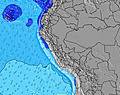 | 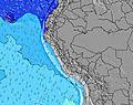 | 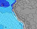 | 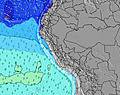 | 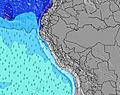 | 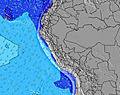 | ||||||||||||
Wave Height (m) Direction Period (s) | S 8 | S 8 | S 8 | S 8 | S 7 | S 8 | S 8 | S 8 | S 8 | S 8 | S 8 | S 8 | S 8 | S 8 | SW 13 | SW 13 | SW 12 | SW 12 | SW 12 |
Wave Graph | |||||||||||||||||||
177 | 176 | 196 | 160 | 156 | 160 | 135 | 160 | 164 | 181 | 153 | 157 | 157 | 157 | 193 | 193 | 216 | 212 | 244 | |
Wind (km/h) | |||||||||||||||||||
Wind State on-shore cross-onshore cross-shore cross-offshore off-shore glassy | cross | cross | cross | cross | cross | cross-off | cross | cross | cross | cross | cross | cross | cross | cross-off | cross | cross-on | cross-on | cross | cross |
High Tide | 6:50PM1.08m | 7:15AM1.30m | 7:34PM1.06m | 7:47AM1.25m | 8:26PM1.04m | ||||||||||||||
Low Tide | 1:08PM0.37m | 00:50AM0.31m | 1:41PM0.35m | 1:27AM0.39m | 2:19PM0.33m | ||||||||||||||
— | — | — | — | 6:30 | — | — | — | — | — | — | — | 6:30 | — | — | — | — | — | — | |
6:16 | — | — | — | — | — | — | — | 6:16 | — | — | — | — | — | — | — | 6:16 | — | — | |
mm | — | — | — | — | — | — | — | — | — | — | — | — | — | — | — | — | — | — | — |
Temp °C | 22 | 21 | 21 | 21 | 20 | 20 | 22 | 22 | 22 | 21 | 21 | 21 | 21 | 20 | 21 | 22 | 22 | 22 | 21 |
Feels °C | 20 | 19 | 19 | 20 | 20 | 19 | 21 | 20 | 20 | 20 | 21 | 22 | 22 | 20 | 21 | 21 | 21 | 22 | 22 |
Swell 1 Height (m) Direction Period (s) | SW 10 | SW 10 | SW 13 | SW 13 | SW 13 | S 8 | SW 13 | SW 13 | SW 12 | SW 12 | S 8 | S 8 | S 8 | S 8 | S 8 | SW 13 | SW 12 | SW 12 | S 8 |
80 | 80 | 140 | 138 | 136 | 160 | 132 | 128 | 124 | 122 | 153 | 157 | 157 | 157 | 127 | 193 | 216 | 212 | 114 | |
Swell 2 Height (m) Direction Period (s) | SW 13 | SW 13 | SW 10 | SW 10 | SW 10 | SW 13 | SW 9 | SW 9 | SW 9 | SSW 12 | SW 12 | SSW 11 | SSW 12 | SSW 12 | SW 13 | SSW 10 | W 11 | W 11 | SW 12 |
142 | 142 | 61 | 61 | 32 | 134 | 29 | 29 | 29 | 15 | 141 | 51 | 82 | 104 | 193 | 35 | 2 | 2 | 244 | |
Swell 3 Height (m) Direction Period (s) | W 11 | W 11 | W 11 | W 11 | W 11 | SW 9 | W 11 | W 11 | W 11 | W 11 | W 11 | SW 12 | SW 12 | SW 12 | SSW 10 | W 11 | — | SW 20 | SSW 9 |
2 | 2 | 2 | 2 | 2 | 41 | 2 | 2 | 2 | 2 | 2 | 37 | 35 | 35 | 31 | 2 | — | 16 | 28 | |
Wind waves Height (m) Direction Period (s) | S 8 | S 8 | S 8 | S 8 | S 7 | — | S 8 | S 8 | S 8 | S 8 | — | — | — | — | — | S 8 | S 8 | S 8 | — |
177 | 176 | 196 | 160 | 156 | — | 135 | 160 | 164 | 181 | — | — | — | — | — | 157 | 157 | 157 | — | |
Nearest Offshore or Glassy | |||||||||||||||||||
Distance (km) | 563 | 493 | 1 | 1 | 1 | 1 | 55 | 545 | 545 | 55 | 1 | 1 | 1 | 0 | 55 | 99 | 541 | 55 | 1 |
Best forecast wave conditions in La Libertad and Lambayeque | |||||||||||||||||||
Best forecast wave conditions in Peru | |||||||||||||||||||
Header Global | |||||||||||||||||||
- Map Icons:
 Break
Break Live Wave Height (m)
 Live Wind Speed (km/h)
 Surf Rating (10 Max)
 Ocean Swells (m)
- Wind Speed (km/h)
Latest Updates


FREE! Surf-Forecast.com widget for your website
The surf report / weather widget below is available to embed on third party websites free of charge and provides a summary of our Chicama - El Point surf forecast. Simply grab the html code snippet that we provide and paste it into your own site. You can choose your preferred language and metric/imperial units for the surf forecast feed to suit users of your site. Click here to get the code.
 Nearest