

Surf Forecasts:

Carola surf forecast from 3 Aug 2026:
- Most powerful swell: Monday 3 Aug, 12PM (local time) - 0.5ft (0.2m), 12s period, WSW swell with 14 kJ wave energy.
Best Forecast Surf Conditions for Carola this week:
The most powerful waves expected at Carola in the next 16 days are 0.2m 12s and forecast to arrive on Monday (Aug 03) at 12PM. Winds are predicted to be cross-offshore at the time the swell arrives. The largest open ocean swell (not directed at the beach) is 1.5m 8s period and expected on Monday (Aug 03) at 12PM.
| Wave Type | Time (-06) & Date | Wave Height & Period |
|---|---|---|
| Next good surf (1 star+) | - | - |
| Best Surf | - | - |
| Most Powerful | 12PM (Mon 3rd Aug) | 0.5ft (0.2m) 12s |
Table - best surf conditions forecast for Carola over the next 16 days.
The Lowdown
Alright, Rusty here. Let’s look at what we’ve got for the next 16 days.
Honestly, it’s a pretty grim stretch. The pattern is flat, or near as damn it. There’s a long gap of nothingness from the start, with the first proper surf not showing up until Monday afternoon, 5th August, and even then it’s tiny. The only spot on the radar is Carola, a reef break for advanced crew only. It’s fairly consistent, but that doesn’t mean much when there’s no swell.
We kick off with a couple of tiny, poor-quality waves on Monday 3rd August – 1 foot from the north with a 9-second period, energy is weak at just 13. Wind is cross-off from the SSE, so the surface is clean, but the wave state is just “poor surf conditions.” The next day is a total zero. Tuesday, Wednesday, Thursday, Friday, Saturday, Sunday – all flat. Monday 10th, nope. Tuesday 11th, maybe a 0.6 foot ripple from the north with a 9-second period and energy of 6. That’s essentially a lake. This pattern of tiny, weak pulses continues right through to the end of the window.
The only day that even looks slightly less pathetic is Saturday 15th August. We get a 1 foot north-northeast swell, 8-second period, and the combined energy climbs to 26 – still weak. The wind is light to moderate cross-off from the SSE, so the surface will be clean. For a reef break, that’s about as good as it gets in this window. But it’s still only 1 feet. That’s a knee-high wave for experts only. Because it’s a reef, with a very short period, it’ll be a bit fat and rolly, but the cross-off wind will keep it lined up.
There is no standout. Not one. The best on offer is that Saturday 15th August session at Carola, but that’s a desperate call. You’d be better off checking the forecast again in a few days. For now, the board stays in the car.
Rusty
Short Range ForecastMostly dry. Warm (max 25°C on Sun night, min 24°C on Sun night). Wind will be generally light. | Days 5-7 Weather SummaryMostly dry. Warm (max 25°C on Sat morning, min 24°C on Wed night). Wind will be generally light. | ||||||||||||||||||
Monday 3 | Tuesday 4 | Wednesday 5 | Thursday 6 | Friday 7 | Saturday 8 | ||||||||||||||
Night | AM | PM | Night | AM | PM | Night | AM | PM | Night | AM | PM | Night | AM | PM | Night | AM | PM | Night | |
Swell Height Map |  | 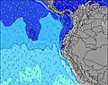 | 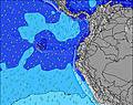 | 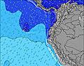 | 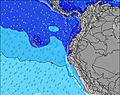 | 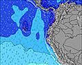 | 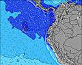 | ||||||||||||
Wave Height (m) Direction Period (s) | SSE 8 | N 9 | WSW 12 | SSE 8 | SSE 8 | SSE 8 | SSE 8 | SSW 14 | SW 13 | SW 13 | SW 18 | S 4 | SW 16 | SSW 15 | SSW 15 | SSW 14 | SSW 14 | SSW 13 | SW 13 |
Wave Graph | |||||||||||||||||||
0 | 13 | 14 | 0 | 0 | 0 | 0 | 0 | 0 | 0 | 0 | 6 | 0 | 0 | 0 | 0 | 0 | 0 | 0 | |
Wind (km/h) | |||||||||||||||||||
Wind State on-shore cross-onshore cross-shore cross-offshore off-shore glassy | cross-off | cross-off | cross-off | cross-off | cross-off | cross | cross | cross | cross | cross | cross | cross-off | cross-off | cross-off | cross-off | cross-off | cross-off | cross-off | cross-off |
High Tide | 5:32AM2.01m | 5:46PM1.84m | 6:09AM1.98m | 6:29PM1.78m | 6:52AM1.92m | 7:20PM1.71m | 7:42AM1.85m | 8:22PM1.64m | 8:45AM1.79m | 9:36PM1.62m | 9:58AM1.75m | 10:56PM1.66m | |||||||
Low Tide | 11:15PM0.28m | 11:45AM0.35m | 11:52PM0.33m | 12:25PM0.37m | 00:32AM0.40m | 1:11PM0.42m | 1:20AM0.49m | 2:06PM0.46m | 2:19AM0.59m | 3:13PM0.50m | 3:34AM0.65m | 4:30PM0.49m | |||||||
— | 6:01 | — | — | 6:01 | — | — | 6:01 | — | — | 6:01 | — | — | 6:01 | — | — | 6:01 | — | — | |
— | — | 6:06 | — | — | 6:06 | — | — | 6:06 | — | — | 6:06 | — | — | 6:06 | — | — | 6:06 | — | |
mm | — | — | — | — | — | — | — | — | — | — | — | — | — | — | — | — | — | — | — |
Temp °C | 25 | 25 | 25 | 24 | 24 | 24 | 24 | 25 | 25 | 24 | 24 | 24 | 24 | 24 | 24 | 24 | 25 | 25 | 24 |
Feels °C | 25 | 25 | 25 | 24 | 24 | 24 | 24 | 26 | 25 | 24 | 24 | 24 | 25 | 25 | 25 | 25 | 26 | 26 | 25 |
Swell 1 Height (m) Direction Period (s) | SW 12 | SW 12 | SSW 12 | SSE 8 | SW 11 | SW 14 | SSW 13 | SSE 8 | SSE 8 | SSE 8 | SSE 8 | SSW 17 | SW 16 | SSW 15 | SSW 15 | SSW 14 | SSW 14 | SSW 13 | SW 13 |
75 | 74 | 101 | 221 | 44 | 89 | 106 | 172 | 140 | 144 | 144 | 481 | 587 | 632 | 568 | 553 | 407 | 304 | 241 | |
Swell 2 Height (m) Direction Period (s) | SW 16 | SW 15 | N 8 | SW 12 | SW 14 | S 12 | S 12 | SSW 14 | SW 13 | SW 13 | SW 12 | SSE 8 | SSE 8 | SSE 8 | SSE 8 | SSE 8 | S 10 | SSW 18 | SW 16 |
64 | 36 | 11 | 36 | 54 | 46 | 71 | 261 | 257 | 172 | 212 | 103 | 113 | 94 | 92 | 67 | 8 | 31 | 127 | |
Swell 3 Height (m) Direction Period (s) | SW 9 | N 9 | WSW 12 | SW 15 | S 13 | SW 11 | SSW 20 | S 11 | S 12 | SW 18 | SW 18 | SW 12 | SW 12 | SW 11 | S 11 | S 10 | SSW 18 | S 10 | S 10 |
21 | 13 | 14 | 33 | 28 | 5 | 37 | 92 | 67 | 162 | 312 | 144 | 112 | 57 | 20 | 18 | 31 | 8 | 7 | |
Wind waves Height (m) Direction Period (s) | SSE 8 | SSE 8 | SSE 8 | — | SSE 8 | SSE 8 | SSE 8 | — | — | — | — | S 4 | — | — | — | — | SSE 8 | SSE 8 | SSE 8 |
221 | 215 | 246 | — | 238 | 238 | 206 | — | — | — | — | 6 | — | — | — | — | 67 | 98 | 98 | |
Nearest Offshore or Glassy | |||||||||||||||||||
Distance (km) | 1015 | 976 | 1296 | 976 | 976 | 1328 | 1047 | 974 | 1334 | 94 | 976 | 94 | 3 | 3 | 1291 | 3 | 976 | 1235 | 3 |
Best forecast wave conditions in Galapagos - San Cristobal | |||||||||||||||||||
Best forecast wave conditions in Ecuador | |||||||||||||||||||
Header Global | |||||||||||||||||||
- Map Icons:
 Break
Break Live Wave Height (m)
 Live Wind Speed (km/h)
 Surf Rating (10 Max)
 Ocean Swells (m)
- Wind Speed (km/h)
Latest Updates


FREE! Surf-Forecast.com widget for your website
The surf report / weather widget below is available to embed on third party websites free of charge and provides a summary of our Carola surf forecast. Simply grab the html code snippet that we provide and paste it into your own site. You can choose your preferred language and metric/imperial units for the surf forecast feed to suit users of your site. Click here to get the code.
Information about the Carola Surf forecast
The above surf forecast table for Carola provides essential information for determining whether the surfing conditions will be good over the next 16 days. A general guide to surfing at Carola can be found by selecting the local surf guide option on the grey menu. Our Carola surf forecast is unique since it includes wave energy (power) that defines the real feel of the surf rather than just the height or the period. If you surf the same spot (Carola) regularly then make a mental note of the wave energy from the surf forecast table each time you go. Very soon you may start to choose your surf days based on the wave energy alone combined with our forecast of favourable offshore wind conditions. Our star ratings will help here and of course you will also find the usual wave height and period predictions on our surf forecasts as well as a full break down of the swell components under our advanced users option (to reveal that, click the little Einstein character under the tide times).
Further information to help with frequently asked questions about our surf forecast for Carola may be found under the help tab on the top menu and also by moving your mouse over the question marks on the surf forecast table itself. Please always bear in mind that the forecast is for near-shore open water and local factors at each surf break influence the actual breaking wave height, such as the beach / reef profile, water depths offshore and shelter.
Are you planning a holiday in Galapagos - San Cristobal? If you are looking for accommodation near Carola, camping, hotels and holiday cottages in Galapagos - San Cristobal, consider staying in Galapagos Islands which is 2 km (1 miles) away. Other places in and around Galapagos - San Cristobal where you can find information about places to rent, and car hire include San Cristobal which is 51 km (32 miles) away and Bahia de la Academia, 80 km (50 miles) away.
 Nearest