

Surf Forecasts:

Barcarola - Puerto del Carmen surf forecast from 19 Jul 2026:
- Most powerful swell: Monday 20 Jul, 1AM (local time) - 0.5ft (0.1m), 16s period, S swell with 5 kJ wave energy.
Best Forecast Surf Conditions for Barcarola - Puerto del Carmen this week:
The most powerful waves expected at Barcarola - Puerto del Carmen in the next 16 days are 0.1m 16s and forecast to arrive on Monday (Jul 20) at 1AM. Winds are predicted to be offshore at the time the swell arrives. The largest open ocean swell (not directed at the beach) is 2.5m 8s period and expected on Saturday (Jul 25) at 10PM.
| Wave Type | Time (WEST) & Date | Wave Height & Period |
|---|---|---|
| Next good surf (1 star+) | - | - |
| Best Surf | - | - |
| Most Powerful | 1AM (Mon 20th Jul) | 0.5ft (0.1m) 16s |
Table - best surf conditions forecast for Barcarola - Puerto del Carmen over the next 16 days.
The Lowdown
Alright folks, Rusty here. Let’s have a look at what’s on the menu for the next couple of weeks.
We’re looking at a pretty grim stretch ahead, I’ve gotta be honest with you. The only spot in the game is Barcarola - Puerto del Carmen, and it’s a tough ask. This is a sheltered reef break that’s inconsistent to begin with, and we’ve got a long, dry spell of flatness on the cards. The entire 16-day window from now through to the 2nd of August is basically a total blank. There’s a zero on the energy scale (0) for nearly every single session, which is about as quiet as it gets.
Right from the start on Saturday the 18th, we’ve got nothing but clean, offshore winds, but zero swell. That pattern sticks. The water’s sitting at 73°F, which is a touch warmer than normal for this time of year, but you won’t be swimming, let alone surfing. The wind stays offshore or cross-offshore the whole time, often a fresh breeze (19 to 25 mph), but without any waves to work with, it’s like having a perfect car with no engine.
There is a tiny blip on Monday the 20th where we see a 0.3 ft swell from the south with a long period of 14 seconds, but the energy is barely a whisper (4). That’s just a ripple, not a ride. The rest of the days are all dashes for swell height and zeros for energy. The wind eases up a bit toward the end of July and into August, with some gentle breezes and even a slight air on the 1st of August, but it’s all for nothing.
Honestly, there are no standouts here. Nothing to recommend. If you’re desperate for a paddle, you’ve got clean, flat water and a reef that rarely breaks anyway. This is one of those times where the forecast just doesn’t deliver. It’s a tough stretch for the area, but it happens. Keep an eye on the charts; things can change.
Rusty.
Short Range ForecastMostly dry. Warm (max 23°C on Sun afternoon, min 20°C on Sat night). Mainly strong winds. | Days 4-6 Weather SummaryMostly dry. Warm (max 23°C on Thu afternoon, min 20°C on Tue night). Mainly fresh winds. | ||||||||||||||||||||
Sunday 19 | Monday 20 | Tuesday 21 | Wednesday 22 | Thursday 23 | Friday 24 | Saturday 25 | |||||||||||||||
AM | PM | Night | AM | PM | Night | AM | PM | Night | AM | PM | Night | AM | PM | Night | AM | PM | Night | AM | PM | Night | |
Swell Height Map |  |  |  | 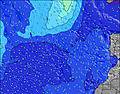 | 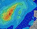 | 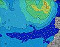 | 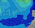 | ||||||||||||||
Wave Height (m) Direction Period (s) | NE 8 | NE 8 | S 16 | S 14 | NE 8 | NNE 8 | NNE 8 | NNE 7 | NNE 7 | NNE 7 | NNE 7 | S 11 | NNE 8 | NNE 8 | NNE 7 | NNE 8 | NNE 8 | NNE 8 | NNE 8 | NNE 8 | NNE 9 |
Wave Graph | |||||||||||||||||||||
0 | 0 | 5 | 4 | 0 | 0 | 0 | 0 | 0 | 0 | 0 | 2 | 0 | 0 | 0 | 0 | 0 | 0 | 0 | 0 | 0 | |
Wind (km/h) | |||||||||||||||||||||
Wind State on-shore cross-onshore cross-shore cross-offshore off-shore glassy | off | off | off | off | off | off | off | off | off | off | off | off | off | off | off | off | off | off | off | off | off |
High Tide | 5:49AM2.11m | 6:05PM2.28m | 6:35AM1.98m | 6:52PM2.06m | 7:26AM1.86m | 7:47PM1.86m | 8:25AM1.76m | 8:54PM1.71m | 9:36AM1.72m | 10:13PM1.65m | 10:50AM1.75m | 11:25PM1.68m | 11:51AM1.84m | 00:21AM1.77m | |||||||
Low Tide | 11:43AM0.41m | 00:21AM0.41m | 12:30PM0.57m | 1:07AM0.58m | 1:24PM0.71m | 2:00AM0.73m | 2:32PM0.82m | 3:06AM0.83m | 3:55PM0.86m | 4:22AM0.85m | 5:12PM0.81m | 5:29AM0.79m | 6:11PM0.70m | ||||||||
7:07 | — | — | 7:07 | — | — | 7:07 | — | — | 7:09 | — | — | 7:09 | — | — | 7:09 | — | — | 7:11 | — | — | |
— | 8:52 | — | — | 8:52 | — | — | 8:52 | — | — | 8:52 | — | — | 8:51 | — | — | 8:51 | — | — | 8:50 | — | |
mm | — | — | — | — | — | — | — | — | — | — | — | — | — | — | — | — | — | — | — | — | — |
Temp °C | 22 | 23 | 20 | 22 | 22 | 20 | 22 | 22 | 20 | 22 | 22 | 20 | 22 | 23 | 21 | 23 | 23 | 21 | 23 | 23 | 21 |
Feels °C | 18 | 19 | 17 | 18 | 18 | 17 | 19 | 18 | 17 | 18 | 19 | 17 | 19 | 20 | 18 | 20 | 19 | 18 | 19 | 19 | 17 |
Swell 1 Height (m) Direction Period (s) | W 9 | W 9 | W 8 | W 8 | NW 8 | NW 8 | W 12 | W 11 | W 11 | W 10 | W 10 | W 9 | W 9 | W 9 | W 9 | W 9 | — | W 9 | W 8 | W 8 | — |
2 | 2 | 1 | 1 | 2 | 2 | 3 | 2 | 2 | 2 | 2 | 2 | 2 | 2 | 2 | 2 | — | 1 | 1 | 1 | — | |
Swell 2 Height (m) Direction Period (s) | — | — | S 16 | S 14 | — | NW 9 | W 12 | NW 11 | W 8 | W 8 | W 8 | S 11 | — | — | — | — | — | — | — | — | — |
— | — | 5 | 4 | — | 3 | 3 | 5 | 1 | 1 | 1 | 2 | — | — | — | — | — | — | — | — | — | |
Swell 3 Height (m) Direction Period (s) | — | — | — | — | — | W 12 | — | W 9 | — | — | — | — | — | — | — | — | — | — | — | — | — |
— | — | — | — | — | 3 | — | 2 | — | — | — | — | — | — | — | — | — | — | — | — | — | |
Wind waves Height (m) Direction Period (s) | NE 8 | NE 8 | NE 7 | NE 8 | NE 8 | NNE 8 | NNE 8 | NNE 7 | NNE 7 | NNE 7 | NNE 7 | NNE 7 | NNE 8 | NNE 8 | NNE 7 | NNE 8 | NNE 8 | NNE 8 | NNE 8 | NNE 8 | NNE 9 |
326 | 344 | 349 | 485 | 485 | 356 | 287 | 279 | 249 | 249 | 263 | 265 | 302 | 296 | 327 | 345 | 414 | 432 | 659 | 692 | 853 | |
Nearest Offshore or Glassy | |||||||||||||||||||||
Distance (km) | 237 | 237 | 316 | 316 | 237 | 237 | 311 | 316 | 237 | 311 | 316 | 316 | 316 | 350 | 316 | 316 | 409 | 546 | 317 | 317 | 316 |
Best forecast wave conditions in Lanzarote | |||||||||||||||||||||
Best forecast wave conditions in Spain (Africa) | |||||||||||||||||||||
Header Global | |||||||||||||||||||||
- Map Icons:
 Break
Break Live Wave Height (m)
 Live Wind Speed (km/h)
 Surf Rating (10 Max)
 Ocean Swells (m)
- Wind Speed (km/h)


FREE! Surf-Forecast.com widget for your website
The surf report / weather widget below is available to embed on third party websites free of charge and provides a summary of our Barcarola - Puerto del Carmen surf forecast. Simply grab the html code snippet that we provide and paste it into your own site. You can choose your preferred language and metric/imperial units for the surf forecast feed to suit users of your site. Click here to get the code.
Information about the Barcarola - Puerto del Carmen Surf forecast
The above surf forecast table for Barcarola - Puerto del Carmen provides essential information for determining whether the surfing conditions will be good over the next 16 days. A general guide to surfing at Barcarola - Puerto del Carmen can be found by selecting the local surf guide option on the grey menu. Our Barcarola - Puerto del Carmen surf forecast is unique since it includes wave energy (power) that defines the real feel of the surf rather than just the height or the period. If you surf the same spot (Barcarola - Puerto del Carmen) regularly then make a mental note of the wave energy from the surf forecast table each time you go. Very soon you may start to choose your surf days based on the wave energy alone combined with our forecast of favourable offshore wind conditions. Our star ratings will help here and of course you will also find the usual wave height and period predictions on our surf forecasts as well as a full break down of the swell components under our advanced users option (to reveal that, click the little Einstein character under the tide times).
Further information to help with frequently asked questions about our surf forecast for Barcarola - Puerto del Carmen may be found under the help tab on the top menu and also by moving your mouse over the question marks on the surf forecast table itself. Please always bear in mind that the forecast is for near-shore open water and local factors at each surf break influence the actual breaking wave height, such as the beach / reef profile, water depths offshore and shelter.
 Nearest