

Surf Forecasts:

Arue Beach surf forecast from 1 Aug 2026:
- Most powerful swell: Sunday 2 Aug, 5AM (local time) - 2.5ft (0.8m), 7s period, ENE swell with 73 kJ wave energy.
Best Forecast Surf Conditions for Arue Beach this week:
The most powerful waves expected at Arue Beach in the next 16 days are 0.8m 7s and forecast to arrive on Sunday (Aug 02) at 5AM. Winds are predicted to be cross-offshore at the time the swell arrives. The largest open ocean swell (not directed at the beach) is 1.5m 5s period and expected on Saturday (Aug 08) at 5AM.
| Wave Type | Time (-10) & Date | Wave Height & Period |
|---|---|---|
| Next good surf (1 star+) | - | - |
| Best Surf | - | - |
| Most Powerful | 5AM (Sun 2nd Aug) | 2.5ft (0.8m) 7s |
Table - best surf conditions forecast for Arue Beach over the next 16 days.
The Lowdown
Alright, Rusty here. Let's get straight into it.
To be honest, it's a grim run of surf ahead. Over the next 16 days, there's nothing on the cards that’s really worth paddling out for. The only break on the radar is Arue Beach, and for the first week, the swell is tiny—mostly under 1 foot—with combined swell energy as low as 6 (weak) and hardly ever cracking 100. The wind is often cross-off, which keeps the surface clean, but with such small waves, it’s just not going to happen. By Sunday the 2nd, we see a tiny bump to 2 feet with energy at 87 (still weak), but the period is short at 8 seconds, so it’s very average. The water temperature at Arue Beach is about average for this time of year.
The second week doesn't get any better. The swell stays tiny, around 0.7 to 1 feet, and the wind gets brutal. From around the 8th of August, we’re looking at strong to near-gale force offshore winds, 25 to 34 mph, which makes paddling out nearly impossible. The energy values stay in the low double digits, like 14 or 31 (weak). It’s not even worth suiting up. The 14th of August brings a 1 feet NW swell with a period of 15 seconds, which is a long period groundswell, but the energy is only 105 (weak) and the wind is still a near-gale. It’s a write-off for paddle surfing; this setup looks more interesting for kite surfing than anything else.
Honestly, there’s not a single standout in this 16-day window. It’s a long, blank run. Forecasts can change, but for now, the board stays in the bag.
Rusty.
Short Range ForecastMostly dry. Warm (max 25°C on Sun afternoon, min 24°C on Sat morning). Winds decreasing (fresh winds from the ESE on Sat morning, light winds from the NE by Mon night). | Days 4-6 Weather SummaryMostly dry. Warm (max 26°C on Wed afternoon, min 25°C on Tue morning). Wind will be generally light. | ||||||||||||||||||||
Saturday 1 | Sunday 2 | Monday 3 | Tuesday 4 | Wednesday 5 | Thursday 6 | Friday 7 | |||||||||||||||
AM | PM | Night | AM | PM | Night | AM | PM | Night | AM | PM | Night | AM | PM | Night | AM | PM | Night | AM | PM | Night | |
Swell Height Map |  |  |  |  | 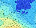 | 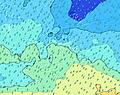 | 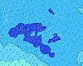 | ||||||||||||||
Wave Height (m) Direction Period (s) | NNE 9 | N 9 | N 10 | ENE 7 | ENE 7 | ENE 8 | N 9 | NNE 9 | ENE 7 | ENE 6 | ENE 6 | NE 12 | NE 11 | NE 11 | SW 18 | SSW 17 | SSW 16 | ENE 7 | ENE 7 | NNE 10 | NNE 9 |
Wave Graph | |||||||||||||||||||||
17 | 6 | 8 | 57 | 55 | 65 | 6 | 8 | 62 | 39 | 39 | 23 | 20 | 19 | 0 | 0 | 0 | 30 | 19 | 18 | 15 | |
Wind (km/h) | |||||||||||||||||||||
Wind State on-shore cross-onshore cross-shore cross-offshore off-shore glassy | cross-off | cross-off | cross-off | cross-off | cross-off | cross-off | cross-off | cross-off | cross-off | cross | cross-off | cross-off | cross-off | glassy | glassy | off | off | off | cross-off | off | off |
High Tide | 2:21PM0.43m | 2:07AM0.38m | 2:47PM0.41m | 2:21AM0.37m | 3:16PM0.39m | 2:32AM0.36m | 3:48PM0.36m | 2:35AM0.34m | 4:33PM0.33m | 2:06AM0.33m | 11:24PM0.33m | 11:08AM0.31m | 11:10PM0.35m | ||||||||
Low Tide | 8:23PM0.21m | 8:18AM0.19m | 8:46PM0.23m | 8:37AM0.20m | 9:07PM0.25m | 8:55AM0.22m | 9:26PM0.28m | 9:06AM0.24m | 9:28PM0.30m | 8:37AM0.27m | 6:21AM0.28m | 4:41PM0.25m | |||||||||
6:24 | — | — | 6:22 | — | — | 6:22 | — | — | 6:22 | — | — | 6:22 | — | — | 6:22 | — | — | 6:20 | — | — | |
— | 5:44 | — | — | 5:44 | — | — | 5:45 | — | — | 5:45 | — | — | 5:45 | — | — | 5:45 | — | — | 5:45 | — | |
mm | — | — | — | — | — | — | — | — | — | — | — | — | — | — | — | — | — | — | 2 | 1 | 5 |
Temp °C | 24 | 24 | 24 | 24 | 25 | 25 | 25 | 25 | 25 | 25 | 25 | 25 | 25 | 26 | 26 | 26 | 26 | 26 | 25 | 25 | 25 |
Feels °C | 20 | 22 | 21 | 23 | 25 | 24 | 24 | 25 | 26 | 25 | 27 | 27 | 27 | 29 | 29 | 28 | 28 | 27 | 25 | 26 | 26 |
Swell 1 Height (m) Direction Period (s) | SW 10 | SW 10 | SW 15 | ENE 7 | ENE 7 | ENE 8 | E 7 | E 7 | SW 13 | ENE 6 | ENE 6 | E 8 | E 8 | E 8 | E 8 | E 8 | E 8 | SW 16 | SW 15 | SW 15 | SW 14 |
35 | 34 | 59 | 57 | 55 | 65 | 54 | 48 | 44 | 39 | 39 | 80 | 80 | 98 | 74 | 55 | 74 | 421 | 597 | 543 | 529 | |
Swell 2 Height (m) Direction Period (s) | NNE 9 | SW 16 | SW 9 | SSW 15 | SSW 14 | SW 14 | SW 14 | SW 14 | NNE 9 | ESE 8 | SW 14 | SW 13 | SW 13 | SW 12 | SW 12 | SW 11 | SSW 16 | ENE 7 | ENE 7 | E 8 | NNE 9 |
17 | 67 | 12 | 84 | 82 | 47 | 46 | 51 | 8 | 12 | 103 | 85 | 82 | 72 | 69 | 77 | 173 | 30 | 19 | 68 | 15 | |
Swell 3 Height (m) Direction Period (s) | SSW 18 | N 9 | N 10 | NE 13 | N 9 | ESE 7 | N 9 | NNE 9 | NE 13 | SW 13 | ESE 8 | NE 12 | NE 11 | NE 11 | SW 18 | SSW 17 | SW 11 | NNE 9 | NNE 9 | NNE 10 | NW 12 |
31 | 6 | 8 | 27 | 7 | 10 | 6 | 8 | 7 | 27 | 21 | 23 | 20 | 19 | 82 | 200 | 73 | 8 | 17 | 18 | 6 | |
Wind waves Height (m) Direction Period (s) | E 7 | E 7 | ENE 7 | — | — | — | — | — | ENE 7 | — | — | — | — | — | S 2 | SE 3 | SSE 3 | ESE 4 | ESE 4 | SE 4 | ESE 5 |
146 | 86 | 91 | — | — | — | — | — | 62 | — | — | — | — | — | 1 | 5 | 4 | 40 | 54 | 40 | 95 | |
Nearest Offshore or Glassy | |||||||||||||||||||||
Distance (km) | 2475 | 2282 | 2282 | 1158 | 13 | 0 | 13 | 1 | 13 | 13 | 13 | 13 | 0 | 0 | 0 | 0 | 0 | 1 | 2613 | 2613 | 2613 |
Best forecast wave conditions in Tahiti | |||||||||||||||||||||
Best forecast wave conditions in French Polynesia | |||||||||||||||||||||
Header Global | |||||||||||||||||||||
- Map Icons:
 Break
Break Live Wave Height (m)
 Live Wind Speed (km/h)
 Surf Rating (10 Max)
 Ocean Swells (m)
- Wind Speed (km/h)
Latest Updates


FREE! Surf-Forecast.com widget for your website
The surf report / weather widget below is available to embed on third party websites free of charge and provides a summary of our Arue Beach surf forecast. Simply grab the html code snippet that we provide and paste it into your own site. You can choose your preferred language and metric/imperial units for the surf forecast feed to suit users of your site. Click here to get the code.
Information about the Arue Beach Surf forecast
The above surf forecast table for Arue Beach provides essential information for determining whether the surfing conditions will be good over the next 16 days. A general guide to surfing at Arue Beach can be found by selecting the local surf guide option on the grey menu. Our Arue Beach surf forecast is unique since it includes wave energy (power) that defines the real feel of the surf rather than just the height or the period. If you surf the same spot (Arue Beach) regularly then make a mental note of the wave energy from the surf forecast table each time you go. Very soon you may start to choose your surf days based on the wave energy alone combined with our forecast of favourable offshore wind conditions. Our star ratings will help here and of course you will also find the usual wave height and period predictions on our surf forecasts as well as a full break down of the swell components under our advanced users option (to reveal that, click the little Einstein character under the tide times).
Further information to help with frequently asked questions about our surf forecast for Arue Beach may be found under the help tab on the top menu and also by moving your mouse over the question marks on the surf forecast table itself. Please always bear in mind that the forecast is for near-shore open water and local factors at each surf break influence the actual breaking wave height, such as the beach / reef profile, water depths offshore and shelter.
Are you planning a holiday in Tahiti? If you are looking for accommodation near Arue Beach, camping, hotels and holiday cottages in Tahiti, consider staying in Papeete which is 10 km (6 miles) away. Other places in and around Tahiti where you can find information about places to rent, and car hire include Faaa which is 11 km (7 miles) away and Punaauia, 16 km (10 miles) away.
 Nearest