

Surf Forecasts:

Apolonia surf forecast from 31 Jul 2026:
- Best quality surf: Wednesday 5 Aug, 12AM (local time) - 2.5ft (0.8m), 6s period, WNW swell with glassy winds.
- Most powerful swell: Saturday 1 Aug, 6AM (local time) - 2.5ft (0.8m), 8s period, WNW swell with 90 kJ wave energy.
- Next surfable swell (1★+): Wednesday 5 Aug, 12AM (local time) - 2.5ft (0.8m), 6s period with WNW swell.
Best Forecast Surf Conditions for Apolonia this week:
The surf forecast for Apolonia over the next 16 days: The first swell (rated 1 star or higher) is forecast to arrive on Wednesday (Aug 05) at 12AM. The primary swell is predicted to be 0.8m and 6s period. The wind is predicted to be glassy as the swell arrives.
The most powerful waves expected at Apolonia in the next 16 days are 0.8m 8s and forecast to arrive on Saturday (Aug 01) at 6AM. Winds are predicted to be cross-onshore at the time the swell arrives.
| Wave Type | Time (IDT) & Date | Wave Height & Period |
|---|---|---|
| Next good surf (1 star+) | 12AM (Wed 5th Aug) | 2.5ft (0.8m) 6s |
| Best Surf | 12AM (Wed 5th Aug) | 2.5ft (0.8m) 6s |
| Most Powerful | 6AM (Sat 1st Aug) | 2.5ft (0.8m) 8s |
Table - best surf conditions forecast for Apolonia over the next 16 days.
The Lowdown
Alright, grab your board and let’s talk about what’s shaking. To be straight with you, the next couple of weeks are looking pretty lean for Apolonia. We’ve got a long stretch of small, weak surf and iffy winds. It’s not a total bust, but you’re going to have to be patient and pick your moments.
Right now, we’re starting off with a weak pulse of swell. Friday morning the 31st has the best of a pretty average run. We’re looking at a small 3ft wave from the WNW with a short, 8-second period. The energy reading is weak at 71, and the water is sitting at 84°, which is a touch warmer than normal for this time of year. The wind is light and cross-onshore, so it’s not going to be perfect. The sandbar is inconsistent, so you’ll be waiting around for the good ones. It’s marginal at best, so don’t expect much.
After that, it’s a real grind. From Friday afternoon through the weekend and into next week, the swell drops off and the wind, mostly from the NW, gets onshore and choppy. Saturday morning the 1st is a similar story to Friday, but the afternoon gets blown out. Sunday through Tuesday the 2nd to the 4th, we’re just scraping the bottom of the barrel with waves around 2ft and weak energy readings in the 20s and 30s. The period drops to 5-6 seconds, so it’s gutless and messy.
We basically have a dead spell for over a week. There’s nothing rideable until the 15th of August. That’s a long stretch of waiting. The forecast shows the swell finally bumps up a tiny bit on Saturday morning the 15th, with a 2ft WNW swell and a slightly better 7-second period. Energy is still weak at 48, but the morning wind is light cross-onshore, which at least gives a bit of clean surface. It’s still marginal, but it’s the only thing on the horizon that’s even worth a look. The period is short, so it’ll be a bit crumbly, but at this point, you take what you can get.
Honestly, if you’re not a beginner, this is a great time to take a break or find another hobby. For a sandbar that’s already inconsistent, this long stretch of flatness is normal for the area. The good news is, forecasts change, and it won’t stay this poor forever. But for now, don’t get your hopes up.
Rusty
Short Range ForecastMostly dry. Warm (max 30°C on Fri morning, min 27°C on Fri night). Wind will be generally light. | Days 4-6 Weather SummaryMostly dry. Warm (max 29°C on Mon morning, min 26°C on Mon night). Wind will be generally light. | ||||||||||||||||||||
Friday 31 | Saturday 1 | Sunday 2 | Monday 3 | Tuesday 4 | Wednesday 5 | Thursday 6 | |||||||||||||||
AM | PM | Night | AM | PM | Night | AM | PM | Night | AM | PM | Night | AM | PM | Night | AM | PM | Night | AM | PM | Night | |
Swell Height Map | 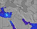 | 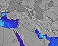 | 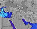 | 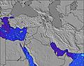 | 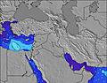 | 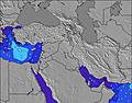 | 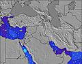 | ||||||||||||||
Wave Height (m) Direction Period (s) | WNW 8 | WNW 8 | WNW 8 | WNW 8 | WNW 8 | WNW 7 | WNW 6 | NW 6 | NW 4 | NW 5 | NW 5 | NW 5 | WNW 6 | WNW 6 | WNW 7 | WNW 6 | WNW 7 | WNW 6 | WNW 6 | WNW 6 | WNW 6 |
Wave Graph | |||||||||||||||||||||
71 | 66 | 75 | 86 | 51 | 41 | 27 | 31 | 12 | 19 | 29 | 20 | 28 | 40 | 38 | 37 | 38 | 33 | 32 | 41 | 27 | |
Wind (km/h) | |||||||||||||||||||||
Wind State on-shore cross-onshore cross-shore cross-offshore off-shore glassy | cross-on | on | cross | cross-on | cross-on | cross | cross-on | cross-on | cross-on | on | cross-on | cross-on | cross-on | on | glassy | cross-on | on | cross-on | cross-on | on | cross |
High Tide | 11:55AM0.40m | 00:26AM0.34m | 12:24PM0.39m | 00:54AM0.34m | 12:55PM0.37m | 1:25AM0.34m | 1:29PM0.34m | 1:58AM0.33m | 2:07PM0.30m | 2:39AM0.32m | 2:56PM0.26m | 3:35AM0.30m | 4:23PM0.22m | 5:10AM0.29m | |||||||
Low Tide | 6:20PM0.01m | 6:16AM0.06m | 6:46PM0.02m | 6:49AM0.06m | 7:13PM0.03m | 7:25AM0.07m | 7:43PM0.06m | 8:06AM0.09m | 8:15PM0.09m | 9:00AM0.11m | 8:55PM0.12m | 10:27AM0.13m | 10:01PM0.15m | ||||||||
5:54 | — | — | 5:54 | — | — | 5:54 | — | — | 5:56 | — | — | 5:56 | — | — | 5:56 | — | — | 5:58 | — | — | |
— | 7:38 | — | — | 7:37 | — | — | 7:37 | — | — | 7:37 | — | — | 7:36 | — | — | 7:35 | — | — | 7:34 | — | |
mm | — | — | — | — | — | — | — | — | — | — | — | — | — | — | — | — | — | — | — | — | — |
Temp °C | 30 | 30 | 28 | 30 | 30 | 28 | 30 | 30 | 28 | 29 | 29 | 27 | 29 | 29 | 27 | 28 | 28 | 27 | 28 | 29 | 27 |
Feels °C | 31 | 30 | 30 | 30 | 29 | 29 | 30 | 30 | 30 | 29 | 28 | 29 | 30 | 30 | 31 | 30 | 29 | 30 | 29 | 30 | 30 |
Swell 1 Height (m) Direction Period (s) | WNW 8 | WNW 8 | WNW 8 | WNW 8 | WNW 8 | WNW 7 | WNW 6 | — | WNW 6 | NW 5 | — | NW 5 | WNW 6 | — | WNW 7 | WNW 6 | — | WNW 6 | WNW 6 | — | WNW 6 |
71 | 66 | 75 | 86 | 51 | 41 | 27 | — | 4 | 19 | — | 20 | 28 | — | 38 | 37 | — | 33 | 32 | — | 27 | |
Swell 2 Height (m) Direction Period (s) | — | — | — | — | — | — | N 4 | — | — | NNW 6 | — | — | — | — | — | — | — | — | — | — | — |
— | — | — | — | — | — | 2 | — | — | 3 | — | — | — | — | — | — | — | — | — | — | — | |
Swell 3 Height (m) Direction Period (s) | — | — | — | — | — | — | — | — | — | — | — | — | — | — | — | — | — | — | — | — | — |
— | — | — | — | — | — | — | — | — | — | — | — | — | — | — | — | — | — | — | — | — | |
Wind waves Height (m) Direction Period (s) | — | — | NNW 3 | — | NW 3 | N 4 | — | NW 6 | NW 4 | — | NW 5 | — | — | WNW 6 | — | — | WNW 7 | — | — | WNW 6 | — |
— | — | 2 | — | 2 | 5 | — | 31 | 12 | — | 29 | — | — | 40 | — | — | 38 | — | — | 41 | — | |
Nearest Offshore or Glassy | |||||||||||||||||||||
Distance (km) | 9 | 1321 | 7 | 2223 | 2223 | 933 | 2223 | 1321 | 2223 | 2223 | 2223 | 2223 | 318 | 3613 | 313 | 45 | 2223 | 2223 | 3472 | 3635 | 2223 |
Best forecast wave conditions in Tel Aviv and South | |||||||||||||||||||||
Best forecast wave conditions in Israel | |||||||||||||||||||||
Header Global | |||||||||||||||||||||
- Map Icons:
 Break
Break Live Wave Height (m)
 Live Wind Speed (km/h)
 Surf Rating (10 Max)
 Ocean Swells (m)
- Wind Speed (km/h)
Latest Updates


FREE! Surf-Forecast.com widget for your website
The surf report / weather widget below is available to embed on third party websites free of charge and provides a summary of our Apolonia surf forecast. Simply grab the html code snippet that we provide and paste it into your own site. You can choose your preferred language and metric/imperial units for the surf forecast feed to suit users of your site. Click here to get the code.
Information about the Apolonia Surf forecast
The above surf forecast table for Apolonia provides essential information for determining whether the surfing conditions will be good over the next 16 days. A general guide to surfing at Apolonia can be found by selecting the local surf guide option on the grey menu. Our Apolonia surf forecast is unique since it includes wave energy (power) that defines the real feel of the surf rather than just the height or the period. If you surf the same spot (Apolonia) regularly then make a mental note of the wave energy from the surf forecast table each time you go. Very soon you may start to choose your surf days based on the wave energy alone combined with our forecast of favourable offshore wind conditions. Our star ratings will help here and of course you will also find the usual wave height and period predictions on our surf forecasts as well as a full break down of the swell components under our advanced users option (to reveal that, click the little Einstein character under the tide times).
Further information to help with frequently asked questions about our surf forecast for Apolonia may be found under the help tab on the top menu and also by moving your mouse over the question marks on the surf forecast table itself. Please always bear in mind that the forecast is for near-shore open water and local factors at each surf break influence the actual breaking wave height, such as the beach / reef profile, water depths offshore and shelter.
Are you planning a holiday in Tel Aviv and South? If you are looking for accommodation near Apolonia, camping, hotels and holiday cottages in Tel Aviv and South, consider staying in Herzliya which is 4 km (2 miles) away. Other places in and around Tel Aviv and South where you can find information about places to rent, and car hire include Ra'anana which is 6 km (4 miles) away, Ramat HaSharon, Hod HaSharon and Kfar Saba.
 Nearest