

Surf Forecasts:

Westport-The Groins surf forecast from 3 Aug 2026:
- Best quality surf: Monday 3 Aug, 11AM (local time) - 3.5ft (1.0m), 7s period, W swell with glassy winds.
- Most powerful swell: Wednesday 5 Aug, 2PM (local time) - 5ft (1.5m), 8s period, WNW swell with 307 kJ wave energy.
- Next surfable swell (1★+): Monday 3 Aug, 11AM (local time) - 3.5ft (1.0m), 7s period with W swell.
Best Forecast Surf Conditions for Westport-The Groins this week:
The surf forecast for Westport-The Groins over the next 16 days: The first swell (rated 1 star or higher) is forecast to arrive on Monday (Aug 03) at 11AM. The primary swell is predicted to be 1.0m and 7s period with a secondary swell of 0.3m and 13s. The wind is predicted to be glassy as the swell arrives.
The most powerful waves expected at Westport-The Groins in the next 16 days are 1.5m 8s and forecast to arrive on Wednesday (Aug 05) at 2PM. Winds are predicted to be cross-onshore at the time the swell arrives.
| Wave Type | Time (PDT) & Date | Wave Height & Period |
|---|---|---|
| Next good surf (1 star+) | 11AM (Mon 3rd Aug) | 3.5ft (1.0m) 7s |
| Best Surf | 11AM (Mon 3rd Aug) | 3.5ft (1.0m) 7s |
| Most Powerful | 2PM (Wed 5th Aug) | 5ft (1.5m) 8s |
Table - best surf conditions forecast for Westport-The Groins over the next 16 days.
The Lowdown
Alright folks, Rusty here. Let’s get into it for Westport, specifically the Groins. The whole 16-day window is a bit of a mixed bag, but I’ll tell you straight up: there’s some decent potential if you play the waiting game. The water temp is about average for this time of year, nothing wild there.
The first few days are a write-off, to be honest. Monday morning, August 3rd, starts off with a tiny 3ft W swell and glassy conditions, but the energy is weak (189) and the period is short. It’s surfable, but you’d be scratching for anything decent. Then things get ugly real quick. From Monday afternoon all the way through to the morning of Saturday, August 15th, the wind is almost always onshore or cross-onshore, making a mess of things. The swell hangs around 3ft to 6ft, mostly from the WNW, with moderate to fresh breezes. The energy picks up into the moderate range (from 220 up to 581), but the wind just ruins it. It’s choppy, lumpy, and not worth your time. This is a long stretch of poor surf, about 12 days of mainly junk.
Now, pay attention. The standout in this whole forecast is the morning of Sunday, August 16th. We finally get a break in the weather. The wind swings to a light SSW offshore, blowing at just 3 mph, and the forecast is calling for clean conditions. The swell is 4ft from the WNW with a moderate energy reading (421). It’s not a massive swell, but with that offshore wind, the Groins will clean up nicely. This is the best on offer, no question. It’s a bit of a wait, but it’s the one session you want to circle.
After that, the swell drops off fast. Sunday afternoon and Monday the 17th see tiny 2ft to 2ft SW groundswells with a very long period of 15-16 seconds. The energy is still moderate (244-298), and the wind is light, but the waves are small and weak. The long period will make it a bit tricky at the beach/jetty setup, but it’ll be clean and glassy on Monday morning. Not a standout, but a nice paddle if you’re desperate. Tuesday the 18th morning has a stronger offshore wind (16 mph from the S) but the swell is still tiny at 2ft, making it more of a kite-surfing day than a proper paddle session.
So, to sum it up: the first two weeks are mostly a washout. The one true standout is the morning of Sunday, August 16th, with that offshore wind. Don’t get your hopes up for anything else. It’s a long quiet spell, but that Saturday morning could be a little gem.
Rusty.
Short Range ForecastMostly dry. Warm (max 21°C on Tue morning, min 12°C on Mon morning). Winds decreasing (fresh winds from the NNW on Sun night, calm by Mon morning). | Days 5-7 Weather SummaryMostly dry. Very mild (max 16°C on Wed night, min 14°C on Wed night). Wind will be generally light. | ||||||||||||||||||
Monday 3 | Tuesday 4 | Wednesday 5 | Thursday 6 | Friday 7 | Saturday 8 | ||||||||||||||
Night | AM | PM | Night | AM | PM | Night | AM | PM | Night | AM | PM | Night | AM | PM | Night | AM | PM | Night | |
Swell Height Map |  | 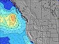 | 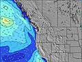 | 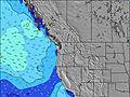 | 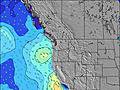 | 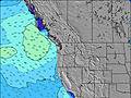 | 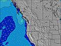 | ||||||||||||
Wave Height (m) Direction Period (s) | WNW 8 | W 7 | WNW 7 | WNW 6 | SW 16 | WNW 7 | WNW 8 | WNW 8 | WNW 8 | WNW 8 | WNW 8 | WNW 8 | WNW 7 | WNW 7 | WNW 7 | NW 6 | WNW 7 | NW 7 | WNW 7 |
Wave Graph | |||||||||||||||||||
229 | 112 | 118 | 104 | 84 | 108 | 188 | 228 | 223 | 212 | 188 | 163 | 131 | 93 | 99 | 88 | 173 | 206 | 180 | |
Wind (km/h) | |||||||||||||||||||
Wind State on-shore cross-onshore cross-shore cross-offshore off-shore glassy | on | glassy | cross-on | on | on | cross-on | on | cross-on | cross-on | cross-on | cross-off | cross | cross | cross | cross-on | cross-on | cross-on | cross-on | cross-on |
High Tide | 4:10AM2.25m | 4:50PM2.54m | 5:01AM2.05m | 5:25PM2.58m | 6:05AM1.86m | 6:08PM2.62m | 7:25AM1.73m | 7:03PM2.64m | 8:53AM1.72m | 8:11PM2.68m | 10:15AM1.83m | 9:22PM2.76m | |||||||
Low Tide | 10:07PM0.45m | 10:08AM0.12m | 10:55PM0.36m | 10:42AM0.37m | 11:51PM0.28m | 11:23AM0.64m | 00:57AM0.21m | 12:18PM0.90m | 2:09AM0.10m | 1:35PM1.09m | 3:20AM-0.05m | 2:58PM1.16m | 4:26AM-0.23m | ||||||
— | 5:58 | — | — | 5:58 | — | — | 6:00 | — | — | 6:01 | — | — | 6:03 | — | — | 6:03 | — | — | |
8:46 | — | 8:45 | — | — | 8:44 | — | — | 8:43 | — | — | 8:40 | — | — | 8:39 | — | — | 8:37 | — | |
mm | — | — | — | — | — | — | — | — | — | — | — | — | — | — | — | — | — | — | — |
Temp °C | 14 | 16 | 18 | 16 | 21 | 21 | 17 | 19 | 18 | 16 | 16 | 16 | 15 | 15 | 15 | 15 | 15 | 15 | 14 |
Feels °C | 8 | 15 | 14 | 12 | 19 | 17 | 13 | 18 | 15 | 14 | 15 | 14 | 14 | 13 | 12 | 11 | 12 | 11 | 9 |
Swell 1 Height (m) Direction Period (s) | WNW 8 | W 7 | SW 13 | WNW 6 | WNW 7 | W 9 | WNW 8 | WNW 8 | SW 15 | WNW 8 | WNW 8 | WNW 8 | SW 13 | WNW 7 | SW 13 | SW 13 | SW 13 | SW 16 | SW 17 |
229 | 112 | 27 | 104 | 84 | 42 | 188 | 228 | 54 | 212 | 188 | 163 | 45 | 93 | 60 | 58 | 25 | 94 | 71 | |
Swell 2 Height (m) Direction Period (s) | SW 13 | SW 13 | WSW 18 | SW 16 | SW 16 | SW 16 | SW 15 | SW 15 | SW 12 | SW 14 | SW 14 | SW 14 | WSW 19 | SW 13 | SW 18 | SW 18 | SW 18 | SW 12 | SW 12 |
63 | 28 | 30 | 66 | 66 | 65 | 58 | 55 | 6 | 51 | 50 | 48 | 37 | 44 | 50 | 49 | 49 | 40 | 24 | |
Swell 3 Height (m) Direction Period (s) | WSW 18 | SW 18 | — | SW 13 | WSW 13 | SW 12 | SW 12 | SW 12 | W 20 | SW 21 | SW 21 | SW 20 | W 16 | WSW 18 | W 12 | WNW 11 | W 13 | W 13 | W 12 |
31 | 49 | — | 27 | 16 | 6 | 6 | 6 | 8 | 18 | 17 | 15 | 5 | 34 | 11 | 24 | 14 | 31 | 27 | |
Wind waves Height (m) Direction Period (s) | — | — | WNW 7 | — | — | WNW 7 | — | — | WNW 8 | — | — | — | WNW 7 | — | WNW 7 | NW 6 | WNW 7 | NW 7 | WNW 7 |
— | — | 118 | — | — | 108 | — | — | 223 | — | — | — | 131 | — | 99 | 88 | 173 | 206 | 180 | |
Nearest Offshore or Glassy | |||||||||||||||||||
Distance (km) | 3 | 0 | 165 | 6 | 3 | 165 | 6 | 72 | 143 | 51 | 0 | 259 | 51 | 159 | 767 | 71 | 140 | 159 | 140 |
Best forecast wave conditions in Washington State | |||||||||||||||||||
Best forecast wave conditions in United States | |||||||||||||||||||
Header Global | |||||||||||||||||||
- Map Icons:
 Break
Break Live Wave Height (m)
 Live Wind Speed (km/h)
 Surf Rating (10 Max)
 Ocean Swells (m)
- Wind Speed (km/h)
Latest Updates


FREE! Surf-Forecast.com widget for your website
The surf report / weather widget below is available to embed on third party websites free of charge and provides a summary of our Westport-The Groins surf forecast. Simply grab the html code snippet that we provide and paste it into your own site. You can choose your preferred language and metric/imperial units for the surf forecast feed to suit users of your site. Click here to get the code.
Information about the Westport-The Groins Surf forecast
The above surf forecast table for Westport-The Groins provides essential information for determining whether the surfing conditions will be good over the next 16 days. A general guide to surfing at Westport-The Groins can be found by selecting the local surf guide option on the grey menu. Our Westport-The Groins surf forecast is unique since it includes wave energy (power) that defines the real feel of the surf rather than just the height or the period. If you surf the same spot (Westport-The Groins) regularly then make a mental note of the wave energy from the surf forecast table each time you go. Very soon you may start to choose your surf days based on the wave energy alone combined with our forecast of favourable offshore wind conditions. Our star ratings will help here and of course you will also find the usual wave height and period predictions on our surf forecasts as well as a full break down of the swell components under our advanced users option (to reveal that, click the little Einstein character under the tide times).
Further information to help with frequently asked questions about our surf forecast for Westport-The Groins may be found under the help tab on the top menu and also by moving your mouse over the question marks on the surf forecast table itself. Please always bear in mind that the forecast is for near-shore open water and local factors at each surf break influence the actual breaking wave height, such as the beach / reef profile, water depths offshore and shelter.
Are you planning a vacation in Washington State? If you are looking for accommodation near Westport-The Groins, camping, hotels and condos and appartments in Washington State, consider staying in Aberdeen which is 23 km (14 miles) away. Other places in and around Washington State where you can find information about places to rent, and car hire include Astoria which is 84 km (52 miles) away, Centralia, Olympia and Lacey.
 Nearest