

Surf Forecasts:

Two Ways surf forecast from 3 Aug 2026:
- Best quality surf: Tuesday 4 Aug, 2PM (local time) - 3.5ft (1.0m), 15s period, SSW swell with cross-offshore winds.
- Most powerful swell: Wednesday 5 Aug, 8AM (local time) - 4.5ft (1.3m), 19s period, SSW swell with 1,085 kJ wave energy.
- Next surfable swell (1★+): Tuesday 4 Aug, 2PM (local time) - 3.5ft (1.0m), 15s period with SSW swell.
Best Forecast Surf Conditions for Two Ways this week:
The surf forecast for Two Ways over the next 16 days: The first swell (rated 1 star or higher) is forecast to arrive on Tuesday (Aug 04) at 2PM. The primary swell is predicted to be 1.0m and 15s period with a secondary swell of 0.7m and 8s. The wind is predicted to be cross-offshore as the swell arrives.
The most powerful waves expected at Two Ways in the next 16 days are 1.3m 19s and forecast to arrive on Wednesday (Aug 05) at 8AM. Winds are predicted to be cross-onshore at the time the swell arrives.
| Wave Type | Time (+05) & Date | Wave Height & Period |
|---|---|---|
| Next good surf (1 star+) | 2PM (Tue 4th Aug) | 3.5ft (1.0m) 15s |
| Best Surf | 2PM (Tue 4th Aug) | 3.5ft (1.0m) 15s |
| Most Powerful | 8AM (Wed 5th Aug) | 4.5ft (1.3m) 19s |
Table - best surf conditions forecast for Two Ways over the next 16 days.
The Lowdown
Alright folks, Rusty here. Let’s get straight into it for Two Ways. It’s a bit of a mixed bag for the next couple of weeks, so we need to be patient.
Overall, the pattern is a long, drawn-out stretch of average to poor conditions, with the real standout hiding away at the end. The first week and a half is pretty much a write-off, with a lot of wind and messy, weak surf. We’re looking at a gap of about 12 days before things get genuinely good.
Monday, August 3rd kicks things off with a small 4ft SSW swell, but it’s a long-period groundswell (16 seconds). The wind is light and cross-on, so it’s not clean. The wave energy is moderate (962). This is a marginal call at best, and the same goes for the rest of the week. Tuesday the 4th drops to 3ft, and Wednesday the 5th sees a bit more size but with stronger cross-onshore winds that chop it up. The combined energy on Wednesday afternoon is moderate (1164), but the quality is just not there.
Thursday the 6th through to the weekend of the 9th and 10th is a stretch of onshore winds and sloppy conditions. The swell sticks around 5ft to 6ft, but the short period (9-10 seconds) and constant cross-onshore breeze make it a chop-fest. The wave energy is moderate (around 900-1081), but you’ll be fighting a mess. This is more of a kite-surfing show than a paddling session.
The following week, from Monday, August 11th to Thursday, August 14th, is still a tough call. The swell stays around 5ft to 6ft, but the wind is cross or cross-off, and the period is still short (10 seconds). The wave energy is moderate (around 745-1076). It’s a bit cleaner on the 14th with a cross-off wind, but it’s nothing to write home about.
Now, here’s the light at the end of the tunnel. Saturday, August 15th is where things start to look up. A new pulse of long-period SSW groundswell (16 seconds) at 4ft arrives. The wind goes cross-off in the morning and turns light cross-off in the afternoon, making it clean. The combined energy is moderate (1268 in the morning). It’s a solid option.
But the absolute standout is Sunday, August 16th. This is the one. We’ve got a clean 5ft SSW swell, with a very long period of 16 seconds. The wind is glassy – dead calm – all day. The combined energy is strong (1346 in the morning, 1294 in the afternoon). This is *excellent surf* for experienced surfers. The long period means the waves will have great shape and power, with long gaps between sets. At this size, it’s a bit beefy for beginners. For the rest of us, this is the session to aim for. It’s still a week and a half away, so keep an eye on the forecast, but it looks promising.
After that, the 18th turns onshore again, so grab that Sunday window.
Rusty.
Short Range ForecastModerate rain (total 19mm), heaviest on Mon night. Warm (max 28°C on Mon morning, min 27°C on Mon morning). Wind will be generally light. | Days 4-6 Weather SummaryLight rain (total 8mm), mostly falling on Sat morning. Warm (max 28°C on Sat afternoon, min 26°C on Thu morning). Wind will be generally light. | ||||||||||||||||||||
Monday 3 | Tuesday 4 | Wednesday 5 | Thursday 6 | Friday 7 | Saturday 8 | Sunday 9 | |||||||||||||||
AM | PM | Night | AM | PM | Night | AM | PM | Night | AM | PM | Night | AM | PM | Night | AM | PM | Night | AM | PM | Night | |
Swell Height Map | 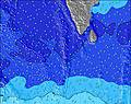 | 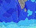 | 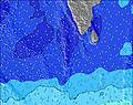 | 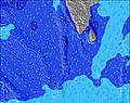 | 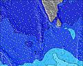 | 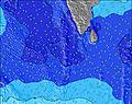 | 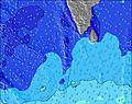 | ||||||||||||||
Wave Height (m) Direction Period (s) | SSW 16 | SSW 16 | SSW 15 | SSW 15 | SSW 15 | S 20 | SSW 18 | SSW 17 | SSE 10 | SSW 15 | SSE 9 | SSE 11 | SSE 11 | SSE 11 | SSE 10 | SSE 10 | S 10 | SSE 10 | SSE 10 | SSE 10 | SSE 10 |
Wave Graph | |||||||||||||||||||||
761 | 733 | 661 | 405 | 405 | 485 | 832 | 813 | 603 | 360 | 466 | 743 | 798 | 813 | 663 | 763 | 416 | 690 | 663 | 574 | 490 | |
Wind (km/h) | |||||||||||||||||||||
Wind State on-shore cross-onshore cross-shore cross-offshore off-shore glassy | cross-on | cross | cross | cross | cross | cross-on | cross-on | cross-on | cross-on | cross | cross-on | cross-on | cross-on | cross-on | cross-on | cross-on | cross-on | cross-on | cross-on | cross-on | on |
High Tide | 4:04PM1.05m | 4:38AM0.95m | 4:28PM0.99m | 5:21AM0.90m | 4:54PM0.91m | 6:19AM0.83m | 5:22PM0.82m | 7:56AM0.77m | 5:58PM0.73m | 10:24AM0.79m | 8:10PM0.64m | 11:48AM0.88m | 10:49PM0.67m | ||||||||
Low Tide | 9:53AM0.24m | 10:24PM0.17m | 10:26AM0.32m | 10:56PM0.17m | 11:03AM0.41m | 11:35PM0.20m | 11:48AM0.51m | 00:28AM0.24m | 1:05PM0.61m | 1:53AM0.27m | 5:04PM0.62m | 3:56AM0.26m | 6:19PM0.53m | ||||||||
6:09 | — | — | 6:09 | — | — | 6:09 | — | — | 6:09 | — | — | 6:07 | — | — | 6:07 | — | — | 6:07 | — | — | |
— | 6:15 | — | — | 6:15 | — | — | 6:15 | — | — | 6:15 | — | — | 6:15 | — | — | 6:15 | — | — | 6:15 | — | |
mm | — | 3 | 5 | 1 | — | 2 | 3 | 2 | 3 | — | — | 1 | — | — | 2 | 4 | — | 1 | — | — | — |
Temp °C | 28 | 27 | 27 | 27 | 28 | 28 | 27 | 27 | 27 | 27 | 27 | 27 | 27 | 27 | 27 | 27 | 28 | 28 | 27 | 28 | 28 |
Feels °C | 32 | 30 | 30 | 30 | 31 | 31 | 29 | 29 | 29 | 28 | 27 | 28 | 29 | 28 | 27 | 28 | 29 | 29 | 29 | 30 | 30 |
Swell 1 Height (m) Direction Period (s) | SSW 16 | SSW 16 | SSW 15 | SSW 15 | SSW 15 | SSW 15 | SSW 18 | SSE 9 | SSE 10 | S 10 | SSE 9 | SSE 11 | SSE 11 | SSE 11 | SSE 10 | SSE 10 | S 10 | SSE 10 | SSE 10 | SSE 10 | SSE 10 |
761 | 733 | 661 | 405 | 405 | 461 | 832 | 351 | 603 | 312 | 466 | 743 | 798 | 813 | 663 | 763 | 416 | 690 | 663 | 574 | 490 | |
Swell 2 Height (m) Direction Period (s) | SE 8 | SSE 8 | SSE 8 | SE 9 | S 9 | S 10 | SE 8 | SSW 17 | SSW 16 | SE 10 | SSW 14 | S 18 | S 17 | S 16 | S 14 | S 16 | SE 10 | S 18 | S 16 | S 15 | S 14 |
201 | 179 | 133 | 77 | 102 | 161 | 142 | 813 | 540 | 177 | 276 | 402 | 367 | 343 | 192 | 129 | 290 | 298 | 325 | 294 | 257 | |
Swell 3 Height (m) Direction Period (s) | WNW 9 | NW 9 | NW 8 | S 8 | SE 9 | S 20 | S 10 | NW 8 | NW 7 | SSW 15 | S 19 | SSW 14 | SSW 13 | NW 7 | S 17 | SW 15 | S 16 | SW 15 | SW 14 | SSW 23 | SSW 21 |
108 | 79 | 70 | 58 | 62 | 485 | 153 | 28 | 27 | 360 | 175 | 149 | 101 | 14 | 211 | 59 | 132 | 54 | 46 | 213 | 359 | |
Wind waves Height (m) Direction Period (s) | — | — | — | — | — | — | — | — | — | — | — | — | — | — | — | — | — | — | — | — | — |
— | — | — | — | — | — | — | — | — | — | — | — | — | — | — | — | — | — | — | — | — | |
Nearest Offshore or Glassy | |||||||||||||||||||||
Distance (km) | 54 | 54 | 54 | 25 | 54 | 54 | 54 | 198 | 1046 | 1195 | 1195 | 1203 | 1195 | 1195 | 1203 | 1203 | 1202 | 1203 | 1061 | 198 | 172 |
Best forecast wave conditions in Huvadhoo Atoll | |||||||||||||||||||||
Best forecast wave conditions in Maldives | |||||||||||||||||||||
Header Global | |||||||||||||||||||||
- Map Icons:
 Break
Break Live Wave Height (m)
 Live Wind Speed (km/h)
 Surf Rating (10 Max)
 Ocean Swells (m)
- Wind Speed (km/h)
Latest Updates


FREE! Surf-Forecast.com widget for your website
The surf report / weather widget below is available to embed on third party websites free of charge and provides a summary of our Two Ways surf forecast. Simply grab the html code snippet that we provide and paste it into your own site. You can choose your preferred language and metric/imperial units for the surf forecast feed to suit users of your site. Click here to get the code.
Information about the Two Ways Surf forecast
The above surf forecast table for Two Ways provides essential information for determining whether the surfing conditions will be good over the next 16 days. A general guide to surfing at Two Ways can be found by selecting the local surf guide option on the grey menu. Our Two Ways surf forecast is unique since it includes wave energy (power) that defines the real feel of the surf rather than just the height or the period. If you surf the same spot (Two Ways) regularly then make a mental note of the wave energy from the surf forecast table each time you go. Very soon you may start to choose your surf days based on the wave energy alone combined with our forecast of favourable offshore wind conditions. Our star ratings will help here and of course you will also find the usual wave height and period predictions on our surf forecasts as well as a full break down of the swell components under our advanced users option (to reveal that, click the little Einstein character under the tide times).
Further information to help with frequently asked questions about our surf forecast for Two Ways may be found under the help tab on the top menu and also by moving your mouse over the question marks on the surf forecast table itself. Please always bear in mind that the forecast is for near-shore open water and local factors at each surf break influence the actual breaking wave height, such as the beach / reef profile, water depths offshore and shelter.
Two Ways is 105 km (65 miles) from the city of Gan. If you plan a holiday in Huvadhoo Atoll, look for hotels and other accommodation in Gan. Gan has rooms for a wide range of budgets as well as car hire and transport links.
 Nearest