

Surf Forecasts:

Trigg Beach surf forecast from 3 Aug 2026:
- Best quality surf: Wednesday 5 Aug, 11PM (local time) - 11ft (3.5m), 16s period, WSW swell with cross-offshore winds.
- Most powerful swell: Saturday 8 Aug, 11PM (local time) - 11ft (3.5m), 16s period, WSW swell with 7,057 kJ wave energy.
- Next surfable swell (1★+): Wednesday 5 Aug, 8PM (local time) - 10ft (3.0m), 16s period with WSW swell.
Best Forecast Surf Conditions for Trigg Beach this week:
The surf forecast for Trigg Beach over the next 16 days: The first swell (rated 1 star or higher) is forecast to arrive on Wednesday (Aug 05) at 8PM. The primary swell is predicted to be 3.0m and 16s period. The wind is predicted to be glassy as the swell arrives.
The most powerful waves expected at Trigg Beach in the next 16 days are 3.5m 16s and forecast to arrive on Saturday (Aug 08) at 11PM. Winds are predicted to be cross-offshore at the time the swell arrives.
| Wave Type | Time (AWST) & Date | Wave Height & Period |
|---|---|---|
| Next good surf (1 star+) | 8PM (Wed 5th Aug) | 10ft (3.0m) 16s |
| Best Surf | 11PM (Wed 5th Aug) | 11ft (3.5m) 16s |
| Most Powerful | 11PM (Sat 8th Aug) | 11ft (3.5m) 16s |
Table - best surf conditions forecast for Trigg Beach over the next 16 days.
The Lowdown
G’day, it’s Rusty here with a look at the surf ahead for Trigg Beach. This is a beach and point setup, fairly exposed to the swell. Right now, we’ve got a fair bit of surf on the table, but it’s a mixed bag of quality and conditions, so let’s work through it carefully.
The first clean window we see is Thursday morning, August 6th, and this is the standout of the whole run. The morning brings a glassy surface with zero wind – dead calm – and a solid 9.8ft swell from the WSW, with a period of 16 seconds. That’s a proper groundswell, and the combined wave energy is strong at 4295. The water temp is about average for this time of year, so nothing unusual there. This is a session for experienced surfers only, as the size is well over 8.2ft, but the conditions are near-perfect. The offshore wind direction is NW, which is good for this spot, and the break is fairly consistent. Crowds are often here, so expect company.
Leading up to that, Wednesday, August 5th has some potential. The morning sees a 8.2ft WSW swell at 16 seconds, with a light cross-shore breeze from the north at 5 km/h. The wave energy is very strong at 3504, but the surf is listed as marginal due to tide conditions. By afternoon, the swell jumps to 9.8ft with the same 16-second period, from the WSW, and the wind shifts onshore from the WSW at 10 km/h. The energy is even stronger at 5065, but the onshore wind will make it messy. Not the best, but a morning paddle might be worth a look if you’re keen.
Now, Friday, August 7th is a write-off. Strong onshore winds from the WNW at 30 km/h, 9.8ft swell, poor conditions. Don’t bother.
Saturday, August 8th delivers a massive pulse: 11.5ft swell from the WSW with a 15-16 second period, and the combined energy rockets to 5767 in the morning and a whopping 12544 in the afternoon. That’s very strong wave energy. The wind is cross-shore from the south at 20-25 km/h, but the swell is too big for this break. Only for experts, and even then, it’s a heavy, challenging day. The break is a beach and point, so with this much power, it might be more interesting for kite surfing than paddle surfing.
Sunday, August 9th eases off a bit. The morning has a 9.8ft WSW swell at 16 seconds, with a light cross-shore breeze from the north at 10 km/h. The energy is 4483, still strong. It’s listed as marginal, so not a standout, but a possible session if you’re desperate. The afternoon goes cross-onshore and the quality drops.
Monday, August 10th is poor again. Strong onshore winds from the SW, 25-30 km/h, and the swell drops to 6.2-7.2ft. Choppy and lumpy. Skip it.
A better window opens Tuesday morning, August 11th. A clean cross-offshore breeze from the SSE at 25 km/h, a 7.5ft swell from the SW at 16 seconds, and combined energy of 2676. It’s listed as marginal, but the wind is clean, so the surf will be shaped. Not a huge standout, but workable.
Wednesday morning, August 12th is another highlight. Clear skies, a cross-offshore breeze from the NE at 10 km/h, and a 7.9ft swell from the SW at 16 seconds. The energy is 2831, and the description says excellent conditions for experienced surfers. This is a good call – the swell is still over 8.2ft, so it’s only for the experienced, but the wind is tidy and the waves will have good form.
Thursday, August 13th sees the swell drop to 5.2ft from the SW at 15 seconds, with a clean cross-offshore breeze from the ENE at 10 km/h. The energy is 1263, which is moderate. It’s listed as very good surf conditions, but with the lower size, it’s a fun, smaller session for all levels.
Friday, August 14th is similar: 5.2ft swell from the SW, 15 seconds, clean cross-offshore wind from the NE at 20 km/h. The energy is 1234. Marginal, but clean.
Short Range ForecastLight rain (total 8mm), mostly falling on Mon night. Very mild (max 18°C on Mon night, min 12°C on Thu morning). Winds decreasing (fresh winds from the WNW on Mon night, calm by Wed night). | Days 5-7 Weather SummaryLight rain (total 5mm), mostly falling on Fri night. Very mild (max 18°C on Fri afternoon, min 11°C on Sun morning). Winds increasing (calm on Thu night, strong winds from the SSW by Fri night). | ||||||||||||||||||
Tuesday 4 | Wednesday 5 | Thursday 6 | Friday 7 | Saturday 8 | Sunday 9 | ||||||||||||||
Night | AM | PM | Night | AM | PM | Night | AM | PM | Night | AM | PM | Night | AM | PM | Night | AM | PM | Night | |
Swell Height Map |  |  |  |  | 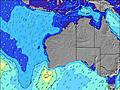 | 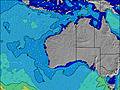 | 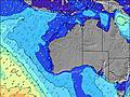 | ||||||||||||
Wave Height (m) Direction Period (s) | WSW 16 | WSW 19 | WSW 17 | WSW 16 | WSW 16 | WSW 16 | WSW 16 | WSW 16 | WSW 16 | WSW 16 | WSW 15 | WSW 15 | WSW 15 | WSW 15 | WSW 16 | WSW 17 | WSW 16 | WSW 16 | SW 15 |
Wave Graph | |||||||||||||||||||
811 | 2938 | 3904 | 2583 | 3504 | 5065 | 4919 | 4295 | 3614 | 3113 | 3756 | 3484 | 3800 | 5767 | 6662 | 6613 | 4478 | 3329 | 2120 | |
Wind (km/h) | |||||||||||||||||||
Wind State on-shore cross-onshore cross-shore cross-offshore off-shore glassy | on | on | cross-on | on | cross | on | cross-off | glassy | cross-on | glassy | on | on | cross-on | cross | cross | cross-off | cross | cross-on | on |
High Tide | 1:28AM0.46m | 10:41AM0.37m | 2:02AM0.52m | 2:57AM0.57m | 4:07AM0.62m | 5:18AM0.67m | 6:24AM0.71m | ||||||||||||
Low Tide | 7:12AM0.33m | 6:06PM0.21m | 5:15PM0.21m | 2:59PM0.14m | 3:09PM0.06m | 3:37PM-0.01m | 4:12PM-0.04m | ||||||||||||
— | 7:03 | — | — | 7:03 | — | — | 7:01 | — | — | 7:01 | — | — | 7:00 | — | — | 6:58 | — | — | |
5:42 | — | 5:42 | — | — | 5:43 | — | — | 5:43 | — | — | 5:44 | — | — | 5:45 | — | — | 5:45 | — | |
mm | 8 | — | — | — | — | — | — | — | — | — | — | 1 | 4 | — | — | — | — | — | 1 |
Temp °C | 18 | 17 | 17 | 16 | 17 | 17 | 17 | 15 | 16 | 16 | 17 | 18 | 16 | 14 | 14 | 13 | 12 | 15 | 16 |
Feels °C | 15 | 14 | 12 | 13 | 15 | 14 | 16 | 13 | 14 | 15 | 11 | 12 | 10 | 7 | 8 | 9 | 9 | 12 | 13 |
Swell 1 Height (m) Direction Period (s) | WSW 16 | WSW 19 | WSW 17 | WSW 16 | WSW 16 | WSW 16 | WSW 16 | WSW 16 | WSW 16 | WSW 16 | WSW 15 | WSW 15 | — | WSW 15 | WSW 16 | WSW 17 | WSW 16 | WSW 16 | SW 15 |
811 | 2938 | 3904 | 2583 | 3504 | 5065 | 4919 | 4295 | 3614 | 3113 | 3756 | 3484 | — | 5767 | 6662 | 6613 | 4478 | 3329 | 2120 | |
Swell 2 Height (m) Direction Period (s) | WSW 21 | — | — | — | — | — | — | — | — | — | — | — | — | — | — | NW 12 | NW 11 | WSW 21 | WSW 19 |
302 | — | — | — | — | — | — | — | — | — | — | — | — | — | — | 6 | 5 | 404 | 657 | |
Swell 3 Height (m) Direction Period (s) | — | — | — | — | — | — | — | — | — | — | — | — | — | — | — | — | — | NW 11 | NW 11 |
— | — | — | — | — | — | — | — | — | — | — | — | — | — | — | — | — | 5 | 5 | |
Wind waves Height (m) Direction Period (s) | WNW 5 | W 6 | — | — | — | — | — | — | — | — | — | — | WSW 15 | — | WSW 16 | — | — | — | — |
75 | 92 | — | — | — | — | — | — | — | — | — | — | 3800 | — | 5882 | — | — | — | — | |
Nearest Offshore or Glassy | |||||||||||||||||||
Distance (km) | 369 | 288 | 440 | 288 | 7 | 281 | 0 | 0 | 362 | 0 | 364 | 1126 | 1624 | 2385 | 2449 | 1 | 7 | 409 | 288 |
Best forecast wave conditions in Perth City Coast | |||||||||||||||||||
Best forecast wave conditions in Australia | |||||||||||||||||||
Header Global | |||||||||||||||||||
- Map Icons:
 Break
Break Live Wave Height (m)
 Live Wind Speed (km/h)
 Surf Rating (10 Max)
 Ocean Swells (m)
- Wind Speed (km/h)
Latest Updates


FREE! Surf-Forecast.com widget for your website
The surf report / weather widget below is available to embed on third party websites free of charge and provides a summary of our Trigg Beach surf forecast. Simply grab the html code snippet that we provide and paste it into your own site. You can choose your preferred language and metric/imperial units for the surf forecast feed to suit users of your site. Click here to get the code.
Information about the Trigg Beach Surf forecast
The above surf forecast table for Trigg Beach provides essential information for determining whether the surfing conditions will be good over the next 16 days. A general guide to surfing at Trigg Beach can be found by selecting the local surf guide option on the grey menu. Our Trigg Beach surf forecast is unique since it includes wave energy (power) that defines the real feel of the surf rather than just the height or the period. If you surf the same spot (Trigg Beach) regularly then make a mental note of the wave energy from the surf forecast table each time you go. Very soon you may start to choose your surf days based on the wave energy alone combined with our forecast of favourable offshore wind conditions. Our star ratings will help here and of course you will also find the usual wave height and period predictions on our surf forecasts as well as a full break down of the swell components under our advanced users option (to reveal that, click the little Einstein character under the tide times).
Further information to help with frequently asked questions about our surf forecast for Trigg Beach may be found under the help tab on the top menu and also by moving your mouse over the question marks on the surf forecast table itself. Please always bear in mind that the forecast is for near-shore open water and local factors at each surf break influence the actual breaking wave height, such as the beach / reef profile, water depths offshore and shelter.
Are you planning a holiday in Perth City Coast? If you are looking for accommodation near Trigg Beach, camping, hotels and holiday cottages in Perth City Coast, consider staying in Perth which is 14 km (9 miles) away. Other places in and around Perth City Coast where you can find information about places to rent, and car hire include Fremantle which is 21 km (13 miles) away, Canning Vale, Gosnells and Kwinana.
 Nearest