

Surf Forecasts:

The Wash Right surf forecast from 3 Aug 2026:
- Best quality surf: Thursday 6 Aug, 9PM (local time) - 2.5ft (0.7m), 18s period, SSW swell with cross-offshore winds.
- Most powerful swell: Saturday 8 Aug, 3AM (local time) - 4ft (1.2m), 16s period, SSW swell with 724 kJ wave energy.
- Next surfable swell (1★+): Monday 3 Aug, 6AM (local time) - 2.5ft (0.8m), 13s period with SSW swell.
Best Forecast Surf Conditions for The Wash Right this week:
The surf forecast for The Wash Right over the next 16 days: The first swell (rated 1 star or higher) is forecast to arrive on Monday (Aug 03) at 6AM. The primary swell is predicted to be 0.8m and 13s period. The wind is predicted to be cross-offshore as the swell arrives.
The most powerful waves expected at The Wash Right in the next 16 days are 1.2m 16s and forecast to arrive on Saturday (Aug 08) at 3AM. Winds are predicted to be cross-offshore at the time the swell arrives. The largest open ocean swell (not directed at the beach) is 0.7m 4s period and expected on Monday (Aug 03) at 6AM.
| Wave Type | Time (CST) & Date | Wave Height & Period |
|---|---|---|
| Next good surf (1 star+) | 6AM (Mon 3rd Aug) | 2.5ft (0.8m) 13s |
| Best Surf | 9PM (Thu 6th Aug) | 2.5ft (0.7m) 18s |
| Most Powerful | 3AM (Sat 8th Aug) | 4ft (1.2m) 16s |
Table - best surf conditions forecast for The Wash Right over the next 16 days.
The Lowdown
Alright folks, Rusty here. Let’s see what The Wash Right has cooking for us.
We’re looking at a long stretch of small, clean surf, but the real fun doesn’t kick in until Saturday the 8th of August. Before that, from Monday the 3rd through Friday the 7th, we’ve got waves mostly in the 0.4m to 1.0m range, with some glassy mornings and onshore afternoons. The energy is weak to moderate, with the combined swell energy sitting between 200 and 393 (moderate energy). Water temp is about average for this time of year. Not much to write home about.
The standout window is Saturday the 8th of August. Saturday morning: clear skies, glassy calm, 0 km/h wind, and a clean 1.1m, 16-second SSW groundswell. The combined energy is a solid 809 (moderate-to-strong). This is the pick of the run – smooth, lined-up, and fun. It can get busy here, so pack your patience.
Sunday the 9th of August is another beauty. Sunday morning: clear skies, glassy calm, and a 1.1m, 14-second SSW swell. Combined energy of 548 (moderate energy). Clean, easy, and welcoming.
Tuesday the 11th of August offers a glassy morning with 0.9m of 18-second SSW groundswell. That long period is magic for this reef. Combined energy of 795 (moderate-to-strong). Clean and punchy.
Looking further out, Friday the 14th of August has some bite. Friday morning shows a 1.1m, 18-second SSW swell, with a cross-offshore breeze (NW) and clean conditions. Combined energy jumps to 1078 (strong wave energy). That’s a powerful swell. The afternoon sees the swell hit 1.4m, 17 seconds, with combined energy of 1135 (strong). This is for experienced surfers only – the size and power are real. The long period means it’s best for this reef, but it’s a serious session.
After that, the surf settles into the 0.8m to 1.2m range for the rest of the second week, with a few more glassy mornings like Monday the 17th of August offering clean 0.8m, 14-second SSW swell.
For the best of the best, I’m paddling out early on Saturday the 8th or Sunday the 9th. For the brave, Friday the 14th is the one.
Rusty, signing off.
Short Range ForecastLight rain (total 7mm), mostly falling on Sun night. Warm (max 30°C on Mon morning, min 27°C on Mon night). Wind will be generally light. | Days 5-7 Weather SummaryHeavy rain (total 24mm), heaviest during Thu night. Warm (max 30°C on Thu morning, min 25°C on Fri morning). Wind will be generally light. | ||||||||||||||||||
Monday 3 | Tuesday 4 | Wednesday 5 | Thursday 6 | Friday 7 | Saturday 8 | ||||||||||||||
Night | AM | PM | Night | AM | PM | Night | AM | PM | Night | AM | PM | Night | AM | PM | Night | AM | PM | Night | |
Swell Height Map |  |  |  |  | 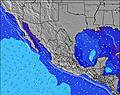 | 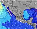 | 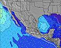 | ||||||||||||
Wave Height (m) Direction Period (s) | SW 13 | SSW 13 | SSW 13 | SSW 13 | SW 16 | SSW 12 | SW 15 | SW 14 | SW 14 | SW 14 | SW 13 | SSW 18 | SSW 18 | SSW 18 | SSW 16 | SSW 16 | SSW 16 | SSW 15 | SSW 14 |
Wave Graph | |||||||||||||||||||
245 | 261 | 141 | 137 | 87 | 96 | 134 | 132 | 128 | 149 | 212 | 286 | 214 | 637 | 559 | 627 | 589 | 530 | 508 | |
Wind (km/h) | |||||||||||||||||||
Wind State on-shore cross-onshore cross-shore cross-offshore off-shore glassy | cross-off | glassy | cross-on | cross-off | cross-off | glassy | off | cross | on | cross-off | cross | on | cross-off | cross | cross | glassy | glassy | on | cross-off |
High Tide | 10:28PM0.56m | 11:19AM0.60m | 10:48PM0.48m | 11:12AM0.61m | 10:19PM0.39m | 10:49AM0.62m | 10:07AM0.64m | 9:38AM0.67m | 5:07PM0.57m | 9:36AM0.69m | 6:28PM0.63m | ||||||||
Low Tide | 4:49AM0.31m | 5:46PM0.37m | 4:30AM0.37m | 7:02PM0.37m | 00:40AM0.28m | 1:05AM0.16m | 2:51PM0.55m | 1:38AM0.06m | 2:32PM0.54m | 2:13AM-0.01m | |||||||||
— | 6:31 | — | — | 6:31 | — | — | 6:31 | — | — | 6:31 | — | — | 6:33 | — | — | 6:33 | — | — | |
— | — | 7:27 | — | — | 7:25 | — | — | 7:25 | — | — | 7:24 | — | — | 7:24 | — | — | 7:23 | — | |
mm | 2 | — | — | 3 | — | 2 | — | — | — | 3 | 1 | 1 | 9 | 5 | — | 2 | — | 3 | — |
Temp °C | 29 | 30 | 30 | 29 | 30 | 29 | 29 | 30 | 30 | 29 | 30 | 30 | 29 | 29 | 29 | 28 | 30 | 29 | 28 |
Feels °C | 33 | 35 | 35 | 33 | 35 | 35 | 34 | 34 | 34 | 34 | 34 | 35 | 33 | 33 | 31 | 33 | 34 | 33 | 30 |
Swell 1 Height (m) Direction Period (s) | SW 13 | SSW 13 | SSW 13 | SSW 13 | SSW 12 | SSW 12 | SW 15 | S 9 | S 9 | SW 14 | SW 13 | SW 13 | SW 13 | SSW 18 | SSW 16 | SSW 16 | SSW 16 | SSW 15 | SSW 14 |
245 | 261 | 141 | 137 | 85 | 96 | 134 | 56 | 56 | 149 | 212 | 208 | 196 | 637 | 559 | 627 | 589 | 530 | 508 | |
Swell 2 Height (m) Direction Period (s) | SW 18 | W 4 | SW 12 | SW 16 | S 8 | S 8 | S 8 | SW 14 | SW 14 | S 9 | S 8 | SSW 18 | SSW 18 | SW 12 | SW 12 | SW 12 | SW 12 | SSE 12 | SW 11 |
111 | 10 | 52 | 91 | 21 | 33 | 33 | 132 | 128 | 56 | 50 | 286 | 214 | 178 | 141 | 144 | 114 | 106 | 76 | |
Swell 3 Height (m) Direction Period (s) | W 9 | SW 16 | W 5 | SW 12 | SW 16 | SW 15 | SSW 12 | SSW 12 | SSW 11 | SW 20 | SSW 18 | S 8 | S 8 | S 8 | S 8 | S 12 | SSE 12 | SW 11 | S 8 |
14 | 69 | 7 | 51 | 87 | 77 | 56 | 54 | 48 | 97 | 131 | 51 | 51 | 34 | 33 | 104 | 106 | 43 | 47 | |
Wind waves Height (m) Direction Period (s) | W 5 | — | — | WNW 4 | — | — | WNW 5 | — | — | WNW 5 | — | — | NW 3 | — | — | — | — | — | NW 3 |
21 | — | — | 5 | — | — | 5 | — | — | 2 | — | — | 3 | — | — | — | — | — | 5 | |
Nearest Offshore or Glassy | |||||||||||||||||||
Distance (km) | 0 | 0 | 850 | 0 | 0 | 0 | 0 | 4 | 355 | 0 | 4 | 881 | 0 | 4 | 185 | 0 | 0 | 355 | 0 |
Best forecast wave conditions in Michoacan | |||||||||||||||||||
Best forecast wave conditions in Mexico | |||||||||||||||||||
Header Global | |||||||||||||||||||
- Map Icons:
 Break
Break Live Wave Height (m)
 Live Wind Speed (km/h)
 Surf Rating (10 Max)
 Ocean Swells (m)
- Wind Speed (km/h)
Latest Updates


FREE! Surf-Forecast.com widget for your website
The surf report / weather widget below is available to embed on third party websites free of charge and provides a summary of our The Wash Right surf forecast. Simply grab the html code snippet that we provide and paste it into your own site. You can choose your preferred language and metric/imperial units for the surf forecast feed to suit users of your site. Click here to get the code.
Information about the The Wash Right Surf forecast
The above surf forecast table for The Wash Right provides essential information for determining whether the surfing conditions will be good over the next 16 days. A general guide to surfing at The Wash Right can be found by selecting the local surf guide option on the grey menu. Our The Wash Right surf forecast is unique since it includes wave energy (power) that defines the real feel of the surf rather than just the height or the period. If you surf the same spot (The Wash Right) regularly then make a mental note of the wave energy from the surf forecast table each time you go. Very soon you may start to choose your surf days based on the wave energy alone combined with our forecast of favourable offshore wind conditions. Our star ratings will help here and of course you will also find the usual wave height and period predictions on our surf forecasts as well as a full break down of the swell components under our advanced users option (to reveal that, click the little Einstein character under the tide times).
Further information to help with frequently asked questions about our surf forecast for The Wash Right may be found under the help tab on the top menu and also by moving your mouse over the question marks on the surf forecast table itself. Please always bear in mind that the forecast is for near-shore open water and local factors at each surf break influence the actual breaking wave height, such as the beach / reef profile, water depths offshore and shelter.
The Wash Right is 93 km (58 miles) from Tecoman. If you plan a holiday in Michoacan, look for hotels and other accommodation in Tecoman. Tecoman has rooms for a wide range of budgets as well as car hire and transport links.
 Nearest