

Surf Forecasts:

Salamumu surf forecast from 3 Aug 2026:
- Best quality surf: Tuesday 4 Aug, 7AM (local time) - 3.5ft (1.1m), 13s period, SW swell with glassy winds.
- Most powerful swell: Monday 10 Aug, 7AM (local time) - 8ft (2.5m), 17s period, S swell with 4,273 kJ wave energy.
- Next surfable swell (1★+): Tuesday 4 Aug, 7AM (local time) - 3.5ft (1.1m), 13s period with SW swell.
Best Forecast Surf Conditions for Salamumu this week:
The surf forecast for Salamumu over the next 16 days: The first swell (rated 1 star or higher) is forecast to arrive on Tuesday (Aug 04) at 7AM. The primary swell is predicted to be 1.1m and 13s period with a secondary swell of 0.7m and 11s. The wind is predicted to be glassy as the swell arrives.
The most powerful waves expected at Salamumu in the next 16 days are 2.5m 17s and forecast to arrive on Monday (Aug 10) at 7AM. Winds are predicted to be cross-onshore at the time the swell arrives. The largest open ocean swell (not directed at the beach) is 0.2m 12s period and expected on Monday (Aug 10) at 4AM.
| Wave Type | Time (+13) & Date | Wave Height & Period |
|---|---|---|
| Next good surf (1 star+) | 7AM (Tue 4th Aug) | 3.5ft (1.1m) 13s |
| Best Surf | 7AM (Tue 4th Aug) | 3.5ft (1.1m) 13s |
| Most Powerful | 7AM (Mon 10th Aug) | 8ft (2.5m) 17s |
Table - best surf conditions forecast for Salamumu over the next 16 days.
The Lowdown
G’day, I’m Rusty. Let’s have a look at what’s shaping up over the next couple of weeks.
Right now, we’ve got a bit of a gap before anything decent comes through at Salamumu (Samoa). For the first few days, the trade winds are hammering it from the SSE and SE, and the wave quality is just not there. Tuesday the 4th kicks off with a 4 ft SW swell, but it’s a 13-second period and the wind is cross-on, so it’s messy and not worth paddling out for. The combined swell energy is moderate at 570 on Tuesday morning, but it’s a no-go. Wednesday and Thursday see the swell building to 5 ft and 6 ft, but the wind is fresh cross-onshore and lumpy, keeping the scores low. It’s a real struggle.
Friday the 7th and Saturday the 8th – the swell keeps climbing, hitting 7 ft on Friday and 10 ft on Saturday, but the wind is pumping strong cross-onshore and near gale, blowing everything out. This is more like a kite-surfing setup than something for a paddle board. The combined energy is strong, hitting 2114 on Saturday morning, but the conditions are just too rough. The period drops to 8 seconds on Friday, which is short and weak, and while it stretches to 10 seconds on Saturday, it’s still a mess.
Sunday the 9th stays poor, with 8 ft swell and strong cross-onshore winds. The energy is still up there, 1100 to 1643, but the quality is zero. Monday the 10th is where things get a bit interesting, but not in a good way. The swell jumps to 10 ft from the S with a 16-second period – that’s a very long period groundswell, meaning it’s packing serious energy (5157). But the wind is a strong cross-shore, creating messy cross-chop. That’s expert-only territory, and even then, it’s blown out. The period is so long it’s better suited to a point or reef break, but with these winds, it’s a washout.
From Tuesday the 11th through to Friday the 14th, the swell drops and the wind stays cross-shore or cross-off. The combined energy drops too, from 1611 down to 303. There’s a risk of thunderstorms in the middle of the week, and the wave heights are between 2 ft and 7 ft, but the conditions are marginal at best. Nothing to get excited about.
Finally, on Saturday the 15th and Sunday the 16th, we start to see a glimmer. The swell is small, around 3 ft to 4 ft from the SW, but the wind swings to cross-offshore, and the period is long at 16 to 17 seconds. The combined energy is moderate, around 898 to 1007, and the wave state is described as clean. This is a session for the patient surfer on a bigger board – the long period will make it a bit walled-off at the beach breaks, but it should be clean and glassy. The crowds are sometimes present, so you might have a few others out there.
The standout, if you can call it that, is Sunday the 16th and Monday the 17th. The swell is 4 ft, SW direction, with a 17-second period, cross-off winds from the ENE at 12 mph, and clean conditions. The combined energy is moderate (1007 on Sunday morning). It’s not huge, but it’s the best we’ve got. The water temperature is about average for this time of year, so no surprises there.
For the second week, the outlook is quiet. The swell drops to 2 ft to 3 ft, and the winds are a mix of cross-off and cross. The energy is low, between 303 and 898. Nothing stands out as a must-surf. The window from the 15th to the 18th is the only time you’ll get a clean wave, but it’s small and requires patience.
So, overall, there’s a long gap of poor surf from the start until mid-month. The best bet is the weekend of the 16th, with small but clean SW swell under light offshore winds. It’s not a classic, but it’s surfable.
Rusty.
Short Range ForecastSome drizzle, heaviest during Wed night. Warm (max 27°C on Mon night, min 24°C on Wed night). Winds increasing (calm on Mon night, fresh winds from the SSE by Wed night). | Days 4-6 Weather SummaryMostly dry. Warm (max 25°C on Sun afternoon, min 23°C on Thu night). Mainly near gales. | ||||||||||||||||||||
Tuesday 4 | Wednesday 5 | Thursday 6 | Friday 7 | Saturday 8 | Sunday 9 | Monday 10 | |||||||||||||||
AM | PM | Night | AM | PM | Night | AM | PM | Night | AM | PM | Night | AM | PM | Night | AM | PM | Night | AM | PM | Night | |
Swell Height Map | 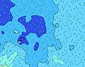 |  |  | 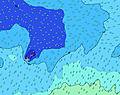 | 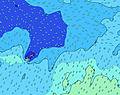 | 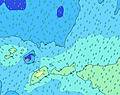 |  | ||||||||||||||
Wave Height (m) Direction Period (s) | SW 13 | SW 13 | SW 13 | SW 13 | SSW 12 | SW 18 | S 11 | S 11 | SW 16 | SSE 8 | SSE 8 | S 10 | S 10 | SSE 10 | SSE 10 | SSE 9 | SSE 12 | S 18 | S 16 | S 16 | S 14 |
Wave Graph | |||||||||||||||||||||
444 | 444 | 459 | 418 | 666 | 635 | 826 | 716 | 644 | 585 | 536 | 1555 | 1916 | 1474 | 1340 | 938 | 1288 | 1452 | 4266 | 3644 | 1818 | |
Wind (km/h) | |||||||||||||||||||||
Wind State on-shore cross-onshore cross-shore cross-offshore off-shore glassy | on | cross-on | cross-on | cross-on | cross-on | cross-on | cross-on | cross-on | cross-on | cross-on | cross-on | cross-on | cross-on | cross-on | cross-on | cross-on | cross-on | cross-on | cross | cross | cross |
High Tide | 10:16AM0.96m | 10:50PM0.99m | 11:13AM0.92m | 11:48PM1.00m | 12:18PM0.90m | 00:52AM1.03m | 1:28PM0.90m | 1:58AM1.07m | 2:37PM0.93m | 3:01AM1.13m | 3:39PM0.98m | 4:00AM1.19m | 4:37PM1.04m | ||||||||
Low Tide | 4:05AM0.28m | 4:26PM0.25m | 5:02AM0.29m | 5:19PM0.26m | 6:07AM0.28m | 6:21PM0.27m | 7:18AM0.24m | 7:28PM0.25m | 8:28AM0.19m | 8:35PM0.21m | 9:31AM0.12m | 9:38PM0.16m | 10:29AM0.05m | 10:36PM0.10m | |||||||
6:48 | — | — | 6:47 | — | — | 6:47 | — | — | 6:47 | — | — | 6:46 | — | — | 6:46 | — | — | 6:45 | — | — | |
— | 6:19 | — | — | 6:19 | — | — | 6:20 | — | — | 6:20 | — | — | 6:20 | — | — | 6:20 | — | — | 6:20 | — | |
mm | — | — | — | — | — | 1 | — | — | — | — | — | — | — | — | — | — | — | — | — | 1 | 16 |
Temp °C | 26 | 25 | 25 | 25 | 25 | 25 | 24 | 24 | 24 | 24 | 24 | 24 | 24 | 24 | 24 | 24 | 25 | 25 | 26 | 26 | 26 |
Feels °C | 29 | 27 | 25 | 24 | 24 | 24 | 21 | 22 | 20 | 19 | 19 | 18 | 18 | 18 | 17 | 18 | 20 | 20 | 22 | 23 | 24 |
Swell 1 Height (m) Direction Period (s) | SW 13 | SW 13 | SW 13 | SW 13 | SSW 12 | S 12 | SW 17 | SW 16 | SW 16 | S 15 | S 15 | S 14 | SW 14 | SW 13 | NE 9 | NE 9 | S 19 | S 18 | S 16 | S 16 | S 14 |
444 | 444 | 459 | 418 | 666 | 464 | 754 | 625 | 644 | 447 | 453 | 553 | 162 | 88 | 42 | 43 | 266 | 1452 | 4266 | 3644 | 1818 | |
Swell 2 Height (m) Direction Period (s) | SE 11 | SE 10 | S 15 | S 13 | SSW 12 | SW 11 | SW 12 | SW 12 | S 16 | SW 16 | SW 15 | SW 15 | SW 21 | NE 9 | SW 13 | SW 13 | NE 10 | SW 12 | NE 10 | NNE 10 | S 18 |
126 | 87 | 272 | 355 | 461 | 209 | 108 | 68 | 190 | 416 | 273 | 106 | 18 | 21 | 44 | 43 | 47 | 24 | 23 | 10 | 230 | |
Swell 3 Height (m) Direction Period (s) | NE 10 | SSW 16 | SE 10 | SW 20 | SW 19 | SW 18 | NE 8 | S 18 | S 13 | NNE 10 | NNE 9 | NE 12 | SW 21 | SW 21 | SSW 20 | S 21 | SW 13 | SSW 18 | NE 10 | SW 12 | SW 18 |
24 | 89 | 51 | 322 | 384 | 635 | 10 | 99 | 92 | 9 | 8 | 22 | 18 | 18 | 39 | 76 | 42 | 30 | 15 | 5 | 50 | |
Wind waves Height (m) Direction Period (s) | — | SSE 3 | S 5 | S 6 | SE 9 | SSE 5 | S 11 | S 11 | SSE 8 | SSE 8 | SSE 8 | S 10 | S 10 | SSE 10 | SSE 10 | SSE 9 | SSE 12 | SSE 9 | ESE 9 | ESE 9 | ESE 9 |
— | 3 | 34 | 80 | 12 | 48 | 826 | 716 | 497 | 585 | 536 | 1555 | 1916 | 1474 | 1340 | 938 | 1288 | 732 | 853 | 820 | 193 | |
Nearest Offshore or Glassy | |||||||||||||||||||||
Distance (km) | 27 | 27 | 121 | 863 | 863 | 1521 | 2207 | 1516 | 2207 | 2259 | 2259 | 1232 | 1232 | 1232 | 1232 | 1232 | 1232 | 1232 | 1232 | 1239 | 1208 |
Best forecast wave conditions in Upolu | |||||||||||||||||||||
Best forecast wave conditions in Samoa | |||||||||||||||||||||
Header Global | |||||||||||||||||||||
- Map Icons:
 Break
Break Live Wave Height (m)
 Live Wind Speed (km/h)
 Surf Rating (10 Max)
 Ocean Swells (m)
- Wind Speed (km/h)
Latest Updates


FREE! Surf-Forecast.com widget for your website
The surf report / weather widget below is available to embed on third party websites free of charge and provides a summary of our Salamumu surf forecast. Simply grab the html code snippet that we provide and paste it into your own site. You can choose your preferred language and metric/imperial units for the surf forecast feed to suit users of your site. Click here to get the code.
Information about the Salamumu Surf forecast
The above surf forecast table for Salamumu provides essential information for determining whether the surfing conditions will be good over the next 16 days. A general guide to surfing at Salamumu can be found by selecting the local surf guide option on the grey menu. Our Salamumu surf forecast is unique since it includes wave energy (power) that defines the real feel of the surf rather than just the height or the period. If you surf the same spot (Salamumu) regularly then make a mental note of the wave energy from the surf forecast table each time you go. Very soon you may start to choose your surf days based on the wave energy alone combined with our forecast of favourable offshore wind conditions. Our star ratings will help here and of course you will also find the usual wave height and period predictions on our surf forecasts as well as a full break down of the swell components under our advanced users option (to reveal that, click the little Einstein character under the tide times).
Further information to help with frequently asked questions about our surf forecast for Salamumu may be found under the help tab on the top menu and also by moving your mouse over the question marks on the surf forecast table itself. Please always bear in mind that the forecast is for near-shore open water and local factors at each surf break influence the actual breaking wave height, such as the beach / reef profile, water depths offshore and shelter.
Salad Bowls is 19 km (12 miles) from the city of Kruisfontein. If you plan a holiday in Eastern Cape (South), look for hotels and other accommodation in Kruisfontein. Kruisfontein has rooms for a wide range of budgets as well as car hire and transport links.
 Nearest