

Surf Forecasts:

Rainbow Rocks surf forecast from 1 Aug 2026:
- Best quality surf: Tuesday 4 Aug, 8PM (local time) - 8ft (2.5m), 8s period, NW swell with glassy winds.
- Most powerful swell: Monday 3 Aug, 5PM (local time) - 11ft (3.5m), 8s period, NNW swell with 1,703 kJ wave energy.
- Next surfable swell (1★+): Tuesday 4 Aug, 2AM (local time) - 8ft (2.4m), 8s period with NNW swell.
Best Forecast Surf Conditions for Rainbow Rocks this week:
The surf forecast for Rainbow Rocks over the next 16 days: The first swell (rated 1 star or higher) is forecast to arrive on Tuesday (Aug 04) at 2AM. The primary swell is predicted to be 2.4m and 8s period with a secondary swell of 0.3m and 16s. The wind is predicted to be cross-offshore as the swell arrives.
The most powerful waves expected at Rainbow Rocks in the next 16 days are 3.5m 8s and forecast to arrive on Monday (Aug 03) at 5PM. Winds are predicted to be cross-offshore at the time the swell arrives. The largest open ocean swell (not directed at the beach) is 0.3m 13s period and expected on Saturday (Aug 01) at 2PM.
| Wave Type | Time (PDT) & Date | Wave Height & Period |
|---|---|---|
| Next good surf (1 star+) | 2AM (Tue 4th Aug) | 8ft (2.4m) 8s |
| Best Surf | 8PM (Tue 4th Aug) | 8ft (2.5m) 8s |
| Most Powerful | 5PM (Mon 3rd Aug) | 11ft (3.5m) 8s |
Table - best surf conditions forecast for Rainbow Rocks over the next 16 days.
The Lowdown
Alright, Rusty here. Let's have a look at what's coming our way.
Honestly, the next couple of weeks are a bit of a mixed bag for Rainbow Rocks. We’ve got a solid stretch of reasonably sized NW swell rolling in, but the wind is mostly going to be a problem. It’s a beach and reef setup, and it’s exposed to the swell, but there’s a real lack of that clean, glassy moment we’re all chasing. The water’s sitting at 56°, which is pretty much average for this time of year, so no surprises there.
The first few days are a write-off for a decent surf. Saturday the 1st starts with a 4ft NW swell (301 energy) but with a cross wind, it’s just messy. That afternoon jumps to 8ft, but the wind is cross-off and fresh, so it’s clean but the quality is a bit meh. This pattern basically holds through the weekend and into Monday, with swell swinging between 7ft and 12ft, and winds staying cross-off but on the stronger side. The wave energy is moderate to strong (up to 1840 on Monday afternoon), but the conditions never really click for a great session.
We get a bit of a reprieve on Wednesday the 5th. The swell drops to 7ft in the morning, but the wind turns light. The afternoon is where it’s at though – 12ft of NW swell, light cross-off breeze, and the energy is pumping (1574). That’s the standout of the first week. It’s big, it’s clean, and the waves will have some punch. For experienced surfers only at that size, okay? Beginners, stay on the sand.
After that, it’s a repeating pattern of moderate to strong NW swell with cross-off winds, but nothing quite as special as that Wednesday arvo. The wind stays fresh, the swell stays solid, but the quality just doesn’t hit that same high note. By the second weekend, the swell backs off a touch, but the wind is still muscle.
Around the 13th of August, we see a complete change. The NW swell dies right down, and we get a very long-period SSW groundswell sneaking in. The swell is tiny – 2ft to 4ft – but with periods of 16 to 19 seconds. That’s a proper groundswell, and it’ll wrap in with some long lines. The energy is still moderate (644 to 1096), but the wind is howling out of the NNW, 22 to 31 mph. That’s too strong for a clean surf, and for a beach and reef setup, it’s going to be blown out. This looks more like a kite-surfing window than a paddle-surfing one.
The 16th sees the swell settle at 3ft from the SSW, but with a cross wind, it’s not worth getting excited about.
So, the one true standout? It’s Wednesday afternoon, the 5th of August. 12ft of NW swell, light cross-off wind, and a heap of energy. That’s your window. For the rest, it’s a case of waiting for the wind to drop or the swell to get a better angle.
Rusty.
Short Range ForecastMostly dry. Warm (max 26°C on Mon afternoon, min 13°C on Sat night). Winds increasing (light winds from the N on Sat morning, strong winds from the NNW by Sun afternoon). | Days 4-6 Weather SummaryMostly dry. Warm (max 22°C on Tue afternoon, min 14°C on Thu night). Wind will be generally light. | ||||||||||||||||||||
Saturday 1 | Sunday 2 | Monday 3 | Tuesday 4 | Wednesday 5 | Thursday 6 | Friday 7 | |||||||||||||||
AM | PM | Night | AM | PM | Night | AM | PM | Night | AM | PM | Night | AM | PM | Night | AM | PM | Night | AM | PM | Night | |
Swell Height Map |  |  | 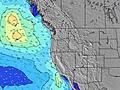 | 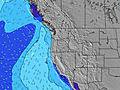 | 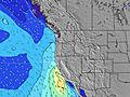 | 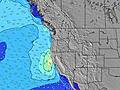 | 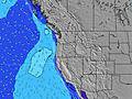 | ||||||||||||||
Wave Height (m) Direction Period (s) | WNW 8 | NW 6 | NW 7 | NW 7 | NW 8 | NW 8 | NW 8 | NNW 8 | NNW 8 | NW 8 | NW 8 | NW 8 | NW 8 | NW 8 | NW 8 | NW 8 | NW 8 | NW 8 | NW 8 | NNW 7 | NNW 7 |
Wave Graph | |||||||||||||||||||||
175 | 411 | 335 | 434 | 1377 | 900 | 699 | 1703 | 769 | 719 | 824 | 640 | 545 | 655 | 498 | 400 | 355 | 338 | 322 | 586 | 342 | |
Wind (km/h) | |||||||||||||||||||||
Wind State on-shore cross-onshore cross-shore cross-offshore off-shore glassy | cross | cross-off | cross-off | cross-off | cross-off | cross-off | cross-off | cross-off | cross-off | cross | cross | glassy | cross | cross | cross-off | cross | cross | glassy | cross | cross | cross-off |
High Tide | 2:42PM1.88m | 2:08AM1.89m | 3:11PM1.95m | 2:56AM1.75m | 3:42PM2.02m | 3:53AM1.59m | 4:17PM2.08m | 5:03AM1.44m | 4:59PM2.12m | 6:30AM1.35m | 5:51PM2.16m | 8:08AM1.35m | 6:54PM2.20m | ||||||||
Low Tide | 8:11AM-0.08m | 8:27PM0.65m | 8:41AM0.06m | 9:14PM0.56m | 9:12AM0.24m | 10:07PM0.46m | 9:46AM0.46m | 11:07PM0.36m | 10:26AM0.68m | 00:14AM0.24m | 11:16AM0.88m | 1:27AM0.11m | 12:23PM1.03m | 2:38AM-0.05m | |||||||
6:09 | — | — | 6:11 | — | — | 6:11 | — | — | 6:13 | — | — | 6:13 | — | — | 6:15 | — | — | 6:16 | — | — | |
— | 8:36 | — | — | 8:35 | — | — | 8:34 | — | — | 8:31 | — | — | 8:30 | — | — | 8:30 | — | — | 8:29 | — | |
mm | — | — | — | — | — | — | — | — | — | — | — | — | — | — | — | — | — | — | — | — | — |
Temp °C | 20 | 19 | 18 | 21 | 23 | 20 | 22 | 26 | 22 | 20 | 22 | 17 | 19 | 19 | 16 | 18 | 17 | 15 | 17 | 19 | 16 |
Feels °C | 16 | 14 | 13 | 15 | 14 | 13 | 17 | 19 | 16 | 17 | 19 | 17 | 19 | 19 | 16 | 18 | 17 | 15 | 16 | 17 | 15 |
Swell 1 Height (m) Direction Period (s) | SSW 14 | SSW 14 | SW 14 | SW 14 | SSW 14 | SW 13 | SW 13 | SW 13 | NNW 8 | NW 8 | SW 15 | NW 8 | NW 8 | NW 8 | NW 8 | NW 8 | SW 13 | NW 8 | SW 13 | SW 13 | SSW 18 |
134 | 134 | 99 | 93 | 71 | 45 | 44 | 43 | 769 | 719 | 82 | 640 | 545 | 655 | 498 | 400 | 63 | 338 | 83 | 82 | 133 | |
Swell 2 Height (m) Direction Period (s) | S 13 | S 13 | S 13 | S 13 | SW 18 | SW 18 | SW 17 | SW 16 | SW 16 | SW 16 | SSW 12 | SW 15 | SW 14 | SW 14 | SW 14 | SW 14 | SW 19 | SW 13 | SW 18 | SSW 18 | SW 13 |
31 | 31 | 13 | 31 | 49 | 49 | 47 | 41 | 41 | 64 | 14 | 56 | 74 | 73 | 71 | 93 | 59 | 84 | 80 | 126 | 78 | |
Swell 3 Height (m) Direction Period (s) | SW 20 | SW 20 | WSW 19 | SW 19 | S 12 | S 12 | S 12 | S 12 | SSW 13 | SSW 12 | S 15 | SSW 12 | S 14 | S 13 | SSW 11 | SSW 20 | S 12 | SSW 19 | W 15 | S 12 | W 13 |
16 | 15 | 37 | 14 | 11 | 11 | 12 | 11 | 16 | 14 | 4 | 14 | 15 | 14 | 12 | 37 | 12 | 35 | 17 | 11 | 32 | |
Wind waves Height (m) Direction Period (s) | WNW 8 | NW 6 | NW 7 | NW 7 | NW 8 | NW 8 | NW 8 | NNW 8 | — | — | NW 8 | — | — | — | — | — | NW 8 | — | NW 8 | NNW 7 | NNW 7 |
175 | 411 | 335 | 434 | 1377 | 900 | 699 | 1703 | — | — | 824 | — | — | — | — | — | 355 | — | 322 | 586 | 342 | |
Nearest Offshore or Glassy | |||||||||||||||||||||
Distance (km) | 432 | 601 | 20 | 464 | 938 | 20 | 393 | 228 | 20 | 347 | 230 | 20 | 32 | 34 | 20 | 104 | 34 | 20 | 34 | 228 | 20 |
Best forecast wave conditions in South Oregon | |||||||||||||||||||||
Best forecast wave conditions in United States | |||||||||||||||||||||
Header Global | |||||||||||||||||||||
- Map Icons:
 Break
Break Live Wave Height (m)
 Live Wind Speed (km/h)
 Surf Rating (10 Max)
 Ocean Swells (m)
- Wind Speed (km/h)
Latest Updates


FREE! Surf-Forecast.com widget for your website
The surf report / weather widget below is available to embed on third party websites free of charge and provides a summary of our Rainbow Rocks surf forecast. Simply grab the html code snippet that we provide and paste it into your own site. You can choose your preferred language and metric/imperial units for the surf forecast feed to suit users of your site. Click here to get the code.
Information about the Rainbow Rocks Surf forecast
The above surf forecast table for Rainbow Rocks provides essential information for determining whether the surfing conditions will be good over the next 16 days. A general guide to surfing at Rainbow Rocks can be found by selecting the local surf guide option on the grey menu. Our Rainbow Rocks surf forecast is unique since it includes wave energy (power) that defines the real feel of the surf rather than just the height or the period. If you surf the same spot (Rainbow Rocks) regularly then make a mental note of the wave energy from the surf forecast table each time you go. Very soon you may start to choose your surf days based on the wave energy alone combined with our forecast of favourable offshore wind conditions. Our star ratings will help here and of course you will also find the usual wave height and period predictions on our surf forecasts as well as a full break down of the swell components under our advanced users option (to reveal that, click the little Einstein character under the tide times).
Further information to help with frequently asked questions about our surf forecast for Rainbow Rocks may be found under the help tab on the top menu and also by moving your mouse over the question marks on the surf forecast table itself. Please always bear in mind that the forecast is for near-shore open water and local factors at each surf break influence the actual breaking wave height, such as the beach / reef profile, water depths offshore and shelter.
Are you planning a vacation in South Oregon? If you are looking for accommodation near Rainbow Rocks, camping, hotels and condos and appartments in South Oregon, consider staying in Grants Pass which is 92 km (57 miles) away.
 Nearest