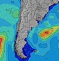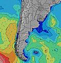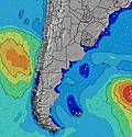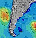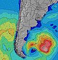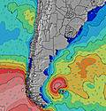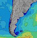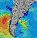
- Forecast
- Maps
- Live
- Weather State
- Spot Information
Surf Forecasts:

Punta del Diablo surfForecast / North / Uruguay
Forecast update in hr min s Forecast update imminent
Punta del Diablo surf forecast is for near shore open water. Breaking waves will often be smaller at less exposed spots.
Today's Punta del Diablo sea temperature is
24.3° C
(Which is 3.8°C warmer than normal for this time of year)How big are the waves at Punta del Diablo today?
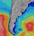
The current surf forecast for Punta del Diablo at 4AM is: 1.3m 14s primary swell from a South-southeast direction and 0.7m 15s secondary swell from a South-southeast direction, 0.2m 7s secondary swell from a East direction (forecast issued at 08:00pm April 05). The wind direction is predicted to be cross-onshore.
| Time (-03) & Date | Wave Height | Wave Period |
|---|---|---|
| Morning (06 Apr) | 4ft (1.2m) | 14s |
| Afternoon (06 Apr) | 3.5ft (1.1m) | 13s |
| Evening (06 Apr) | 3.5ft (1.0m) | 13s |
Table - waves today at Punta del Diablo. (Swell directed towards the surf break)
Updates in hr min s Forecast update imminent
Sun 05 | Monday 06 | Tuesday 07 | Wednesday 08 | |||||||||||||||||||||
| 6 PM | 9 PM | 0 AM | 3 AM | 6 AM | 9 AM | 12 PM | 3 PM | 6 PM | 9 PM | 0 AM | 3 AM | 6 AM | 9 AM | 12 PM | 3 PM | 6 PM | 9 PM | 0 AM | 3 AM | 6 AM | 9 AM | 12 PM | 3 PM | |
Rating (10 max) | ||||||||||||||||||||||||
Swell Height Map | ||||||||||||||||||||||||
| Wave Height (m) & direction (?) | ||||||||||||||||||||||||
| Period(s) (?) | 12 | 12 | 12 | 14 | 14 | 14 | 14 | 13 | 13 | 13 | 12 | 12 | 8 | 8 | 8 | 8 | 8 | 8 | 8 | 9 | 9 | 10 | 11 | 11 |
Wave (?)Graph | ||||||||||||||||||||||||
| 420 | 419 | 405 | 578 | 427 | 490 | 415 | 396 | 373 | 302 | 288 | 245 | 525 | 251 | 468 | 185 | 195 | 169 | 140 | 157 | 101 | 494 | 2730 | 2513 | |
Wind (km/h) | ||||||||||||||||||||||||
| Wind State (?) onshore cross-onshore cross-shore cross-offshore offshore glassy | on | cross- on | cross- on | cross- on | cross- on | cross | cross | cross | cross | cross | cross | cross | cross | cross- off | cross- off | cross- off | cross- off | off | off | off | off | cross | cross | cross |
High Tide / height (m) | 3:39PM 0.37 | 10:07PM 0.55 | 3:34AM 0.26 | 10:42AM 0.40 | 4:28PM 0.36 | 10:48PM 0.56 | 4:16AM 0.24 | 11:24AM 0.38 | 5:20PM 0.35 | 11:27PM 0.55 | 5:02AM 0.23 | 12:03PM 0.37 | ||||||||||||
Low Tide / height (m) | 6:33PM 0.19 | 1:48AM 0.22 | 6:58AM 0.00 | 1:38PM 0.21 | 7:12PM 0.22 | 2:40AM 0.22 | 7:39AM 0.03 | 2:23PM 0.20 | 7:49PM 0.25 | 3:30AM 0.21 | 8:20AM 0.06 | |||||||||||||
Sun 05 | Monday 06 | Tuesday 07 | Wednesday 08 | |||||||||||||||||||||
| Sunrise | - | - | - | - | - | 6:48 | - | - | - | - | - | - | - | 6:50 | - | - | - | - | - | - | - | 6:50 | - | - |
| Sunset | 6:23 | - | - | - | - | - | - | - | 6:22 | - | - | - | - | - | - | - | 6:21 | - | - | - | - | - | - | - |
Rain (mm) | - | - | - | - | - | - | - | - | - | - | 3 | 12 | 11 | 3 | 1 | 2 | 4 | 2 | 5 | 8 | 1 | 3 | 3 | - |
| Temp. °C | 18 | 18 | 19 | 19 | 20 | 20 | 21 | 21 | 21 | 21 | 20 | 21 | 21 | 20 | 21 | 21 | 20 | 20 | 20 | 19 | 17 | 19 | 20 | 20 |
| Feels °C (?) | 16 | 15 | 16 | 15 | 17 | 16 | 18 | 18 | 18 | 18 | 16 | 19 | 20 | 20 | 21 | 22 | 22 | 22 | 22 | 16 | 14 | 13 | 15 | 15 |
- Map Icons:
Break
Live Wave Height (m)
Live Wind Speed (km/h)
Surf Rating (10 Max)
Ocean Swells (m)
Wind Speed (km/h)


