

Surf Forecasts:

Terceira - Porto Novo surf forecast from 22 Jul 2026:
- Best quality surf: Friday 24 Jul, 3AM (local time) - 3.5ft (1.1m), 9s period, NE swell with cross-offshore winds.
- Most powerful swell: Thursday 23 Jul, 12AM (local time) - 4.5ft (1.3m), 9s period, NE swell with 249 kJ wave energy.
- Next surfable swell (1★+): Friday 24 Jul, 3AM (local time) - 3.5ft (1.1m), 9s period with NE swell.
Best Forecast Surf Conditions for Terceira - Porto Novo this week:
The surf forecast for Terceira - Porto Novo over the next 16 days: The first swell (rated 1 star or higher) is forecast to arrive on Friday (Jul 24) at 3AM. The primary swell is predicted to be 1.1m and 9s period. The wind is predicted to be cross-offshore as the swell arrives.
The most powerful waves expected at Terceira - Porto Novo in the next 16 days are 1.3m 9s and forecast to arrive on Thursday (Jul 23) at 12AM. Winds are predicted to be cross-onshore at the time the swell arrives. The largest open ocean swell (not directed at the beach) is 0.4m 13s period and expected on Wednesday (Jul 22) at 9AM.
| Wave Type | Time (+00) & Date | Wave Height & Period |
|---|---|---|
| Next good surf (1 star+) | 3AM (Fri 24th Jul) | 3.5ft (1.1m) 9s |
| Best Surf | 3AM (Fri 24th Jul) | 3.5ft (1.1m) 9s |
| Most Powerful | 12AM (Thu 23rd Jul) | 4.5ft (1.3m) 9s |
Table - best surf conditions forecast for Terceira - Porto Novo over the next 16 days.
The Lowdown
Alright folks, Rusty here. Gotta say, looking at the charts for our little slice of paradise, it’s a tough stretch. We’re in for a long, flat spell before anything even thinks about moving.
The first solid week of the forecast is pretty much a write-off. From Wednesday the 22nd of July right through to the end of the month, the swell is tiny and the wind is mostly a cross or cross-onshore mess. The combined energy is weak, barely cracking 100 (57 to 243) even when it peaks, but the waves are too small and choppy to bother with. We’re looking at waist-high slop at best, and it’s just not worth paddling out for. You’ll be better off waxing the deck and waiting.
Things start to look a little more interesting around the 2nd of August. The swell picks up, but unfortunately, the wind stays stubbornly cross-onshore from the NE. The energy jumps into the moderate range (146-146), but the “poor surf conditions” tag is hard to ignore. Still, it’s a sign of life.
Now, here’s the real kicker. The best window of the whole 16-day run is shaping up for the 4th of August, Tuesday. That’s over a week away, so don’t book the time off just yet, but this is the one to watch. The swell is solid, pushing 5 ft from the NNE with a nice long 12-second period. That’s proper groundswell energy, and the combined energy is legitimately strong (751). For a sheltered spot like Terceira - Porto Novo, that’s a lot of juice. The caveat is that the wind is still cross-onshore from the NE, so it won’t be perfect, but it will be the biggest, most powerful surf we’ve seen in the entire forecast. The wave energy will be pulsing through, and if you can handle that trade wind bump, you’ll be in for a session.
The water temp is about average for this time of year, which is nice.
So, overall, the standout is Tuesday the 4th of August at Porto-Novo. It’s the only day with real power and size. For the rest of it, you’re looking at a whole lot of waiting. The good news is that the swell is trying to build at the end, so hopefully the forecasts change and clean it up. Hang in there.
Rusty.
Short Range ForecastSome drizzle, heaviest during Wed morning. Warm (max 21°C on Fri morning, min 18°C on Tue night). Wind will be generally light. | Days 5-7 Weather SummaryMostly dry. Warm (max 21°C on Sun night, min 18°C on Fri night). Wind will be generally light. | ||||||||||||||||||
Wednesday 22 | Thursday 23 | Friday 24 | Saturday 25 | Sunday 26 | Monday 27 | ||||||||||||||
Night | AM | PM | Night | AM | PM | Night | AM | PM | Night | AM | PM | Night | AM | PM | Night | AM | PM | Night | |
Swell Height Map |  |  |  |  | 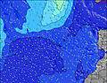 | 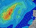 | 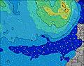 | ||||||||||||
Wave Height (m) Direction Period (s) | NE 7 | NE 7 | NE 6 | NE 9 | NE 9 | NE 8 | NE 8 | NE 9 | NE 9 | NE 8 | NE 8 | NE 7 | NE 7 | NE 7 | NE 8 | NE 7 | NE 7 | NE 7 | NE 7 |
Wave Graph | |||||||||||||||||||
52 | 57 | 78 | 249 | 243 | 201 | 180 | 202 | 168 | 126 | 96 | 77 | 65 | 65 | 45 | 33 | 23 | 23 | 11 | |
Wind (km/h) | |||||||||||||||||||
Wind State on-shore cross-onshore cross-shore cross-offshore off-shore glassy | cross-on | cross-on | cross-on | cross-on | cross-on | cross | cross | cross | cross-on | cross-on | cross-on | on | on | cross-on | cross-on | glassy | glassy | glassy | on |
High Tide | 8:43AM1.06m | 9:07PM1.05m | 9:54AM1.05m | 10:20PM1.02m | 11:03AM1.08m | 11:26PM1.04m | 12:00PM1.13m | 00:19AM1.09m | 12:47PM1.20m | 1:03AM1.15m | 1:27PM1.27m | 1:41AM1.21m | |||||||
Low Tide | 2:22AM0.41m | 2:51PM0.49m | 3:27AM0.46m | 4:08PM0.52m | 4:36AM0.47m | 5:20PM0.49m | 5:38AM0.44m | 6:17PM0.44m | 6:28AM0.38m | 7:02PM0.37m | 7:09AM0.31m | 7:40PM0.31m | |||||||
— | 6:39 | — | — | 6:41 | — | — | 6:41 | — | — | 6:43 | — | — | 6:43 | — | — | 6:45 | — | — | |
9:07 | — | — | 9:07 | — | — | 9:07 | — | — | 9:06 | — | — | 9:05 | — | — | 9:05 | — | — | 9:04 | |
mm | — | 1 | — | — | — | — | — | — | — | — | — | — | — | — | — | — | — | — | — |
Temp °C | 19 | 20 | 20 | 20 | 20 | 20 | 20 | 21 | 20 | 20 | 19 | 19 | 19 | 20 | 20 | 21 | 21 | 21 | 21 |
Feels °C | 17 | 18 | 18 | 19 | 18 | 18 | 18 | 19 | 18 | 19 | 18 | 18 | 19 | 20 | 20 | 22 | 22 | 22 | 21 |
Swell 1 Height (m) Direction Period (s) | S 14 | NE 7 | ENE 7 | S 12 | NE 9 | NE 8 | NE 8 | NE 9 | NE 9 | NE 8 | NE 8 | NE 7 | NE 7 | NE 7 | NE 8 | NE 7 | NE 7 | NE 7 | NE 7 |
62 | 57 | 35 | 47 | 243 | 201 | 180 | 202 | 168 | 126 | 96 | 77 | 65 | 65 | 45 | 33 | 23 | 23 | 11 | |
Swell 2 Height (m) Direction Period (s) | ENE 6 | S 13 | NE 9 | S 8 | S 12 | S 12 | S 11 | S 12 | S 12 | S 12 | S 11 | S 11 | S 10 | S 11 | S 11 | S 11 | S 11 | S 10 | S 10 |
8 | 55 | 22 | 5 | 47 | 44 | 39 | 25 | 25 | 44 | 39 | 37 | 34 | 21 | 21 | 20 | 20 | 19 | 8 | |
Swell 3 Height (m) Direction Period (s) | SSE 9 | SSE 8 | S 13 | W 8 | S 7 | S 7 | S 8 | S 8 | W 9 | W 8 | W 8 | W 8 | S 15 | N 5 | N 5 | N 5 | NW 11 | NW 11 | NW 10 |
8 | 7 | 31 | 1 | 1 | 1 | 1 | 1 | 2 | 1 | 1 | 1 | 4 | 1 | 2 | 2 | 5 | 4 | 4 | |
Wind waves Height (m) Direction Period (s) | NE 7 | — | NE 6 | NE 9 | — | — | — | — | — | — | — | — | — | — | — | — | — | — | NW 4 |
52 | — | 78 | 249 | — | — | — | — | — | — | — | — | — | — | — | — | — | — | 1 | |
Nearest Offshore or Glassy | |||||||||||||||||||
Distance (km) | 17 | 17 | 1099 | 163 | 258 | 258 | 2 | 2 | 258 | 258 | 97 | 97 | 97 | 22 | 94 | 94 | 94 | 17 | 94 |
Best forecast wave conditions in The Azores | |||||||||||||||||||
Best forecast wave conditions in Portugal | |||||||||||||||||||
Header Global | |||||||||||||||||||
- Map Icons:
 Break
Break Live Wave Height (m)
 Live Wind Speed (km/h)
 Surf Rating (10 Max)
 Ocean Swells (m)
- Wind Speed (km/h)


FREE! Surf-Forecast.com widget for your website
The surf report / weather widget below is available to embed on third party websites free of charge and provides a summary of our Terceira - Porto Novo surf forecast. Simply grab the html code snippet that we provide and paste it into your own site. You can choose your preferred language and metric/imperial units for the surf forecast feed to suit users of your site. Click here to get the code.
Information about the Terceira - Porto Novo Surf forecast
The above surf forecast table for Terceira - Porto Novo provides essential information for determining whether the surfing conditions will be good over the next 16 days. A general guide to surfing at Terceira - Porto Novo can be found by selecting the local surf guide option on the grey menu. Our Terceira - Porto Novo surf forecast is unique since it includes wave energy (power) that defines the real feel of the surf rather than just the height or the period. If you surf the same spot (Terceira - Porto Novo) regularly then make a mental note of the wave energy from the surf forecast table each time you go. Very soon you may start to choose your surf days based on the wave energy alone combined with our forecast of favourable offshore wind conditions. Our star ratings will help here and of course you will also find the usual wave height and period predictions on our surf forecasts as well as a full break down of the swell components under our advanced users option (to reveal that, click the little Einstein character under the tide times).
Further information to help with frequently asked questions about our surf forecast for Terceira - Porto Novo may be found under the help tab on the top menu and also by moving your mouse over the question marks on the surf forecast table itself. Please always bear in mind that the forecast is for near-shore open water and local factors at each surf break influence the actual breaking wave height, such as the beach / reef profile, water depths offshore and shelter.
Are you planning a holiday in The Azores? If you are looking for accommodation near Terceira - Porto Novo, camping, hotels and holiday cottages in The Azores, consider staying in Angra do Heroísmo which is 13 km (8 miles) away.
 Nearest