

Surf Forecasts:

Pavos surf forecast from 16 Jul 2026:
- Best quality surf: Sunday 19 Jul, 4AM (local time) - 3.5ft (1.1m), 11s period, SW swell with glassy winds.
- Most powerful swell: Tuesday 21 Jul, 1AM (local time) - 5.5ft (1.7m), 12s period, SW swell with 822 kJ wave energy.
- Next surfable swell (1★+): Sunday 19 Jul, 4AM (local time) - 3.5ft (1.1m), 11s period with SW swell.
Best Forecast Surf Conditions for Pavos this week:
The surf forecast for Pavos over the next 16 days: The first swell (rated 1 star or higher) is forecast to arrive on Sunday (Jul 19) at 4AM. The primary swell is predicted to be 1.1m and 11s period with a secondary swell of 0.7m and 14s. The wind is predicted to be glassy as the swell arrives.
The most powerful waves expected at Pavos in the next 16 days are 1.7m 12s and forecast to arrive on Tuesday (Jul 21) at 1AM. Winds are predicted to be cross-shore at the time the swell arrives.
| Wave Type | Time (-05) & Date | Wave Height & Period |
|---|---|---|
| Next good surf (1 star+) | 4AM (Sun 19th Jul) | 3.5ft (1.1m) 11s |
| Best Surf | 4AM (Sun 19th Jul) | 3.5ft (1.1m) 11s |
| Most Powerful | 1AM (Tue 21st Jul) | 5.5ft (1.7m) 12s |
Table - best surf conditions forecast for Pavos over the next 16 days.
The Lowdown
Alright folks, Rusty here. Let’s have a look at what’s happening for the next couple of weeks.
First up, I’ve gotta be straight with you – the surf is in a real funk. There’s nothing on the cards today (Thursday, July 16th) worth paddling out for. The conditions are just too marginal, with a crummy cross-shore wind and a wave that’s got no drive. The water is a whopping 8°F warmer than usual for this time of year, which is a very unusual anomaly, so it’s gonna feel like a bath.
We’re looking at a long stretch of poor conditions right through until at least late next week. The wind stays mostly cross or cross-onshore, and the swell is just not getting its act together. The energy is weak, usually under 1000, and the wave heights are all under 6ft.
The one tiny glimmer in the whole 16-day window is around Friday, July 24th through Sunday, July 26th. Even then, it’s not a guarantee. The combined energy finally pushes into four digits, reaching 1020 on Friday morning and climbing to 1324 on Friday afternoon. You’ll see a 5ft SSW swell rolling in, period around 13 seconds. That’s a little bump of groundswell. The wind is forecast to be light, which is a major positive for clean conditions. But it’s still marginal, so don’t expect perfection.
The standout pick would be Pavos itself on Friday, July 24th afternoon. It’s the best of a bad bunch. The swell is 5ft from the SSW, with a 13-second period, and the light cross-onshore wind will keep it rideable. The energy is moderate (1324). It’s not a day for the history books, but if you’re desperate and the tide lines up, you might snag a few.
After that, the swell fades again. By Monday, July 27th, the energy is still moderate (1060), but the wave heights drop to 4ft and the winds get a little cross-chop. It’s just more of the same: marginal.
Honestly, this is a tough run. If you’ve got a kite, you might get more out of the cross-shore breezes than a paddle surfer will. The setup is more interesting for that.
Stay patient, folks. It tends not to stay this poor for long, and the forecasts can change. Check back in a few days.
Rusty.
Short Range ForecastMostly dry. Very mild (max 19°C on Thu morning, min 17°C on Thu night). Wind will be generally light. | Days 4-6 Weather SummaryMostly dry. Warm (max 20°C on Mon morning, min 17°C on Sun night). Wind will be generally light. | ||||||||||||||||||||
Thursday 16 | Friday 17 | Saturday 18 | Sunday 19 | Monday 20 | Tuesday 21 | Wednesday 22 | |||||||||||||||
AM | PM | Night | AM | PM | Night | AM | PM | Night | AM | PM | Night | AM | PM | Night | AM | PM | Night | AM | PM | Night | |
Swell Height Map |  |  | 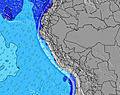 | 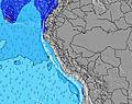 | 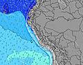 | 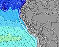 |  | ||||||||||||||
Wave Height (m) Direction Period (s) | SSW 13 | SSW 13 | SSW 12 | SSW 12 | SSW 12 | SSW 12 | SSW 11 | SSW 11 | SW 11 | SW 13 | SW 12 | SW 11 | SW 11 | SW 13 | SW 12 | SW 11 | SW 11 | SW 10 | SW 11 | S 8 | S 8 |
Wave Graph | |||||||||||||||||||||
796 | 772 | 668 | 551 | 419 | 371 | 341 | 335 | 403 | 757 | 760 | 497 | 414 | 374 | 822 | 728 | 572 | 212 | 186 | 286 | 286 | |
Wind (km/h) | |||||||||||||||||||||
Wind State on-shore cross-onshore cross-shore cross-offshore off-shore glassy | cross | cross | cross | cross | cross | cross | cross-on | cross-on | cross | cross-on | cross-on | cross | cross-on | cross | cross | cross-on | cross | cross | cross-on | cross | cross |
High Tide | 7:21PM0.59m | 8:15AM1.04m | 8:22PM0.60m | 8:58AM0.97m | 9:26PM0.61m | 9:39AM0.88m | 10:35PM0.63m | 10:20AM0.78m | 11:48PM0.65m | 11:01AM0.68m | 1:05AM0.68m | 11:46AM0.59m | 2:16AM0.72m | ||||||||
Low Tide | 2:10PM0.21m | 1:10AM0.04m | 2:57PM0.20m | 2:02AM0.13m | 3:43PM0.20m | 2:56AM0.24m | 4:29PM0.20m | 3:59AM0.34m | 5:15PM0.20m | 5:19AM0.42m | 6:01PM0.21m | 7:02AM0.46m | 6:50PM0.21m | ||||||||
6:28 | — | — | 6:28 | — | — | 6:28 | — | — | 6:28 | — | — | 6:28 | — | — | 6:28 | — | — | 6:28 | — | — | |
— | 5:58 | — | — | 5:58 | — | — | 5:59 | — | — | 5:59 | — | — | 5:59 | — | — | 5:59 | — | — | 6:00 | — | |
mm | — | — | — | — | — | — | — | — | — | — | — | — | — | — | — | — | — | — | — | — | — |
Temp °C | 19 | 19 | 18 | 19 | 19 | 18 | 19 | 19 | 18 | 19 | 19 | 18 | 20 | 19 | 18 | 19 | 19 | 18 | 19 | 19 | 18 |
Feels °C | 18 | 18 | 17 | 18 | 18 | 17 | 19 | 18 | 19 | 18 | 19 | 17 | 20 | 18 | 17 | 18 | 17 | 16 | 18 | 17 | 17 |
Swell 1 Height (m) Direction Period (s) | SSW 13 | SSW 13 | SSW 12 | SSW 12 | SSW 12 | SSW 12 | SSW 11 | SSW 11 | SW 11 | SW 13 | SW 12 | SW 11 | SW 11 | SW 13 | SW 12 | SW 11 | SW 11 | SW 10 | SSW 7 | S 8 | S 8 |
796 | 772 | 668 | 551 | 419 | 371 | 341 | 335 | 403 | 757 | 760 | 497 | 414 | 374 | 822 | 728 | 572 | 212 | 186 | 286 | 286 | |
Swell 2 Height (m) Direction Period (s) | S 22 | SW 21 | S 6 | S 6 | SSW 18 | W 11 | SW 16 | SSW 15 | SSW 15 | WSW 16 | WSW 13 | SW 15 | SSW 13 | SW 10 | W 21 | W 20 | S 11 | SSW 11 | SW 11 | SW 11 | SW 10 |
9 | 18 | 1 | 1 | 34 | 2 | 67 | 148 | 142 | 26 | 17 | 55 | 35 | 157 | 8 | 32 | 89 | 173 | 166 | 140 | 85 | |
Swell 3 Height (m) Direction Period (s) | — | SW 21 | SW 21 | W 11 | W 11 | NW 11 | WSW 15 | WSW 15 | SSW 5 | NW 10 | S 16 | SSW 15 | W 22 | W 21 | — | SW 21 | W 20 | W 19 | SSW 11 | SW 26 | SSW 11 |
— | 17 | 17 | 2 | 2 | 5 | 21 | 21 | 8 | 4 | 20 | 22 | 9 | 9 | — | 18 | 30 | 29 | 73 | 106 | 82 | |
Wind waves Height (m) Direction Period (s) | — | S 7 | S 4 | S 4 | S 4 | S 4 | S 5 | S 5 | — | S 5 | — | S 4 | SSW 4 | S 4 | S 5 | — | — | SSW 6 | — | — | — |
— | 15 | 4 | 5 | 8 | 14 | 13 | 13 | — | 4 | — | 6 | 6 | 10 | 11 | — | — | 90 | — | — | — | |
Nearest Offshore or Glassy | |||||||||||||||||||||
Distance (km) | 3 | 5 | 3 | 3 | 5 | 3 | 5 | 5 | 3 | 5 | 5 | 3 | 5 | 5 | 3 | 5 | 5 | 3 | 5 | 5 | 5 |
Best forecast wave conditions in Lima | |||||||||||||||||||||
Best forecast wave conditions in Peru | |||||||||||||||||||||
Header Global | |||||||||||||||||||||
- Map Icons:
 Break
Break Live Wave Height (m)
 Live Wind Speed (km/h)
 Surf Rating (10 Max)
 Ocean Swells (m)
- Wind Speed (km/h)


FREE! Surf-Forecast.com widget for your website
The surf report / weather widget below is available to embed on third party websites free of charge and provides a summary of our Pavos surf forecast. Simply grab the html code snippet that we provide and paste it into your own site. You can choose your preferred language and metric/imperial units for the surf forecast feed to suit users of your site. Click here to get the code.
Information about the Pavos Surf forecast
The above surf forecast table for Pavos provides essential information for determining whether the surfing conditions will be good over the next 16 days. A general guide to surfing at Pavos can be found by selecting the local surf guide option on the grey menu. Our Pavos surf forecast is unique since it includes wave energy (power) that defines the real feel of the surf rather than just the height or the period. If you surf the same spot (Pavos) regularly then make a mental note of the wave energy from the surf forecast table each time you go. Very soon you may start to choose your surf days based on the wave energy alone combined with our forecast of favourable offshore wind conditions. Our star ratings will help here and of course you will also find the usual wave height and period predictions on our surf forecasts as well as a full break down of the swell components under our advanced users option (to reveal that, click the little Einstein character under the tide times).
Further information to help with frequently asked questions about our surf forecast for Pavos may be found under the help tab on the top menu and also by moving your mouse over the question marks on the surf forecast table itself. Please always bear in mind that the forecast is for near-shore open water and local factors at each surf break influence the actual breaking wave height, such as the beach / reef profile, water depths offshore and shelter.
Pavos is 4 km (2 miles) from the city of Lima. If you plan a holiday in Lima, look for hotels and other accommodation in Lima. Lima has rooms for a wide range of budgets as well as car hire and transport links.
 Nearest