

Surf Forecasts:

Triangulo surf forecast from 2 Aug 2026:
- Best quality surf: Friday 7 Aug, 1AM (local time) - 5ft (1.5m), 16s period, SW swell with cross-offshore winds.
- Most powerful swell: Thursday 6 Aug, 7PM (local time) - 5ft (1.5m), 16s period, SW swell with 1,109 kJ wave energy.
- Next surfable swell (1★+): Sunday 2 Aug, 4AM (local time) - 4.5ft (1.3m), 8s period with S swell.
Best Forecast Surf Conditions for Triangulo this week:
The surf forecast for Triangulo over the next 16 days: The first swell (rated 1 star or higher) is forecast to arrive on Sunday (Aug 02) at 4AM. The primary swell is predicted to be 1.3m and 8s period with a secondary swell of 0.8m and 10s. The wind is predicted to be cross-offshore as the swell arrives.
The most powerful waves expected at Triangulo in the next 16 days are 1.5m 16s and forecast to arrive on Thursday (Aug 06) at 7PM. Winds are predicted to be cross-offshore at the time the swell arrives.
| Wave Type | Time (-05) & Date | Wave Height & Period |
|---|---|---|
| Next good surf (1 star+) | 4AM (Sun 2nd Aug) | 4.5ft (1.3m) 8s |
| Best Surf | 1AM (Fri 7th Aug) | 5ft (1.5m) 16s |
| Most Powerful | 7PM (Thu 6th Aug) | 5ft (1.5m) 16s |
Table - best surf conditions forecast for Triangulo over the next 16 days.
The Lowdown
Alright, this is Rusty checkin' in with a look at what's on the menu for the next couple of weeks around Triangulo.
Right off the bat, I gotta be straight with ya – the first week is a bit of a grind. We've got swell, but it's tangled up with cross and cross-onshore winds for the most part, keepin' things choppy and pretty average. The water temp is sitting at 72°, which is a massive 9° warmer than normal for this time of year – that's wild, feels like a warm bath out there.
The first real chance to get a clean one starts to show up around Thursday, August 6th. The afternoon session sees the wind finally switch to a cross-offshore breeze, cleaning things up nicely. The swell is coming from the SW at 4 ft with a solid 16-second period, packing a good amount of punch with a combined wave energy of 885. That's some proper groundswell, so the longer waits between sets will be worth it for those clean lines.
The standout of the whole run, though, is shaping up to be the morning of August 11th (Tuesday). We've got a 3 ft SSW groundswell with a very long 16-second period, and the wind is light and cross-offshore – clean. The energy is strong (848). This is a point break reef setup, so that long-period energy is right in its wheelhouse. It won't be huge, but it'll be quality.
Another one to circle on the calendar is the morning of Friday, August 14th. The wind drops to glassy – dead calm – with a nice 4 ft SW swell and a 16-second period. The combined energy is strong (712). If you want silky, smooth waves with no wind bumps, that's your session. Just keep an eye on the tide.
Crowds here are listed as "often," so don't expect to have the place to yourself on those cleaner days. And remember, this break is rated as "inconsistent," so the good ones might not roll through all the time.
Alright, that's the story for now. The second week has a few more marginal calls, but those couple of mornings are where it's at. Get on 'em if you can.
Rusty
Short Range ForecastMostly dry. Warm (max 21°C on Tue morning, min 19°C on Sat afternoon). Wind will be generally light. | Days 5-7 Weather SummaryMostly dry. Warm (max 21°C on Wed morning, min 18°C on Thu night). Wind will be generally light. | |||||||||||||||||||
Sat 1 | Sunday 2 | Monday 3 | Tuesday 4 | Wednesday 5 | Thursday 6 | Friday 7 | ||||||||||||||
PM | Night | AM | PM | Night | AM | PM | Night | AM | PM | Night | AM | PM | Night | AM | PM | Night | AM | PM | Night | |
Swell Height Map |  | 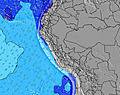 | 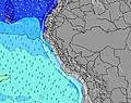 | 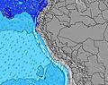 | 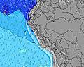 | 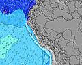 | 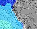 | |||||||||||||
Wave Height (m) Direction Period (s) | S 8 | S 8 | S 8 | S 8 | SW 13 | S 8 | S 8 | SSW 8 | SW 12 | SW 11 | SW 12 | SW 13 | SW 12 | SW 12 | SW 17 | SW 16 | SW 16 | SW 14 | SW 14 | SW 13 |
Wave Graph | ||||||||||||||||||||
223 | 193 | 168 | 212 | 205 | 142 | 148 | 151 | 292 | 189 | 449 | 466 | 430 | 309 | 505 | 567 | 1082 | 746 | 667 | 398 | |
Wind (km/h) | ||||||||||||||||||||
Wind State on-shore cross-onshore cross-shore cross-offshore off-shore glassy | cross-on | cross-off | cross | cross-on | cross-off | cross-on | cross | cross-off | cross | cross | cross-off | cross | cross | cross-off | cross | cross-off | cross-off | cross | cross | cross-off |
High Tide | 7:36PM0.57m | 8:06AM0.87m | 8:22PM0.59m | 8:30AM0.82m | 9:14PM0.61m | 8:58AM0.76m | 10:16PM0.64m | 9:31AM0.70m | 11:28PM0.67m | 10:17AM0.63m | 00:49AM0.72m | 11:22AM0.56m | 2:06AM0.79m | |||||||
Low Tide | 1:15AM0.21m | 2:45PM0.26m | 1:52AM0.28m | 3:13PM0.24m | 2:35AM0.34m | 3:45PM0.22m | 3:33AM0.41m | 4:26PM0.20m | 5:00AM0.46m | 5:19PM0.18m | 7:10AM0.47m | 6:27PM0.15m | ||||||||
— | — | 6:26 | — | — | 6:26 | — | — | 6:26 | — | — | 6:24 | — | — | 6:24 | — | — | 6:24 | — | — | |
6:01 | — | — | 6:01 | — | — | 6:01 | — | — | 6:01 | — | — | 6:01 | — | — | 6:01 | — | — | 6:01 | — | |
mm | — | — | — | — | — | — | — | — | — | — | — | — | — | — | — | — | — | — | — | — |
Temp °C | 20 | 19 | 20 | 20 | 19 | 20 | 20 | 19 | 21 | 20 | 19 | 21 | 20 | 19 | 20 | 20 | 19 | 20 | 20 | 19 |
Feels °C | 19 | 18 | 20 | 20 | 19 | 20 | 20 | 19 | 21 | 20 | 19 | 21 | 20 | 19 | 19 | 19 | 18 | 20 | 20 | 18 |
Swell 1 Height (m) Direction Period (s) | S 8 | SW 10 | S 8 | S 8 | SSW 8 | S 8 | S 8 | SSW 8 | S 7 | S 8 | SW 12 | SW 13 | SW 12 | SW 12 | SW 12 | SW 16 | SW 16 | SW 14 | SW 14 | SW 13 |
223 | 184 | 168 | 212 | 178 | 142 | 145 | 151 | 112 | 186 | 449 | 466 | 430 | 309 | 272 | 567 | 1082 | 746 | 667 | 398 | |
Swell 2 Height (m) Direction Period (s) | SW 11 | SW 15 | SW 10 | SW 10 | SW 13 | SSW 12 | SSW 11 | SSW 11 | SW 12 | SW 11 | S 8 | S 7 | SSW 8 | S 8 | SW 17 | SW 12 | S 8 | S 8 | S 8 | S 8 |
198 | 134 | 100 | 98 | 205 | 82 | 148 | 97 | 292 | 189 | 121 | 70 | 101 | 76 | 505 | 232 | 88 | 64 | 104 | 103 | |
Swell 3 Height (m) Direction Period (s) | SW 15 | W 11 | SW 14 | SW 13 | SSW 13 | SSW 9 | SW 12 | SW 14 | SSW 9 | SW 14 | SW 20 | SW 20 | SW 19 | SW 18 | S 8 | S 8 | — | NW 10 | NW 11 | W 11 |
109 | 3 | 149 | 142 | 57 | 56 | 73 | 92 | 66 | 189 | 16 | 97 | 131 | 157 | 63 | 86 | — | 4 | 5 | 2 | |
Wind waves Height (m) Direction Period (s) | — | S 8 | — | — | — | — | — | — | — | — | — | — | — | — | — | — | — | — | — | — |
— | 193 | — | — | — | — | — | — | — | — | — | — | — | — | — | — | — | — | — | — | |
Nearest Offshore or Glassy | ||||||||||||||||||||
Distance (km) | 2 | 30 | 2 | 2 | 0 | 2 | 2 | 0 | 2 | 2 | 0 | 2 | 2 | 0 | 2 | 2 | 0 | 2 | 2 | 0 |
Best forecast wave conditions in Lima | ||||||||||||||||||||
Best forecast wave conditions in Peru | ||||||||||||||||||||
Header Global | ||||||||||||||||||||
- Map Icons:
 Break
Break Live Wave Height (m)
 Live Wind Speed (km/h)
 Surf Rating (10 Max)
 Ocean Swells (m)
- Wind Speed (km/h)
Latest Updates


FREE! Surf-Forecast.com widget for your website
The surf report / weather widget below is available to embed on third party websites free of charge and provides a summary of our Triangulo surf forecast. Simply grab the html code snippet that we provide and paste it into your own site. You can choose your preferred language and metric/imperial units for the surf forecast feed to suit users of your site. Click here to get the code.
Information about the Triangulo Surf forecast
The above surf forecast table for Triangulo provides essential information for determining whether the surfing conditions will be good over the next 16 days. A general guide to surfing at Triangulo can be found by selecting the local surf guide option on the grey menu. Our Triangulo surf forecast is unique since it includes wave energy (power) that defines the real feel of the surf rather than just the height or the period. If you surf the same spot (Triangulo) regularly then make a mental note of the wave energy from the surf forecast table each time you go. Very soon you may start to choose your surf days based on the wave energy alone combined with our forecast of favourable offshore wind conditions. Our star ratings will help here and of course you will also find the usual wave height and period predictions on our surf forecasts as well as a full break down of the swell components under our advanced users option (to reveal that, click the little Einstein character under the tide times).
Further information to help with frequently asked questions about our surf forecast for Triangulo may be found under the help tab on the top menu and also by moving your mouse over the question marks on the surf forecast table itself. Please always bear in mind that the forecast is for near-shore open water and local factors at each surf break influence the actual breaking wave height, such as the beach / reef profile, water depths offshore and shelter.
Triangulo is 7 km (4 miles) from the city of Lima. If you plan a holiday in Lima, look for hotels and other accommodation in Lima. Lima has rooms for a wide range of budgets as well as car hire and transport links.
 Nearest