

Surf Forecasts:

How big are the waves at Paea today (22 Jul):
- Afternoon surf: Afternoon surf (22 Jul, local time) - 8ft (2.5m), 17s period with SSW swell.
- Evening surf: Evening surf (22 Jul, local time) - 8ft (2.5m), 17s period with SSW swell.
The current surf forecast for Paea at 12AM is: 2.4m 17s primary swell from a South-southwest direction and 0.7m 10s secondary swell from a South-southeast direction (forecast issued at 07:00pm July 21). An open ocean swell of 1.2m 6s is not directed at the surf break. The wind direction is predicted to be cross-offshore.
| Time (-10) & Date | Wave Height | Wave Period |
|---|---|---|
| Morning (22 Jul) | - | - |
| Afternoon (22 Jul) | 8ft (2.5m) | 17s |
| Evening (22 Jul) | 8ft (2.5m) | 17s |
Table - waves today at Paea. (Swell directed towards the surf break)
Short Range ForecastLight rain (total 8mm), mostly falling on Tue night. Warm (max 26°C on Thu afternoon, min 24°C on Tue night). Winds decreasing (strong winds from the E on Wed night, light winds from the W by Fri afternoon). | |||||||||||||||||||
Tue 21 | Wednesday 22 | Thursday 23 | |||||||||||||||||
5 PM | 8 PM | 11 PM | 2 AM | 5 AM | 8 AM | 11 AM | 2 PM | 5 PM | 8 PM | 11 PM | 2 AM | 5 AM | 8 AM | 11 AM | 2 PM | 5 PM | 8 PM | 11 PM | |
Swell Height Map |  |  |  |  |  | 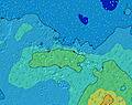 |  | ||||||||||||
Wave Height (m) Direction Period (s) | SSW 17 | SSW 17 | SSW 17 | SSW 16 | SSW 16 | SSW 16 | SSW 19 | SSW 18 | SSW 18 | SSW 17 | SSW 17 | SSW 16 | SSW 16 | SSW 16 | SSW 16 | SSW 16 | SSW 16 | SSW 16 | SSW 15 |
Wave Graph | |||||||||||||||||||
4144 | 3876 | 3354 | 2748 | 2290 | 2511 | 5043 | 4473 | 4618 | 4327 | 4178 | 4272 | 4030 | 3415 | 3133 | 2576 | 2338 | 2115 | 1631 | |
Wind (km/h) | |||||||||||||||||||
Wind State on-shore cross-onshore cross-shore cross-offshore off-shore glassy | cross-off | cross-off | cross-off | cross-off | cross-off | cross-off | cross-off | cross-off | cross-off | cross-off | cross-off | cross-off | cross-off | cross-off | cross-off | off | off | off | cross-off |
High Tide | 5:09PM0.18m | 2:56AM0.19m | 2:34PM0.14m | 11:28PM0.18m | 9:41AM0.17m | ||||||||||||||
Low Tide | 10:13PM0.16m | 12:04PM0.14m | 3:51PM0.14m | 5:38AM0.15m | 4:55PM0.11m | ||||||||||||||
— | — | — | — | 6:28 | — | — | — | — | — | — | — | 6:26 | — | — | — | — | — | — | |
5:40 | — | — | — | — | — | — | — | 5:40 | — | — | — | — | — | — | — | 5:40 | — | — | |
mm | — | — | 1 | 1 | — | — | — | — | — | 1 | — | — | — | — | — | — | 1 | 1 | 1 |
Temp °C | 24 | 24 | 24 | 24 | 25 | 25 | 25 | 25 | 25 | 24 | 24 | 25 | 25 | 25 | 25 | 26 | 26 | 26 | 26 |
Feels °C | 22 | 21 | 21 | 21 | 22 | 21 | 21 | 22 | 22 | 20 | 20 | 22 | 22 | 22 | 22 | 24 | 25 | 25 | 26 |
Swell 1 Height (m) Direction Period (s) | SSW 17 | SSW 17 | SSW 17 | SSW 16 | SSW 16 | SSW 16 | SSW 19 | SSW 18 | SSW 18 | SSW 17 | SSW 17 | SSW 16 | SSW 16 | SSW 16 | SSW 16 | SSW 16 | SSW 16 | SSW 16 | SSW 15 |
4144 | 3876 | 3354 | 2748 | 2290 | 2511 | 5043 | 4473 | 4618 | 4327 | 4178 | 4272 | 4030 | 3415 | 3133 | 2576 | 2338 | 2115 | 1631 | |
Swell 2 Height (m) Direction Period (s) | SSE 10 | — | SSE 10 | SSW 22 | SSW 20 | SSW 20 | SSE 10 | SSE 10 | SSE 10 | SSE 9 | SSE 8 | SSE 9 | S 9 | SSE 10 | SSE 9 | — | — | — | ENE 7 |
326 | — | 104 | 408 | 1312 | 1461 | 190 | 77 | 102 | 69 | 57 | 48 | 42 | 51 | 32 | — | — | — | 11 | |
Swell 3 Height (m) Direction Period (s) | — | — | SSW 22 | SSW 22 | SSE 10 | SSE 10 | — | — | — | — | — | — | — | — | — | — | — | — | — |
— | — | 265 | 408 | 227 | 194 | — | — | — | — | — | — | — | — | — | — | — | — | — | |
Wind waves Height (m) Direction Period (s) | — | SSE 10 | SE 6 | SE 10 | SE 6 | E 4 | E 5 | ESE 7 | ESE 7 | ESE 7 | ESE 7 | E 5 | ENE 4 | ENE 4 | ENE 4 | NE 4 | NE 4 | NE 4 | NNE 4 |
— | 378 | 96 | 392 | 157 | 37 | 51 | 173 | 209 | 198 | 198 | 51 | 36 | 25 | 28 | 35 | 32 | 27 | 31 | |
Nearest Offshore or Glassy | |||||||||||||||||||
Distance (km) | 2277 | 2470 | 2282 | 2277 | 2277 | 2277 | 2277 | 2277 | 2305 | 2381 | 2628 | 2628 | 1134 | 1135 | 2628 | 1134 | 226 | 226 | 2582 |
Best forecast wave conditions in Tahiti | |||||||||||||||||||
Best forecast wave conditions in French Polynesia | |||||||||||||||||||
Header Global | |||||||||||||||||||
- Map Icons:
 Break
Break Live Wave Height (m)
 Live Wind Speed (km/h)
 Surf Rating (10 Max)
 Ocean Swells (m)
- Wind Speed (km/h)


FREE! Surf-Forecast.com widget for your website
The surf report / weather widget below is available to embed on third party websites free of charge and provides a summary of our Paea surf forecast. Simply grab the html code snippet that we provide and paste it into your own site. You can choose your preferred language and metric/imperial units for the surf forecast feed to suit users of your site. Click here to get the code.
 Nearest