

Surf Forecasts:

Nai Harn Beach surf forecast from 3 Aug 2026:
- Most powerful swell: Friday 7 Aug, 7AM (local time) - 10ft (3.0m), 9s period, WSW swell with 1,541 kJ wave energy.
Best Forecast Surf Conditions for Nai Harn Beach this week:
The most powerful waves expected at Nai Harn Beach in the next 16 days are 3.0m 9s and forecast to arrive on Friday (Aug 07) at 7AM. Winds are predicted to be onshore at the time the swell arrives. The largest open ocean swell (not directed at the beach) is 1.9m 9s period and expected on Sunday (Aug 09) at 10PM.
| Wave Type | Time (+07) & Date | Wave Height & Period |
|---|---|---|
| Next good surf (1 star+) | - | - |
| Best Surf | - | - |
| Most Powerful | 7AM (Fri 7th Aug) | 10ft (3.0m) 9s |
Table - best surf conditions forecast for Nai Harn Beach over the next 16 days.
The Lowdown
Hey folks, Rusty here. I’ve had a good look at the charts for Nai Harn Beach, and I’ve got to be straight with you—it’s a tough run ahead. The whole 16-day window is a real mixed bag of size and messy conditions, and honestly, there’s no day where it all clicks for a proper paddle session. The swell is there, no doubt, but the wind is the main villain in this story.
The first real surf we see kicks off on Monday, 3rd August, but it’s tiny. You’re looking at a 0.7ft to 2ft swell from the WSW, with a period that’s long at 15 seconds early, dropping to 9 seconds later. The energy is weak, sitting at 45 to 65, and that’s just not enough to get excited about. The wind is cross-onshore, light at first but then picking up, so it’s choppy and poor. Not a wave worth paddling for.
Then from Tuesday, 4th August, the swell jumps up. We’re seeing 7ft to 8ft from the WSW with a period of 8 seconds, pushing moderate energy around 519 to 766. That’s a solid size, but it’s coming straight onshore with the wind, and the wind is blowing hard—16 mph to 22 mph. The water temp is about average for the time of year, so no surprises there, but the conditions are a write-off. The break is a beach and reef setup, inconsistent, and with all that wind and size, it’s looking more like a kite session than a surf.
This pattern just keeps going. From Wednesday, 5th August, right through to the end of the forecast on Tuesday, 18th August, the swell hangs around the 5ft to 10ft mark, mostly from the W or WSW, with periods between 8 and 10 seconds. The combined energy gets strong, hitting 1,372 at its peak on Friday, 7th August. But the wind is relentless—onshore or cross-onshore, gusting 22 mph to 28 mph, and it’s often described as “fresh cross-onshore and lumpy.” The surf quality is poor, and the scores are all zeros. There’s a gap of good surf, really, from the start to the end, with no recommendation. The only thing that changes is the wind direction occasionally, but it never gets clean.
The best of a bad bunch? Honestly, there isn’t one. The swell is too big for beginners, over 8ft at times, and the wind makes it a mess for everyone. The break is inconsistent anyway, so this blank run feels pretty normal for the area. Keep an eye on the forecasts—things can shift, but right now, it’s a no-go for paddle surfing. I’d wait for a better window.
Rusty
Short Range ForecastHeavy rain (total 61mm), heaviest during Tue night. Warm (max 30°C on Mon afternoon, min 28°C on Mon night). Winds increasing (light winds from the SSW on Sun night, strong winds from the WSW by Wed afternoon). | Days 4-6 Weather SummaryHeavy rain (total 71mm), heaviest during Wed night. Warm (max 29°C on Thu morning, min 27°C on Thu afternoon). Winds decreasing (strong winds from the WSW on Fri afternoon, moderate winds from the SW by Sat afternoon). | ||||||||||||||||||||
Monday 3 | Tuesday 4 | Wednesday 5 | Thursday 6 | Friday 7 | Saturday 8 | Sunday 9 | |||||||||||||||
AM | PM | Night | AM | PM | Night | AM | PM | Night | AM | PM | Night | AM | PM | Night | AM | PM | Night | AM | PM | Night | |
Swell Height Map | 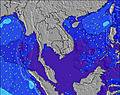 | 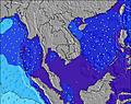 | 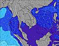 | 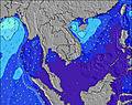 | 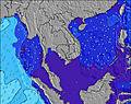 | 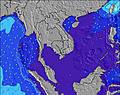 | 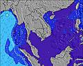 | ||||||||||||||
Wave Height (m) Direction Period (s) | WSW 15 | W 9 | W 9 | WSW 8 | WSW 8 | WSW 9 | WSW 9 | W 9 | W 9 | WSW 10 | WSW 10 | WSW 9 | W 9 | W 9 | W 9 | W 9 | W 9 | W 9 | W 9 | W 9 | W 9 |
Wave Graph | |||||||||||||||||||||
23 | 43 | 56 | 507 | 755 | 906 | 923 | 705 | 742 | 1170 | 1021 | 1126 | 1372 | 1279 | 1129 | 805 | 680 | 764 | 718 | 664 | 203 | |
Wind (km/h) | |||||||||||||||||||||
Wind State on-shore cross-onshore cross-shore cross-offshore off-shore glassy | cross-on | cross-on | on | on | on | cross-on | on | on | on | on | on | on | on | on | cross-on | on | on | on | on | on | cross-on |
High Tide | 1:04PM1.83m | 1:37AM1.74m | 1:39PM1.71m | 2:16AM1.69m | 2:20PM1.57m | 3:05AM1.62m | 3:12PM1.40m | 4:10AM1.54m | 4:30PM1.24m | 5:41AM1.50m | 6:30PM1.19m | 7:19AM1.58m | 8:11PM1.29m | ||||||||
Low Tide | 6:59AM0.27m | 7:22PM0.11m | 7:37AM0.34m | 7:56PM0.19m | 8:22AM0.44m | 8:36PM0.30m | 9:18AM0.55m | 9:27PM0.44m | 10:40AM0.65m | 10:43PM0.57m | 12:34PM0.64m | 00:28AM0.61m | 2:09PM0.50m | 2:00AM0.52m | |||||||
6:18 | — | — | 6:18 | — | — | 6:18 | — | — | 6:18 | — | — | 6:18 | — | — | 6:18 | — | — | 6:18 | — | — | |
— | 6:45 | — | — | 6:45 | — | — | 6:45 | — | — | 6:45 | — | — | 6:45 | — | — | 6:45 | — | — | 6:44 | — | |
mm | 1 | — | 8 | 5 | 8 | 20 | 8 | 8 | 19 | 4 | 12 | 19 | 7 | 2 | 2 | 2 | 4 | 4 | 4 | 6 | 6 |
Temp °C | 29 | 30 | 29 | 28 | 28 | 28 | 28 | 28 | 28 | 29 | 28 | 28 | 28 | 28 | 28 | 28 | 28 | 29 | 29 | 28 | 28 |
Feels °C | 32 | 33 | 33 | 31 | 29 | 28 | 26 | 26 | 26 | 28 | 25 | 26 | 25 | 24 | 25 | 26 | 29 | 29 | 28 | 29 | 26 |
Swell 1 Height (m) Direction Period (s) | W 7 | W 9 | W 9 | — | SW 17 | SSE 5 | SSE 5 | WSW 16 | — | — | — | — | — | — | — | W 9 | W 9 | SE 4 | W 9 | W 9 | W 9 |
17 | 43 | 56 | — | 11 | 5 | 3 | 26 | — | — | — | — | — | — | — | 805 | 680 | 1 | 718 | 664 | 539 | |
Swell 2 Height (m) Direction Period (s) | WSW 15 | W 15 | W 15 | SW 18 | — | — | — | SE 5 | SE 4 | — | — | — | — | — | — | W 16 | SSE 4 | — | W 16 | W 16 | W 16 |
23 | 18 | 4 | 12 | — | — | — | 1 | 1 | — | — | — | — | — | — | 5 | 2 | — | 5 | 5 | 5 | |
Swell 3 Height (m) Direction Period (s) | W 10 | — | W 18 | — | — | — | — | SW 16 | — | — | — | — | — | — | — | — | SW 17 | — | — | W 16 | W 16 |
2 | — | 6 | — | — | — | — | 10 | — | — | — | — | — | — | — | — | 11 | — | — | 5 | 5 | |
Wind waves Height (m) Direction Period (s) | S 4 | S 4 | S 4 | WSW 8 | WSW 8 | WSW 9 | WSW 9 | W 9 | W 9 | WSW 10 | WSW 10 | WSW 9 | W 9 | W 9 | W 9 | SE 4 | WSW 9 | W 9 | WSW 9 | — | W 9 |
3 | 4 | 2 | 507 | 755 | 906 | 923 | 705 | 742 | 1170 | 1021 | 1126 | 1372 | 1279 | 1129 | 1 | 254 | 764 | 289 | — | 203 | |
Nearest Offshore or Glassy | |||||||||||||||||||||
Distance (km) | 108 | 4 | 4 | 24 | 82 | 24 | 782 | 1002 | 1002 | 82 | 82 | 82 | 797 | 797 | 797 | 82 | 24 | 601 | 641 | 24 | 601 |
Best forecast wave conditions in Phuket | |||||||||||||||||||||
Best forecast wave conditions in Thailand | |||||||||||||||||||||
Header Global | |||||||||||||||||||||
- Map Icons:
 Break
Break Live Wave Height (m)
 Live Wind Speed (km/h)
 Surf Rating (10 Max)
 Ocean Swells (m)
- Wind Speed (km/h)
Latest Updates


FREE! Surf-Forecast.com widget for your website
The surf report / weather widget below is available to embed on third party websites free of charge and provides a summary of our Nai Harn Beach surf forecast. Simply grab the html code snippet that we provide and paste it into your own site. You can choose your preferred language and metric/imperial units for the surf forecast feed to suit users of your site. Click here to get the code.
Information about the Nai Harn Beach Surf forecast
The above surf forecast table for Nai Harn Beach provides essential information for determining whether the surfing conditions will be good over the next 16 days. A general guide to surfing at Nai Harn Beach can be found by selecting the local surf guide option on the grey menu. Our Nai Harn Beach surf forecast is unique since it includes wave energy (power) that defines the real feel of the surf rather than just the height or the period. If you surf the same spot (Nai Harn Beach) regularly then make a mental note of the wave energy from the surf forecast table each time you go. Very soon you may start to choose your surf days based on the wave energy alone combined with our forecast of favourable offshore wind conditions. Our star ratings will help here and of course you will also find the usual wave height and period predictions on our surf forecasts as well as a full break down of the swell components under our advanced users option (to reveal that, click the little Einstein character under the tide times).
Further information to help with frequently asked questions about our surf forecast for Nai Harn Beach may be found under the help tab on the top menu and also by moving your mouse over the question marks on the surf forecast table itself. Please always bear in mind that the forecast is for near-shore open water and local factors at each surf break influence the actual breaking wave height, such as the beach / reef profile, water depths offshore and shelter.
Nai Harn Beach is 8 km (5 miles) from the city of Ban Chalong. If you plan a holiday in Phuket, look for hotels and other accommodation in Ban Chalong. Ban Chalong has rooms for a wide range of budgets as well as car hire and transport links.
 Nearest