

Surf Forecasts:

| Time (EEST) & Date | Wave Height | Wave Period |
|---|---|---|
| Morning (19 Jun) | - | - |
| Afternoon (19 Jun) | 1ft (0.3m) | 4s |
| Evening (19 Jun) | - | - |
Table - waves today at Lousta. (Swell directed towards the surf break)
Updates in hr min s Forecast update imminent
Short Range ForecastMostly dry. Warm (max 28°C on Sun morning, min 24°C on Fri night). Wind will be generally light. | ||||||||||||||||||||||||
Fri 19 | Saturday 20 | Sunday 21 | Mon 22 | |||||||||||||||||||||
12 PM | 3 PM | 6 PM | 9 PM | 12 AM | 3 AM | 6 AM | 9 AM | 12 PM | 3 PM | 6 PM | 9 PM | 12 AM | 3 AM | 6 AM | 9 AM | 12 PM | 3 PM | 6 PM | 9 PM | 12 AM | 3 AM | 6 AM | 9 AM | |
Swell Height Map | 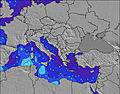 | 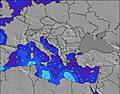 | 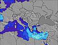 | 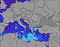 | 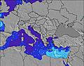 | 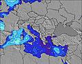 | 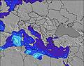 |  | 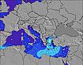 | 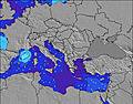 | ||||||||||||||
Wave Height (m) Direction Period (s) | WNW 4 | WNW 4 | WNW 4 | NW 6 | W 4 | W 4 | NW 5 | SE 4 | — | — | — | WSW 2 | WSW 2 | — | — | SE 4 | — | NW 3 | WNW 3 | NW 3 | WNW 3 | WNW 4 | WNW 4 | WNW 4 |
Wave Graph | ||||||||||||||||||||||||
2 | 3 | 0 | 0 | 0 | 0 | 0 | 0 | 0 | 0 | 0 | 1 | 1 | 0 | 0 | 0 | 0 | 2 | 3 | 3 | 0 | 0 | 0 | 0 | |
Wind (km/h) | ||||||||||||||||||||||||
Wind State on-shore cross-onshore cross-shore cross-offshore off-shore glassy | cross | cross-on | glassy | glassy | cross-off | glassy | cross-off | glassy | on | on | cross-on | cross | cross-off | cross-off | cross-off | cross-off | cross | cross-on | cross | cross-off | off | cross-off | cross-off | cross-off |
High Tide | 7:39PM0.10m | 9:18AM0.09m | 8:26PM0.09m | 10:24AM0.09m | 9:34PM0.08m | |||||||||||||||||||
Low Tide | 1:40PM0.04m | 2:32AM0.01m | 2:49PM0.05m | 3:20AM0.02m | 4:15PM0.05m | 4:14AM0.03m | ||||||||||||||||||
— | — | — | — | — | — | 6:13 | — | — | — | — | — | — | — | 6:13 | — | — | — | — | — | — | — | 6:13 | — | |
— | — | 8:53 | — | — | — | — | — | — | — | 8:53 | — | — | — | — | — | — | — | 8:53 | — | — | — | — | 8:54 | |
mm | — | — | — | — | — | — | — | — | — | — | — | — | — | — | — | — | — | — | — | — | — | — | — | — |
Temp °C | 27 | 26 | 26 | 26 | 25 | 24 | 24 | 25 | 26 | 26 | 26 | 25 | 25 | 24 | 24 | 26 | 28 | 28 | 28 | 27 | 26 | 26 | 25 | 27 |
Feels °C | 25 | 25 | 26 | 27 | 25 | 24 | 24 | 25 | 25 | 25 | 25 | 25 | 25 | 24 | 23 | 24 | 27 | 26 | 26 | 26 | 25 | 25 | 24 | 26 |
Swell 1 Height (m) Direction Period (s) | W 4 | NW 4 | WNW 4 | NW 4 | W 4 | W 4 | — | — | — | — | — | — | — | — | — | SE 4 | — | — | — | W 3 | WNW 3 | WNW 4 | WNW 4 | WNW 4 |
1 | 1 | 2 | 1 | 1 | 1 | — | — | — | — | — | — | — | — | — | 1 | — | — | — | 2 | 1 | 1 | 1 | 1 | |
Swell 2 Height (m) Direction Period (s) | — | — | — | — | NW 5 | NW 5 | NW 5 | — | — | — | — | NW 4 | — | — | — | — | — | — | — | — | — | — | — | — |
— | — | — | — | 1 | 1 | 1 | — | — | — | — | 1 | — | — | — | — | — | — | — | — | — | — | — | — | |
Swell 3 Height (m) Direction Period (s) | — | — | — | NW 6 | — | — | — | SE 4 | — | — | — | — | — | — | — | — | — | — | — | — | — | — | E 7 | — |
— | — | — | 1 | — | — | — | 1 | — | — | — | — | — | — | — | — | — | — | — | — | — | — | 1 | — | |
Wind waves Height (m) Direction Period (s) | WNW 4 | WNW 4 | — | — | — | — | — | — | — | — | — | WSW 2 | WSW 2 | — | — | — | — | NW 3 | WNW 3 | NW 3 | — | — | — | — |
2 | 3 | — | — | — | — | — | — | — | — | — | 1 | 1 | — | — | — | — | 2 | 3 | 3 | — | — | — | — | |
Nearest Offshore or Glassy | ||||||||||||||||||||||||
Distance (km) | 2113 | 2201 | 2201 | 237 | 237 | 237 | 237 | 1290 | 2109 | 2114 | 2198 | 237 | 214 | 214 | 1297 | 1583 | 2109 | 2109 | 2157 | 237 | 237 | 237 | 1964 | 2246 |
Best forecast wave conditions in Pelloponisos | ||||||||||||||||||||||||
Best forecast wave conditions in Greece | ||||||||||||||||||||||||
Header Global | ||||||||||||||||||||||||
- Map Icons:
 Break
Break Live Wave Height (m)
 Live Wind Speed (km/h)
 Surf Rating (10 Max)
 Ocean Swells (m)
- Wind Speed (km/h)


FREE! Surf-Forecast.com widget for your website
The surf report / weather widget below is available to embed on third party websites free of charge and provides a summary of our Lousta surf forecast. Simply grab the html code snippet that we provide and paste it into your own site. You can choose your preferred language and metric/imperial units for the surf forecast feed to suit users of your site. Click here to get the code.
 Nearest