

Surf Forecasts:

Jobo's surf forecast from 16 Jul 2026:
- Best quality surf: Wednesday 22 Jul, 8AM (local time) - 3ft (0.9m), 6s period, ENE swell with cross-offshore winds.
- Most powerful swell: Sunday 19 Jul, 5PM (local time) - 6ft (1.9m), 6s period, ENE swell with 263 kJ wave energy.
- Next surfable swell (1★+): Wednesday 22 Jul, 8AM (local time) - 3ft (0.9m), 6s period with ENE swell.
Best Forecast Surf Conditions for Jobo's this week:
The surf forecast for Jobo's over the next 16 days: The first swell (rated 1 star or higher) is forecast to arrive on Wednesday (Jul 22) at 8AM. The primary swell is predicted to be 0.9m and 6s period with a secondary swell of 0.3m and 7s. Another secondary swell of 0.6m and 7s is also forecast. The wind is predicted to be cross-offshore as the swell arrives.
The most powerful waves expected at Jobo's in the next 16 days are 1.9m 6s and forecast to arrive on Sunday (Jul 19) at 5PM. Winds are predicted to be cross-shore at the time the swell arrives. The largest open ocean swell (not directed at the beach) is 1.8m 6s period and expected on Friday (Jul 17) at 8PM.
| Wave Type | Time (AST) & Date | Wave Height & Period |
|---|---|---|
| Next good surf (1 star+) | 8AM (Wed 22nd Jul) | 3ft (0.9m) 6s |
| Best Surf | 8AM (Wed 22nd Jul) | 3ft (0.9m) 6s |
| Most Powerful | 5PM (Sun 19th Jul) | 6ft (1.9m) 6s |
Table - best surf conditions forecast for Jobo's over the next 16 days.
The Lowdown
Alright, let me switch gears into feet and knots for you.
The surf window starts on Thursday the 16th, but she’s flat and ugly. We’re talking a weak 1ft north-northwest windswell with a short 8-second period, and a nasty 19-knot cross-shore wind out of the east-northeast, whipping up a lumpy chop. The combined energy is a measly 12, so it’s basically flat and blown out. This grim pattern of small, wind-chopped swell and fresh cross-shore breezes is going to lock us in for over a week. We’ll see pulses of bigger, messy swell – like 6ft on the 17th afternoon and 7ft on the 19th afternoon – but they come with the same fresh, messy cross-winds. Water temp is 83°, right on average, but with the conditions, it’s no consolation.
The first real break in the clouds is Wednesday morning, July 22nd. The wind drops to a glassy 3 knots out of the north, and we see a small but clean 3ft swell from the northeast (7-second period). The combined energy is only 83, so it’s weak, but those glassy conditions will make it look way better than it is. It’s surfable but ordinary – a morning for the longboard if you’re jonesing for a paddle.
The standout, the one to plan for, is Monday afternoon, July 27th. After a brutal stretch, we get a late-afternoon switch. The wind turns light (6 knots) and goes cross-offshore from the east, and the swell cleans right up. We’ve got a 4ft east-northeast swell with a 9-second period, giving it some shape and push, with moderate energy at 237. This is the best of the entire outlook – clean, workable waves for an advanced crew at Jobos. That “expect good surf conditions” call is your signal. That’s the one session to chase.
First week is a wipeout for decent surf. The second week holds one very promising afternoon. Mark that 27th.
Rusty.
Short Range ForecastLight rain (total 9mm), mostly falling on Thu night. Warm (max 30°C on Thu morning, min 24°C on Sat night). Mainly fresh winds. | Days 4-6 Weather SummaryLight rain (total 3mm), mostly falling on Sun afternoon. Warm (max 30°C on Sun morning, min 25°C on Sun night). Mainly fresh winds. | ||||||||||||||||||||
Thursday 16 | Friday 17 | Saturday 18 | Sunday 19 | Monday 20 | Tuesday 21 | Wednesday 22 | |||||||||||||||
AM | PM | Night | AM | PM | Night | AM | PM | Night | AM | PM | Night | AM | PM | Night | AM | PM | Night | AM | PM | Night | |
Swell Height Map |  |  |  | 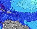 | 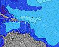 | 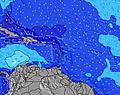 | 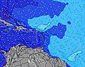 | ||||||||||||||
Wave Height (m) Direction Period (s) | N 8 | N 7 | NNE 8 | E 6 | ENE 6 | NNE 7 | NE 7 | ENE 6 | NE 8 | NE 9 | ENE 6 | ENE 6 | ENE 6 | ENE 6 | NNE 8 | ENE 6 | ENE 6 | ENE 6 | NE 6 | NE 7 | ENE 8 |
Wave Graph | |||||||||||||||||||||
10 | 10 | 6 | 94 | 0 | 10 | 14 | 0 | 10 | 19 | 263 | 237 | 205 | 263 | 7 | 104 | 109 | 97 | 83 | 109 | 158 | |
Wind (km/h) | |||||||||||||||||||||
Wind State on-shore cross-onshore cross-shore cross-offshore off-shore glassy | cross | cross | cross-off | cross | cross | cross-off | cross | cross | cross-off | cross | cross | cross-off | cross | cross | cross-off | cross | cross | cross-off | cross | on | off |
High Tide | 9:52AM0.41m | 10:48PM0.62m | 10:54AM0.44m | 11:31PM0.58m | 11:55AM0.47m | 00:13AM0.52m | 12:56PM0.48m | 00:52AM0.47m | 1:57PM0.49m | 1:30AM0.41m | 2:57PM0.50m | 2:09AM0.37m | 3:56PM0.50m | 2:49AM0.33m | |||||||
Low Tide | 3:49PM0.04m | 5:16AM0.15m | 4:50PM0.09m | 5:58AM0.14m | 5:52PM0.14m | 6:39AM0.12m | 6:59PM0.19m | 7:20AM0.11m | 8:09PM0.22m | 8:01AM0.10m | 9:21PM0.24m | 8:43AM0.09m | 10:33PM0.25m | ||||||||
6:00 | — | — | 6:00 | — | — | 6:01 | — | — | 6:01 | — | — | 6:01 | — | — | 6:01 | — | — | 6:01 | — | — | |
— | 7:07 | — | — | 7:07 | — | — | 7:07 | — | — | 7:07 | — | — | 7:07 | — | — | 7:07 | — | — | 7:06 | — | |
mm | — | 2 | 3 | — | 1 | 2 | — | 1 | — | — | 1 | — | — | 1 | — | — | 1 | — | — | 10 | — |
Temp °C | 30 | 28 | 27 | 30 | 29 | 28 | 30 | 29 | 27 | 30 | 29 | 27 | 30 | 28 | 26 | 29 | 29 | 27 | 29 | 28 | 27 |
Feels °C | 28 | 26 | 26 | 30 | 28 | 30 | 29 | 29 | 26 | 28 | 28 | 26 | 29 | 25 | 25 | 28 | 28 | 28 | 32 | 31 | 30 |
Swell 1 Height (m) Direction Period (s) | N 8 | N 7 | N 7 | NNE 7 | — | NNE 7 | NE 7 | — | NE 8 | NE 9 | N 8 | NE 9 | NE 9 | — | NNE 8 | NNE 8 | — | — | NE 6 | NE 7 | ENE 8 |
10 | 10 | 4 | 9 | — | 10 | 14 | — | 10 | 19 | 1 | 3 | 12 | — | 7 | 6 | — | — | 83 | 109 | 158 | |
Swell 2 Height (m) Direction Period (s) | N 9 | — | NNE 8 | NE 9 | — | NNE 8 | — | — | NNE 10 | N 9 | — | — | — | — | — | — | — | — | E 7 | NE 10 | E 7 |
2 | — | 6 | 3 | — | 7 | — | — | 9 | 2 | — | — | — | — | — | — | — | — | 10 | 14 | 4 | |
Swell 3 Height (m) Direction Period (s) | N 6 | — | N 7 | — | — | — | — | — | N 10 | — | — | — | — | — | — | — | — | — | NE 9 | E 8 | — |
1 | — | 1 | — | — | — | — | — | 2 | — | — | — | — | — | — | — | — | — | 13 | 4 | — | |
Wind waves Height (m) Direction Period (s) | E 4 | E 6 | E 6 | E 6 | ENE 6 | E 6 | E 6 | ENE 6 | ENE 6 | ENE 6 | ENE 6 | ENE 6 | ENE 6 | ENE 6 | ENE 6 | ENE 6 | ENE 6 | ENE 6 | — | — | — |
38 | 197 | 88 | 94 | 208 | 127 | 110 | 159 | 135 | 145 | 263 | 237 | 205 | 263 | 132 | 104 | 109 | 97 | — | — | — | |
Nearest Offshore or Glassy | |||||||||||||||||||||
Distance (km) | 746 | 879 | 48 | 133 | 879 | 228 | 879 | 632 | 87 | 879 | 879 | 38 | 879 | 632 | 301 | 301 | 430 | 47 | 0 | 217 | 0 |
Best forecast wave conditions in Puerto Rico | |||||||||||||||||||||
Best forecast wave conditions in Puerto Rico | |||||||||||||||||||||
Header Global | |||||||||||||||||||||
- Map Icons:
 Break
Break Live Wave Height (m)
 Live Wind Speed (km/h)
 Surf Rating (10 Max)
 Ocean Swells (m)
- Wind Speed (km/h)


FREE! Surf-Forecast.com widget for your website
The surf report / weather widget below is available to embed on third party websites free of charge and provides a summary of our Jobo's surf forecast. Simply grab the html code snippet that we provide and paste it into your own site. You can choose your preferred language and metric/imperial units for the surf forecast feed to suit users of your site. Click here to get the code.
Information about the Jobo's Surf forecast
The above surf forecast table for Jobo's provides essential information for determining whether the surfing conditions will be good over the next 16 days. A general guide to surfing at Jobo's can be found by selecting the local surf guide option on the grey menu. Our Jobo's surf forecast is unique since it includes wave energy (power) that defines the real feel of the surf rather than just the height or the period. If you surf the same spot (Jobo's) regularly then make a mental note of the wave energy from the surf forecast table each time you go. Very soon you may start to choose your surf days based on the wave energy alone combined with our forecast of favourable offshore wind conditions. Our star ratings will help here and of course you will also find the usual wave height and period predictions on our surf forecasts as well as a full break down of the swell components under our advanced users option (to reveal that, click the little Einstein character under the tide times).
Further information to help with frequently asked questions about our surf forecast for Jobo's may be found under the help tab on the top menu and also by moving your mouse over the question marks on the surf forecast table itself. Please always bear in mind that the forecast is for near-shore open water and local factors at each surf break influence the actual breaking wave height, such as the beach / reef profile, water depths offshore and shelter.
Jobo's is 8 km (5 miles) from the city of Aguadilla. If you plan a holiday in Puerto Rico, look for hotels and other accommodation in Aguadilla. Aguadilla has rooms for a wide range of budgets as well as car hire and transport links.
 Nearest