

Surf Forecasts:

How big are the waves at Horseshoe Bay 1 today (04 Aug):
- Morning surf: Morning surf (04 Aug, local time) - 6.5ft (2.0m), 12s period with SSW swell.
- Afternoon surf: Afternoon surf (04 Aug, local time) - 6ft (1.9m), 11s period with SSW swell.
- Evening surf: Evening surf (04 Aug, local time) - 5.5ft (1.7m), 11s period with SSW swell.
The current surf forecast for Horseshoe Bay 1 at 3AM is: 2.2m 12s primary swell from a South-southwest direction and 0.8m 17s secondary swell from a South-southwest direction (forecast issued at 08:30pm August 03). The wind direction is predicted to be cross-onshore.
| Time (ACST) & Date | Wave Height | Wave Period |
|---|---|---|
| Morning (04 Aug) | 6.5ft (2.0m) | 12s |
| Afternoon (04 Aug) | 6ft (1.9m) | 11s |
| Evening (04 Aug) | 5.5ft (1.7m) | 11s |
Table - waves today at Horseshoe Bay 1. (Swell directed towards the surf break)
Short Range ForecastMostly dry. Very mild (max 14°C on Thu morning, min 8°C on Tue night). Wind will be generally light. | ||||||||||||||||||
Mon 3 | Tuesday 4 | Wednesday 5 | ||||||||||||||||
6 PM | 9 PM | 12 AM | 3 AM | 6 AM | 9 AM | 12 PM | 3 PM | 6 PM | 9 PM | 12 AM | 3 AM | 6 AM | 9 AM | 12 PM | 3 PM | 6 PM | 9 PM | |
Swell Height Map |  | 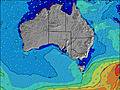 | 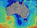 | 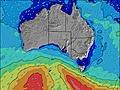 | 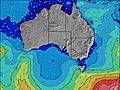 | 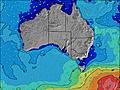 | 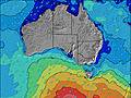 | |||||||||||
Wave Height (m) Direction Period (s) | SSW 13 | SSW 13 | SSW 13 | SSW 12 | SSW 12 | SSW 12 | SSW 12 | SSW 11 | SSW 11 | SSW 11 | SSW 10 | SSW 20 | SSW 19 | SSW 19 | SSW 19 | SSW 18 | SSW 18 | SSW 17 |
Wave Graph | ||||||||||||||||||
1974 | 1803 | 1777 | 1388 | 1207 | 1106 | 1050 | 853 | 711 | 672 | 532 | 437 | 480 | 470 | 450 | 413 | 404 | 528 | |
Wind (km/h) | ||||||||||||||||||
Wind State on-shore cross-onshore cross-shore cross-offshore off-shore glassy | cross-on | cross-on | cross-on | cross-on | cross-on | cross-on | cross-on | cross-on | glassy | glassy | cross-off | off | off | off | cross-off | cross-off | cross-off | cross-off |
High Tide | 3:23AM0.95m | 3:16PM1.03m | 3:59AM1.01m | 3:20PM0.96m | ||||||||||||||
Low Tide | 9:15PM0.45m | 8:43AM0.53m | 9:17PM0.47m | 9:14AM0.68m | 9:13PM0.48m | |||||||||||||
— | — | — | — | 7:07 | — | — | — | — | — | — | — | 7:07 | — | — | — | — | — | |
— | — | — | — | — | — | — | 5:34 | — | — | — | — | — | — | — | 5:35 | — | — | |
mm | — | — | — | — | — | — | — | — | — | — | — | — | — | — | — | — | — | — |
Temp °C | 12 | 11 | 11 | 11 | 11 | 11 | 12 | 12 | 11 | 11 | 9 | 9 | 8 | 10 | 13 | 13 | 12 | 12 |
Feels °C | 8 | 7 | 7 | 8 | 8 | 7 | 8 | 9 | 9 | 9 | 6 | 6 | 5 | 7 | 10 | 10 | 9 | 9 |
Swell 1 Height (m) Direction Period (s) | SSW 18 | SSW 18 | SSW 13 | SSW 12 | SSW 12 | SSW 12 | SSW 12 | SSW 11 | SSW 11 | SSW 11 | SSW 10 | SSW 10 | SSW 10 | SSW 9 | SSW 9 | SSW 14 | SSW 13 | SSW 17 |
182 | 273 | 1777 | 1388 | 1207 | 1106 | 1050 | 853 | 711 | 672 | 532 | 373 | 289 | 222 | 162 | 294 | 282 | 528 | |
Swell 2 Height (m) Direction Period (s) | — | SSW 18 | SSW 18 | SSW 17 | SSW 16 | SSW 16 | SSW 16 | SSW 16 | SSW 15 | SSW 21 | SSW 20 | SSW 20 | SSW 19 | SSW 19 | SSW 14 | SSW 8 | SSW 8 | SSW 8 |
— | 399 | 273 | 329 | 330 | 291 | 149 | 223 | 275 | 291 | 280 | 437 | 480 | 470 | 321 | 118 | 83 | 62 | |
Swell 3 Height (m) Direction Period (s) | — | — | — | — | — | — | — | SW 15 | SW 21 | SSW 15 | SSW 15 | SSW 14 | SSW 15 | SSW 14 | SSW 19 | SSW 18 | SSW 18 | SSW 13 |
— | — | — | — | — | — | — | 530 | 117 | 43 | 45 | 175 | 188 | 183 | 450 | 413 | 404 | 140 | |
Wind waves Height (m) Direction Period (s) | SSW 13 | SSW 13 | — | — | — | — | — | — | — | — | — | — | — | N 2 | — | — | — | — |
1974 | 1803 | — | — | — | — | — | — | — | — | — | — | — | 1 | — | — | — | — | |
Nearest Offshore or Glassy | ||||||||||||||||||
Distance (km) | 569 | 138 | 1 | 1 | 1 | 1 | 9 | 138 | 0 | 0 | 0 | 0 | 0 | 0 | 0 | 0 | 0 | 0 |
Best forecast wave conditions in South Australia - East Coast | ||||||||||||||||||
Best forecast wave conditions in Australia | ||||||||||||||||||
Header Global | ||||||||||||||||||
- Map Icons:
 Break
Break Live Wave Height (m)
 Live Wind Speed (km/h)
 Surf Rating (10 Max)
 Ocean Swells (m)
- Wind Speed (km/h)
Latest Updates


FREE! Surf-Forecast.com widget for your website
The surf report / weather widget below is available to embed on third party websites free of charge and provides a summary of our Horseshoe Bay 1 surf forecast. Simply grab the html code snippet that we provide and paste it into your own site. You can choose your preferred language and metric/imperial units for the surf forecast feed to suit users of your site. Click here to get the code.
 Nearest