

Surf Forecasts:

Ha-Arubot (Bet Yanay) surf forecast from 3 Aug 2026:
- Best quality surf: Friday 7 Aug, 12AM (local time) - 2.5ft (0.7m), 6s period, WNW swell with glassy winds.
- Most powerful swell: Sunday 9 Aug, 12AM (local time) - 3ft (0.9m), 7s period, WNW swell with 66 kJ wave energy.
- Next surfable swell (1★+): Friday 7 Aug, 12AM (local time) - 2.5ft (0.7m), 6s period with WNW swell.
Best Forecast Surf Conditions for Ha-Arubot (Bet Yanay) this week:
The surf forecast for Ha-Arubot (Bet Yanay) over the next 16 days: The first swell (rated 1 star or higher) is forecast to arrive on Friday (Aug 07) at 12AM. The primary swell is predicted to be 0.7m and 6s period. The wind is predicted to be glassy as the swell arrives.
The most powerful waves expected at Ha-Arubot (Bet Yanay) in the next 16 days are 0.9m 7s and forecast to arrive on Sunday (Aug 09) at 12AM. Winds are predicted to be cross-onshore at the time the swell arrives.
| Wave Type | Time (IDT) & Date | Wave Height & Period |
|---|---|---|
| Next good surf (1 star+) | 12AM (Fri 7th Aug) | 2.5ft (0.7m) 6s |
| Best Surf | 12AM (Fri 7th Aug) | 2.5ft (0.7m) 6s |
| Most Powerful | 12AM (Sun 9th Aug) | 3ft (0.9m) 7s |
Table - best surf conditions forecast for Ha-Arubot (Bet Yanay) over the next 16 days.
The Lowdown
Alright, folks. Rusty here. Let’s look at what’s cooking for Ha-Arubot (Bet Yanay). I gotta be honest with you – this whole 16-day stretch is lookin’ real flat and ugly. There’s no decent surf on the table, and it’s a long, dry spell of poor conditions.
The water is sitting at a warm 85°, which is a touch warmer than normal for this time of year, so at least it’ll feel nice if you’re just floating around.
The first real chance doesn’t come until August 3rd, and even then it’s a struggle. Monday the 3rd starts with a tiny 2ft swell from the NW, period of just 4 seconds – that’s short-period junk. The wind is a light cross-onshore breeze, so the surface is all rippled and messy. The combined energy is a weak 22, so there’s no power behind it at all. It’s basically a no-go for any real surfing.
The pattern repeats for days. Tuesday the 4th is even smaller at 2ft, and the wind is onshore or cross-onshore, keeping the waves chopped and ugly. By Wednesday the 5th, we’re still stuck in that same rut – 2ft to 2ft swell, short period, and the wind is never clean. The combined energy stays in the teens and twenties, way too weak to push anything rideable.
There’s a slight uptick around Thursday, August 14th, when we see a 3ft to 4ft swell from the WNW, with a period of 7 seconds. The combined energy finally bumps up to 124 in the afternoon, which is at least moderate wave energy. But the wind is a moderate cross-onshore from the WSW, so it’s gonna be bumpy and choppy. Still not worth paddling out for.
The rest of the run through to August 18th is more of the same: tiny swells, poor wind, and consistently poor surf conditions. The highest combined energy we see is 124, and that’s only for one afternoon. This is a spot that’s inconsistent at the best of times, and this forecast is a true blank run. For a beach break like this, with such weak, short-period swell and messy winds, you’d honestly be better off with a kite than a paddleboard.
Nothing to get worked up about here. The ocean’s just taking a long nap.
Rusty.
Short Range ForecastMostly dry. Warm (max 30°C on Mon morning, min 25°C on Tue night). Wind will be generally light. | Days 4-6 Weather SummaryMostly dry. Warm (max 29°C on Thu morning, min 25°C on Thu night). Wind will be generally light. | ||||||||||||||||||||
Monday 3 | Tuesday 4 | Wednesday 5 | Thursday 6 | Friday 7 | Saturday 8 | Sunday 9 | |||||||||||||||
AM | PM | Night | AM | PM | Night | AM | PM | Night | AM | PM | Night | AM | PM | Night | AM | PM | Night | AM | PM | Night | |
Swell Height Map | 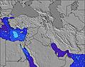 | 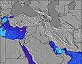 | 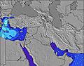 | 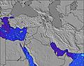 | 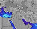 | 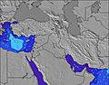 | 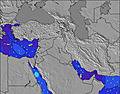 | ||||||||||||||
Wave Height (m) Direction Period (s) | NW 4 | WNW 5 | NW 4 | NW 5 | WNW 5 | WNW 6 | WNW 6 | WNW 7 | WNW 6 | WNW 6 | W 6 | WNW 6 | WNW 6 | W 6 | WNW 6 | WNW 7 | WNW 7 | WNW 7 | WNW 6 | WNW 6 | WNW 6 |
Wave Graph | |||||||||||||||||||||
11 | 15 | 9 | 12 | 25 | 29 | 31 | 47 | 32 | 31 | 40 | 29 | 26 | 24 | 21 | 38 | 49 | 66 | 45 | 28 | 20 | |
Wind (km/h) | |||||||||||||||||||||
Wind State on-shore cross-onshore cross-shore cross-offshore off-shore glassy | cross-on | on | cross-on | cross-on | on | glassy | cross-on | on | cross | cross | cross-on | cross | cross | cross-on | cross-on | cross | cross-on | cross-on | cross | on | cross |
High Tide | 1:28PM0.34m | 1:58AM0.33m | 2:06PM0.30m | 2:39AM0.32m | 2:55PM0.26m | 3:35AM0.30m | 4:22PM0.22m | 5:09AM0.29m | 7:16PM0.22m | 7:08AM0.30m | 8:51PM0.25m | 8:26AM0.33m | 9:39PM0.28m | ||||||||
Low Tide | 7:42PM0.06m | 8:06AM0.09m | 8:15PM0.09m | 9:00AM0.11m | 8:55PM0.12m | 10:27AM0.13m | 10:00PM0.15m | 12:49PM0.13m | 00:18AM0.17m | 2:27PM0.09m | 2:06AM0.15m | 3:22PM0.05m | 3:07AM0.12m | ||||||||
5:56 | — | — | 5:56 | — | — | 5:56 | — | — | 5:58 | — | — | 5:58 | — | — | 5:58 | — | — | 6:00 | — | — | |
— | 7:37 | — | — | 7:36 | — | — | 7:35 | — | — | 7:34 | — | — | 7:32 | — | — | 7:31 | — | — | 7:30 | — | |
mm | — | — | — | — | — | — | — | — | — | — | — | — | — | — | — | — | — | — | — | — | — |
Temp °C | 30 | 30 | 27 | 29 | 29 | 27 | 29 | 29 | 27 | 29 | 29 | 27 | 29 | 29 | 27 | 29 | 29 | 27 | 29 | 29 | 27 |
Feels °C | 29 | 28 | 28 | 30 | 29 | 30 | 30 | 30 | 30 | 30 | 29 | 30 | 29 | 30 | 30 | 30 | 30 | 30 | 30 | 30 | 30 |
Swell 1 Height (m) Direction Period (s) | WNW 6 | — | NW 4 | NW 5 | — | WNW 6 | WNW 6 | WNW 7 | WNW 6 | WNW 6 | — | WNW 6 | WNW 6 | — | WNW 6 | WNW 7 | WNW 7 | WNW 7 | WNW 6 | — | WNW 6 |
4 | — | 9 | 12 | — | 29 | 31 | 38 | 32 | 31 | — | 29 | 26 | — | 21 | 38 | 49 | 66 | 45 | — | 20 | |
Swell 2 Height (m) Direction Period (s) | WNW 6 | — | — | — | — | — | — | — | — | — | — | — | — | — | WNW 8 | — | — | — | — | — | — |
7 | — | — | — | — | — | — | — | — | — | — | — | — | — | 6 | — | — | — | — | — | — | |
Swell 3 Height (m) Direction Period (s) | — | — | — | — | — | — | — | — | — | — | — | — | — | — | — | — | — | — | — | — | — |
— | — | — | — | — | — | — | — | — | — | — | — | — | — | — | — | — | — | — | — | — | |
Wind waves Height (m) Direction Period (s) | NW 4 | WNW 5 | — | — | WNW 5 | — | — | WNW 7 | — | — | W 6 | — | — | W 6 | — | — | — | — | — | WNW 6 | — |
11 | 15 | — | — | 25 | — | — | 47 | — | — | 40 | — | — | 24 | — | — | — | — | — | 28 | — | |
Nearest Offshore or Glassy | |||||||||||||||||||||
Distance (km) | 2224 | 3801 | 3345 | 2224 | 2224 | 2224 | 3386 | 2224 | 104 | 2224 | 2224 | 929 | 2224 | 2224 | 2224 | 2211 | 2741 | 47 | 10 | 3406 | 1571 |
Best forecast wave conditions in Tel Aviv and South | |||||||||||||||||||||
Best forecast wave conditions in Israel | |||||||||||||||||||||
Header Global | |||||||||||||||||||||
- Map Icons:
 Break
Break Live Wave Height (m)
 Live Wind Speed (km/h)
 Surf Rating (10 Max)
 Ocean Swells (m)
- Wind Speed (km/h)
Latest Updates


FREE! Surf-Forecast.com widget for your website
The surf report / weather widget below is available to embed on third party websites free of charge and provides a summary of our Ha-Arubot (Bet Yanay) surf forecast. Simply grab the html code snippet that we provide and paste it into your own site. You can choose your preferred language and metric/imperial units for the surf forecast feed to suit users of your site. Click here to get the code.
Information about the Ha-Arubot (Bet Yanay) Surf forecast
The above surf forecast table for Ha-Arubot (Bet Yanay) provides essential information for determining whether the surfing conditions will be good over the next 16 days. A general guide to surfing at Ha-Arubot (Bet Yanay) can be found by selecting the local surf guide option on the grey menu. Our Ha-Arubot (Bet Yanay) surf forecast is unique since it includes wave energy (power) that defines the real feel of the surf rather than just the height or the period. If you surf the same spot (Ha-Arubot (Bet Yanay)) regularly then make a mental note of the wave energy from the surf forecast table each time you go. Very soon you may start to choose your surf days based on the wave energy alone combined with our forecast of favourable offshore wind conditions. Our star ratings will help here and of course you will also find the usual wave height and period predictions on our surf forecasts as well as a full break down of the swell components under our advanced users option (to reveal that, click the little Einstein character under the tide times).
Further information to help with frequently asked questions about our surf forecast for Ha-Arubot (Bet Yanay) may be found under the help tab on the top menu and also by moving your mouse over the question marks on the surf forecast table itself. Please always bear in mind that the forecast is for near-shore open water and local factors at each surf break influence the actual breaking wave height, such as the beach / reef profile, water depths offshore and shelter.
Ha-Arubot (Bet Yanay) is 6 km (4 miles) from the city of Netanya. If you plan a holiday in Tel Aviv and South, look for hotels and other accommodation in Netanya. Netanya has rooms for a wide range of budgets as well as car hire and transport links.
 Nearest