

Surf Forecasts:

How big are the waves at Devil s Punch Beverly Beach today (02 Aug):
- Morning surf: Morning surf (02 Aug, local time) - 5ft (1.6m), 9s period with WNW swell.
- Afternoon surf: Afternoon surf (02 Aug, local time) - 5.5ft (1.7m), 9s period with WNW swell.
- Evening surf: Evening surf (02 Aug, local time) - 5.5ft (1.7m), 9s period with WNW swell.
The current surf forecast for Devil s Punch Beverly Beach at 2AM is: 1.3m 8s primary swell from a West-northwest direction and 0.6m 14s secondary swell from a Southwest direction (forecast issued at 10:00pm August 01). The wind direction is predicted to be offshore and the swell rating is 2.
| Time (PDT) & Date | Wave Height | Wave Period |
|---|---|---|
| Morning (02 Aug) | 5ft (1.6m) | 9s |
| Afternoon (02 Aug) | 5.5ft (1.7m) | 9s |
| Evening (02 Aug) | 5.5ft (1.7m) | 9s |
Table - waves today at Devil s Punch Beverly Beach. (Swell directed towards the surf break)
Short Range ForecastMostly dry. Warm (max 23°C on Tue morning, min 11°C on Sun night). Mainly fresh winds. | ||||||||||||||||||
Sat 1 | Sunday 2 | Monday 3 | ||||||||||||||||
8 PM | 11 PM | 2 AM | 5 AM | 8 AM | 11 AM | 2 PM | 5 PM | 8 PM | 11 PM | 2 AM | 5 AM | 8 AM | 11 AM | 2 PM | 5 PM | 8 PM | 11 PM | |
Swell Height Map |  |  | 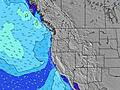 |  |  | 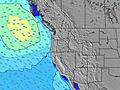 |  | |||||||||||
Wave Height (m) Direction Period (s) | WNW 8 | WNW 8 | WNW 8 | WNW 8 | WNW 9 | WNW 9 | WNW 9 | WNW 9 | WNW 9 | WNW 9 | WNW 8 | NW 8 | NW 8 | NW 8 | NW 7 | NW 7 | NNW 7 | NNW 7 |
Wave Graph | ||||||||||||||||||
143 | 169 | 186 | 291 | 363 | 436 | 484 | 535 | 426 | 352 | 277 | 371 | 277 | 241 | 266 | 296 | 372 | 394 | |
Wind (km/h) | ||||||||||||||||||
Wind State on-shore cross-onshore cross-shore cross-offshore off-shore glassy | cross | cross-off | off | cross-off | glassy | cross | cross | cross | cross-off | cross-off | cross-off | cross-off | cross-off | cross | cross | cross | cross-off | cross-off |
High Tide | 2:39AM2.23m | 3:36PM2.30m | 3:25AM2.06m | 4:08PM2.36m | ||||||||||||||
Low Tide | 8:51PM0.61m | 9:06AM-0.06m | 9:37PM0.50m | 9:37AM0.15m | 10:29PM0.40m | |||||||||||||
— | — | — | 6:03 | — | — | — | — | — | — | — | 6:03 | — | — | — | — | — | — | |
8:42 | — | — | — | — | — | — | — | 8:40 | — | — | — | — | — | — | — | 8:38 | — | |
mm | — | — | — | — | — | — | — | — | — | — | — | — | — | — | — | — | — | — |
Temp °C | 15 | 15 | 14 | 13 | 13 | 17 | 17 | 16 | 15 | 14 | 12 | 11 | 12 | 18 | 19 | 18 | 16 | 15 |
Feels °C | 13 | 15 | 14 | 12 | 13 | 14 | 13 | 11 | 10 | 11 | 10 | 9 | 10 | 15 | 14 | 13 | 13 | 13 |
Swell 1 Height (m) Direction Period (s) | WNW 8 | WNW 8 | WNW 8 | WNW 8 | WNW 9 | WNW 9 | WNW 9 | SW 13 | WNW 9 | WNW 9 | WNW 8 | SW 13 | NW 8 | SW 13 | SW 13 | SW 13 | SW 13 | WSW 16 |
143 | 169 | 186 | 291 | 363 | 436 | 484 | 63 | 426 | 352 | 277 | 45 | 277 | 27 | 27 | 27 | 27 | 25 | |
Swell 2 Height (m) Direction Period (s) | SW 14 | SW 14 | SW 14 | SW 14 | SW 14 | SW 14 | SW 14 | SW 18 | SW 13 | SW 13 | SW 13 | WSW 18 | SW 13 | WSW 18 | WSW 18 | WSW 17 | WSW 16 | SW 13 |
119 | 121 | 123 | 121 | 66 | 64 | 64 | 13 | 63 | 62 | 62 | 31 | 44 | 30 | 30 | 28 | 26 | 26 | |
Swell 3 Height (m) Direction Period (s) | W 20 | SW 20 | WSW 19 | SW 19 | SW 19 | SW 19 | W 19 | — | WSW 18 | WSW 18 | WSW 18 | WSW 18 | WSW 18 | WSW 18 | — | — | — | — |
7 | 15 | 37 | 15 | 15 | 15 | 7 | — | 31 | 31 | 31 | 61 | 31 | 30 | — | — | — | — | |
Wind waves Height (m) Direction Period (s) | — | — | — | — | — | — | — | WNW 9 | N 5 | N 5 | N 5 | NW 8 | — | NW 8 | NW 7 | NW 7 | NNW 7 | NNW 7 |
— | — | — | — | — | — | — | 535 | 34 | 47 | 64 | 371 | — | 241 | 266 | 296 | 372 | 394 | |
Nearest Offshore or Glassy | ||||||||||||||||||
Distance (km) | 381 | 0 | 0 | 0 | 0 | 752 | 769 | 1205 | 769 | 380 | 0 | 0 | 0 | 170 | 401 | 406 | 411 | 0 |
Best forecast wave conditions in North Oregon | ||||||||||||||||||
Best forecast wave conditions in United States | ||||||||||||||||||
Header Global | ||||||||||||||||||
- Map Icons:
 Break
Break Live Wave Height (m)
 Live Wind Speed (km/h)
 Surf Rating (10 Max)
 Ocean Swells (m)
- Wind Speed (km/h)
Latest Updates


FREE! Surf-Forecast.com widget for your website
The surf report / weather widget below is available to embed on third party websites free of charge and provides a summary of our Devil s Punch Beverly Beach surf forecast. Simply grab the html code snippet that we provide and paste it into your own site. You can choose your preferred language and metric/imperial units for the surf forecast feed to suit users of your site. Click here to get the code.
 Nearest