North Oregon Surf
Detailed North Oregon surf forecast maps and the latest eyeball surf report from local surfers in the region. Near-shore swell is shown on the map together with the surf forecast rating for spots in North Oregon. Find the best places to surf in offshore conditions by selecting the wind option on the forecast map. Windsurfers and kite surfers can also use this option to find more favorable cross-shore conditions in North Oregon. Our local Wavefinder indicates where some of the best conditions are likely to be found in North Oregon over the next 7 days. Surf photos from North Oregon and reviews of the best spots and surfing conditions have been provided by local surfers.
North Oregon Surf Forecast map for predicting the best wave and wind conditions across the region. For surfers, the map shows the most powerful swell tracking across near-shore open water and not the peak waves experienced by boats out at sea. Move your mouse over the ocean swell symbols or the surf breaks on the coastline to see a more detailed surf forecast including wave period and wind conditions. The forecast updates every 6 hours and most live weather reports update every hour. You can animate the North Oregon Surf map or show live wind and wave conditions as reported from wavebuoys and local weather stations. Surf breaks shown along the North Oregon coastline are also listed below.
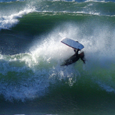
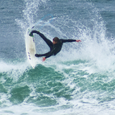
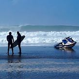
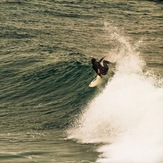
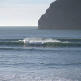
North Oregon Photos
North Oregon Wavefinder
Sun 2 | Monday 3 | Tuesday 4 | Wednesday 5 | Thursday 6 | Friday 7 | Saturday 8 | ||||||||||||||
PM | Night | AM | PM | Night | AM | PM | Night | AM | PM | Night | AM | PM | Night | AM | PM | Night | AM | PM | Night | |
Best forecast wave conditions in North Oregon | ||||||||||||||||||||
Wave Height (m) Direction Period (s) | WNW 9 | WNW 8 | WNW 8 | NW 7 | NW 7 | WNW 7 | NW 7 | NW 8 | WNW 8 | NW 8 | WNW 8 | WNW 8 | NW 8 | NNW 8 | NW 7 | NW 7 | NNW 7 | NW 6 | NW 7 | NNW 7 |
397 | 277 | 170 | 193 | 183 | 127 | 179 | 441 | 219 | 274 | 208 | 208 | 211 | 187 | 55 | 84 | 123 | 66 | 97 | 198 | |
Wind (km/h) | ||||||||||||||||||||
Wind State on-shore cross-onshore cross-shore cross-offshore off-shore glassy | cross | cross-off | cross | cross | cross-off | cross | cross | cross-off | cross-on | cross-on | cross-off | on | cross-on | cross-off | cross-on | cross-on | cross-off | cross | cross | cross-off |
High Tide | 3:52PM3.07m | 3:44AM2.78m | 4:23PM3.12m | 4:26AM2.47m | 4:58PM3.16m | 5:40AM2.38m | 5:40PM3.18m | 7:02AM2.24m | 6:33PM3.19m | 8:40AM2.23m | 7:37PM3.22m | 10:08AM2.34m | 8:56PM2.49m | |||||||
Low Tide | 9:57PM1.21m | 9:53AM0.91m | 10:36PM1.10m | 10:26AM1.14m | 11:27PM0.30m | 11:05AM1.38m | 00:48AM0.92m | 11:54AM1.61m | 1:48AM0.04m | 1:03PM1.79m | 3:00AM-0.14m | 2:28PM1.88m | 4:49AM-0.20m | |||||||
mm | — | — | — | — | — | — | — | — | — | — | — | — | — | — | — | — | — | — | — | — |
Max °C | 16 | 15 | 18 | 19 | 17 | 23 | 23 | 18 | 21 | 20 | 17 | 16 | 17 | 15 | 16 | 17 | 16 | 17 | 16 | 15 |
Min °C | 16 | 12 | 13 | 19 | 16 | 17 | 21 | 14 | 18 | 20 | 15 | 15 | 16 | 13 | 14 | 17 | 14 | 15 | 16 | 13 |
Chill °C | 15 | 13 | 18 | 18 | 16 | 23 | 23 | 17 | 21 | 20 | 17 | 16 | 17 | 14 | 16 | 17 | 15 | 16 | 15 | 14 |
— | — | 6:00 | — | — | 6:01 | — | — | 6:03 | — | — | 6:03 | — | — | 6:05 | — | — | 6:05 | — | — | |
8:44 | — | — | 8:42 | — | — | 8:40 | — | — | 8:38 | — | — | 8:37 | — | — | 8:37 | — | — | 8:35 | — | |
Swell 1 Height (m) Direction Period (s) | WNW 9 | WNW 8 | WNW 8 | SW 13 | NW 7 | WNW 7 | WNW 10 | SW 15 | WNW 8 | NW 8 | WNW 8 | WNW 8 | NW 8 | NNW 8 | NW 7 | NW 7 | WNW 12 | NW 6 | NW 11 | W 11 |
397 | 277 | 170 | 27 | 183 | 127 | 31 | 56 | 219 | 274 | 208 | 208 | 211 | 187 | 55 | 84 | 46 | 66 | 29 | 57 | |
Swell 2 Height (m) Direction Period (s) | SW 13 | SW 13 | SW 13 | WSW 17 | WSW 16 | WSW 16 | WSW 16 | SW 12 | WSW 15 | SW 14 | SW 14 | SW 14 | SW 14 | SW 13 | WNW 8 | SW 13 | SW 13 | WNW 11 | SW 12 | SW 17 |
63 | 28 | 27 | 30 | 25 | 25 | 25 | 6 | 21 | 54 | 51 | 49 | 47 | 61 | 13 | 42 | 56 | 23 | 24 | 70 | |
Wind waves Height (m) Direction Period (s) | — | — | — | NW 7 | — | — | NW 7 | NW 8 | — | — | — | — | — | — | — | — | NNW 7 | — | NW 7 | NNW 7 |
— | — | — | 193 | — | — | 179 | 441 | — | — | — | — | — | — | — | — | 123 | — | 97 | 198 | |
Sea °C | 16 | 16 | 16 | 16 | 15 | 16 | 16 | 14 | 16 | 16 | 16 | 16 | 16 | 14 | 16 | 16 | 14 | 16 | 16 | 15 |
Diff °C | ||||||||||||||||||||
North Oregon Surf Breaks
Northwest Oregon, now this is a place for the hardy surfer! A favorite beach is Indian Beach. The break is gentle to extreme with the fall and winter bringing some menacing storms. You have to watch for driftwood when conditions are stormy. In a lull of harsh weather the break is strong and hollow during fall, winter and spring. Summer breaks are easy going with an occasional set keeping the hopes alive. This region has some hidden swells which are tricky to reach or a long walk downhill. Water temp can range from a chilly 48 degrees F. to a balmy 59-60 degrees F., so a quality wetsuit, boots, gloves and hood will help stay out longer. Wind can make for better surf if it comes out of the east or southwest, as the best swells come from the southwest. Indian Beach, the spot to check out on your next trip to Northwest Oregon. You won't be disappointed!.....Michael Gambill
 Nearest