- Forecast
- Maps
- Live
- Weather State
- Spot Information
Surf Forecasts:
Cocoloco surfForecast / North / Uruguay
Forecast update in hr min s Forecast update imminent
Cocoloco surf forecast is for near shore open water. Breaking waves will often be smaller at less exposed spots.
Today's Cocoloco sea temperature is
18.6° C
(Which is 1.5°C warmer than normal for this time of year)How big are the waves at Cocoloco today?
The current surf forecast for Cocoloco at 6AM is: 1.9m 15s primary swell from a South-southeast direction (forecast issued at 02:00am May 04). An open ocean swell of 0.5m 3s is not directed at the surf break. The wind direction is predicted to be cross-offshore.
| Time (-03) & Date | Wave Height | Wave Period |
|---|---|---|
| Morning (04 May) | 6ft (1.8m) | 15s |
| Afternoon (04 May) | 4.5ft (1.4m) | 14s |
| Evening (04 May) | 3.5ft (1.1m) | 13s |
Table - waves today at Cocoloco. (Swell directed towards the surf break)
Updates in hr min s Forecast update imminent
Short Range ForecastModerate rain (total 11mm), heaviest on Wed night. Warm (max 21°C on Wed night, min 10°C on Mon morning). Winds increasing (calm on Tue morning, fresh winds from the NNE by Wed night). | ||||||||||||||||||||||||
Monday 4 | Tuesday 5 | Wednesday 6 | ||||||||||||||||||||||
12 AM | 3 AM | 6 AM | 9 AM | 12 PM | 3 PM | 6 PM | 9 PM | 12 AM | 3 AM | 6 AM | 9 AM | 12 PM | 3 PM | 6 PM | 9 PM | 12 AM | 3 AM | 6 AM | 9 AM | 12 PM | 3 PM | 6 PM | 9 PM | |
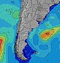
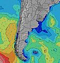
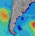
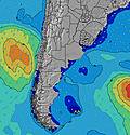
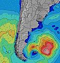
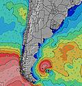
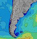
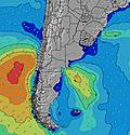
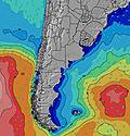
Swell Height Map | ||||||||||||||||||||||||
SSE 15 | SSE 15 | SSE 15 | SSE 15 | SSE 14 | SSE 14 | SSE 13 | SSE 13 | SSE 12 | SSE 12 | SSE 12 | SSE 11 | SSE 11 | SSE 11 | SSE 11 | SSE 10 | SSE 10 | S 10 | S 10 | S 10 | S 10 | S 9 | ENE 4 | ENE 5 | |
1776 | 1712 | 1642 | 1374 | 1114 | 765 | 569 | 395 | 278 | 250 | 196 | 143 | 126 | 93 | 91 | 63 | 58 | 51 | 50 | 49 | 28 | 27 | 34 | 46 | |
Wind (km/h) | ||||||||||||||||||||||||
cross-off | cross-off | cross-off | cross-off | off | off | cross-off | off | off | off | cross-off | cross-off | glassy | glassy | on | cross-on | cross | cross-off | cross-off | cross-off | cross | cross | cross | cross | |
High Tide | 1:33AM0.17m | 9:12AM0.27m | 3:08PM0.25m | 9:11PM0.42m | 2:23AM0.16m | 9:52AM0.26m | 3:56PM0.25m | 9:50PM0.41m | 3:15AM0.16m | 10:30AM0.25m | 4:44PM0.26m | |||||||||||||
Low Tide | 5:20AM0.02m | 12:09PM0.16m | 5:26PM0.20m | 1:36AM0.16m | 6:02AM0.03m | 12:49PM0.15m | 6:07PM0.21m | 2:10AM0.16m | 6:45AM0.04m | 1:27PM0.15m | 6:49PM0.22m | |||||||||||||
— | — | 7:13 | — | — | — | — | — | — | — | 7:15 | — | — | — | — | — | — | — | 7:16 | — | — | — | — | — | |
— | — | — | — | — | 5:52 | — | — | — | — | — | — | — | 5:51 | — | — | — | — | — | — | — | 5:50 | — | — | |
— | — | — | — | — | — | — | — | — | — | — | — | — | — | — | — | — | — | — | 2 | 3 | — | — | — | |
Temp °C | 11 | 10 | 10 | 10 | 15 | 18 | 17 | 15 | 14 | 14 | 15 | 15 | 18 | 19 | 18 | 18 | 18 | 17 | 17 | 17 | 18 | 19 | 19 | 19 |
6 | 5 | 6 | 5 | 11 | 14 | 14 | 12 | 11 | 12 | 13 | 14 | 18 | 19 | 17 | 18 | 17 | 17 | 17 | 17 | 17 | 17 | 17 | 16 | |
Swell 1 Height (m) Direction Period (s) | SSE 15 | SSE 15 | SSE 15 | SSE 15 | SSE 14 | SSE 14 | SSE 13 | SSE 13 | SSE 12 | SSE 12 | SSE 12 | SSE 11 | SSE 11 | SSE 11 | SSE 11 | SSE 10 | SSE 10 | S 10 | S 10 | S 10 | S 10 | S 9 | S 9 | S 9 |
1776 | 1712 | 1642 | 1374 | 1114 | 765 | 569 | 395 | 278 | 250 | 196 | 143 | 126 | 93 | 91 | 63 | 58 | 51 | 50 | 49 | 28 | 27 | 26 | 25 | |
Swell 2 Height (m) Direction Period (s) | — | — | — | — | — | W 5 | W 5 | NNE 4 | E 11 | NE 4 | E 11 | E 11 | E 11 | NE 6 | E 6 | NE 7 | NE 8 | NE 8 | NE 7 | NE 7 | SE 12 | S 12 | SE 12 | S 12 |
— | — | — | — | — | 8 | 5 | 2 | 2 | 1 | 2 | 2 | 2 | 1 | 1 | 2 | 2 | 2 | 2 | 2 | 6 | 3 | 6 | 3 | |
Swell 3 Height (m) Direction Period (s) | — | — | — | — | — | — | — | W 5 | — | E 11 | E 11 | E 11 | NE 6 | E 11 | WSW 3 | — | — | — | — | S 12 | SE 12 | — | SE 12 | S 16 |
— | — | — | — | — | — | — | 1 | — | 2 | 2 | 2 | 1 | 2 | 1 | — | — | — | — | 3 | 6 | — | 6 | 5 | |
Wind waves Height (m) Direction Period (s) | N 3 | N 3 | N 3 | N 3 | N 3 | N 3 | N 3 | NNW 3 | N 2 | NW 2 | N 4 | WSW 4 | — | — | — | — | — | — | ENE 2 | ENE 3 | ENE 3 | ENE 3 | ENE 4 | ENE 5 |
5 | 3 | 5 | 5 | 5 | 3 | 2 | 1 | 1 | 1 | 1 | 3 | — | — | — | — | — | — | 1 | 1 | 3 | 9 | 34 | 46 | |
Nearest Offshore or Glassy | ||||||||||||||||||||||||
Distance (km) | 3 | 3 | 3 | 3 | 0 | 0 | 0 | 0 | 0 | 0 | 0 | 0 | 0 | 1 | 41 | 4 | 3 | 3 | 3 | 1 | 41 | 868 | 713 | 699 |
Best forecast wave conditions in Uruguay - North | ||||||||||||||||||||||||
Best forecast wave conditions in Uruguay | ||||||||||||||||||||||||
Header Global | ||||||||||||||||||||||||
- Map Icons:
Break
Live Wave Height (m)
Live Wind Speed (km/h)
Surf Rating (10 Max)
Ocean Swells (m)
Wind Speed (km/h)


