

Surf Forecasts:

Carrizalillo surf forecast from 13 Jul 2026:
- Best quality surf: Sunday 19 Jul, 9PM (local time) - 3.5ft (1.0m), 17s period, SW swell with glassy winds.
- Most powerful swell: Sunday 19 Jul, 9PM (local time) - 3.5ft (1.0m), 17s period, SW swell with 587 kJ wave energy.
- Next surfable swell (1★+): Monday 13 Jul, 12AM (local time) - 3.5ft (1.1m), 14s period with SSW swell.
Best Forecast Surf Conditions for Carrizalillo this week:
The surf forecast for Carrizalillo over the next 16 days: The first swell (rated 1 star or higher) is forecast to arrive on Monday (Jul 13) at 12AM. The primary swell is predicted to be 1.1m and 14s period. The wind is predicted to be cross-offshore as the swell arrives.
The most powerful waves expected at Carrizalillo in the next 16 days are 1.0m 17s and forecast to arrive on Sunday (Jul 19) at 9PM. Winds are predicted to be glassy at the time the swell arrives. The largest open ocean swell (not directed at the beach) is 1.3m 8s period and expected on Monday (Jul 13) at 6AM.
| Wave Type | Time (CST) & Date | Wave Height & Period |
|---|---|---|
| Next good surf (1 star+) | 12AM (Mon 13th Jul) | 3.5ft (1.1m) 14s |
| Best Surf | 9PM (Sun 19th Jul) | 3.5ft (1.0m) 17s |
| Most Powerful | 9PM (Sun 19th Jul) | 3.5ft (1.0m) 17s |
Table - best surf conditions forecast for Carrizalillo over the next 16 days.
Alright, let’s break it down.
Carrizalillo is looking small to start, but there are plenty of clean, glassy mornings that’ll make the smaller stuff ride way better than the numbers suggest. The water temp is 87°F, so a touch warmer than usual for this time of year.
Sunday the 12th is a no-go – thunderstorms, cross-shore wind, and small swell. Skip it.
Monday the 13th morning is the first good call. Winds go glassy from the ESE, and you’ve got a 3ft SSW groundswell with a 14-second period – that’s a long-period groundswell, so the waves will have shape and punch, but expect longer lulls between sets. Swell energy is moderate (410). The afternoon turns onshore, so hit it early.
Tuesday the 14th morning – clear skies, glassy NW wind, 3ft SSW swell at 13 seconds. Energy is 449 (moderate). Another clean morning. Afternoon goes onshore.
Wednesday the 15th morning – dead calm, glassy, 3ft SSW swell. Energy is 293 (low-moderate). Perfect for a fun small-wave session.
Thursday the 16th morning – glassy again, 3ft SSW swell. Energy is 276. Same story – early bird gets the clean waves.
Friday the 17th morning – glassy, but swell drops to 2ft. Energy is 210 (weak). Surfable but ordinary.
Saturday the 18th morning – dead calm, 2ft SW swell with a very long 18-second period. That’ll give the waves extra push for the size, but at a beach break it can straighten out. Still fun for the size.
Sunday the 19th morning – 3ft SW swell, 17-second period, dead calm. Energy jumps to 505 (moderate). Another solid morning.
Monday the 20th morning – 4ft SW swell, 16-second period, but a cross-shore wind from the SE at 3 mph. Energy is 703 (moderate-strong). Not as perfect as the glassy days, but still surfable.
Tuesday the 21st morning – glassy, 4ft SW swell, 15-second period. Energy is 620 (moderate-strong). Good morning for an intermediate.
Wednesday the 22nd morning – 3ft SW swell, 14-second period, glassy. Energy is 275. Clean and small.
Thursday the 23rd morning – 2ft SW swell, 13-second period, glassy. Energy is 132. Small.
Friday the 24th – very small, 2ft swell, energy down to 82. Not worth it.
Saturday the 25th morning – 2ft SW swell with a huge 21-second period. Energy is 365 (moderate). That period is massive – it’ll have real power, but may close out at the beach. Glassy though.
Sunday the 26th morning – here we go. 4ft SW swell, 19-second period, glassy, and energy hits 959 (strong). This is the best session of the whole run. Clean, powerful, long-period groundswell. This is the one.
Monday the 27th morning – the absolute standout. 4ft SW swell, 18-second period, dead calm, and energy at 1037 (strong). That’s the top energy reading of the entire forecast. If you can only surf one day, make it the morning of Monday the 27th.
So, best bets: mornings of Monday 13th, Tuesday 14th, Wednesday 15th, Thursday 16th, Sunday 19th, Tuesday 21st, and then the big ones on Sunday 26th and Monday 27th. Keep an eye on the long-range stuff as it gets closer, but right now, those last two mornings look like the real deal.
Rusty.
Short Range ForecastLight rain (total 9mm), mostly falling on Sun afternoon. Warm (max 31°C on Tue morning, min 25°C on Mon night). Wind will be generally light. | Days 5-7 Weather SummaryLight rain (total 8mm), mostly falling on Wed night. Warm (max 31°C on Thu morning, min 25°C on Wed night). Wind will be generally light. | ||||||||||||||||||||
Sun 12 | Monday 13 | Tuesday 14 | Wednesday 15 | Thursday 16 | Friday 17 | Saturday 18 | |||||||||||||||
PM | Night | AM | PM | Night | AM | PM | Night | AM | PM | Night | AM | PM | Night | AM | PM | Night | AM | PM | Night | AM | |
Swell Height Map |  |  |  | 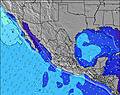 | 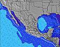 | 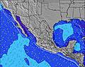 | 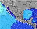 | 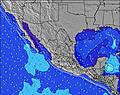 | |||||||||||||
Wave Height (m) Direction Period (s) | SSW 15 | SSW 14 | SSW 14 | SSW 13 | SSW 13 | SSW 13 | SSW 13 | SSW 13 | SSW 13 | SSW 13 | SSW 13 | SSW 13 | SSW 13 | SW 15 | SW 15 | SW 15 | SW 17 | SW 18 | SW 17 | SW 16 | SW 17 |
Wave Graph | |||||||||||||||||||||
405 | 487 | 347 | 282 | 222 | 261 | 319 | 342 | 186 | 378 | 303 | 183 | 235 | 171 | 106 | 106 | 107 | 252 | 173 | 159 | 505 | |
Wind (km/h) | |||||||||||||||||||||
Wind State on-shore cross-onshore cross-shore cross-offshore off-shore glassy | cross | cross-off | glassy | cross-on | cross | glassy | on | cross-off | glassy | on | cross | glassy | on | cross-off | glassy | on | cross-off | glassy | on | cross | glassy |
High Tide | 00:09AM0.73m | 1:09PM1.19m | 1:17AM0.77m | 2:08PM1.20m | 2:26AM0.83m | 3:06PM1.19m | 3:32AM0.90m | 4:01PM1.16m | 4:34AM0.98m | 4:54PM1.12m | 5:32AM1.04m | 5:44PM1.07m | 6:26AM1.08m | ||||||||
Low Tide | 6:47PM0.22m | 6:12AM0.01m | 7:48PM0.18m | 7:21AM0.01m | 8:45PM0.13m | 8:29AM0.02m | 9:39PM0.08m | 9:34AM0.04m | 10:30PM0.04m | 10:37AM0.07m | 11:18PM0.01m | 11:37AM0.10m | 00:04AM0.00m | ||||||||
— | — | 6:03 | — | — | 6:03 | — | — | 6:03 | — | — | 6:05 | — | — | 6:05 | — | — | 6:05 | — | — | 6:05 | |
7:02 | — | — | 7:02 | — | — | 7:02 | — | — | 7:02 | — | — | 7:02 | — | — | 7:02 | — | — | 7:02 | — | 7:02 | |
mm | 3 | 1 | — | — | — | — | — | 5 | — | — | 3 | 1 | 1 | 1 | — | 2 | — | — | 1 | 4 | — |
Temp °C | 28 | 27 | 30 | 30 | 28 | 31 | 31 | 28 | 31 | 30 | 28 | 31 | 30 | 28 | 30 | 30 | 28 | 31 | 31 | 28 | 30 |
Feels °C | 30 | 29 | 33 | 33 | 33 | 33 | 34 | 33 | 34 | 33 | 33 | 34 | 33 | 32 | 32 | 33 | 32 | 33 | 34 | 32 | 32 |
Swell 1 Height (m) Direction Period (s) | SSW 15 | SSW 14 | SSW 14 | SSE 8 | SSW 13 | SSW 13 | SSW 13 | SSW 13 | SSW 13 | SSW 13 | SSW 13 | SSW 13 | SSW 13 | SSW 12 | SSW 12 | SSW 12 | SSW 13 | S 12 | S 12 | S 12 | SW 17 |
405 | 487 | 347 | 176 | 222 | 261 | 317 | 342 | 186 | 378 | 303 | 183 | 235 | 109 | 106 | 186 | 286 | 153 | 180 | 180 | 505 | |
Swell 2 Height (m) Direction Period (s) | SSW 12 | SSE 8 | SSE 8 | SSW 13 | SSE 7 | SSW 17 | SW 18 | SW 18 | SSW 13 | SW 16 | SW 16 | SSE 8 | SSE 8 | SW 15 | S 14 | S 14 | SW 17 | SW 18 | SW 17 | SW 16 | S 13 |
129 | 73 | 122 | 282 | 65 | 188 | 319 | 252 | 60 | 208 | 264 | 56 | 55 | 171 | 150 | 132 | 107 | 252 | 173 | 159 | 222 | |
Swell 3 Height (m) Direction Period (s) | SSE 8 | SW 21 | SSW 18 | SW 19 | SW 19 | S 7 | S 7 | S 7 | SW 17 | SE 7 | SE 8 | SW 16 | SW 15 | SE 8 | SW 15 | SW 15 | SW 13 | S 10 | S 16 | S 15 | S 9 |
56 | 117 | 63 | 184 | 184 | 40 | 37 | 26 | 107 | 2 | 35 | 91 | 113 | 28 | 104 | 106 | 88 | 48 | 121 | 104 | 55 | |
Wind waves Height (m) Direction Period (s) | ESE 7 | SE 8 | — | — | — | — | — | — | — | — | — | NW 3 | — | — | — | — | — | WNW 4 | WSW 4 | W 4 | — |
73 | 142 | — | — | — | — | — | — | — | — | — | 2 | — | — | — | — | — | 5 | 2 | 6 | — | |
Nearest Offshore or Glassy | |||||||||||||||||||||
Distance (km) | 180 | 0 | 0 | 180 | 2 | 0 | 1042 | 0 | 0 | 146 | 2 | 0 | 146 | 0 | 0 | 815 | 0 | 0 | 146 | 2 | 0 |
Best forecast wave conditions in Oaxaca | |||||||||||||||||||||
Best forecast wave conditions in Mexico | |||||||||||||||||||||
Header Global | |||||||||||||||||||||
- Map Icons:
 Break
Break Live Wave Height (m)
 Live Wind Speed (km/h)
 Surf Rating (10 Max)
 Ocean Swells (m)
- Wind Speed (km/h)


FREE! Surf-Forecast.com widget for your website
The surf report / weather widget below is available to embed on third party websites free of charge and provides a summary of our Carrizalillo surf forecast. Simply grab the html code snippet that we provide and paste it into your own site. You can choose your preferred language and metric/imperial units for the surf forecast feed to suit users of your site. Click here to get the code.
Information about the Carrizalillo Surf forecast
The above surf forecast table for Carrizalillo provides essential information for determining whether the surfing conditions will be good over the next 16 days. A general guide to surfing at Carrizalillo can be found by selecting the local surf guide option on the grey menu. Our Carrizalillo surf forecast is unique since it includes wave energy (power) that defines the real feel of the surf rather than just the height or the period. If you surf the same spot (Carrizalillo) regularly then make a mental note of the wave energy from the surf forecast table each time you go. Very soon you may start to choose your surf days based on the wave energy alone combined with our forecast of favourable offshore wind conditions. Our star ratings will help here and of course you will also find the usual wave height and period predictions on our surf forecasts as well as a full break down of the swell components under our advanced users option (to reveal that, click the little Einstein character under the tide times).
Further information to help with frequently asked questions about our surf forecast for Carrizalillo may be found under the help tab on the top menu and also by moving your mouse over the question marks on the surf forecast table itself. Please always bear in mind that the forecast is for near-shore open water and local factors at each surf break influence the actual breaking wave height, such as the beach / reef profile, water depths offshore and shelter.
Are you planning a holiday in Oaxaca? If you are looking for accommodation near Carrizalillo, camping, hotels and holiday cottages in Oaxaca, consider staying in Puerto Escondido which is 2 km (1 miles) away. Other places in and around Oaxaca where you can find information about places to rent, and car hire include Nopala which is 29 km (18 miles) away and Miahuatlan de Porfirio Diaz, 73 km (45 miles) away.
 Nearest