

Surf Forecasts:

How big are the waves at Caracoles today (15 Jul):
- Morning surf: Morning surf (15 Jul, local time) - 3.5ft (1.0m), 6s period with E swell.
- Afternoon surf: Afternoon surf (15 Jul, local time) - 3ft (0.9m), 6s period with E swell.
- Evening surf: Evening surf (15 Jul, local time) - 3.5ft (1.0m), 7s period with E swell.
The current surf forecast for Caracoles at 9AM is: 1.0m 6s primary swell from a East direction and 0.5m 8s secondary swell from a East direction, 0.1m 10s secondary swell from a Northeast direction (forecast issued at 01:00am July 15). The wind direction is predicted to be cross-onshore.
| Time (AST) & Date | Wave Height | Wave Period |
|---|---|---|
| Morning (15 Jul) | 3.5ft (1.0m) | 6s |
| Afternoon (15 Jul) | 3ft (0.9m) | 6s |
| Evening (15 Jul) | 3.5ft (1.0m) | 7s |
Table - waves today at Caracoles. (Swell directed towards the surf break)
Short Range ForecastLight rain (total 3mm), mostly falling on Thu night. Warm (max 29°C on Wed morning, min 26°C on Wed night). Wind will be generally light. | ||||||||||||||||||||||||
Wednesday 15 | Thursday 16 | Friday 17 | ||||||||||||||||||||||
2 AM | 5 AM | 8 AM | 11 AM | 2 PM | 5 PM | 8 PM | 11 PM | 2 AM | 5 AM | 8 AM | 11 AM | 2 PM | 5 PM | 8 PM | 11 PM | 2 AM | 5 AM | 8 AM | 11 AM | 2 PM | 5 PM | 8 PM | 11 PM | |
Swell Height Map |  | 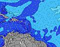 |  |  |  |  |  |  |  | |||||||||||||||
Wave Height (m) Direction Period (s) | E 6 | E 6 | E 6 | E 6 | E 6 | ENE 7 | E 7 | E 6 | E 6 | E 6 | E 6 | E 6 | E 6 | E 6 | E 6 | E 6 | E 6 | E 6 | E 6 | E 6 | E 6 | E 6 | E 6 | E 6 |
Wave Graph | ||||||||||||||||||||||||
88 | 88 | 68 | 52 | 54 | 91 | 112 | 102 | 127 | 127 | 98 | 92 | 92 | 78 | 116 | 153 | 170 | 148 | 139 | 124 | 94 | 100 | 112 | 153 | |
Wind (km/h) | ||||||||||||||||||||||||
Wind State on-shore cross-onshore cross-shore cross-offshore off-shore glassy | cross-on | cross-on | cross-on | cross-on | cross-on | cross-on | cross-on | cross-on | cross-on | cross-on | cross-on | cross-on | cross-on | cross-on | cross-on | cross-on | cross-on | cross-on | cross-on | cross-on | cross-on | cross-on | cross-on | cross-on |
High Tide | 8:58AM0.41m | 10:03PM0.71m | 10:01AM0.45m | 10:50PM0.67m | 11:02AM0.48m | |||||||||||||||||||
Low Tide | 3:51AM0.16m | 2:57PM-0.00m | 4:37AM0.15m | 3:57PM0.04m | 5:20AM0.14m | 4:58PM0.09m | ||||||||||||||||||
— | 6:05 | — | — | — | — | — | — | — | 6:05 | — | — | — | — | — | — | — | 6:05 | — | — | — | — | — | — | |
— | — | — | — | — | 7:15 | — | — | — | — | — | — | — | 7:14 | — | — | — | — | — | — | — | 7:14 | — | — | |
mm | — | — | — | — | — | — | — | — | — | — | — | — | — | — | 1 | 1 | — | — | — | — | — | — | — | — |
Temp °C | 27 | 26 | 27 | 29 | 29 | 29 | 27 | 26 | 26 | 26 | 27 | 28 | 28 | 28 | 26 | 26 | 26 | 26 | 27 | 28 | 29 | 28 | 27 | 26 |
Feels °C | 29 | 28 | 29 | 29 | 29 | 29 | 28 | 27 | 27 | 26 | 27 | 27 | 27 | 28 | 27 | 26 | 27 | 28 | 27 | 28 | 28 | 28 | 29 | 27 |
Swell 1 Height (m) Direction Period (s) | ENE 8 | E 8 | E 8 | E 7 | E 7 | SE 6 | SE 6 | N 8 | N 8 | N 8 | N 8 | N 8 | N 8 | N 7 | N 7 | N 7 | NNE 7 | NNE 7 | NNE 7 | NNE 7 | SE 6 | SE 6 | SE 7 | NE 8 |
20 | 21 | 29 | 28 | 28 | 6 | 6 | 6 | 5 | 5 | 10 | 10 | 10 | 9 | 9 | 8 | 9 | 9 | 9 | 9 | 6 | 6 | 11 | 14 | |
Swell 2 Height (m) Direction Period (s) | NE 10 | NE 10 | NE 10 | SE 6 | SE 6 | N 9 | N 9 | N 9 | N 9 | N 9 | N 9 | N 9 | SE 6 | SE 7 | N 8 | NE 8 | NNE 7 | NNE 7 | — | NNE 8 | NNE 7 | NNE 7 | NNE 7 | NE 8 |
4 | 4 | 4 | 6 | 6 | 2 | 2 | 2 | 2 | 2 | 2 | 2 | 2 | 7 | 1 | 3 | 9 | 9 | — | 7 | 9 | 9 | 10 | 15 | |
Swell 3 Height (m) Direction Period (s) | N 6 | N 6 | SE 6 | NE 10 | NE 9 | N 9 | N 9 | N 9 | — | — | N 9 | N 9 | N 7 | — | — | — | — | — | — | — | NNE 8 | NNE 8 | NNE 8 | NNE 8 |
1 | 1 | 2 | 4 | 3 | 2 | 2 | 2 | — | — | 2 | 2 | 10 | — | — | — | — | — | — | — | 7 | 7 | 7 | 7 | |
Wind waves Height (m) Direction Period (s) | E 6 | E 6 | E 6 | E 6 | E 6 | ENE 7 | E 7 | E 6 | E 6 | E 6 | E 6 | E 6 | E 6 | E 6 | E 6 | E 6 | E 6 | E 6 | E 6 | E 6 | E 6 | E 6 | E 6 | E 6 |
88 | 88 | 68 | 52 | 54 | 91 | 112 | 102 | 127 | 127 | 98 | 92 | 92 | 78 | 116 | 153 | 170 | 148 | 139 | 124 | 94 | 100 | 112 | 153 | |
Nearest Offshore or Glassy | ||||||||||||||||||||||||
Distance (km) | 95 | 147 | 147 | 441 | 620 | 441 | 421 | 147 | 81 | 81 | 180 | 930 | 930 | 441 | 930 | 147 | 147 | 147 | 147 | 930 | 441 | 794 | 151 | 421 |
Best forecast wave conditions in North East Coast - Dominican-Republic | ||||||||||||||||||||||||
Best forecast wave conditions in Dominican Republic | ||||||||||||||||||||||||
Header Global | ||||||||||||||||||||||||
- Map Icons:
 Break
Break Live Wave Height (m)
 Live Wind Speed (km/h)
 Surf Rating (10 Max)
 Ocean Swells (m)
- Wind Speed (km/h)


FREE! Surf-Forecast.com widget for your website
The surf report / weather widget below is available to embed on third party websites free of charge and provides a summary of our Caracoles surf forecast. Simply grab the html code snippet that we provide and paste it into your own site. You can choose your preferred language and metric/imperial units for the surf forecast feed to suit users of your site. Click here to get the code.
 Nearest