

Surf Forecasts:

Buckleys Reef (Wilsons Promontory) surf forecast from 31 Jul 2026:
- Best quality surf: Saturday 1 Aug, 4PM (local time) - 2.5ft (0.8m), 18s period, SW swell with glassy winds.
- Most powerful swell: Monday 3 Aug, 4PM (local time) - 5ft (1.5m), 16s period, WSW swell with 1,150 kJ wave energy.
- Next surfable swell (1★+): Friday 31 Jul, 10PM (local time) - 2ft (0.6m), 11s period with SW swell.
Best Forecast Surf Conditions for Buckleys Reef (Wilsons Promontory) this week:
The surf forecast for Buckleys Reef (Wilsons Promontory) over the next 16 days: The first swell (rated 1 star or higher) is forecast to arrive on Friday (Jul 31) at 10PM. The primary swell is predicted to be 0.6m and 11s period with a secondary swell of 0.3m and 20s. The wind is predicted to be glassy as the swell arrives.
The most powerful waves expected at Buckleys Reef (Wilsons Promontory) in the next 16 days are 1.5m 16s and forecast to arrive on Monday (Aug 03) at 4PM. Winds are predicted to be cross-onshore at the time the swell arrives. The largest open ocean swell (not directed at the beach) is 0.4m 4s period and expected on Monday (Aug 03) at 1AM.
| Wave Type | Time (AEST) & Date | Wave Height & Period |
|---|---|---|
| Next good surf (1 star+) | 10PM (Fri 31st Jul) | 2ft (0.6m) 11s |
| Best Surf | 4PM (Sat 1st Aug) | 2.5ft (0.8m) 18s |
| Most Powerful | 4PM (Mon 3rd Aug) | 5ft (1.5m) 16s |
Table - best surf conditions forecast for Buckleys Reef (Wilsons Promontory) over the next 16 days.
The Lowdown
Alright, Rusty here. Let's get into it.
We are looking at a long 16-day window for Buckleys Reef (Wilsons Promontory), and honestly, it’s a bit of a mixed bag. The water is sitting at 57°, which is pretty normal for this time of year, so no surprises there.
The first real chance to wet a line comes on the 31st of July, Friday afternoon. It's a small one, with a 2ft swell from the SW and a 12-second period, but the 6 mph W wind is cross-on, making it a bit messy. The combined energy is only 160, so it's weak. I’d call it a warm-up, not a standout.
The real bright spot, and the best on offer in the first week, hits on Saturday, the 1st of August. The morning is clean with a light NNE cross-off breeze at 3 mph, but the swell is tiny at 1ft. The afternoon, though, is where it’s at. The wind swings to a glassy SW at 3 mph, and the swell bumps up to 3ft from the SW with a very long 18-second period. The combined energy jumps to a moderate 448. That long period groundswell will wrap around the reef nicely, offering clean, well-shaped little waves. It will be a bit inconsistent between sets, but paddling out will be a breeze. This is the pick of the early days.
Sunday the 2nd stays rideable, with a 3ft SW swell and a 16-second period, but the wind is cross-shore from the NNW and NW, which will put a bit of a bump on the surface. Not bad, but not as clean as Saturday.
Then we hit a rough patch. From Monday the 3rd all the way through to Thursday the 6th, the wind is a problem. Strong onshore and cross-onshore winds, with a few days of rain and storms, make for poor surf. The swell gets a bit bigger, hitting 5ft to 6ft, and the combined energy spikes to a strong 1155 on Monday, but it’s all wind-slapped and messy. A kite surfer might get a kick out of it, but for a paddle surfer, it’s a write-off. There’s a solid 4-day gap here with nothing worth chasing.
The next real opportunity comes on Friday the 7th of August. The morning is clean again with a light NNE cross-off breeze at 3 mph, and a 2ft SW swell with a 15-second period. The combined energy is a solid 412. It’s small, but it’ll be tidy. The afternoon goes glassy again with a light S wind, though the swell drops a touch to 2ft.
Saturday the 8th is a bit of a repeat: small, clean, but nothing special. The wind stays light and cross-off from the NNE.
The second week gets more interesting, but also more uncertain. Sunday the 9th is a write-off with strong NW winds. Monday the 10th sees a big jump in size, with a 7ft W swell and a 14-second period, but the wind is a strong cross-shore from the NW at 19 mph. The combined energy is a massive 2150, but the conditions are lumpy. This is really only for the experts, and even then, it won't be easy. The wind gets even worse through Tuesday and Wednesday.
The most promising spot in the second week, but still a long-range call, is Friday the 14th of August. The afternoon looks good with a glassy SW wind at 3 mph and a 8ft swell from the WSW with a 12-second period. The combined energy is a very strong 1455. That’s a solid, powerful swell. If it cleans up, the reef will hold it well, but watch out – that size is for experienced surfers only. It’s a promising outlook, but keep your fingers crossed.
Saturday the 15th still has some size, with a 6ft WSW swell and a 16-second period, and the wind looks favorable in the afternoon with a light onshore SW breeze. The combined energy sits at 1437. It could be a good end to the run.
So, the standout is the glassy Saturday afternoon on the 1st of August. The second best is the long-range call for Friday the 14th. Keep an eye on the wind, and you'll find some gems.
Stay stoked.
Rusty.
Short Range ForecastLight rain (total 5mm), mostly falling on Mon morning. Very mild (max 16°C on Sun afternoon, min 8°C on Sun night). Winds increasing (calm on Sat afternoon, strong winds from the WNW by Mon morning). | Days 5-7 Weather SummaryHeavy rain (total 27mm), heaviest during Mon afternoon. Very mild (max 12°C on Mon night, min 10°C on Mon afternoon). Winds decreasing (fresh winds from the WNW on Mon afternoon, light winds from the WSW by Thu morning). | |||||||||||||||||||
Fri 31 | Saturday 1 | Sunday 2 | Monday 3 | Tuesday 4 | Wednesday 5 | Thursday 6 | ||||||||||||||
PM | Night | AM | PM | Night | AM | PM | Night | AM | PM | Night | AM | PM | Night | AM | PM | Night | AM | PM | Night | |
Swell Height Map |  |  |  | 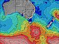 | 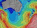 |  |  | |||||||||||||
Wave Height (m) Direction Period (s) | SW 12 | SW 11 | SW 18 | SW 18 | SW 17 | SW 16 | WSW 16 | WSW 15 | W 7 | WSW 16 | WSW 14 | WSW 11 | SW 12 | SW 6 | SW 20 | SW 19 | SW 18 | SW 16 | SW 20 | SW 17 |
Wave Graph | ||||||||||||||||||||
142 | 104 | 109 | 442 | 655 | 443 | 441 | 461 | 276 | 1150 | 1048 | 681 | 660 | 99 | 61 | 58 | 83 | 73 | 60 | 243 | |
Wind (km/h) | ||||||||||||||||||||
Wind State on-shore cross-onshore cross-shore cross-offshore off-shore glassy | cross-on | cross-off | cross-off | glassy | cross-off | cross | cross | cross-off | cross-on | cross-on | on | on | cross-on | on | on | on | on | on | on | cross-off |
High Tide | 8:34PM0.00m | 3:59AM0.00m | ||||||||||||||||||
Low Tide | 12:59PM-0.00m | |||||||||||||||||||
— | — | 7:18 | — | — | 7:16 | — | — | 7:16 | — | — | 7:15 | — | — | 7:13 | — | — | 7:13 | — | — | |
5:22 | — | — | 5:23 | — | — | 5:24 | — | — | 5:25 | — | — | 5:27 | — | — | 5:28 | — | — | 5:28 | — | |
mm | — | — | — | — | — | — | — | — | 5 | 8 | 10 | 3 | 1 | 3 | — | — | 2 | — | — | — |
Temp °C | 11 | 11 | 12 | 12 | 13 | 15 | 16 | 14 | 11 | 11 | 12 | 12 | 12 | 12 | 12 | 12 | 12 | 12 | 12 | 11 |
Feels °C | 9 | 10 | 10 | 9 | 9 | 12 | 13 | 10 | 2 | 3 | 5 | 6 | 7 | 7 | 9 | 8 | 9 | 9 | 9 | 9 |
Swell 1 Height (m) Direction Period (s) | SW 12 | SW 11 | SW 12 | SW 18 | SW 17 | SW 16 | WSW 16 | WSW 15 | SW 14 | E 15 | E 14 | E 14 | E 14 | SW 11 | SW 11 | WSW 10 | SW 13 | SW 12 | WSW 12 | SW 17 |
142 | 104 | 92 | 442 | 655 | 443 | 441 | 461 | 169 | 4 | 4 | 4 | 4 | 99 | 56 | 40 | 83 | 73 | 54 | 243 | |
Swell 2 Height (m) Direction Period (s) | S 4 | WSW 20 | SW 18 | SE 12 | ESE 12 | ESE 12 | SE 12 | E 4 | SW 18 | E 6 | E 14 | — | WSW 10 | WSW 21 | SW 20 | SW 19 | SW 4 | SW 16 | SW 16 | WSW 11 |
1 | 37 | 109 | 6 | 15 | 14 | 5 | 1 | 81 | 1 | 4 | — | 42 | 43 | 61 | 58 | 6 | 66 | 39 | 45 | |
Swell 3 Height (m) Direction Period (s) | SW 21 | SE 11 | SE 12 | — | — | — | — | SE 11 | — | SE 12 | — | — | E 14 | E 14 | SE 10 | SW 14 | SW 18 | SSW 4 | SW 20 | ESE 10 |
17 | 5 | 5 | — | — | — | — | 5 | — | 5 | — | — | 4 | 4 | 4 | 33 | 79 | 1 | 60 | 9 | |
Wind waves Height (m) Direction Period (s) | — | — | — | — | — | — | — | NE 4 | W 7 | WSW 16 | WSW 14 | WSW 11 | SW 12 | SW 6 | SW 6 | SW 5 | — | — | — | — |
— | — | — | — | — | — | — | 3 | 276 | 1150 | 1048 | 681 | 660 | 80 | 46 | 25 | — | — | — | — | |
Nearest Offshore or Glassy | ||||||||||||||||||||
Distance (km) | 30 | 0 | 0 | 0 | 0 | 20 | 20 | 20 | 204 | 183 | 183 | 183 | 15 | 172 | 28 | 110 | 63 | 102 | 112 | 0 |
Best forecast wave conditions in East Coast of Victoria | ||||||||||||||||||||
Best forecast wave conditions in Australia | ||||||||||||||||||||
Header Global | ||||||||||||||||||||
- Map Icons:
 Break
Break Live Wave Height (m)
 Live Wind Speed (km/h)
 Surf Rating (10 Max)
 Ocean Swells (m)
- Wind Speed (km/h)
Latest Updates


FREE! Surf-Forecast.com widget for your website
The surf report / weather widget below is available to embed on third party websites free of charge and provides a summary of our Buckleys Reef (Wilsons Promontory) surf forecast. Simply grab the html code snippet that we provide and paste it into your own site. You can choose your preferred language and metric/imperial units for the surf forecast feed to suit users of your site. Click here to get the code.
Information about the Buckleys Reef (Wilsons Promontory) Surf forecast
The above surf forecast table for Buckleys Reef (Wilsons Promontory) provides essential information for determining whether the surfing conditions will be good over the next 16 days. A general guide to surfing at Buckleys Reef (Wilsons Promontory) can be found by selecting the local surf guide option on the grey menu. Our Buckleys Reef (Wilsons Promontory) surf forecast is unique since it includes wave energy (power) that defines the real feel of the surf rather than just the height or the period. If you surf the same spot (Buckleys Reef (Wilsons Promontory)) regularly then make a mental note of the wave energy from the surf forecast table each time you go. Very soon you may start to choose your surf days based on the wave energy alone combined with our forecast of favourable offshore wind conditions. Our star ratings will help here and of course you will also find the usual wave height and period predictions on our surf forecasts as well as a full break down of the swell components under our advanced users option (to reveal that, click the little Einstein character under the tide times).
Further information to help with frequently asked questions about our surf forecast for Buckleys Reef (Wilsons Promontory) may be found under the help tab on the top menu and also by moving your mouse over the question marks on the surf forecast table itself. Please always bear in mind that the forecast is for near-shore open water and local factors at each surf break influence the actual breaking wave height, such as the beach / reef profile, water depths offshore and shelter.
Are you planning a holiday in East Coast of Victoria? If you are looking for accommodation near Buckleys Reef (Wilsons Promontory), camping, hotels and holiday cottages in East Coast of Victoria, consider staying in Traralgon which is 92 km (57 miles) away.
 Nearest