

Surf Forecasts:

Beruwela surf forecast from 14 Jul 2026:
- Most powerful swell: Monday 20 Jul, 8PM (local time) - 5ft (1.6m), 16s period, S swell with 1,347 kJ wave energy.
Best Forecast Surf Conditions for Beruwela this week:
The most powerful waves expected at Beruwela in the next 16 days are 1.6m 16s and forecast to arrive on Monday (Jul 20) at 8PM. Winds are predicted to be onshore at the time the swell arrives.
| Wave Type | Time (+0530) & Date | Wave Height & Period |
|---|---|---|
| Next good surf (1 star+) | - | - |
| Best Surf | - | - |
| Most Powerful | 8PM (Mon 20th Jul) | 5ft (1.6m) 16s |
Table - best surf conditions forecast for Beruwela over the next 16 days.
The Lowdown
Alright, this is Rusty looking at the surf outlook for Beruwela over the next couple of weeks. Honestly, it's a pretty frustrating stretch for the most part. The setup here is exposed to the swell but the winds are persistently onshore or cross-onshore from the west, which just kills the quality for paddle surfing. We get pulses of energy, but the conditions are rarely in our favour.
The first real week or so is a write-off. From Tuesday the 14th right through to the 19th, the surf is small or poor, with scores consistently in the cellar. There's a very long-period groundswell arriving on the 14th with 3 ft from the SSW at 18 seconds, and the combined energy is a moderate 909, but it's paired with a moderate onshore breeze and described as "poor surf conditions." It's a total tease.
The water temperature is sitting at 84°, which is a touch warmer than normal for this time of year. So at least you won't be cold while you're sitting there frustrated.
Things look a little more interesting around the 20th and 21st. On Monday the 20th, the swell starts to build, pushing to 4 ft from the S with a very long 17-second period. The energy jumps right up, showing 1416 (strong) in the afternoon, and the wind is a light onshore breeze. On Tuesday the 21st, the swell peaks around 5 ft from the S with a 15-second period, and the energy stays strong at 1322. The wind is still onshore but light. These are the best days on offer, but even then, it's only scoring a "marginal" rating. The bigger swell (over 5 ft) might be too much for beginners, but the onshore wind means the faces will be bumpy.
For the rest of the period into the second week, it's a mix of smaller swells and iffy conditions. On Thursday the 24th of July there's a late spike in size to 5 ft from the WNW, with a moderate 726 energy, but the wind remains onshore and conditions are rated marginal. A standout is hard to find here, folks. The persistent onshore winds and the fact that the orientation doesn't match the dominant wind direction make this more of a lookout than a go-out.
Because of the consistent onshore wind, this break looks way more interesting for a kite surfer than a paddle surfer for the majority of the period.
Stay patient, check the forecasts daily for a lucky window.
- Rusty
Short Range ForecastSome drizzle, heaviest during Wed afternoon. Warm (max 28°C on Tue morning, min 26°C on Wed night). Wind will be generally light. | Days 4-6 Weather SummaryHeavy rain (total 32mm), heaviest during Sun morning. Warm (max 28°C on Fri morning, min 26°C on Fri night). Wind will be generally light. | ||||||||||||||||||||
Tuesday 14 | Wednesday 15 | Thursday 16 | Friday 17 | Saturday 18 | Sunday 19 | Monday 20 | |||||||||||||||
AM | PM | Night | AM | PM | Night | AM | PM | Night | AM | PM | Night | AM | PM | Night | AM | PM | Night | AM | PM | Night | |
Swell Height Map | 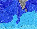 |  | 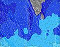 | 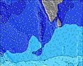 | 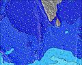 | 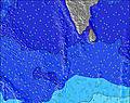 | 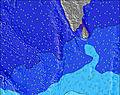 | ||||||||||||||
Wave Height (m) Direction Period (s) | SSW 18 | SSW 16 | SSW 16 | SSW 15 | SSW 15 | SW 16 | SW 14 | SW 14 | SW 14 | SW 14 | SW 14 | SSW 14 | SSW 14 | SSW 13 | SSW 13 | SSW 13 | SSW 13 | SSW 13 | S 18 | S 17 | S 16 |
Wave Graph | |||||||||||||||||||||
348 | 427 | 402 | 398 | 468 | 565 | 482 | 482 | 476 | 482 | 476 | 347 | 328 | 309 | 273 | 269 | 238 | 307 | 759 | 829 | 734 | |
Wind (km/h) | |||||||||||||||||||||
Wind State on-shore cross-onshore cross-shore cross-offshore off-shore glassy | on | on | on | on | on | on | on | on | on | on | on | on | on | on | on | on | on | on | cross-on | on | on |
High Tide | 2:17PM0.67m | 2:37AM0.49m | 2:52PM0.68m | 3:16AM0.53m | 3:24PM0.68m | 3:55AM0.56m | 3:54PM0.66m | 4:32AM0.57m | 4:23PM0.63m | 5:09AM0.57m | 4:51PM0.58m | 5:45AM0.56m | 5:18PM0.53m | ||||||||
Low Tide | 8:51PM0.10m | 8:24AM0.09m | 9:21PM0.06m | 9:05AM0.09m | 9:51PM0.04m | 9:44AM0.10m | 10:20PM0.02m | 10:21AM0.13m | 10:49PM0.03m | 10:57AM0.17m | 11:18PM0.05m | 11:34AM0.21m | 11:47PM0.08m | ||||||||
6:01 | — | — | 6:01 | — | — | 6:01 | — | — | 6:01 | — | — | 6:01 | — | — | 6:01 | — | — | 6:01 | — | — | |
— | 6:30 | — | — | 6:30 | — | — | 6:30 | — | — | 6:30 | — | — | 6:30 | — | — | 6:30 | — | — | 6:30 | — | |
mm | — | — | — | — | 1 | — | — | — | — | — | — | 4 | 3 | 4 | 8 | 4 | 2 | 7 | 5 | 1 | 6 |
Temp °C | 28 | 28 | 27 | 28 | 28 | 27 | 28 | 28 | 27 | 28 | 28 | 27 | 27 | 27 | 26 | 27 | 27 | 27 | 27 | 27 | 27 |
Feels °C | 29 | 29 | 30 | 30 | 29 | 31 | 30 | 29 | 30 | 29 | 29 | 30 | 28 | 28 | 28 | 29 | 28 | 29 | 29 | 28 | 31 |
Swell 1 Height (m) Direction Period (s) | S 11 | S 11 | S 11 | SSW 15 | SSW 15 | SW 16 | SW 14 | SW 14 | SW 14 | SW 14 | SW 14 | SSW 14 | SSW 14 | SSW 13 | SSW 13 | S 8 | S 8 | SSW 13 | S 18 | S 17 | S 16 |
300 | 300 | 237 | 398 | 468 | 565 | 482 | 482 | 476 | 482 | 476 | 347 | 328 | 309 | 273 | 120 | 140 | 307 | 759 | 829 | 734 | |
Swell 2 Height (m) Direction Period (s) | SSW 18 | SSW 16 | SSW 16 | S 11 | S 11 | S 11 | S 10 | S 10 | S 10 | S 10 | S 10 | S 9 | S 9 | S 7 | W 10 | SSW 13 | SSW 13 | S 8 | SSW 13 | S 13 | S 12 |
348 | 427 | 402 | 189 | 146 | 146 | 133 | 125 | 96 | 68 | 68 | 44 | 99 | 47 | 65 | 269 | 238 | 93 | 242 | 339 | 289 | |
Swell 3 Height (m) Direction Period (s) | — | SSE 13 | SSW 5 | S 6 | E 10 | S 6 | SE 9 | WNW 10 | WNW 8 | WNW 9 | WNW 10 | W 10 | W 10 | W 10 | WNW 11 | WNW 10 | W 10 | W 10 | S 7 | W 10 | W 10 |
— | 33 | 15 | 3 | 2 | 3 | 3 | 10 | 20 | 17 | 31 | 56 | 71 | 70 | 41 | 125 | 122 | 115 | 37 | 120 | 117 | |
Wind waves Height (m) Direction Period (s) | W 7 | W 7 | W 7 | W 7 | W 6 | W 6 | W 6 | W 6 | W 6 | W 6 | W 6 | WSW 6 | W 6 | W 6 | WSW 6 | W 6 | W 6 | W 6 | W 6 | W 6 | W 6 |
261 | 183 | 162 | 144 | 141 | 137 | 109 | 89 | 86 | 106 | 96 | 150 | 137 | 153 | 210 | 112 | 85 | 80 | 232 | 128 | 73 | |
Nearest Offshore or Glassy | |||||||||||||||||||||
Distance (km) | 604 | 212 | 212 | 677 | 768 | 212 | 211 | 738 | 212 | 604 | 871 | 212 | 211 | 298 | 212 | 212 | 211 | 293 | 207 | 212 | 212 |
Best forecast wave conditions in West Sri Lanka | |||||||||||||||||||||
Best forecast wave conditions in Sri Lanka | |||||||||||||||||||||
Header Global | |||||||||||||||||||||
- Map Icons:
 Break
Break Live Wave Height (m)
 Live Wind Speed (km/h)
 Surf Rating (10 Max)
 Ocean Swells (m)
- Wind Speed (km/h)


FREE! Surf-Forecast.com widget for your website
The surf report / weather widget below is available to embed on third party websites free of charge and provides a summary of our Beruwela surf forecast. Simply grab the html code snippet that we provide and paste it into your own site. You can choose your preferred language and metric/imperial units for the surf forecast feed to suit users of your site. Click here to get the code.
Information about the Beruwela Surf forecast
The above surf forecast table for Beruwela provides essential information for determining whether the surfing conditions will be good over the next 16 days. A general guide to surfing at Beruwela can be found by selecting the local surf guide option on the grey menu. Our Beruwela surf forecast is unique since it includes wave energy (power) that defines the real feel of the surf rather than just the height or the period. If you surf the same spot (Beruwela) regularly then make a mental note of the wave energy from the surf forecast table each time you go. Very soon you may start to choose your surf days based on the wave energy alone combined with our forecast of favourable offshore wind conditions. Our star ratings will help here and of course you will also find the usual wave height and period predictions on our surf forecasts as well as a full break down of the swell components under our advanced users option (to reveal that, click the little Einstein character under the tide times).
Further information to help with frequently asked questions about our surf forecast for Beruwela may be found under the help tab on the top menu and also by moving your mouse over the question marks on the surf forecast table itself. Please always bear in mind that the forecast is for near-shore open water and local factors at each surf break influence the actual breaking wave height, such as the beach / reef profile, water depths offshore and shelter.
Beruwela is 6 km (4 miles) from Kalutara. If you plan a holiday in West Sri Lanka, look for hotels and other accommodation in Kalutara. Kalutara has rooms for a wide range of budgets as well as car hire and transport links.
 Nearest