
Surf Forecasts:

Barra de Colotepec surf forecast from 2 Aug 2026:
- Best quality surf: Thursday 6 Aug, 9PM (local time) - 2.5ft (0.7m), 18s period, SSW swell with offshore winds.
- Most powerful swell: Saturday 8 Aug, 12PM (local time) - 4.5ft (1.3m), 15s period, SSW swell with 730 kJ wave energy.
- Next surfable swell (1★+): Sunday 2 Aug, 9PM (local time) - 2ft (0.6m), 14s period with SW swell.
Best Forecast Surf Conditions for Barra de Colotepec this week:
The surf forecast for Barra de Colotepec over the next 16 days: The first swell (rated 1 star or higher) is forecast to arrive on Sunday (Aug 02) at 9PM. The primary swell is predicted to be 0.6m and 14s period with a secondary swell of 0.6m and 12s. Another secondary swell of 0.6m and 4s is also forecast. The wind is predicted to be cross-offshore as the swell arrives.
The most powerful waves expected at Barra de Colotepec in the next 16 days are 1.3m 15s and forecast to arrive on Saturday (Aug 08) at 12PM. Winds are predicted to be cross-onshore at the time the swell arrives. The largest open ocean swell (not directed at the beach) is 0.3m 2s period and expected on Wednesday (Aug 05) at 9PM.
| Wave Type | Time (CST) & Date | Wave Height & Period |
|---|---|---|
| Next good surf (1 star+) | 9PM (Sun 2nd Aug) | 2ft (0.6m) 14s |
| Best Surf | 9PM (Thu 6th Aug) | 2.5ft (0.7m) 18s |
| Most Powerful | 12PM (Sat 8th Aug) | 4.5ft (1.3m) 15s |
Table - best surf conditions forecast for Barra de Colotepec over the next 16 days.
The Lowdown
Alright folks, Rusty here. Let’s look at what’s happening at Barra de Colotepec over the next couple of weeks.
We’ve got a solid run of surf coming in, starting right from Sunday morning. The water’s sitting at 87°, which is a touch warmer than normal for this time of year, so you’ll be comfortable in boardies or a spring suit.
It all kicks off on Sunday, August 2nd, with a clean 3ft SSW swell. The wind is light and cross-offshore, making for some tidy lines. The combined energy is moderate at 365, but the clean conditions will make it feel better than the numbers suggest. The morning is the only window here though; by afternoon the wind swings and messes it up.
Monday, August 3rd, is the real standout of the first week. We’ve got glassy conditions with no wind at all, and a 3ft SSW groundswell rolling in at 15 seconds. The energy is 475, and the river mouth setup is going to love that long period. Paddling out will be easier with the longer gaps between sets, and the waves will have some real push. Get out there early.
The pattern continues through the week with clean mornings. Tuesday and Wednesday mornings are glassy, with 2ft and 2ft SSW swells. Not huge, but clean and fun. Thursday morning stays glassy with 2ft, and the energy is still moderate.
Then we hit Friday, August 7th. The morning session is looking very good. A 3ft SSW swell, but the period jumps to 18 seconds. The energy is strong at 664, and with glassy conditions, this is a serious groundswell event. This is a reef and river-mouth setup, so it’s going to handle that long period beautifully. The morning is the window.
Saturday, August 8th, keeps the run going. Morning glass, 4ft SSW swell, 16-second period, and energy of 768. This is consistent, powerful, and clean. Another top session.
Sunday, August 9th, is more of the same – glassy morning, 4ft SSW, 14 seconds, 563 energy. Still very good.
The second week stays promising but a bit more of a distant call. Monday, August 10th, has a clean 3ft SSW swell in the morning. Tuesday, August 11th, is clean with a 3ft SSW swell.
Now, keep your eyes on Friday, August 14th. That morning is looking excellent. We’ve got a 4ft SW swell with a 18-second period, and the energy jumps to a very strong 1186. Glassy conditions again. This is for experienced surfers only – that size and period at a river mouth will have some serious juice. It’s a long way out, so don’t book your flights yet, but it’s a definite red circle on the calendar.
Saturday, August 15th, and Sunday, August 16th, both have clean, glassy mornings with 4ft SW swells. Solid, reliable surf to close out the fortnight.
The main thing here is consistency. Barra de Colotepec is very consistent, and this forecast is full of clean, glassy mornings on a solid SSW to SW swell. The only real downer is that the afternoons nearly always get a cross-onshore wind that chops things up. So be an early bird.
This is Rusty, signing off.
Short Range ForecastModerate rain (total 16mm), heaviest on Sun night. Warm (max 31°C on Tue afternoon, min 27°C on Sun night). Wind will be generally light. | Days 4-6 Weather SummaryLight rain (total 2mm), mostly falling on Wed afternoon. Warm (max 30°C on Wed morning, min 26°C on Wed night). Wind will be generally light. | ||||||||||||||||||||
Sunday 2 | Monday 3 | Tuesday 4 | Wednesday 5 | Thursday 6 | Friday 7 | Saturday 8 | |||||||||||||||
AM | PM | Night | AM | PM | Night | AM | PM | Night | AM | PM | Night | AM | PM | Night | AM | PM | Night | AM | PM | Night | |
Swell Height Map |  |  |  | 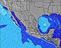 | 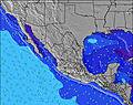 | 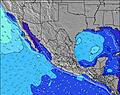 | 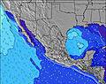 | ||||||||||||||
Wave Height (m) Direction Period (s) | SSW 12 | SW 14 | SW 13 | SSW 15 | SW 13 | SSW 13 | SSW 13 | SSW 12 | S 9 | SW 15 | SW 14 | SW 14 | SW 13 | SW 13 | SSW 18 | SSW 18 | SSW 17 | SSW 16 | SSW 16 | SSW 15 | SSW 14 |
Wave Graph | |||||||||||||||||||||
158 | 123 | 113 | 372 | 164 | 98 | 111 | 99 | 78 | 104 | 103 | 164 | 111 | 212 | 214 | 395 | 481 | 532 | 612 | 584 | 437 | |
Wind (km/h) | |||||||||||||||||||||
Wind State on-shore cross-onshore cross-shore cross-offshore off-shore glassy | cross-off | cross | cross-off | glassy | cross | cross-off | glassy | cross-on | off | glassy | on | off | glassy | cross-on | off | glassy | cross-on | cross-off | glassy | cross-on | cross-off |
High Tide | 5:22PM0.93m | 6:00AM0.97m | 5:59PM0.89m | 6:40AM1.03m | 6:36PM0.86m | 7:21AM1.08m | 7:15PM0.82m | 8:06AM1.11m | 7:58PM0.79m | 8:54AM1.13m | 8:46PM0.77m | 9:48AM1.14m | 9:40PM0.75m | ||||||||
Low Tide | 11:17AM0.24m | 11:36PM0.14m | 12:04PM0.23m | 00:09AM0.11m | 12:50PM0.23m | 00:43AM0.08m | 1:37PM0.23m | 1:21AM0.05m | 2:26PM0.23m | 2:04AM0.02m | 3:19PM0.24m | 2:52AM0.01m | 4:16PM0.24m | ||||||||
6:09 | — | — | 6:09 | — | — | 6:09 | — | — | 6:09 | — | — | 6:09 | — | — | 6:09 | — | — | 6:11 | — | — | |
— | 6:58 | — | — | 6:58 | — | — | 6:57 | — | — | 6:57 | — | — | 6:55 | — | — | 6:55 | — | — | 6:54 | — | |
mm | — | — | 9 | — | 1 | 1 | — | — | 5 | — | 1 | — | — | — | 1 | — | — | — | — | 1 | 3 |
Temp °C | 30 | 30 | 29 | 30 | 30 | 29 | 30 | 31 | 29 | 30 | 30 | 28 | 30 | 30 | 28 | 30 | 30 | 29 | 29 | 30 | 28 |
Feels °C | 33 | 33 | 34 | 33 | 33 | 33 | 33 | 34 | 33 | 32 | 33 | 31 | 32 | 32 | 32 | 33 | 33 | 33 | 31 | 33 | 33 |
Swell 1 Height (m) Direction Period (s) | SSW 12 | SSW 12 | SSW 12 | SSW 15 | SW 13 | SSW 13 | S 8 | S 8 | S 9 | S 9 | S 8 | S 8 | S 8 | SW 13 | SW 13 | SW 13 | SSW 17 | SSW 16 | SSW 16 | SSW 15 | SSW 14 |
158 | 123 | 109 | 372 | 164 | 98 | 46 | 44 | 78 | 76 | 51 | 50 | 50 | 212 | 175 | 238 | 481 | 532 | 612 | 584 | 437 | |
Swell 2 Height (m) Direction Period (s) | SW 14 | SW 14 | SW 13 | SW 13 | S 8 | S 8 | SSW 13 | SSW 12 | SSW 12 | SW 15 | SW 14 | SW 14 | SW 13 | S 8 | S 8 | SSW 18 | SW 12 | S 8 | S 8 | S 8 | SW 11 |
125 | 118 | 113 | 83 | 34 | 29 | 111 | 99 | 58 | 104 | 103 | 164 | 111 | 65 | 63 | 395 | 184 | 64 | 42 | 44 | 58 | |
Swell 3 Height (m) Direction Period (s) | SW 18 | SSE 8 | W 4 | W 8 | SW 16 | SW 12 | SW 12 | SW 15 | SW 15 | SW 12 | SW 12 | SW 20 | SW 20 | SW 18 | SSW 18 | S 8 | S 8 | SW 12 | SW 12 | SE 9 | S 8 |
82 | 12 | 8 | 20 | 67 | 53 | 50 | 60 | 76 | 36 | 34 | 97 | 61 | 159 | 214 | 31 | 66 | 114 | 114 | 20 | 31 | |
Wind waves Height (m) Direction Period (s) | WNW 3 | WSW 3 | W 4 | — | WSW 8 | — | — | WSW 8 | — | — | WSW 2 | WNW 6 | W 5 | — | — | — | — | — | — | — | — |
2 | 3 | 12 | — | 19 | — | — | 11 | — | — | 1 | 3 | 2 | — | — | — | — | — | — | — | — | |
Nearest Offshore or Glassy | |||||||||||||||||||||
Distance (km) | 0 | 1196 | 0 | 0 | 1196 | 0 | 0 | 549 | 0 | 0 | 171 | 0 | 0 | 171 | 0 | 0 | 695 | 0 | 0 | 171 | 0 |
Best forecast wave conditions in Oaxaca | |||||||||||||||||||||
Best forecast wave conditions in Mexico | |||||||||||||||||||||
Header Global | |||||||||||||||||||||
- Map Icons:
 Break
Break Live Wave Height (m)
 Live Wind Speed (km/h)
 Surf Rating (10 Max)
 Ocean Swells (m)
- Wind Speed (km/h)
Latest Updates


FREE! Surf-Forecast.com widget for your website
The surf report / weather widget below is available to embed on third party websites free of charge and provides a summary of our Barra de Colotepec surf forecast. Simply grab the html code snippet that we provide and paste it into your own site. You can choose your preferred language and metric/imperial units for the surf forecast feed to suit users of your site. Click here to get the code.
Information about the Barra de Colotepec Surf forecast
The above surf forecast table for Barra de Colotepec provides essential information for determining whether the surfing conditions will be good over the next 16 days. A general guide to surfing at Barra de Colotepec can be found by selecting the local surf guide option on the grey menu. Our Barra de Colotepec surf forecast is unique since it includes wave energy (power) that defines the real feel of the surf rather than just the height or the period. If you surf the same spot (Barra de Colotepec) regularly then make a mental note of the wave energy from the surf forecast table each time you go. Very soon you may start to choose your surf days based on the wave energy alone combined with our forecast of favourable offshore wind conditions. Our star ratings will help here and of course you will also find the usual wave height and period predictions on our surf forecasts as well as a full break down of the swell components under our advanced users option (to reveal that, click the little Einstein character under the tide times).
Further information to help with frequently asked questions about our surf forecast for Barra de Colotepec may be found under the help tab on the top menu and also by moving your mouse over the question marks on the surf forecast table itself. Please always bear in mind that the forecast is for near-shore open water and local factors at each surf break influence the actual breaking wave height, such as the beach / reef profile, water depths offshore and shelter.
Are you planning a holiday in Oaxaca? If you are looking for accommodation near Barra de Colotepec, camping, hotels and holiday cottages in Oaxaca, consider staying in Puerto Escondido which is 11 km (7 miles) away. Other places in and around Oaxaca where you can find information about places to rent, and car hire include Nopala which is 40 km (25 miles) away and Miahuatlan de Porfirio Diaz, 74 km (46 miles) away.
 Nearest