

Surf Forecasts:

How big are the waves at Aberta A Nova today (05 Jul):
- Morning surf: Morning surf (05 Jul, local time) - 1ft (0.3m), 10s period with WNW swell.
- Afternoon surf: Afternoon surf (05 Jul, local time) - 1.5ft (0.4m), 9s period with WNW swell.
- Evening surf: Evening surf (05 Jul, local time) - 1ft (0.3m), 9s period with WNW swell.
The current surf forecast for Aberta A Nova at 6AM is: 0.3m 10s primary swell from a West-northwest direction and 0.3m 4s secondary swell from a West-northwest direction (forecast issued at 12:00am July 05). The wind direction is predicted to be glassy.
| Time (WEST) & Date | Wave Height | Wave Period |
|---|---|---|
| Morning (05 Jul) | 1ft (0.3m) | 10s |
| Afternoon (05 Jul) | 1.5ft (0.4m) | 9s |
| Evening (05 Jul) | 1ft (0.3m) | 9s |
Table - waves today at Aberta A Nova. (Swell directed towards the surf break)
Updates in hr min s Forecast update imminent
Short Range ForecastMostly dry. Warm (max 33°C on Tue morning, min 22°C on Mon night). Wind will be generally light. | ||||||||||||||||||||||||
Sunday 5 | Monday 6 | Tuesday 7 | ||||||||||||||||||||||
1 AM | 4 AM | 7 AM | 10 AM | 1 PM | 4 PM | 7 PM | 10 PM | 1 AM | 4 AM | 7 AM | 10 AM | 1 PM | 4 PM | 7 PM | 10 PM | 1 AM | 4 AM | 7 AM | 10 AM | 1 PM | 4 PM | 7 PM | 10 PM | |
Swell Height Map |  | 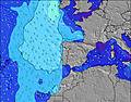 |  |  | 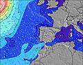 |  |  | 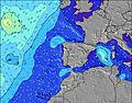 |  | |||||||||||||||
Wave Height (m) Direction Period (s) | WNW 10 | WNW 10 | WNW 10 | WNW 10 | WNW 9 | NW 9 | WNW 9 | WNW 9 | WNW 9 | WNW 9 | WNW 9 | WNW 9 | WNW 10 | WNW 10 | NW 4 | NW 4 | WNW 9 | WNW 9 | WNW 9 | WNW 8 | WNW 8 | WNW 4 | NW 4 | NW 5 |
Wave Graph | ||||||||||||||||||||||||
38 | 38 | 18 | 18 | 33 | 21 | 16 | 16 | 16 | 16 | 16 | 17 | 18 | 18 | 22 | 24 | 16 | 16 | 15 | 7 | 7 | 11 | 40 | 33 | |
Wind (km/h) | ||||||||||||||||||||||||
Wind State on-shore cross-onshore cross-shore cross-offshore off-shore glassy | cross-off | glassy | glassy | glassy | cross-on | on | cross | cross | glassy | glassy | cross-off | glassy | cross-on | cross-on | on | cross | cross-off | cross | cross-off | cross-on | on | on | on | cross-on |
High Tide | 6:34AM2.30m | 6:49PM2.52m | 7:17AM2.26m | 7:33PM2.45m | 8:06AM2.22m | 8:25PM2.37m | ||||||||||||||||||
Low Tide | 00:25AM0.48m | 12:29PM0.57m | 1:06AM0.52m | 1:12PM0.65m | 1:51AM0.57m | 2:04PM0.72m | ||||||||||||||||||
— | 6:16 | — | — | — | — | — | — | — | 6:16 | — | — | — | — | — | — | — | 6:18 | — | — | — | — | — | — | |
— | — | — | — | — | — | 9:00 | — | — | — | — | — | — | — | 9:00 | — | — | — | — | — | — | — | 9:00 | — | |
mm | — | — | — | — | — | — | — | — | — | — | — | — | — | — | — | — | — | — | — | — | — | — | — | — |
Temp °C | 27 | 24 | 24 | 28 | 29 | 32 | 26 | 26 | 27 | 25 | 25 | 28 | 30 | 29 | 31 | 29 | 26 | 23 | 22 | 28 | 33 | 32 | 32 | 30 |
Feels °C | 26 | 24 | 24 | 28 | 27 | 29 | 23 | 25 | 27 | 24 | 23 | 27 | 27 | 26 | 27 | 27 | 23 | 21 | 20 | 26 | 29 | 28 | 29 | 25 |
Swell 1 Height (m) Direction Period (s) | WNW 4 | WNW 10 | WNW 10 | WNW 10 | WNW 9 | NW 9 | WNW 9 | WNW 9 | NW 4 | NW 4 | WNW 9 | WNW 9 | WNW 10 | WNW 10 | S 11 | WNW 9 | NW 5 | NW 5 | NW 5 | NW 4 | WNW 8 | S 12 | W 12 | W 8 |
6 | 38 | 18 | 18 | 33 | 21 | 16 | 16 | 4 | 2 | 16 | 17 | 18 | 18 | 2 | 16 | 10 | 5 | 5 | 3 | 7 | 3 | 3 | 5 | |
Swell 2 Height (m) Direction Period (s) | WNW 10 | NW 4 | WNW 4 | WNW 4 | NW 11 | NW 11 | NNW 10 | NNW 10 | WNW 9 | WNW 9 | WNW 4 | WNW 4 | WNW 4 | NW 9 | NNW 9 | NW 8 | WNW 9 | WNW 9 | WNW 9 | WNW 8 | NW 8 | — | S 12 | W 11 |
38 | 4 | 2 | 1 | 5 | 5 | 10 | 10 | 16 | 16 | 1 | 2 | 2 | 3 | 8 | 3 | 16 | 16 | 15 | 7 | 3 | — | 3 | 3 | |
Swell 3 Height (m) Direction Period (s) | SW 14 | SW 14 | NW 12 | NW 11 | S 12 | S 12 | S 13 | S 13 | NNW 10 | NNW 10 | NNW 9 | NW 9 | NW 9 | S 11 | S 11 | S 11 | NW 8 | NW 8 | NW 8 | NW 8 | S 12 | — | — | NW 8 |
8 | 8 | 6 | 5 | 3 | 3 | 3 | 3 | 10 | 9 | 8 | 3 | 3 | 2 | 2 | 2 | 3 | 3 | 3 | 3 | 3 | — | — | 2 | |
Wind waves Height (m) Direction Period (s) | — | — | — | — | — | — | NW 3 | NW 4 | NW 4 | — | — | — | — | WNW 3 | NW 4 | NW 4 | — | — | — | — | NW 4 | WNW 4 | NW 4 | NW 5 |
— | — | — | — | — | — | 2 | 3 | 6 | — | — | — | — | 3 | 22 | 24 | — | — | — | — | 5 | 11 | 40 | 33 | |
Nearest Offshore or Glassy | ||||||||||||||||||||||||
Distance (km) | 0 | 0 | 30 | 69 | 126 | 42 | 126 | 36 | 36 | 36 | 36 | 42 | 573 | 646 | 572 | 30 | 36 | 36 | 796 | 796 | 1082 | 1082 | 1140 | 76 |
Best forecast wave conditions in Portugal - Alentejo | ||||||||||||||||||||||||
Best forecast wave conditions in Portugal | ||||||||||||||||||||||||
Header Global | ||||||||||||||||||||||||
- Map Icons:
 Break
Break Live Wave Height (m)
 Live Wind Speed (km/h)
 Surf Rating (10 Max)
 Ocean Swells (m)
- Wind Speed (km/h)


FREE! Surf-Forecast.com widget for your website
The surf report / weather widget below is available to embed on third party websites free of charge and provides a summary of our Aberta A Nova surf forecast. Simply grab the html code snippet that we provide and paste it into your own site. You can choose your preferred language and metric/imperial units for the surf forecast feed to suit users of your site. Click here to get the code.
 Nearest