

Surf Forecasts:

How big are the waves at Fraser Island - Waddy Point today (06 Jul):
- Morning surf: Morning surf (06 Jul, local time) - 10ft (3.0m), 8s period with SE swell.
- Afternoon surf: Afternoon surf (06 Jul, local time) - 10ft (3.0m), 8s period with SE swell.
- Evening surf: Evening surf (06 Jul, local time) - 10ft (3.0m), 8s period with SE swell.
The current surf forecast for Fraser Island - Waddy Point at 5AM is: 2.2m 7s primary swell from a Southeast direction and 0.5m 14s secondary swell from a East direction, 0.2m 11s secondary swell from a East-southeast direction (forecast issued at 09:00pm July 05). The wind direction is predicted to be cross-offshore.
| Time (AEST) & Date | Wave Height | Wave Period |
|---|---|---|
| Morning (06 Jul) | 10ft (3.0m) | 8s |
| Afternoon (06 Jul) | 10ft (3.0m) | 8s |
| Evening (06 Jul) | 10ft (3.0m) | 8s |
Table - waves today at Fraser Island - Waddy Point. (Swell directed towards the surf break)
Updates in hr min s Forecast update imminent
Short Range ForecastModerate rain (total 10mm), heaviest on Sun night. Warm (max 20°C on Sun night, min 18°C on Sun night). Mainly strong winds. | ||||||||||||||||||||||||
Sun 5 | Monday 6 | Tuesday 7 | Wednesday 8 | |||||||||||||||||||||
7 PM | 10 PM | 1 AM | 4 AM | 7 AM | 10 AM | 1 PM | 4 PM | 7 PM | 10 PM | 1 AM | 4 AM | 7 AM | 10 AM | 1 PM | 4 PM | 7 PM | 10 PM | 1 AM | 4 AM | 7 AM | 10 AM | 1 PM | 4 PM | |
Swell Height Map |  | 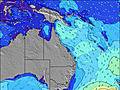 | 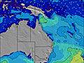 | 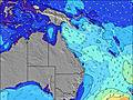 | 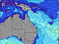 | 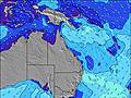 | 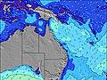 | 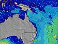 | ||||||||||||||||
Wave Height (m) Direction Period (s) | ESE 7 | ESE 7 | SE 7 | SE 7 | SE 7 | SE 8 | SE 8 | SE 8 | SE 8 | SE 8 | SE 8 | SE 8 | SE 8 | SE 8 | SE 8 | SE 10 | SE 8 | SE 8 | SE 8 | SE 9 | SE 9 | SE 11 | SE 11 | SE 11 |
Wave Graph | ||||||||||||||||||||||||
380 | 444 | 481 | 404 | 583 | 1137 | 1225 | 1032 | 1004 | 1029 | 1057 | 1002 | 1026 | 1028 | 948 | 1178 | 915 | 1225 | 1316 | 1373 | 1366 | 1864 | 1872 | 1685 | |
Wind (km/h) | ||||||||||||||||||||||||
Wind State on-shore cross-onshore cross-shore cross-offshore off-shore glassy | cross-off | cross-off | cross-off | cross-off | cross-off | cross-off | cross-off | cross-off | cross-off | cross-off | cross-off | cross-off | cross-off | cross-off | cross-off | cross-off | cross-off | cross-off | cross-off | cross-off | cross-off | cross-off | cross-off | cross-off |
High Tide | 11:45PM1.63m | 12:44PM1.19m | 00:28AM1.51m | 1:46PM1.25m | 1:16AM1.39m | 2:52PM1.35m | ||||||||||||||||||
Low Tide | 5:08PM0.62m | 6:39AM0.45m | 6:04PM0.70m | 7:21AM0.44m | 7:15PM0.76m | 8:07AM0.42m | ||||||||||||||||||
— | — | — | 6:31 | — | — | — | — | — | — | — | 6:31 | — | — | — | — | — | — | — | 6:31 | — | — | — | — | |
— | — | — | — | — | — | — | 5:09 | — | — | — | — | — | — | — | 5:09 | — | — | — | — | — | — | — | 5:10 | |
mm | — | — | — | — | 1 | 1 | — | — | — | 1 | 1 | 1 | 1 | 1 | — | 1 | — | — | — | — | 1 | — | — | 1 |
Temp °C | 20 | 20 | 20 | 20 | 18 | 19 | 20 | 19 | 19 | 19 | 19 | 18 | 18 | 20 | 19 | 19 | 20 | 20 | 20 | 19 | 20 | 20 | 20 | 19 |
Feels °C | 15 | 15 | 15 | 16 | 12 | 12 | 13 | 12 | 13 | 13 | 13 | 13 | 13 | 14 | 14 | 13 | 13 | 13 | 14 | 14 | 14 | 14 | 14 | 13 |
Swell 1 Height (m) Direction Period (s) | SE 14 | ESE 15 | ESE 15 | E 14 | ESE 14 | ESE 14 | ESE 15 | E 14 | E 13 | E 13 | E 13 | ESE 13 | ESE 13 | E 12 | E 12 | ESE 12 | ESE 12 | ESE 11 | — | — | — | — | — | SE 14 |
54 | 21 | 42 | 93 | 107 | 107 | 71 | 98 | 92 | 92 | 90 | 59 | 58 | 78 | 75 | 81 | 56 | 51 | — | — | — | — | — | 70 | |
Swell 2 Height (m) Direction Period (s) | S 10 | S 10 | S 13 | ESE 11 | SSE 13 | S 15 | SSE 14 | — | — | — | NE 9 | NE 9 | — | — | — | — | — | — | — | — | — | — | — | — |
19 | 8 | 4 | 13 | 59 | 115 | 210 | — | — | — | 3 | 3 | — | — | — | — | — | — | — | — | — | — | — | — | |
Swell 3 Height (m) Direction Period (s) | — | — | — | S 12 | — | — | — | — | — | — | — | — | — | — | — | — | — | — | — | — | — | — | — | — |
— | — | — | 12 | — | — | — | — | — | — | — | — | — | — | — | — | — | — | — | — | — | — | — | — | |
Wind waves Height (m) Direction Period (s) | ESE 7 | ESE 7 | SE 7 | SE 7 | SE 7 | SE 8 | SE 8 | SE 8 | SE 8 | SE 8 | SE 8 | SE 8 | SE 8 | SE 8 | SE 8 | SE 10 | SE 8 | SE 8 | SE 8 | SE 9 | SE 9 | SE 11 | SE 11 | SE 11 |
380 | 444 | 481 | 404 | 583 | 1137 | 1225 | 1032 | 1004 | 1029 | 1057 | 1002 | 1026 | 1028 | 948 | 1178 | 915 | 1225 | 1316 | 1373 | 1366 | 1864 | 1872 | 1685 | |
Nearest Offshore or Glassy | ||||||||||||||||||||||||
Distance (km) | 159 | 159 | 159 | 497 | 352 | 352 | 1153 | 1114 | 352 | 352 | 159 | 159 | 159 | 352 | 352 | 352 | 352 | 159 | 352 | 159 | 352 | 357 | 357 | 357 |
Best forecast wave conditions in Queensland North Coast | ||||||||||||||||||||||||
Best forecast wave conditions in Australia | ||||||||||||||||||||||||
Header Global | ||||||||||||||||||||||||
- Map Icons:
 Break
Break Live Wave Height (m)
 Live Wind Speed (km/h)
 Surf Rating (10 Max)
 Ocean Swells (m)
- Wind Speed (km/h)


FREE! Surf-Forecast.com widget for your website
The surf report / weather widget below is available to embed on third party websites free of charge and provides a summary of our Fraser Island - Waddy Point surf forecast. Simply grab the html code snippet that we provide and paste it into your own site. You can choose your preferred language and metric/imperial units for the surf forecast feed to suit users of your site. Click here to get the code.
 Nearest