

Surf Forecasts:

Seaford Reef surf forecast from 3 Aug 2026:
- Most powerful swell: Sunday 9 Aug, 6AM (local time) - 8ft (2.5m), 7s period, W swell with 639 kJ wave energy.
Best Forecast Surf Conditions for Seaford Reef this week:
The most powerful waves expected at Seaford Reef in the next 16 days are 2.5m 7s and forecast to arrive on Sunday (Aug 09) at 6AM. Winds are predicted to be cross-onshore at the time the swell arrives. The largest open ocean swell (not directed at the beach) is 2.4m 6s period and expected on Saturday (Aug 08) at 3PM.
| Wave Type | Time (ACST) & Date | Wave Height & Period |
|---|---|---|
| Next good surf (1 star+) | - | - |
| Best Surf | - | - |
| Most Powerful | 6AM (Sun 9th Aug) | 8ft (2.5m) 7s |
Table - best surf conditions forecast for Seaford Reef over the next 16 days.
The Lowdown
Alright folks, Rusty here. Let's have a look at what's on the cards over the next couple of weeks.
Right off the bat, I gotta be straight with you – it's a grim stretch for Seaford Reef. We're looking at a real dry spell to kick things off. The first few days of August are all tiny, weak, and poorly shaped. Monday the 3rd you've got a mere 1ft to 1ft of swell from the WSW, but it's a cross-on wind and the water's a bit cool for this time of year at 57°, with just a slight chill in the air. The combined energy is a feeble 57 (weak). It's just not on.
That flat spell runs right through until the 8th of August. We get a little spike on Saturday the 8th with 3ft from the north, but a strong 19 mph cross-offshore wind is going to mess it up, and the forecast is for poor surf anyway. Don't bother.
Now, Sunday the 9th of August is the one day that gets the numbers up. We're looking at a solid 8ft of swell from the west, with a combined energy of 595 (moderate). That's a big jump, but here's the catch – the wind is howling from the WSW at 25 mph, cross-onshore, and the wave period is a short 7 seconds. It's going to be a messy, wind-blown chop. Even though the size is there, the quality isn't. It's a beach-and-reef setup, and with that wind and chunky swell, it's honestly looking more interesting for kite surfing than a paddle session. For the average punter, that's a no-go. For experts, it's still not great.
After that, things drop back down again. Through the second week of August, we're looking at tiny waves, mostly under 3ft, with inconsistent winds. There's a tiny 1ft from the WSW on the 10th, but it's cross-shore. The 11th shows a bit of 4ft from the north, but again, it's windy and onshore. The pattern is clear: a brief, messy pulse on the 9th, and then nothing but small, poor conditions through to the 18th. The last few days show a glassy 1ft on the morning of the 18th, but it's barely a ripple.
So, to sum it up: there are no standouts. The only day with any real size, August 9th, is blown out. The rest of the forecast is a write-off for surf. It's a tough run for this spot, but it happens. The forecasts can change, so keep your eyes peeled, but for now, I'd suggest finding something else to do.
Rusty.
Short Range ForecastMostly dry. Very mild (max 13°C on Mon morning, min 8°C on Tue night). Wind will be generally light. | Days 4-6 Weather SummaryHeavy rain (total 23mm), heaviest during Sat morning. Very mild (max 16°C on Fri afternoon, min 10°C on Sat morning). Winds increasing (calm on Thu afternoon, strong winds from the N by Sat afternoon). | ||||||||||||||||||||
Monday 3 | Tuesday 4 | Wednesday 5 | Thursday 6 | Friday 7 | Saturday 8 | Sunday 9 | |||||||||||||||
AM | PM | Night | AM | PM | Night | AM | PM | Night | AM | PM | Night | AM | PM | Night | AM | PM | Night | AM | PM | Night | |
Swell Height Map | 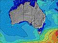 | 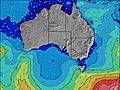 | 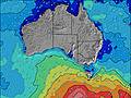 | 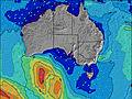 | 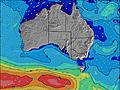 | 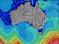 | 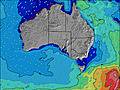 | ||||||||||||||
Wave Height (m) Direction Period (s) | WSW 9 | WSW 9 | WSW 4 | WSW 8 | WSW 8 | WSW 8 | W 7 | W 7 | W 7 | N 3 | N 3 | SW 15 | SW 14 | SW 14 | N 3 | N 4 | NNW 6 | W 6 | W 7 | W 6 | W 6 |
Wave Graph | |||||||||||||||||||||
30 | 15 | 10 | 6 | 12 | 6 | 4 | 1 | 1 | 1 | 1 | 9 | 8 | 8 | 8 | 19 | 0 | 205 | 595 | 321 | 221 | |
Wind (km/h) | |||||||||||||||||||||
Wind State on-shore cross-onshore cross-shore cross-offshore off-shore glassy | cross-on | cross-on | cross-on | cross-on | on | off | cross-off | cross | cross | cross | glassy | off | cross-off | cross | cross-off | cross-off | cross | cross-on | cross-on | on | cross-on |
High Tide | 6:38PM2.14m | 7:03AM2.05m | 7:04PM1.98m | 7:32AM2.07m | 7:30PM1.74m | 8:05AM2.01m | 7:51PM1.45m | 8:44AM1.88m | 7:41PM1.15m | 9:43AM1.69m | 1:49PM1.61m | ||||||||||
Low Tide | 12:30PM0.50m | 00:52AM0.38m | 1:04PM0.52m | 1:12AM0.43m | 1:41PM0.61m | 1:31AM0.50m | 2:26PM0.77m | 1:45AM0.60m | 3:31PM0.97m | 1:37AM0.69m | 11:57PM0.69m | 10:54PM0.49m | |||||||||
7:09 | — | — | 7:09 | — | — | 7:07 | — | — | 7:07 | — | — | 7:05 | — | — | 7:05 | — | — | 7:03 | — | — | |
— | 5:35 | — | — | 5:35 | — | — | 5:36 | — | — | 5:37 | — | — | 5:37 | — | — | 5:37 | — | — | 5:38 | — | |
mm | — | — | — | — | — | — | — | — | — | — | — | — | — | — | — | 7 | 8 | 8 | 1 | — | — |
Temp °C | 13 | 13 | 11 | 11 | 11 | 10 | 10 | 12 | 12 | 12 | 13 | 12 | 14 | 16 | 16 | 10 | 11 | 13 | 12 | 13 | 12 |
Feels °C | 8 | 9 | 7 | 7 | 8 | 8 | 7 | 9 | 9 | 11 | 12 | 10 | 11 | 13 | 12 | 4 | 2 | 6 | 4 | 6 | 8 |
Swell 1 Height (m) Direction Period (s) | WSW 9 | WSW 9 | WSW 8 | WSW 8 | WSW 8 | WSW 8 | W 7 | W 7 | W 7 | W 6 | W 4 | W 4 | SW 14 | SW 10 | SW 10 | W 9 | S 15 | N 5 | — | — | — |
30 | 15 | 7 | 6 | 12 | 6 | 4 | 1 | 1 | 1 | 1 | 1 | 8 | 4 | 4 | 6 | 4 | 21 | — | — | — | |
Swell 2 Height (m) Direction Period (s) | — | — | — | SW 11 | — | — | — | — | — | — | — | SW 15 | — | SW 14 | SW 14 | W 6 | — | — | — | — | — |
— | — | — | 5 | — | — | — | — | — | — | — | 9 | — | 8 | 8 | 1 | — | — | — | — | — | |
Swell 3 Height (m) Direction Period (s) | — | — | — | — | — | — | — | — | — | — | — | — | — | — | — | — | — | — | — | — | — |
— | — | — | — | — | — | — | — | — | — | — | — | — | — | — | — | — | — | — | — | — | |
Wind waves Height (m) Direction Period (s) | WSW 5 | WSW 5 | WSW 4 | WSW 4 | — | — | — | N 3 | — | N 3 | N 3 | — | N 3 | NNW 3 | N 3 | N 4 | NNW 6 | W 6 | W 7 | W 6 | W 6 |
27 | 12 | 10 | 4 | — | — | — | 1 | — | 1 | 1 | — | 2 | 4 | 7 | 19 | 464 | 205 | 595 | 321 | 221 | |
Nearest Offshore or Glassy | |||||||||||||||||||||
Distance (km) | 610 | 617 | 128 | 128 | 135 | 43 | 43 | 43 | 43 | 43 | 135 | 43 | 43 | 43 | 43 | 559 | 559 | 792 | 447 | 629 | 44 |
Best forecast wave conditions in Adelaide | |||||||||||||||||||||
Best forecast wave conditions in Australia | |||||||||||||||||||||
Header Global | |||||||||||||||||||||
- Map Icons:
 Break
Break Live Wave Height (m)
 Live Wind Speed (km/h)
 Surf Rating (10 Max)
 Ocean Swells (m)
- Wind Speed (km/h)
Latest Updates


FREE! Surf-Forecast.com widget for your website
The surf report / weather widget below is available to embed on third party websites free of charge and provides a summary of our Seaford Reef surf forecast. Simply grab the html code snippet that we provide and paste it into your own site. You can choose your preferred language and metric/imperial units for the surf forecast feed to suit users of your site. Click here to get the code.
Information about the Seaford Reef Surf forecast
The above surf forecast table for Seaford Reef provides essential information for determining whether the surfing conditions will be good over the next 16 days. A general guide to surfing at Seaford Reef can be found by selecting the local surf guide option on the grey menu. Our Seaford Reef surf forecast is unique since it includes wave energy (power) that defines the real feel of the surf rather than just the height or the period. If you surf the same spot (Seaford Reef) regularly then make a mental note of the wave energy from the surf forecast table each time you go. Very soon you may start to choose your surf days based on the wave energy alone combined with our forecast of favourable offshore wind conditions. Our star ratings will help here and of course you will also find the usual wave height and period predictions on our surf forecasts as well as a full break down of the swell components under our advanced users option (to reveal that, click the little Einstein character under the tide times).
Further information to help with frequently asked questions about our surf forecast for Seaford Reef may be found under the help tab on the top menu and also by moving your mouse over the question marks on the surf forecast table itself. Please always bear in mind that the forecast is for near-shore open water and local factors at each surf break influence the actual breaking wave height, such as the beach / reef profile, water depths offshore and shelter.
Seaford Reef is 7 km (4 miles) from the very large city of Morphett Vale. If you plan a holiday in Adelaide, look for hotels and other accommodation in Morphett Vale. Morphett Vale has rooms for a wide range of budgets as well as cheap car hire and transport links.
 Nearest