

Surf Forecasts:

How big are the waves at Sacor today (20 Jun):
- Morning surf: Morning surf (20 Jun, local time) - 2.5ft (0.8m), 8s period with WNW swell.
- Afternoon surf: Afternoon surf (20 Jun, local time) - 2.5ft (0.8m), 8s period with W swell.
- Evening surf: Evening surf (20 Jun, local time) - 3ft (0.9m), 8s period with WNW swell.
The current surf forecast for Sacor at 1PM is: 0.8m 8s primary swell from a West-northwest direction and 0.3m 2s secondary swell from a Northwest direction (forecast issued at 06:00am June 20). The wind direction is predicted to be cross-onshore.
| Time (WEST) & Date | Wave Height | Wave Period |
|---|---|---|
| Morning (20 Jun) | 2.5ft (0.8m) | 8s |
| Afternoon (20 Jun) | 2.5ft (0.8m) | 8s |
| Evening (20 Jun) | 3ft (0.9m) | 8s |
Table - waves today at Sacor. (Swell directed towards the surf break)
Updates in hr min s Forecast update imminent
Short Range ForecastLight rain (total 4mm), mostly falling on Sun afternoon. Warm (max 23°C on Sun morning, min 17°C on Sun night). Wind will be generally light. | ||||||||||||||||||||||||
Saturday 20 | Sunday 21 | Monday 22 | Tue 23 | |||||||||||||||||||||
4 AM | 7 AM | 10 AM | 1 PM | 4 PM | 7 PM | 10 PM | 1 AM | 4 AM | 7 AM | 10 AM | 1 PM | 4 PM | 7 PM | 10 PM | 1 AM | 4 AM | 7 AM | 10 AM | 1 PM | 4 PM | 7 PM | 10 PM | 1 AM | |
Swell Height Map |  |  | 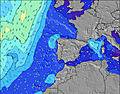 |  | 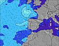 |  |  | 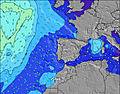 | 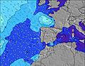 |  | ||||||||||||||
Wave Height (m) Direction Period (s) | WNW 8 | WNW 8 | WNW 8 | WNW 8 | W 8 | W 8 | WNW 8 | WNW 7 | WNW 7 | WNW 7 | WNW 7 | W 7 | W 7 | W 7 | W 7 | W 7 | W 8 | W 8 | W 7 | W 7 | W 7 | W 7 | W 10 | W 10 |
Wave Graph | ||||||||||||||||||||||||
109 | 85 | 83 | 79 | 74 | 74 | 99 | 73 | 73 | 71 | 54 | 36 | 34 | 23 | 23 | 23 | 31 | 41 | 39 | 38 | 36 | 34 | 49 | 68 | |
Wind (km/h) | ||||||||||||||||||||||||
Wind State on-shore cross-onshore cross-shore cross-offshore off-shore glassy | cross-off | cross | cross-on | cross-on | cross-on | cross-on | cross-on | cross-on | glassy | cross-off | cross | on | cross-on | cross-on | cross-on | on | cross-on | cross-on | cross-on | cross | on | cross-on | cross-on | glassy |
High Tide | 8:33AM2.92m | 8:49PM3.24m | 9:29AM3.00m | 9:44PM3.27m | 10:19AM3.09m | 10:34PM3.29m | ||||||||||||||||||
Low Tide | 2:18AM0.90m | 2:32PM1.11m | 3:16AM0.84m | 3:29PM1.03m | 4:07AM0.80m | 4:20PM0.95m | ||||||||||||||||||
6:01 | — | — | — | — | — | — | — | 6:01 | — | — | — | — | — | — | — | 6:01 | — | — | — | — | — | — | 6:01 | |
— | — | — | — | — | 9:09 | — | — | — | — | — | — | — | 9:09 | — | — | — | — | — | — | — | 9:10 | — | 9:10 | |
mm | — | — | — | — | — | — | — | — | — | — | — | — | — | 1 | 1 | — | 1 | — | — | — | 1 | — | — | — |
Temp °C | 18 | 18 | 21 | 21 | 21 | 21 | 19 | 20 | 21 | 20 | 23 | 22 | 20 | 18 | 18 | 19 | 18 | 17 | 18 | 21 | 19 | 18 | 19 | 18 |
Feels °C | 18 | 17 | 20 | 19 | 18 | 18 | 18 | 20 | 22 | 20 | 23 | 21 | 19 | 17 | 18 | 19 | 18 | 17 | 19 | 21 | 17 | 18 | 20 | 20 |
Swell 1 Height (m) Direction Period (s) | WNW 8 | WNW 8 | WNW 8 | WNW 8 | W 8 | W 8 | WNW 8 | WNW 7 | WNW 7 | WNW 7 | WNW 7 | W 7 | W 7 | W 7 | W 7 | W 7 | W 8 | W 8 | W 7 | W 7 | W 7 | W 7 | W 7 | W 10 |
109 | 85 | 83 | 79 | 74 | 74 | 99 | 73 | 73 | 71 | 54 | 36 | 34 | 23 | 23 | 23 | 31 | 41 | 39 | 38 | 36 | 34 | 35 | 68 | |
Swell 2 Height (m) Direction Period (s) | — | — | — | — | — | — | — | N 9 | NW 9 | W 11 | NW 8 | NW 8 | NW 8 | NNW 9 | NW 9 | NW 9 | NNW 8 | NW 4 | NW 4 | NW 4 | W 11 | NW 4 | W 10 | W 7 |
— | — | — | — | — | — | — | 2 | 3 | 2 | 3 | 3 | 3 | 8 | 12 | 12 | 7 | 7 | 5 | 5 | 21 | 7 | 49 | 23 | |
Swell 3 Height (m) Direction Period (s) | — | — | — | — | — | — | — | — | — | NW 9 | NW 11 | NW 10 | NW 10 | — | W 8 | W 8 | W 12 | NNW 8 | NNW 8 | NNW 8 | NNW 8 | W 10 | NW 8 | NW 5 |
— | — | — | — | — | — | — | — | — | 3 | 5 | 4 | 4 | — | 6 | 6 | 3 | 6 | 6 | 6 | 6 | 33 | 2 | 9 | |
Wind waves Height (m) Direction Period (s) | — | — | — | NW 2 | NW 3 | NW 4 | NW 4 | — | — | — | — | — | NW 3 | NW 4 | NW 4 | NW 4 | NW 4 | — | — | — | NW 5 | — | NW 5 | — |
— | — | — | 1 | 3 | 7 | 23 | — | — | — | — | — | 5 | 7 | 8 | 6 | 9 | — | — | — | 8 | — | 7 | — | |
Nearest Offshore or Glassy | ||||||||||||||||||||||||
Distance (km) | 0 | 1 | 56 | 285 | 457 | 156 | 56 | 16 | 0 | 0 | 10 | 160 | 70 | 234 | 37 | 234 | 56 | 56 | 22 | 1 | 186 | 156 | 13 | 0 |
Best forecast wave conditions in Douro and Minho | ||||||||||||||||||||||||
Best forecast wave conditions in Portugal | ||||||||||||||||||||||||
Header Global | ||||||||||||||||||||||||
- Map Icons:
 Break
Break Live Wave Height (m)
 Live Wind Speed (km/h)
 Surf Rating (10 Max)
 Ocean Swells (m)
- Wind Speed (km/h)


FREE! Surf-Forecast.com widget for your website
The surf report / weather widget below is available to embed on third party websites free of charge and provides a summary of our Sacor surf forecast. Simply grab the html code snippet that we provide and paste it into your own site. You can choose your preferred language and metric/imperial units for the surf forecast feed to suit users of your site. Click here to get the code.
 Nearest