

Surf Forecasts:

Punta Rosarito surf forecast from 26 Jul 2026:
- Best quality surf: Tuesday 28 Jul, 5AM (local time) - 2ft (0.6m), 17s period, SW swell with glassy winds.
- Most powerful swell: Monday 27 Jul, 11AM (local time) - 2.5ft (0.7m), 18s period, SW swell with 338 kJ wave energy.
- Next surfable swell (1★+): Tuesday 28 Jul, 5AM (local time) - 2ft (0.6m), 17s period with SW swell.
Best Forecast Surf Conditions for Punta Rosarito this week:
The surf forecast for Punta Rosarito over the next 16 days: The first swell (rated 1 star or higher) is forecast to arrive on Tuesday (Jul 28) at 5AM. The primary swell is predicted to be 0.6m and 17s period with a secondary swell of 0.6m and 8s. The wind is predicted to be glassy as the swell arrives.
The most powerful waves expected at Punta Rosarito in the next 16 days are 0.7m 18s and forecast to arrive on Monday (Jul 27) at 11AM. Winds are predicted to be cross-onshore at the time the swell arrives.
| Wave Type | Time (PDT) & Date | Wave Height & Period |
|---|---|---|
| Next good surf (1 star+) | 5AM (Tue 28th Jul) | 2ft (0.6m) 17s |
| Best Surf | 5AM (Tue 28th Jul) | 2ft (0.6m) 17s |
| Most Powerful | 11AM (Mon 27th Jul) | 2.5ft (0.7m) 18s |
Table - best surf conditions forecast for Punta Rosarito over the next 16 days.
The Lowdown
Alright folks, Rusty here. Let’s take a look at what’s cookin’ for Punta Rosarito over the next couple of weeks. Gotta be straight with you – this one’s a tough sit. We’re lookin’ at a real quiet stretch ahead.
Right off the bat, the pattern is pretty flat. For the first week and a half, from Sunday the 26th of July right through to around Friday the 7th of August, there’s just nothing doing. The swell is tiny, mostly around 2ft to 1ft, and it’s coming from the SW or WSW with periods that bounce around but never really lock in. The combined wave energy is weak, mostly sittin’ under 300 (265 to 285 early on) and dropping into the double digits (83 to 38) by the end of that first week. Winds are a constant cross or cross-onshore, never offshore, so the surface is always a bit choppy or rippled. It’s just poor surf conditions day after day. This is a proper blank run.
The water temp on Sunday the 26th is a toasty 73°, which is a whopping 6° warmer than usual for this time of year – that’s seriously unusual. But with no waves, it’s a swim, not a surf.
There’s a little blip of energy on Sunday the 2nd of August, with a period droppin’ to 8 seconds and a direction shift to WNW, but the swell is only 2ft and the energy is weak at 131. Still poor conditions.
After that, it just fades further. The second week, from the 4th of August onward, the swell drops to 1ft to 0.7ft, and the combined energy is way down, barely cracking 100. There’s no standout day, no hidden gem, nothing to get excited about. The wind is never favorable for clean surf.
Honestly, for a consistent reef break like Punta Rosarito, this is a tough stretch. No standouts. If you’re itchin’ for a paddle, you’re better off waitin’ for the next system. The only thing that saves this is that it’s a consistent spot – it tends not to stay this poor for long, and forecasts can change.
Rusty, out.
Short Range ForecastMostly dry. Warm (max 24°C on Mon afternoon, min 20°C on Sun night). Wind will be generally light. | Days 4-6 Weather SummaryLight rain (total 2mm), mostly falling on Fri night. Warm (max 23°C on Wed morning, min 19°C on Thu night). Wind will be generally light. | ||||||||||||||||||||
Sunday 26 | Monday 27 | Tuesday 28 | Wednesday 29 | Thursday 30 | Friday 31 | Saturday 1 | |||||||||||||||
AM | PM | Night | AM | PM | Night | AM | PM | Night | AM | PM | Night | AM | PM | Night | AM | PM | Night | AM | PM | Night | |
Swell Height Map |  |  |  | 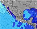 | 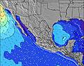 | 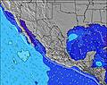 | 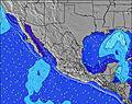 | ||||||||||||||
Wave Height (m) Direction Period (s) | WSW 18 | WSW 18 | WSW 18 | SW 18 | WSW 17 | SW 17 | SW 17 | SW 17 | SW 16 | SW 16 | SW 16 | SW 16 | SW 15 | SW 15 | SW 14 | SW 13 | SW 13 | SW 12 | SW 11 | SW 11 | SW 13 |
Wave Graph | |||||||||||||||||||||
228 | 209 | 276 | 338 | 184 | 243 | 238 | 230 | 129 | 159 | 157 | 151 | 171 | 209 | 238 | 171 | 166 | 144 | 99 | 90 | 49 | |
Wind (km/h) | |||||||||||||||||||||
Wind State on-shore cross-onshore cross-shore cross-offshore off-shore glassy | cross-on | cross | cross | cross-on | cross | cross-on | cross-on | cross | cross | cross-on | cross-on | cross | cross-on | cross | cross | cross-on | cross | cross | cross-on | cross-on | cross-off |
High Tide | 8:52AM1.58m | 7:33PM2.30m | 9:18AM1.64m | 8:11PM2.38m | 9:43AM1.70m | 8:46PM2.42m | 10:09AM1.76m | 9:19PM2.43m | 10:35AM1.82m | 9:52PM2.38m | 11:01AM1.88m | 10:26PM2.27m | 11:28AM1.95m | 11:01PM2.12m | |||||||
Low Tide | 1:12PM1.21m | 2:50AM0.28m | 1:52PM1.13m | 3:20AM0.22m | 2:29PM1.05m | 3:48AM0.19m | 3:05PM0.99m | 4:14AM0.20m | 3:41PM0.94m | 4:40AM0.25m | 4:19PM0.91m | 5:04AM0.33m | 5:01PM0.88m | ||||||||
5:54 | — | — | 5:54 | — | — | 5:54 | — | — | 5:56 | — | — | 5:56 | — | — | 5:56 | — | — | 5:58 | — | — | |
— | 7:30 | — | — | 7:30 | — | — | 7:30 | — | — | 7:29 | — | — | 7:28 | — | — | 7:28 | — | — | 7:27 | — | |
mm | — | — | — | — | — | — | — | — | — | — | — | — | — | — | — | — | — | 2 | — | — | — |
Temp °C | 23 | 23 | 21 | 23 | 24 | 21 | 23 | 24 | 21 | 23 | 23 | 21 | 23 | 23 | 21 | 22 | 22 | 20 | 22 | 23 | 21 |
Feels °C | 24 | 22 | 22 | 22 | 23 | 21 | 22 | 24 | 21 | 23 | 22 | 21 | 22 | 22 | 21 | 21 | 21 | 20 | 23 | 23 | 21 |
Swell 1 Height (m) Direction Period (s) | WSW 18 | WSW 18 | WSW 18 | SW 18 | WSW 17 | SW 17 | SW 17 | SW 17 | WNW 8 | WNW 8 | SW 16 | WNW 8 | SW 15 | SW 15 | SW 14 | SW 13 | SW 13 | SW 12 | SW 11 | SW 11 | WNW 8 |
228 | 209 | 276 | 338 | 184 | 243 | 238 | 230 | 42 | 44 | 157 | 45 | 171 | 209 | 238 | 171 | 166 | 144 | 99 | 90 | 40 | |
Swell 2 Height (m) Direction Period (s) | WNW 7 | WSW 14 | WNW 8 | WNW 8 | WNW 8 | WNW 8 | WNW 8 | WNW 8 | SW 16 | SW 16 | SW 16 | SW 16 | NW 8 | WNW 8 | WNW 8 | WNW 9 | — | WNW 9 | WNW 5 | WNW 9 | SW 10 |
29 | 18 | 35 | 26 | 26 | 37 | 46 | 46 | 129 | 159 | 40 | 151 | 34 | 27 | 28 | 31 | — | 31 | 8 | 43 | 49 | |
Swell 3 Height (m) Direction Period (s) | WNW 9 | SW 11 | SW 13 | SW 10 | SW 12 | WSW 12 | SW 9 | SW 8 | SW 9 | W 8 | W 8 | W 9 | W 8 | W 8 | — | — | — | W 21 | NW 9 | W 20 | SW 13 |
8 | 5 | 28 | 4 | 6 | 14 | 3 | 3 | 3 | 1 | 1 | 2 | 1 | 1 | — | — | — | 9 | 20 | 7 | 46 | |
Wind waves Height (m) Direction Period (s) | — | WNW 9 | — | — | WNW 3 | — | — | WNW 3 | — | — | WNW 8 | — | — | WNW 3 | — | — | WNW 9 | — | — | NW 9 | — |
— | 53 | — | — | 1 | — | — | 3 | — | — | 47 | — | — | 1 | — | — | 45 | — | — | 77 | — | |
Nearest Offshore or Glassy | |||||||||||||||||||||
Distance (km) | 307 | 307 | 244 | 307 | 307 | 244 | 307 | 675 | 244 | 307 | 307 | 244 | 307 | 494 | 307 | 307 | 494 | 307 | 543 | 307 | 177 |
Best forecast wave conditions in Baja Norte | |||||||||||||||||||||
Best forecast wave conditions in Mexico | |||||||||||||||||||||
Header Global | |||||||||||||||||||||
- Map Icons:
 Break
Break Live Wave Height (m)
 Live Wind Speed (km/h)
 Surf Rating (10 Max)
 Ocean Swells (m)
- Wind Speed (km/h)


FREE! Surf-Forecast.com widget for your website
The surf report / weather widget below is available to embed on third party websites free of charge and provides a summary of our Punta Rosarito surf forecast. Simply grab the html code snippet that we provide and paste it into your own site. You can choose your preferred language and metric/imperial units for the surf forecast feed to suit users of your site. Click here to get the code.
Information about the Punta Rosarito Surf forecast
The above surf forecast table for Punta Rosarito provides essential information for determining whether the surfing conditions will be good over the next 16 days. A general guide to surfing at Punta Rosarito can be found by selecting the local surf guide option on the grey menu. Our Punta Rosarito surf forecast is unique since it includes wave energy (power) that defines the real feel of the surf rather than just the height or the period. If you surf the same spot (Punta Rosarito) regularly then make a mental note of the wave energy from the surf forecast table each time you go. Very soon you may start to choose your surf days based on the wave energy alone combined with our forecast of favourable offshore wind conditions. Our star ratings will help here and of course you will also find the usual wave height and period predictions on our surf forecasts as well as a full break down of the swell components under our advanced users option (to reveal that, click the little Einstein character under the tide times).
Further information to help with frequently asked questions about our surf forecast for Punta Rosarito may be found under the help tab on the top menu and also by moving your mouse over the question marks on the surf forecast table itself. Please always bear in mind that the forecast is for near-shore open water and local factors at each surf break influence the actual breaking wave height, such as the beach / reef profile, water depths offshore and shelter.
Are you planning a holiday in Baja Norte? If you are looking for accommodation near Punta Rosarito, camping, hotels and holiday cottages in Baja Norte, consider staying in Santa Isabel which is 82 km (51 miles) away. Alternatively, find information about places to stay and car hire in Aguaje which is 86 km (53 miles) away
 Nearest