

Surf Forecasts:

Playa Pantaleta surf forecast from 3 Aug 2026:
- Best quality surf: Thursday 6 Aug, 5AM (local time) - 5ft (1.6m), 7s period, ENE swell with cross-offshore winds.
- Most powerful swell: Friday 7 Aug, 8AM (local time) - 6ft (1.8m), 7s period, ENE swell with 353 kJ wave energy.
- Next surfable swell (1★+): Monday 3 Aug, 5AM (local time) - 3ft (0.9m), 6s period with ENE swell.
Best Forecast Surf Conditions for Playa Pantaleta this week:
The surf forecast for Playa Pantaleta over the next 16 days: The first swell (rated 1 star or higher) is forecast to arrive on Monday (Aug 03) at 5AM. The primary swell is predicted to be 0.9m and 6s period with a secondary swell of 0.2m and 8s. The wind is predicted to be cross-offshore as the swell arrives.
The most powerful waves expected at Playa Pantaleta in the next 16 days are 1.8m 7s and forecast to arrive on Friday (Aug 07) at 8AM. Winds are predicted to be cross-shore at the time the swell arrives.
| Wave Type | Time (-04) & Date | Wave Height & Period |
|---|---|---|
| Next good surf (1 star+) | 5AM (Mon 3rd Aug) | 3ft (0.9m) 6s |
| Best Surf | 5AM (Thu 6th Aug) | 5ft (1.6m) 7s |
| Most Powerful | 8AM (Fri 7th Aug) | 6ft (1.8m) 7s |
Table - best surf conditions forecast for Playa Pantaleta over the next 16 days.
The Lowdown
Alright folks, Rusty here again. Let’s break it down.
To be brutally honest, the next two weeks look like a total flat spell for Playa Pantaleta. The whole 16-day window is a bust, with onshore rubbish and no real swell. We’re starting with nothing, and it barely gets a pulse.
From Monday, August 3rd, right through to Thursday, August 13th, the conditions are just poor. The swell is tiny, coming from the ENE at a measly 4 to 5ft, with a short, weak period of 6 to 7 seconds. That’s just wind slop. The wind is constant cross-shore from the east, never letting up, keeping the surface all chopped up and messy. The combined wave energy is weak to moderate, sitting between 103 and 186 (weak to moderate energy). Nothing to get your heart rate up.
Into the second week, it barely improves. Around Friday, August 14th, we see a slight bump, pushing up to 6ft from the ENE, with the period stretching to 8 seconds. The energy picks up a bit (347 on Friday morning, 322 in the afternoon). But the wind is still cross-shore, and the forecast still calls it “poor surf conditions.” It’s not paddleable.
The only glimmer is on Saturday, August 15th. The morning sees the swell at 6ft from the ENE, with an 8-second period and combined energy of 430 (moderate energy). The conditions are described as “marginal” – which is the best we get. The wind is still a gentle cross-shore, so it’s not clean, but for a desperate surfer, it’s the only window. This is marginal for intermediates, and the constant cross-wind means it’ll be bumpy and hard to get a good ride. The break is a beach and reef setup, so kite surfers might have a better time here than paddle surfers.
The water temperature is about average for this time of year, so no surprises there.
The standout, if you can call it that, is Saturday, August 15th morning. Swell size is 6ft, direction ENE. It’s not great, it’s not clean, and it’s likely to be crowded if anyone else is as desperate as you. The swell direction (ENE) is a bit off the optimum (NNE), so it’s not wrapping in perfectly.
After that, it fades away again, dropping back to tiny 3ft junk by Monday, August 17th.
Bottom line: this is a blank run. There’s no good surf to be had. If you’re a dedicated local, maybe check the Saturday 15th morning for a grovel, but don’t expect much. The forecasts can change, but right now, it’s a hard pass.
Rusty.
Short Range ForecastModerate rain (total 13mm), heaviest on Mon afternoon. Warm (max 30°C on Tue morning, min 25°C on Sun night). Wind will be generally light. | Days 5-7 Weather SummaryLight rain (total 5mm), mostly falling on Wed night. Warm (max 30°C on Fri afternoon, min 25°C on Wed night). Wind will be generally light. | ||||||||||||||||||
Monday 3 | Tuesday 4 | Wednesday 5 | Thursday 6 | Friday 7 | Saturday 8 | ||||||||||||||
Night | AM | PM | Night | AM | PM | Night | AM | PM | Night | AM | PM | Night | AM | PM | Night | AM | PM | Night | |
Swell Height Map |  | 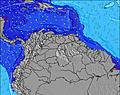 | 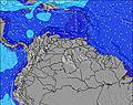 | 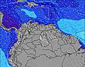 | 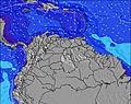 | 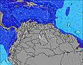 | 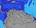 | ||||||||||||
Wave Height (m) Direction Period (s) | ENE 6 | ENE 7 | ENE 7 | ENE 7 | ENE 7 | ENE 7 | NE 6 | ENE 7 | ENE 6 | ENE 7 | ENE 7 | ENE 7 | ENE 7 | ENE 7 | ENE 7 | ENE 7 | ENE 6 | ENE 6 | ENE 6 |
Wave Graph | |||||||||||||||||||
57 | 154 | 159 | 168 | 154 | 123 | 123 | 134 | 103 | 165 | 186 | 175 | 198 | 271 | 186 | 107 | 117 | 100 | 85 | |
Wind (km/h) | |||||||||||||||||||
Wind State on-shore cross-onshore cross-shore cross-offshore off-shore glassy | cross-off | cross | cross | cross-off | cross | cross | cross-off | cross | cross | cross-off | cross | cross | cross | cross | cross | cross-off | cross | cross | cross-off |
High Tide | 3:01AM0.26m | 5:32PM0.29m | 3:13AM0.20m | 6:10PM0.33m | 6:54PM0.36m | 8:43AM0.11m | 7:42PM0.39m | 8:32PM0.42m | 9:23PM0.45m | ||||||||||
Low Tide | 10:01PM0.22m | 10:06AM0.15m | 00:05AM0.20m | 10:06AM0.14m | 10:13AM0.12m | 5:10AM0.09m | 5:41AM0.05m | 6:16AM0.01m | |||||||||||
— | 6:15 | — | — | 6:16 | — | — | 6:16 | — | — | 6:16 | — | — | 6:16 | — | — | 6:16 | — | — | |
6:50 | — | 6:50 | — | — | 6:49 | — | — | 6:49 | — | — | 6:49 | — | — | 6:47 | — | — | 6:47 | — | |
mm | 1 | — | 3 | 3 | 2 | 2 | 1 | — | 1 | 3 | — | 1 | 1 | — | — | — | — | — | 6 |
Temp °C | 26 | 29 | 29 | 26 | 30 | 29 | 26 | 30 | 30 | 26 | 29 | 28 | 27 | 29 | 30 | 26 | 29 | 30 | 26 |
Feels °C | 29 | 31 | 32 | 29 | 33 | 32 | 29 | 31 | 32 | 29 | 30 | 31 | 29 | 30 | 30 | 28 | 30 | 30 | 29 |
Swell 1 Height (m) Direction Period (s) | ENE 6 | — | ENE 7 | ENE 7 | ENE 7 | — | NE 6 | — | ENE 6 | ENE 7 | — | E 10 | ENE 7 | — | — | N 10 | NNE 8 | NNE 9 | — |
57 | — | 159 | 168 | 154 | — | 123 | — | 103 | 165 | — | 2 | 198 | — | — | 2 | 7 | 8 | — | |
Swell 2 Height (m) Direction Period (s) | ENE 8 | — | — | — | — | — | — | — | — | — | — | — | — | — | — | N 10 | — | — | — |
7 | — | — | — | — | — | — | — | — | — | — | — | — | — | — | 2 | — | — | — | |
Swell 3 Height (m) Direction Period (s) | — | — | — | — | — | — | — | — | — | — | — | — | — | — | — | — | — | — | — |
— | — | — | — | — | — | — | — | — | — | — | — | — | — | — | — | — | — | — | |
Wind waves Height (m) Direction Period (s) | — | ENE 7 | — | — | — | ENE 7 | — | ENE 7 | — | — | ENE 7 | ENE 7 | — | ENE 7 | ENE 7 | ENE 7 | ENE 6 | ENE 6 | ENE 6 |
— | 154 | — | — | — | 123 | — | 134 | — | — | 186 | 175 | — | 271 | 186 | 107 | 117 | 100 | 85 | |
Nearest Offshore or Glassy | |||||||||||||||||||
Distance (km) | 0 | 29 | 1 | 0 | 1 | 1 | 0 | 29 | 1 | 0 | 29 | 29 | 1 | 29 | 29 | 0 | 29 | 29 | 0 |
Best forecast wave conditions in Caracas | |||||||||||||||||||
Best forecast wave conditions in Venezuela | |||||||||||||||||||
Header Global | |||||||||||||||||||
- Map Icons:
 Break
Break Live Wave Height (m)
 Live Wind Speed (km/h)
 Surf Rating (10 Max)
 Ocean Swells (m)
- Wind Speed (km/h)
Latest Updates


FREE! Surf-Forecast.com widget for your website
The surf report / weather widget below is available to embed on third party websites free of charge and provides a summary of our Playa Pantaleta surf forecast. Simply grab the html code snippet that we provide and paste it into your own site. You can choose your preferred language and metric/imperial units for the surf forecast feed to suit users of your site. Click here to get the code.
Information about the Playa Pantaleta Surf forecast
The above surf forecast table for Playa Pantaleta provides essential information for determining whether the surfing conditions will be good over the next 16 days. A general guide to surfing at Playa Pantaleta can be found by selecting the local surf guide option on the grey menu. Our Playa Pantaleta surf forecast is unique since it includes wave energy (power) that defines the real feel of the surf rather than just the height or the period. If you surf the same spot (Playa Pantaleta) regularly then make a mental note of the wave energy from the surf forecast table each time you go. Very soon you may start to choose your surf days based on the wave energy alone combined with our forecast of favourable offshore wind conditions. Our star ratings will help here and of course you will also find the usual wave height and period predictions on our surf forecasts as well as a full break down of the swell components under our advanced users option (to reveal that, click the little Einstein character under the tide times).
Further information to help with frequently asked questions about our surf forecast for Playa Pantaleta may be found under the help tab on the top menu and also by moving your mouse over the question marks on the surf forecast table itself. Please always bear in mind that the forecast is for near-shore open water and local factors at each surf break influence the actual breaking wave height, such as the beach / reef profile, water depths offshore and shelter.
Playa Pantaleta is 13 km (8 miles) from the city of Caraballeda. If you plan a holiday in Caracas, look for hotels and other accommodation in Caraballeda. Caraballeda has rooms for a wide range of budgets as well as car hire and transport links.
 Nearest