

Surf Forecasts:

Playa Blanca surf forecast from 3 Aug 2026:
- Best quality surf: Thursday 6 Aug, 7AM (local time) - 4.5ft (1.4m), 12s period, SW swell with glassy winds.
- Most powerful swell: Thursday 6 Aug, 4PM (local time) - 5ft (1.6m), 16s period, SW swell with 1,215 kJ wave energy.
- Next surfable swell (1★+): Monday 3 Aug, 7AM (local time) - 4ft (1.2m), 7s period with S swell.
Best Forecast Surf Conditions for Playa Blanca this week:
The surf forecast for Playa Blanca over the next 16 days: The first swell (rated 1 star or higher) is forecast to arrive on Monday (Aug 03) at 7AM. The primary swell is predicted to be 1.2m and 7s period with a secondary swell of 0.6m and 9s. The wind is predicted to be glassy as the swell arrives.
The most powerful waves expected at Playa Blanca in the next 16 days are 1.6m 16s and forecast to arrive on Thursday (Aug 06) at 4PM. Winds are predicted to be cross-onshore at the time the swell arrives.
| Wave Type | Time (-05) & Date | Wave Height & Period |
|---|---|---|
| Next good surf (1 star+) | 7AM (Mon 3rd Aug) | 4ft (1.2m) 7s |
| Best Surf | 7AM (Thu 6th Aug) | 4.5ft (1.4m) 12s |
| Most Powerful | 4PM (Thu 6th Aug) | 5ft (1.6m) 16s |
Table - best surf conditions forecast for Playa Blanca over the next 16 days.
The Lowdown
Right, folks, Rusty here. Let’s have a look at what’s cookin’ for Playa Blanca. It’s a bit of a quiet period ahead, so don’t get your hopes up for anything epic. This is a beginner-friendly spot and it’s consistent, but the quality is gonna be a struggle for the next two weeks. The water’s sitting about average for the time of year, so no wild surprises there.
The first day we see any sort of rideable waves is Monday the 3rd, but honestly, it’s a tough start. Monday morning you’ve got a 4ft swell from the SSW with a short 8-second period, weak energy, and the wind is onshore. It’s a marginal surf forecast, so it’s gonna be bumpy and unruly. Monday afternoon is even worse with poor surf conditions. That sets the tone for the whole outlook.
Tuesday the 4th is a little better with a 4ft swell from the SW, but the period jumps to 12 seconds, giving it a bit more shape. The energy is moderate, but the wind is cross-onshore, so expect some ripples. Still, it’s a marginal day. The whole week through Saturday the 8th is a procession of light onshore and cross-onshore winds, with swell hanging around 4ft to 5ft and periods between 8 and 14 seconds. Nothing stands out. The combined energy peaks a bit on Thursday afternoon the 6th with a 5ft swell, but that’s cross-onshore and fairly choppy. Not a good look for a paddle surf.
The real standouts in this whole 16-day window are on Tuesday the 11th and Wednesday the 12th. Tuesday morning the 11th has a 6ft swell from the SSW with a solid 12-second period and strong energy. The wind is onshore, which is a bummer, but the size is there. That afternoon the swell drops to 6ft but still has good energy. However, it’s cross-onshore, so it’s not clean. Wednesday morning the 12th is a bit smaller at 5ft with moderate energy, but the wind is still onshore.
If I had to pick the best of a mediocre bunch, I’d lean towards Tuesday the 11th morning. The swell is the biggest of the period at 6ft, and it’s got that 12-second period which means reasonable power. But the wind is onshore, so it’s going to be bumpy. For a beginner spot, 6ft might be a bit much for some, but it’s not over 8ft, so it’s still in the game for those with a bit of experience. It’s the only time the swell really pushes past the 5ft mark for an extended period.
After the 12th, the swell fades. Thursday the 13th drops to 2ft in the morning with a very long 18-second period, but that’s just too small. The energy is moderate but the cross-onshore wind won’t help. The rest of the second week, from the 14th to the 18th, is a mix of 4ft to 5ft swells with periods from 12 to 16 seconds, all with onshore or cross-onshore winds. It’s consistent, but the quality is never there. The last day, Tuesday the 18th, has a 4ft swell with 12-second period and weak energy, with onshore wind. It’s a flat end to a flat outlook.
The bottom line: Playa Blanca is a consistent beginner wave, but for the next 16 days, the wind is never favorable. The best bet is Tuesday the 11th morning for the biggest swell, but expect chop. This setup looks more interesting for kite surfing than paddle surfing given the persistent onshore airflow. Don’t expect magic, and keep an eye on the forecasts because it tends not to stay poor for long.
Rusty.
Short Range ForecastMostly dry. Warm (max 21°C on Mon morning, min 18°C on Sun night). Wind will be generally light. | Days 4-6 Weather SummaryMostly dry. Warm (max 21°C on Thu morning, min 18°C on Wed night). Wind will be generally light. | ||||||||||||||||||||
Monday 3 | Tuesday 4 | Wednesday 5 | Thursday 6 | Friday 7 | Saturday 8 | Sunday 9 | |||||||||||||||
AM | PM | Night | AM | PM | Night | AM | PM | Night | AM | PM | Night | AM | PM | Night | AM | PM | Night | AM | PM | Night | |
Swell Height Map |  |  | 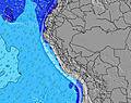 | 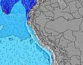 | 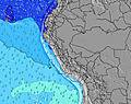 | 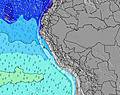 |  | ||||||||||||||
Wave Height (m) Direction Period (s) | SSW 8 | SSW 8 | SSW 8 | SW 12 | SW 12 | SW 12 | SW 13 | SW 12 | SSW 12 | SW 17 | SW 16 | SW 16 | SW 14 | SW 14 | SW 13 | SW 13 | SW 13 | S 8 | S 9 | S 9 | S 9 |
Wave Graph | |||||||||||||||||||||
207 | 183 | 207 | 336 | 456 | 494 | 466 | 437 | 647 | 493 | 1215 | 1170 | 825 | 736 | 444 | 369 | 277 | 245 | 355 | 363 | 529 | |
Wind (km/h) | |||||||||||||||||||||
Wind State on-shore cross-onshore cross-shore cross-offshore off-shore glassy | on | on | glassy | cross-on | on | cross-on | cross-on | on | cross-on | on | cross-on | cross-on | on | cross-on | glassy | cross-on | on | on | cross-on | on | cross-on |
High Tide | 8:47AM0.79m | 9:36PM0.59m | 9:15AM0.73m | 10:37PM0.62m | 9:48AM0.66m | 11:47PM0.66m | 10:34AM0.59m | 1:05AM0.71m | 11:39AM0.53m | 2:20AM0.78m | 1:06PM0.48m | 3:24AM0.86m | 2:33PM0.48m | ||||||||
Low Tide | 3:32PM0.22m | 2:55AM0.34m | 4:03PM0.20m | 3:57AM0.40m | 4:42PM0.19m | 5:31AM0.45m | 5:34PM0.17m | 7:37AM0.44m | 6:40PM0.14m | 9:14AM0.39m | 7:49PM0.10m | 10:18AM0.33m | 8:54PM0.06m | ||||||||
6:24 | — | — | 6:24 | — | — | 6:24 | — | — | 6:24 | — | — | 6:24 | — | — | 6:22 | — | — | 6:22 | — | — | |
— | 5:59 | — | — | 6:00 | — | — | 6:00 | — | — | 6:00 | — | — | 6:00 | — | — | 6:00 | — | — | 6:00 | — | |
mm | — | — | — | — | — | — | — | — | — | — | — | — | — | — | — | — | — | — | — | — | — |
Temp °C | 21 | 20 | 19 | 21 | 21 | 18 | 21 | 20 | 19 | 21 | 20 | 19 | 21 | 20 | 18 | 21 | 20 | 18 | 21 | 20 | 18 |
Feels °C | 20 | 20 | 20 | 21 | 21 | 19 | 21 | 20 | 20 | 21 | 19 | 19 | 21 | 20 | 19 | 21 | 20 | 19 | 22 | 20 | 19 |
Swell 1 Height (m) Direction Period (s) | SSW 8 | SSW 8 | SSW 8 | SSW 8 | SW 12 | SW 12 | SW 13 | SW 12 | SSW 12 | SW 12 | SW 16 | SW 16 | SW 14 | SW 14 | S 8 | S 8 | S 8 | S 8 | S 9 | S 9 | S 9 |
207 | 183 | 207 | 173 | 456 | 494 | 466 | 437 | 647 | 361 | 1215 | 1170 | 825 | 736 | 186 | 257 | 277 | 245 | 355 | 363 | 529 | |
Swell 2 Height (m) Direction Period (s) | SSW 12 | SSW 11 | SW 13 | SW 12 | S 8 | S 7 | S 7 | SSW 7 | SW 18 | SW 17 | S 8 | S 8 | S 7 | S 8 | SW 13 | SW 13 | SW 13 | SW 12 | SW 15 | SW 15 | SW 14 |
109 | 135 | 144 | 336 | 177 | 112 | 77 | 89 | 199 | 493 | 82 | 76 | 88 | 124 | 444 | 369 | 269 | 167 | 137 | 209 | 162 | |
Swell 3 Height (m) Direction Period (s) | WSW 13 | WSW 12 | S 11 | W 13 | SW 20 | SW 20 | SW 19 | SW 19 | S 11 | S 7 | W 10 | SSW 9 | NW 10 | NW 11 | SW 19 | SW 18 | SW 18 | SW 16 | SW 12 | SSW 11 | SW 19 |
108 | 98 | 63 | 3 | 15 | 16 | 58 | 131 | 9 | 68 | 2 | 16 | 4 | 4 | 15 | 50 | 48 | 93 | 67 | 12 | 133 | |
Wind waves Height (m) Direction Period (s) | — | — | — | — | — | — | — | — | — | — | — | — | — | — | — | — | — | — | — | — | — |
— | — | — | — | — | — | — | — | — | — | — | — | — | — | — | — | — | — | — | — | — | |
Nearest Offshore or Glassy | |||||||||||||||||||||
Distance (km) | 21 | 21 | 0 | 21 | 21 | 9 | 21 | 21 | 21 | 21 | 21 | 9 | 21 | 21 | 0 | 80 | 21 | 9 | 21 | 21 | 12 |
Best forecast wave conditions in Lima | |||||||||||||||||||||
Best forecast wave conditions in Peru | |||||||||||||||||||||
Header Global | |||||||||||||||||||||
- Map Icons:
 Break
Break Live Wave Height (m)
 Live Wind Speed (km/h)
 Surf Rating (10 Max)
 Ocean Swells (m)
- Wind Speed (km/h)
Latest Updates


FREE! Surf-Forecast.com widget for your website
The surf report / weather widget below is available to embed on third party websites free of charge and provides a summary of our Playa Blanca surf forecast. Simply grab the html code snippet that we provide and paste it into your own site. You can choose your preferred language and metric/imperial units for the surf forecast feed to suit users of your site. Click here to get the code.
Information about the Playa Blanca Surf forecast
The above surf forecast table for Playa Blanca provides essential information for determining whether the surfing conditions will be good over the next 16 days. A general guide to surfing at Playa Blanca can be found by selecting the local surf guide option on the grey menu. Our Playa Blanca surf forecast is unique since it includes wave energy (power) that defines the real feel of the surf rather than just the height or the period. If you surf the same spot (Playa Blanca) regularly then make a mental note of the wave energy from the surf forecast table each time you go. Very soon you may start to choose your surf days based on the wave energy alone combined with our forecast of favourable offshore wind conditions. Our star ratings will help here and of course you will also find the usual wave height and period predictions on our surf forecasts as well as a full break down of the swell components under our advanced users option (to reveal that, click the little Einstein character under the tide times).
Further information to help with frequently asked questions about our surf forecast for Playa Blanca may be found under the help tab on the top menu and also by moving your mouse over the question marks on the surf forecast table itself. Please always bear in mind that the forecast is for near-shore open water and local factors at each surf break influence the actual breaking wave height, such as the beach / reef profile, water depths offshore and shelter.
Playa Blanca is 12 km (7 miles) from Mala. If you plan a holiday in Lima, look for hotels and other accommodation in Mala. Mala has rooms for a wide range of budgets as well as car hire and transport links.
 Nearest