

Surf Forecasts:

How big are the waves at Petacalco today (20 Jun):
- Afternoon surf: Afternoon surf (20 Jun, local time) - 4.5ft (1.4m), 15s period with SW swell.
- Evening surf: Evening surf (20 Jun, local time) - 4.5ft (1.4m), 15s period with SW swell.
The current surf forecast for Petacalco at 9PM is: 1.4m 15s primary swell from a Southwest direction and 0.9m 13s secondary swell from a South direction (forecast issued at 05:00pm June 20). The wind direction is predicted to be glassy and the swell rating is 4.
| Time (CST) & Date | Wave Height | Wave Period |
|---|---|---|
| Morning (20 Jun) | - | - |
| Afternoon (20 Jun) | 4.5ft (1.4m) | 15s |
| Evening (20 Jun) | 4.5ft (1.4m) | 15s |
Table - waves today at Petacalco. (Swell directed towards the surf break)
Updates in hr min s Forecast update imminent
Short Range ForecastLight rain (total 5mm), mostly falling on Sat afternoon. Warm (max 31°C on Mon morning, min 25°C on Sat night). Wind will be generally light. | ||||||||||||||||||||||||
Sat 20 | Sunday 21 | Monday 22 | Tue 23 | |||||||||||||||||||||
3 PM | 6 PM | 9 PM | 12 AM | 3 AM | 6 AM | 9 AM | 12 PM | 3 PM | 6 PM | 9 PM | 12 AM | 3 AM | 6 AM | 9 AM | 12 PM | 3 PM | 6 PM | 9 PM | 12 AM | 3 AM | 6 AM | 9 AM | 12 PM | |
Swell Height Map |  |  |  |  |  |  |  |  | 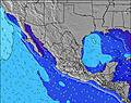 | |||||||||||||||
Wave Height (m) Direction Period (s) | SW 15 | SW 15 | SW 15 | SW 14 | SW 14 | SW 14 | SW 14 | SW 18 | SW 18 | SW 18 | SW 14 | SW 17 | SSW 16 | SW 16 | SW 16 | SW 16 | SW 16 | SW 16 | SSW 16 | SSW 19 | SSW 19 | SW 15 | SSW 18 | SSW 18 |
Wave Graph | ||||||||||||||||||||||||
868 | 844 | 844 | 763 | 763 | 676 | 676 | 719 | 614 | 485 | 363 | 347 | 452 | 508 | 595 | 595 | 1044 | 917 | 822 | 758 | 687 | 623 | 603 | 1561 | |
Wind (km/h) | ||||||||||||||||||||||||
Wind State on-shore cross-onshore cross-shore cross-offshore off-shore glassy | glassy | on | glassy | glassy | cross-off | cross-off | glassy | cross-on | cross-on | cross-on | glassy | glassy | cross-off | cross-off | cross | cross-on | cross-on | cross-on | glassy | glassy | glassy | glassy | glassy | cross-on |
High Tide | 6:39PM0.67m | 7:43AM0.56m | 7:08PM0.64m | 8:39AM0.62m | 7:31PM0.60m | 9:26AM0.66m | ||||||||||||||||||
Low Tide | 1:22AM0.26m | 12:58PM0.36m | 1:47AM0.21m | 1:58PM0.40m | 2:11AM0.17m | |||||||||||||||||||
— | — | — | — | — | 6:13 | — | — | — | — | — | — | — | 6:13 | — | — | — | — | — | — | — | 6:13 | — | — | |
— | 7:25 | — | — | — | — | — | — | — | 7:25 | — | — | — | — | — | — | — | 7:25 | — | — | — | — | — | 7:25 | |
mm | 2 | 1 | 1 | — | — | 1 | — | — | — | — | — | — | — | — | — | — | — | — | — | — | — | — | — | — |
Temp °C | 27 | 27 | 26 | 26 | 25 | 25 | 27 | 30 | 30 | 29 | 28 | 27 | 26 | 26 | 29 | 31 | 30 | 30 | 28 | 28 | 27 | 27 | 29 | 31 |
Feels °C | 32 | 31 | 31 | 30 | 29 | 29 | 31 | 32 | 32 | 31 | 33 | 31 | 29 | 29 | 33 | 33 | 32 | 33 | 33 | 34 | 32 | 32 | 34 | 34 |
Swell 1 Height (m) Direction Period (s) | SW 15 | SW 15 | SW 15 | SW 14 | SW 14 | SW 14 | SW 14 | SW 14 | SW 14 | SW 14 | SW 14 | SW 13 | SW 13 | SW 16 | SW 16 | SW 16 | SW 16 | SW 16 | SSW 16 | SSW 19 | SW 15 | SW 15 | SW 14 | SSW 18 |
868 | 844 | 844 | 763 | 763 | 676 | 676 | 521 | 507 | 485 | 363 | 347 | 342 | 508 | 595 | 595 | 1044 | 917 | 822 | 758 | 543 | 623 | 536 | 1561 | |
Swell 2 Height (m) Direction Period (s) | S 13 | S 13 | S 13 | S 12 | S 12 | S 12 | SSW 18 | SW 18 | SW 18 | SW 18 | SW 18 | SW 17 | SSW 16 | SW 13 | SW 13 | SW 13 | SSW 20 | SSW 20 | SSW 20 | SSW 15 | SSW 19 | SSW 18 | SSW 18 | S 10 |
276 | 345 | 263 | 243 | 187 | 184 | 547 | 719 | 614 | 455 | 312 | 334 | 452 | 347 | 347 | 347 | 227 | 336 | 336 | 377 | 687 | 537 | 603 | 50 | |
Swell 3 Height (m) Direction Period (s) | SW 19 | SW 20 | SW 20 | SSW 19 | SSW 19 | SW 18 | S 12 | S 12 | S 12 | S 12 | S 12 | S 11 | S 11 | S 11 | S 11 | S 11 | S 11 | S 11 | SW 12 | SW 12 | SSE 10 | S 10 | S 10 | W 18 |
384 | 306 | 186 | 148 | 143 | 323 | 184 | 180 | 180 | 137 | 132 | 123 | 119 | 86 | 86 | 61 | 61 | 59 | 114 | 116 | 35 | 51 | 51 | 6 | |
Wind waves Height (m) Direction Period (s) | — | — | — | — | — | — | — | — | — | — | — | — | — | — | — | — | SSW 6 | — | — | — | — | — | — | — |
— | — | — | — | — | — | — | — | — | — | — | — | — | — | — | — | 12 | — | — | — | — | — | — | — | |
Nearest Offshore or Glassy | ||||||||||||||||||||||||
Distance (km) | 21 | 44 | 21 | 21 | 21 | 21 | 21 | 128 | 78 | 79 | 21 | 21 | 21 | 21 | 21 | 471 | 451 | 444 | 21 | 21 | 21 | 21 | 21 | 473 |
Best forecast wave conditions in Guerrero | ||||||||||||||||||||||||
Best forecast wave conditions in Mexico | ||||||||||||||||||||||||
Header Global | ||||||||||||||||||||||||
- Map Icons:
 Break
Break Live Wave Height (m)
 Live Wind Speed (km/h)
 Surf Rating (10 Max)
 Ocean Swells (m)
- Wind Speed (km/h)


FREE! Surf-Forecast.com widget for your website
The surf report / weather widget below is available to embed on third party websites free of charge and provides a summary of our Petacalco surf forecast. Simply grab the html code snippet that we provide and paste it into your own site. You can choose your preferred language and metric/imperial units for the surf forecast feed to suit users of your site. Click here to get the code.
 Nearest