

Surf Forecasts:

Maravi surf forecast from 2 Aug 2026:
- Most powerful swell: Thursday 6 Aug, 6PM (local time) - 2.5ft (0.8m), 7s period, WNW swell with 50 kJ wave energy.
Best Forecast Surf Conditions for Maravi this week:
The most powerful waves expected at Maravi in the next 16 days are 0.8m 7s and forecast to arrive on Thursday (Aug 06) at 6PM. Winds are predicted to be cross-onshore at the time the swell arrives. The largest open ocean swell (not directed at the beach) is 0.4m 4s period and expected on Monday (Aug 03) at 9AM.
| Wave Type | Time (IDT) & Date | Wave Height & Period |
|---|---|---|
| Next good surf (1 star+) | - | - |
| Best Surf | - | - |
| Most Powerful | 6PM (Thu 6th Aug) | 2.5ft (0.8m) 7s |
Table - best surf conditions forecast for Maravi over the next 16 days.
The Lowdown
Alright crew, Rusty here. Let’s cut to the chase – the next couple of weeks are looking pretty bleak for Maravi. There’s a huge gap of flat or near-flat conditions before we finally see a pulse of swell.
We’re talking a long, dry spell from now all the way through to the morning of the 14th of August. The surf is just plain poor. Tiny waves, short periods, and mostly messy wind. The water temp is sitting at 84°, which is a touch warmer than normal for this time of year, so it’s not gonna be cold, but you’ll be bobbing around waiting for a wave that never comes.
The first real hope comes on the morning of Friday the 14th of August. The swell picks up to 4ft from the WNW, with a period of 7 seconds. The combined energy hits 135, which is a moderate pulse. The wind is a clean cross-offshore from the SSW, so it’s going to be clean. It’s not a classic, but it’s the first rideable wave we’ve seen in two weeks.
The one to really circle on the calendar is the morning of Saturday the 15th of August. The swell bumps up to 5ft from the WNW, period at 8 seconds, and the energy jumps to 353 – that’s a solid, punchy swell. The wind is a gentle cross-shore from the SW, so it’ll be a little textured but not choppy. This is the best session on offer. At 5ft, it’s pushing into the zone where beginners might want to sit it out, but for everyone else, it’s time to go. Maravi is fairly exposed, and with the swell coming from the optimum SW direction, it should line up nicely. The crowds are listed as “sometimes,” so you might have a few guys out, but it won’t be packed.
The energy drops off fast after that. By Sunday morning the 16th, the swell is back to 4-5ft with energy down to 250, and the wind turns onshore in the afternoon, so get your waves early.
So, here’s the deal: you’ve got a massive gap of no surf until the 14th, then a couple of days of genuine fun waves. The 15th of August is the one to aim for. It’s not going to be a classic, but it’s the best we’ve got.
Rusty.
Short Range ForecastMostly dry. Warm (max 29°C on Sun night, min 26°C on Mon night). Wind will be generally light. | Days 5-7 Weather SummaryMostly dry. Warm (max 29°C on Fri afternoon, min 25°C on Wed night). Wind will be generally light. | ||||||||||||||||||
Monday 3 | Tuesday 4 | Wednesday 5 | Thursday 6 | Friday 7 | Saturday 8 | ||||||||||||||
Night | AM | PM | Night | AM | PM | Night | AM | PM | Night | AM | PM | Night | AM | PM | Night | AM | PM | Night | |
Swell Height Map | 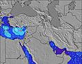 | 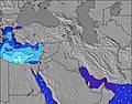 | 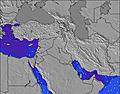 | 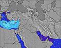 | 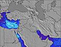 | 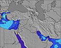 | 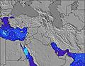 | ||||||||||||
Wave Height (m) Direction Period (s) | NW 6 | WNW 6 | NW 5 | NW 4 | NW 5 | NW 5 | NW 6 | WNW 6 | WNW 7 | WNW 6 | WNW 6 | WNW 6 | WNW 6 | WNW 6 | WNW 6 | WNW 6 | WNW 7 | WNW 7 | WNW 6 |
Wave Graph | |||||||||||||||||||
13 | 7 | 13 | 8 | 12 | 23 | 38 | 35 | 40 | 37 | 31 | 44 | 33 | 23 | 18 | 15 | 42 | 48 | 35 | |
Wind (km/h) | |||||||||||||||||||
Wind State on-shore cross-onshore cross-shore cross-offshore off-shore glassy | cross-on | cross-on | on | cross-on | glassy | on | glassy | cross | on | cross | cross | cross-on | cross | cross | cross-on | cross | cross | cross-on | cross |
High Tide | 1:25AM0.34m | 1:29PM0.34m | 1:58AM0.33m | 2:07PM0.30m | 2:39AM0.32m | 2:56PM0.26m | 3:35AM0.30m | 4:24PM0.22m | 5:10AM0.29m | 7:18PM0.22m | 7:09AM0.30m | 8:52PM0.25m | |||||||
Low Tide | 7:25AM0.07m | 7:43PM0.06m | 8:06AM0.09m | 8:15PM0.09m | 9:00AM0.11m | 8:55PM0.12m | 10:27AM0.13m | 10:02PM0.15m | 12:49PM0.13m | 00:21AM0.17m | 2:27PM0.09m | 2:08AM0.15m | |||||||
— | 5:56 | — | — | 5:56 | — | — | 5:58 | — | — | 5:58 | — | — | 5:58 | — | — | 6:00 | — | — | |
7:37 | — | 7:37 | — | — | 7:36 | — | — | 7:35 | — | — | 7:34 | — | — | 7:32 | — | — | 7:31 | — | |
mm | — | — | — | — | — | — | — | — | — | — | — | — | — | — | — | — | — | — | — |
Temp °C | 29 | 29 | 29 | 28 | 28 | 28 | 27 | 28 | 28 | 27 | 28 | 28 | 28 | 28 | 29 | 27 | 28 | 28 | 28 |
Feels °C | 29 | 30 | 27 | 28 | 28 | 28 | 29 | 30 | 29 | 30 | 29 | 28 | 30 | 28 | 29 | 29 | 29 | 29 | 31 |
Swell 1 Height (m) Direction Period (s) | NW 6 | NW 4 | — | WNW 5 | NW 5 | — | NW 6 | WNW 6 | WNW 7 | WNW 6 | WNW 6 | — | WNW 6 | WNW 6 | — | WNW 6 | WNW 7 | WNW 7 | WNW 6 |
10 | 6 | — | 3 | 12 | — | 38 | 35 | 40 | 37 | 31 | — | 33 | 23 | — | 15 | 42 | 48 | 35 | |
Swell 2 Height (m) Direction Period (s) | — | NNE 4 | — | WNW 5 | — | — | — | — | — | — | — | — | — | — | — | WNW 8 | — | — | — |
— | 5 | — | 5 | — | — | — | — | — | — | — | — | — | — | — | 12 | — | — | — | |
Swell 3 Height (m) Direction Period (s) | — | WNW 6 | — | — | — | — | — | — | — | — | — | — | — | — | — | — | — | — | — |
— | 7 | — | — | — | — | — | — | — | — | — | — | — | — | — | — | — | — | — | |
Wind waves Height (m) Direction Period (s) | NNW 4 | — | NW 5 | NW 4 | — | NW 5 | — | — | — | — | — | WNW 6 | — | — | WNW 6 | — | — | — | — |
13 | — | 13 | 8 | — | 23 | — | — | — | — | — | 44 | — | — | 18 | — | — | — | — | |
Nearest Offshore or Glassy | |||||||||||||||||||
Distance (km) | 2224 | 2224 | 3620 | 2786 | 2224 | 2224 | 2224 | 2224 | 2224 | 325 | 2224 | 2224 | 935 | 2513 | 2224 | 2224 | 2224 | 2224 | 84 |
Best forecast wave conditions in Tel Aviv and South | |||||||||||||||||||
Best forecast wave conditions in Israel | |||||||||||||||||||
Header Global | |||||||||||||||||||
- Map Icons:
 Break
Break Live Wave Height (m)
 Live Wind Speed (km/h)
 Surf Rating (10 Max)
 Ocean Swells (m)
- Wind Speed (km/h)
Latest Updates


FREE! Surf-Forecast.com widget for your website
The surf report / weather widget below is available to embed on third party websites free of charge and provides a summary of our Maravi surf forecast. Simply grab the html code snippet that we provide and paste it into your own site. You can choose your preferred language and metric/imperial units for the surf forecast feed to suit users of your site. Click here to get the code.
Information about the Maravi Surf forecast
The above surf forecast table for Maravi provides essential information for determining whether the surfing conditions will be good over the next 16 days. A general guide to surfing at Maravi can be found by selecting the local surf guide option on the grey menu. Our Maravi surf forecast is unique since it includes wave energy (power) that defines the real feel of the surf rather than just the height or the period. If you surf the same spot (Maravi) regularly then make a mental note of the wave energy from the surf forecast table each time you go. Very soon you may start to choose your surf days based on the wave energy alone combined with our forecast of favourable offshore wind conditions. Our star ratings will help here and of course you will also find the usual wave height and period predictions on our surf forecasts as well as a full break down of the swell components under our advanced users option (to reveal that, click the little Einstein character under the tide times).
Further information to help with frequently asked questions about our surf forecast for Maravi may be found under the help tab on the top menu and also by moving your mouse over the question marks on the surf forecast table itself. Please always bear in mind that the forecast is for near-shore open water and local factors at each surf break influence the actual breaking wave height, such as the beach / reef profile, water depths offshore and shelter.
Maravi is 1 km (1 miles) from the city of Yafo. If you plan a holiday in Tel Aviv and South, look for hotels and other accommodation in Yafo. Yafo has rooms for a wide range of budgets as well as car hire and transport links.
 Nearest