

Surf Forecasts:

Los Naranjos surf forecast from 3 Aug 2026:
- Best quality surf: Friday 7 Aug, 10PM (local time) - 10ft (3.0m), 9s period, NE swell with cross-shore winds.
- Most powerful swell: Friday 7 Aug, 10PM (local time) - 10ft (3.0m), 9s period, NE swell with 1,411 kJ wave energy.
- Next surfable swell (1★+): Wednesday 5 Aug, 10AM (local time) - 6.5ft (2.0m), 8s period with NE swell.
Best Forecast Surf Conditions for Los Naranjos this week:
The surf forecast for Los Naranjos over the next 16 days: The first swell (rated 1 star or higher) is forecast to arrive on Wednesday (Aug 05) at 10AM. The primary swell is predicted to be 2.0m and 8s period. The wind is predicted to be glassy as the swell arrives.
The most powerful waves expected at Los Naranjos in the next 16 days are 3.0m 9s and forecast to arrive on Friday (Aug 07) at 10PM. Winds are predicted to be cross-shore at the time the swell arrives. The largest open ocean swell (not directed at the beach) is 2.5m 8s period and expected on Saturday (Aug 08) at 4AM.
| Wave Type | Time (-05) & Date | Wave Height & Period |
|---|---|---|
| Next good surf (1 star+) | 10AM (Wed 5th Aug) | 6.5ft (2.0m) 8s |
| Best Surf | 10PM (Fri 7th Aug) | 10ft (3.0m) 9s |
| Most Powerful | 10PM (Fri 7th Aug) | 10ft (3.0m) 9s |
Table - best surf conditions forecast for Los Naranjos over the next 16 days.
The Lowdown
Rusty here. Let’s talk about the waves coming up. We’ve got a bit of a slow start, but the first real chance to get wet is on Wednesday, August 5th. Then it’s a bit of a waiting game for the next good day.
The first real surf window opens on Wednesday, August 5th, in the morning. Los Naranjos (a sandbar/river setup) is looking at a 2.0m NE swell, with an 8-second period and moderate wave energy (545). The wind is glassy – dead calm – and that’s a big deal. The forecast says “expect very good surf conditions,” and with that clean surface, the waves will be perfect. The water temp is about average for this time of year, so no surprises. This is a beginner-friendly spot, but that 2.0m swell is on the upper edge for greenhorns. The NE swell matches the optimum direction, and the break is very consistent, so you’ll get plenty of waves. Just watch for crowds, because they’re possible.
The next standout is Monday, August 10th, in the morning. Again, Los Naranjos. The swell is holding at 2.0m from the NE, 8-second period, and moderate energy (532). The wind is glassy again – a light ENE breeze that’s making it “glassy.” This is a prime window. The surf will be clean and consistent. The afternoon gets a little cross-onshore, so mornings are the key.
After that, the swell gets big. For Wednesday, August 12th, and Thursday, August 13th, we’re looking at 3.0m NE swells with a 9-second period and very strong energy (1156 and 1541). The wind is onshore or cross-onshore, and the forecast straight-up says the swell is too big for this break – it’s expert-only. Saturday, August 15th is even worse, with a 3.5m NE swell and 10-second period (1962 energy). That’s a monster for a river-mouth sandbar, and with a moderate cross-onshore wind, it’s more of a kite-surfing show than a paddle session.
The rest of the second week, from August 14th to the 18th, is a mixed bag. You’ll see 2.0m to 2.5m swells, but most of the time the wind is cross-onshore, making it choppy. The energy is moderate to strong, but the quality just isn’t there.
So, the best on offer is Wednesday, August 5th, in the morning and Monday, August 10th, in the morning at Los Naranjos. Both have glassy winds and solid, consistent swell. The rest of the window is either too big, too windy, or just average. Get out there on those two mornings.
Rusty.
Short Range ForecastModerate rain (total 18mm), heaviest on Tue afternoon. Warm (max 30°C on Mon morning, min 26°C on Sun night). Wind will be generally light. | Days 4-6 Weather SummaryHeavy rain (total 25mm), heaviest during Fri afternoon. Warm (max 30°C on Fri morning, min 25°C on Thu afternoon). Wind will be generally light. | ||||||||||||||||||||
Monday 3 | Tuesday 4 | Wednesday 5 | Thursday 6 | Friday 7 | Saturday 8 | Sunday 9 | |||||||||||||||
AM | PM | Night | AM | PM | Night | AM | PM | Night | AM | PM | Night | AM | PM | Night | AM | PM | Night | AM | PM | Night | |
Swell Height Map | 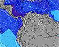 | 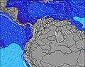 | 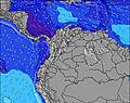 | 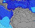 | 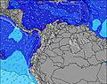 | 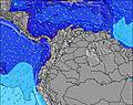 | 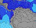 | ||||||||||||||
Wave Height (m) Direction Period (s) | NE 8 | NE 8 | NE 8 | NE 8 | NE 8 | NE 8 | NE 8 | NE 8 | NE 8 | NE 8 | NE 8 | NE 8 | NE 8 | NE 8 | NE 8 | NE 8 | NE 7 | NE 7 | NE 7 | NE 8 | NE 8 |
Wave Graph | |||||||||||||||||||||
560 | 446 | 567 | 493 | 457 | 678 | 545 | 371 | 544 | 406 | 333 | 639 | 560 | 542 | 836 | 682 | 537 | 0 | 429 | 300 | 682 | |
Wind (km/h) | |||||||||||||||||||||
Wind State on-shore cross-onshore cross-shore cross-offshore off-shore glassy | cross-on | cross-on | cross | cross-on | cross-on | cross-on | glassy | glassy | cross | cross-on | cross-off | cross | cross-on | cross-on | cross | cross-on | on | cross | cross-on | on | cross |
High Tide | 3:56PM0.25m | 2:02AM0.18m | 4:38PM0.29m | 3:11AM0.13m | 5:23PM0.33m | 4:38AM0.09m | 6:11PM0.36m | 6:00AM0.07m | 7:00PM0.39m | 7:10AM0.06m | 7:50PM0.41m | 8:11AM0.06m | 8:40PM0.42m | ||||||||
Low Tide | 8:31AM0.10m | 11:06PM0.17m | 8:47AM0.08m | 00:44AM0.12m | 9:14AM0.06m | 1:46AM0.08m | 9:53AM0.04m | 2:33AM0.05m | 10:42AM0.02m | 3:17AM0.02m | 11:35AM0.01m | 4:01AM0.01m | |||||||||
5:43 | — | — | 5:43 | — | — | 5:43 | — | — | 5:43 | — | — | 5:43 | — | — | 5:43 | — | — | 5:43 | — | — | |
— | 6:19 | — | — | 6:19 | — | — | 6:19 | — | — | 6:17 | — | — | 6:17 | — | — | 6:16 | — | — | 6:16 | — | |
mm | — | 2 | 2 | 1 | 4 | 2 | 2 | 5 | 3 | 2 | 8 | 1 | — | 9 | 1 | — | 1 | — | — | 4 | 3 |
Temp °C | 30 | 29 | 27 | 29 | 29 | 27 | 28 | 28 | 26 | 29 | 26 | 26 | 30 | 29 | 27 | 30 | 29 | 27 | 29 | 30 | 27 |
Feels °C | 33 | 33 | 30 | 33 | 33 | 30 | 33 | 34 | 28 | 32 | 29 | 28 | 33 | 32 | 29 | 32 | 32 | 29 | 33 | 34 | 29 |
Swell 1 Height (m) Direction Period (s) | — | — | — | — | — | — | NE 8 | — | — | — | NE 8 | — | — | — | — | — | — | — | — | — | — |
— | — | — | — | — | — | 545 | — | — | — | 333 | — | — | — | — | — | — | — | — | — | — | |
Swell 2 Height (m) Direction Period (s) | — | — | — | — | — | — | — | — | — | — | — | — | — | — | — | — | — | — | — | — | — |
— | — | — | — | — | — | — | — | — | — | — | — | — | — | — | — | — | — | — | — | — | |
Swell 3 Height (m) Direction Period (s) | — | — | — | — | — | — | — | — | — | — | — | — | — | — | — | — | — | — | — | — | — |
— | — | — | — | — | — | — | — | — | — | — | — | — | — | — | — | — | — | — | — | — | |
Wind waves Height (m) Direction Period (s) | NE 8 | NE 8 | NE 8 | NE 8 | NE 8 | NE 8 | — | NE 8 | NE 8 | NE 8 | — | NE 8 | NE 8 | NE 8 | NE 8 | NE 8 | NE 7 | NE 7 | NE 7 | NE 8 | NE 8 |
560 | 446 | 567 | 493 | 457 | 678 | — | 371 | 544 | 406 | — | 639 | 560 | 542 | 836 | 682 | 537 | 569 | 429 | 300 | 682 | |
Nearest Offshore or Glassy | |||||||||||||||||||||
Distance (km) | 159 | 621 | 116 | 114 | 6 | 114 | 0 | 0 | 114 | 114 | 0 | 6 | 26 | 658 | 663 | 116 | 632 | 664 | 159 | 21 | 14 |
Best forecast wave conditions in Caribbean Coast | |||||||||||||||||||||
Best forecast wave conditions in Colombia | |||||||||||||||||||||
Header Global | |||||||||||||||||||||
- Map Icons:
 Break
Break Live Wave Height (m)
 Live Wind Speed (km/h)
 Surf Rating (10 Max)
 Ocean Swells (m)
- Wind Speed (km/h)
Latest Updates


FREE! Surf-Forecast.com widget for your website
The surf report / weather widget below is available to embed on third party websites free of charge and provides a summary of our Los Naranjos surf forecast. Simply grab the html code snippet that we provide and paste it into your own site. You can choose your preferred language and metric/imperial units for the surf forecast feed to suit users of your site. Click here to get the code.
Information about the Los Naranjos Surf forecast
The above surf forecast table for Los Naranjos provides essential information for determining whether the surfing conditions will be good over the next 16 days. A general guide to surfing at Los Naranjos can be found by selecting the local surf guide option on the grey menu. Our Los Naranjos surf forecast is unique since it includes wave energy (power) that defines the real feel of the surf rather than just the height or the period. If you surf the same spot (Los Naranjos) regularly then make a mental note of the wave energy from the surf forecast table each time you go. Very soon you may start to choose your surf days based on the wave energy alone combined with our forecast of favourable offshore wind conditions. Our star ratings will help here and of course you will also find the usual wave height and period predictions on our surf forecasts as well as a full break down of the swell components under our advanced users option (to reveal that, click the little Einstein character under the tide times).
Further information to help with frequently asked questions about our surf forecast for Los Naranjos may be found under the help tab on the top menu and also by moving your mouse over the question marks on the surf forecast table itself. Please always bear in mind that the forecast is for near-shore open water and local factors at each surf break influence the actual breaking wave height, such as the beach / reef profile, water depths offshore and shelter.
Los Naranjos is 29 km (18 miles) from the city of Santa Marta. If you plan a holiday in Caribbean Coast, look for hotels and other accommodation in Santa Marta. Santa Marta has rooms for a wide range of budgets as well as car hire and transport links.
 Nearest