

Surf Forecasts:

Laniakea surf forecast from 13 Jul 2026:
- Best quality surf: Monday 13 Jul, 1AM (local time) - 3.5ft (1.0m), 13s period, SSW swell with cross-offshore winds.
- Most powerful swell: Sunday 19 Jul, 1AM (local time) - 5.5ft (1.7m), 12s period, SSW swell with 835 kJ wave energy.
- Next surfable swell (1★+): Monday 13 Jul, 1AM (local time) - 3.5ft (1.0m), 13s period with SSW swell.
Best Forecast Surf Conditions for Laniakea this week:
The surf forecast for Laniakea over the next 16 days: The first swell (rated 1 star or higher) is forecast to arrive on Monday (Jul 13) at 1AM. The primary swell is predicted to be 1.0m and 13s period with a secondary swell of 0.7m and 9s. The wind is predicted to be cross-offshore as the swell arrives.
The most powerful waves expected at Laniakea in the next 16 days are 1.7m 12s and forecast to arrive on Sunday (Jul 19) at 1AM. Winds are predicted to be cross-shore at the time the swell arrives.
| Wave Type | Time (-05) & Date | Wave Height & Period |
|---|---|---|
| Next good surf (1 star+) | 1AM (Mon 13th Jul) | 3.5ft (1.0m) 13s |
| Best Surf | 1AM (Mon 13th Jul) | 3.5ft (1.0m) 13s |
| Most Powerful | 1AM (Sun 19th Jul) | 5.5ft (1.7m) 12s |
Table - best surf conditions forecast for Laniakea over the next 16 days.
Alright folks, Rusty here. Let’s get into it.
We’ve got a bit of a run ahead, but don’t get your hopes up too high. The next 16 days are looking pretty marginal for Laniakea. The water is sitting at 69°F which is much warmer than normal for this time of year, so at least you won’t need a thick suit.
The first real surf we can talk about kicks off on Sunday, July 12th. It’s not a classic. Swell is coming in from the SSW at 4ft with a period of 13 seconds, which is decent groundswell, but the wind is a cross-on from the south at 9 mph, making it fairly choppy. The combined energy is moderate at 583. It’s a “gentle cross-onshore and fairly choppy” kind of day, and the score is low. It’s surfable, but it’s not going to be pretty.
Monday, July 13th through to Saturday, July 18th is pretty much the same story. Swell heights bounce between 3ft and 5ft, mostly from the SSW or SW, with periods between 12 and 15 seconds. The wind is persistently cross or cross-on from the south, keeping a bit of chop on the surface. The best of this bunch is probably Thursday, July 16th morning, with a 5ft SSW swell and 13-second period, but the wind is still cross-on. The energy is moderate (802). It’s not a standout, just the least ugly of the lot.
We hit a real dry spell from Sunday, July 19th through to Thursday, July 23rd. Swell drops off hard, with heights down to 2ft to 3ft. The energy falls into the 200s, which is weak. Conditions are mostly poor, with a few “marginal” tags. Honestly, this is a stretch to leave the board in the car.
Then, things start to look a little more interesting around Friday, July 24th. The swell picks back up to 3ft to 5ft, with a longer 14-second period, and the energy jumps to 501-795. Still, the wind is cross or cross-on, so it’s not clean.
The real standout, and the only one worth getting excited about, is Saturday, July 25th. This is the best on offer across the whole 16 days. We’ve got a 6ft SSW swell with a 14-second period, and the combined energy jumps to a strong 1221. The wind swings around to the WSW at 3-6 mph, going onshore. It’s a shame the wind is on it, because the swell size and period are the best we’ve seen. If you’re an expert, it’s worth a look, but the onshore wind will make it a bit lumpy. After that, the swell backs off again into the following week.
So, bottom line: the pick of the litter is Saturday, July 25th at Laniakea for the biggest swell, but don’t expect perfection. The rest of the run is a struggle for clean, quality waves.
Rusty.
Short Range ForecastMostly dry. Warm (max 20°C on Tue afternoon, min 17°C on Sun night). Wind will be generally light. | Days 5-7 Weather SummaryMostly dry. Very mild (max 19°C on Wed afternoon, min 17°C on Wed night). Wind will be generally light. | ||||||||||||||||||||
Sun 12 | Monday 13 | Tuesday 14 | Wednesday 15 | Thursday 16 | Friday 17 | Saturday 18 | |||||||||||||||
PM | Night | AM | PM | Night | AM | PM | Night | AM | PM | Night | AM | PM | Night | AM | PM | Night | AM | PM | Night | AM | |
Swell Height Map |  | 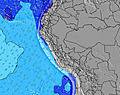 | 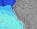 | 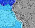 | 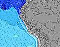 | 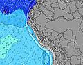 | 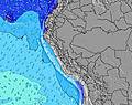 | 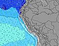 | |||||||||||||
Wave Height (m) Direction Period (s) | SSW 13 | SSW 17 | SSW 12 | SSW 15 | SSW 14 | SSW 13 | SSW 13 | SW 13 | SW 13 | SW 13 | SW 13 | SSW 13 | SSW 13 | SSW 12 | SSW 12 | SSW 12 | SSW 12 | SSW 12 | SW 12 | SSW 12 | SW 11 |
Wave Graph | |||||||||||||||||||||
528 | 351 | 393 | 334 | 799 | 454 | 350 | 711 | 647 | 679 | 711 | 784 | 772 | 668 | 534 | 419 | 365 | 488 | 718 | 835 | 411 | |
Wind (km/h) | |||||||||||||||||||||
Wind State on-shore cross-onshore cross-shore cross-offshore off-shore glassy | cross-on | cross-off | cross | cross | cross | cross | cross-on | cross | cross-on | cross-on | cross | cross-on | cross | cross | cross | cross | cross | cross | cross | cross | cross-on |
High Tide | 5:04AM1.01m | 4:21PM0.56m | 5:54AM1.06m | 5:22PM0.57m | 6:43AM1.09m | 6:21PM0.58m | 7:30AM1.08m | 7:21PM0.59m | 8:15AM1.04m | 8:22PM0.60m | 8:58AM0.97m | 9:26PM0.61m | 9:39AM0.88m | ||||||||
Low Tide | 9:45PM-0.01m | 11:41AM0.29m | 10:38PM-0.04m | 12:32PM0.26m | 11:29PM-0.05m | 1:22PM0.23m | 00:20AM-0.02m | 2:10PM0.21m | 1:10AM0.04m | 2:57PM0.20m | 2:02AM0.13m | 3:43PM0.20m | 2:56AM0.24m | ||||||||
— | — | 6:28 | — | — | 6:28 | — | — | 6:28 | — | — | 6:28 | — | — | 6:28 | — | — | 6:28 | — | — | 6:28 | |
5:57 | — | — | 5:57 | — | — | 5:58 | — | — | 5:58 | — | — | 5:58 | — | — | 5:58 | — | — | 5:59 | — | 5:59 | |
mm | — | — | — | — | — | — | — | — | — | — | — | — | — | — | — | — | — | — | — | — | — |
Temp °C | 19 | 18 | 19 | 19 | 17 | 19 | 20 | 18 | 19 | 19 | 18 | 19 | 19 | 18 | 19 | 19 | 18 | 19 | 19 | 18 | 19 |
Feels °C | 18 | 18 | 18 | 19 | 17 | 19 | 20 | 18 | 18 | 18 | 18 | 19 | 18 | 18 | 18 | 18 | 17 | 19 | 18 | 18 | 19 |
Swell 1 Height (m) Direction Period (s) | SSW 13 | SSW 13 | SSW 12 | SSW 15 | SSW 14 | SSW 13 | SSW 13 | SW 13 | SW 13 | SW 13 | SW 13 | SSW 13 | SSW 13 | SSW 12 | SSW 12 | SSW 12 | SSW 12 | SSW 12 | SW 12 | SSW 12 | SW 11 |
528 | 351 | 393 | 334 | 799 | 454 | 350 | 711 | 647 | 679 | 711 | 784 | 772 | 668 | 534 | 419 | 365 | 488 | 718 | 835 | 411 | |
Swell 2 Height (m) Direction Period (s) | S 7 | S 9 | SSW 15 | SSW 12 | W 13 | SW 16 | SW 14 | S 12 | W 12 | NW 12 | W 12 | SW 22 | SSW 16 | SW 20 | W 11 | SSW 18 | W 11 | SSW 16 | NW 10 | SSW 15 | S 6 |
51 | 85 | 372 | 180 | 3 | 287 | 317 | 180 | 3 | 6 | 3 | 18 | 51 | 16 | 2 | 33 | 2 | 25 | 4 | 86 | 66 | |
Swell 3 Height (m) Direction Period (s) | W 14 | SSW 17 | W 14 | S 8 | NW 13 | W 13 | WSW 9 | WSW 9 | — | SW 20 | — | — | SW 21 | W 11 | — | W 11 | SW 16 | NW 11 | — | SW 18 | SSW 13 |
4 | 313 | 4 | 66 | 7 | 3 | 8 | 7 | — | 16 | — | — | 17 | 2 | — | 2 | 10 | 4 | — | 12 | 70 | |
Wind waves Height (m) Direction Period (s) | — | — | — | — | — | — | — | — | — | — | — | — | S 7 | S 6 | S 6 | S 3 | S 4 | S 5 | S 6 | S 6 | — |
— | — | — | — | — | — | — | — | — | — | — | — | 8 | 7 | 7 | 3 | 15 | 29 | 58 | 83 | — | |
Nearest Offshore or Glassy | |||||||||||||||||||||
Distance (km) | 4 | 2 | 4 | 4 | 2 | 4 | 4 | 2 | 4 | 4 | 2 | 4 | 4 | 2 | 2 | 4 | 2 | 4 | 4 | 2 | 4 |
Best forecast wave conditions in Lima | |||||||||||||||||||||
Best forecast wave conditions in Peru | |||||||||||||||||||||
Header Global | |||||||||||||||||||||
- Map Icons:
 Break
Break Live Wave Height (m)
 Live Wind Speed (km/h)
 Surf Rating (10 Max)
 Ocean Swells (m)
- Wind Speed (km/h)


FREE! Surf-Forecast.com widget for your website
The surf report / weather widget below is available to embed on third party websites free of charge and provides a summary of our Laniakea surf forecast. Simply grab the html code snippet that we provide and paste it into your own site. You can choose your preferred language and metric/imperial units for the surf forecast feed to suit users of your site. Click here to get the code.
Information about the Laniakea Surf forecast
The above surf forecast table for Laniakea provides essential information for determining whether the surfing conditions will be good over the next 16 days. A general guide to surfing at Laniakea can be found by selecting the local surf guide option on the grey menu. Our Laniakea surf forecast is unique since it includes wave energy (power) that defines the real feel of the surf rather than just the height or the period. If you surf the same spot (Laniakea) regularly then make a mental note of the wave energy from the surf forecast table each time you go. Very soon you may start to choose your surf days based on the wave energy alone combined with our forecast of favourable offshore wind conditions. Our star ratings will help here and of course you will also find the usual wave height and period predictions on our surf forecasts as well as a full break down of the swell components under our advanced users option (to reveal that, click the little Einstein character under the tide times).
Further information to help with frequently asked questions about our surf forecast for Laniakea may be found under the help tab on the top menu and also by moving your mouse over the question marks on the surf forecast table itself. Please always bear in mind that the forecast is for near-shore open water and local factors at each surf break influence the actual breaking wave height, such as the beach / reef profile, water depths offshore and shelter.
Laniakea is 5 km (3 miles) from the city of Lima. If you plan a holiday in Lima, look for hotels and other accommodation in Lima. Lima has rooms for a wide range of budgets as well as car hire and transport links.
 Nearest