

Surf Forecasts:

Lakouvardos or Lagkouvardos surf forecast from 2 Aug 2026:
- Most powerful swell: Saturday 8 Aug, 3PM (local time) - 2.5ft (0.7m), 4s period, WNW swell with 13 kJ wave energy.
Best Forecast Surf Conditions for Lakouvardos or Lagkouvardos this week:
The most powerful waves expected at Lakouvardos or Lagkouvardos in the next 16 days are 0.7m 4s and forecast to arrive on Saturday (Aug 08) at 3PM. Winds are predicted to be cross-onshore at the time the swell arrives.
| Wave Type | Time (EEST) & Date | Wave Height & Period |
|---|---|---|
| Next good surf (1 star+) | - | - |
| Best Surf | - | - |
| Most Powerful | 3PM (Sat 8th Aug) | 2.5ft (0.7m) 4s |
Table - best surf conditions forecast for Lakouvardos or Lagkouvardos over the next 16 days.
The Lowdown
Alright folks, Rusty here. Let’s take a look at what’s on the cards for the next couple of weeks.
Honestly, I’m looking at a pretty quiet stretch ahead. The swell window is just not cooperating, and we’ve got a long gap with no real surf to speak of. The first proper recommendation doesn’t pop up until the 12th of August, so we’re looking at a solid week or more of flat, small, or just plain messy conditions. The early days are all about tiny, short-period windswell with lousy, choppy winds. Nothing to get excited about.
Water temps are sitting around 80°F at the start, which is a touch warmer than usual for this time of year, but nothing to write home about when there’s no waves to ride.
The one spot that offers a glimmer of hope is Lakouvardos or Lagkouvardos. It’s an exposed spot, but it’s inconsistent and better suited for beginners. The standout period looks like Wednesday the 12th of August, through the afternoon. We’ve got a moderate NW swell pushing in at 3ft from the NW, with a period of 6 seconds and a combined energy of 114 (moderate). The wind is a cross-onshore at 12 mph from the NW, which will put a bit of chop on the face, but it’s the best we’ll see. The swell direction is close to the optimum WSW, so it’ll wrap in okay. For a beginner, this is your window. Crowds are possible here, so be ready to share.
The next morning, the 13th, has a similar size but a bit less energy (41), and the wind is still cross-onshore, so it’s a secondary look. After that, it drops right back off. The 15th of August has a glassy morning with a tiny 2ft WNW swell, but the energy is weak (13) and the period is short (4 seconds). It’s clean, but small.
Overall, this is a lean run. If you’re a beginner and you’re desperate, pencil in the 12th. Otherwise, save your energy.
Rusty.
Short Range ForecastMostly dry. Warm (max 29°C on Tue morning, min 25°C on Sun night). Wind will be generally light. | Days 5-7 Weather SummaryMostly dry. Warm (max 29°C on Thu morning, min 25°C on Thu night). Wind will be generally light. | ||||||||||||||||||
Monday 3 | Tuesday 4 | Wednesday 5 | Thursday 6 | Friday 7 | Saturday 8 | ||||||||||||||
Night | AM | PM | Night | AM | PM | Night | AM | PM | Night | AM | PM | Night | AM | PM | Night | AM | PM | Night | |
Swell Height Map | 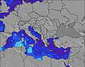 | 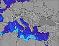 | 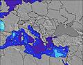 | 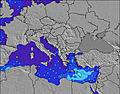 | 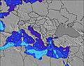 | 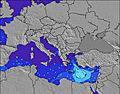 | 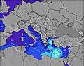 | ||||||||||||
Wave Height (m) Direction Period (s) | — | — | — | — | NW 3 | NW 3 | NW 3 | NW 3 | WNW 3 | WNW 4 | NW 4 | WNW 4 | WNW 4 | WNW 4 | WNW 3 | NW 4 | NW 4 | WNW 4 | WNW 4 |
Wave Graph | |||||||||||||||||||
0 | 0 | 0 | 0 | 2 | 5 | 4 | 4 | 7 | 5 | 7 | 8 | 5 | 3 | 6 | 2 | 2 | 13 | 11 | |
Wind (km/h) | |||||||||||||||||||
Wind State on-shore cross-onshore cross-shore cross-offshore off-shore glassy | cross | glassy | on | cross | cross | cross-on | cross | cross | cross-on | cross | cross | on | cross-on | cross-on | on | cross | cross | cross-on | cross-on |
High Tide | 7:20AM0.11m | 7:04PM0.11m | 8:00AM0.11m | 7:45PM0.09m | 8:55AM0.11m | 8:46PM0.08m | 10:08AM0.11m | 10:45PM0.07m | 11:52AM0.11m | 1:21AM0.07m | 1:16PM0.12m | 2:33AM0.08m | |||||||
Low Tide | 00:56AM0.01m | 1:14PM0.04m | 1:26AM0.02m | 2:06PM0.05m | 2:00AM0.03m | 3:22PM0.05m | 2:48AM0.04m | 5:29PM0.05m | 4:14AM0.05m | 7:30PM0.04m | 6:21AM0.05m | 8:29PM0.03m | |||||||
— | 6:39 | — | — | 6:39 | — | — | 6:41 | — | — | 6:41 | — | — | 6:43 | — | — | 6:43 | — | — | |
8:39 | — | 8:38 | — | — | 8:37 | — | — | 8:37 | — | — | 8:36 | — | — | 8:35 | — | — | 8:34 | — | |
mm | — | — | — | — | — | — | — | — | — | — | — | — | — | — | — | — | — | — | — |
Temp °C | 26 | 28 | 28 | 26 | 29 | 28 | 26 | 29 | 29 | 28 | 29 | 29 | 27 | 28 | 28 | 27 | 29 | 29 | 28 |
Feels °C | 28 | 27 | 28 | 27 | 27 | 28 | 28 | 28 | 29 | 30 | 28 | 30 | 30 | 28 | 28 | 30 | 30 | 30 | 30 |
Swell 1 Height (m) Direction Period (s) | — | — | — | — | — | — | — | — | — | — | WNW 4 | — | — | WNW 4 | — | WSW 4 | WSW 4 | — | — |
— | — | — | — | — | — | — | — | — | — | 5 | — | — | 3 | — | 1 | 1 | — | — | |
Swell 2 Height (m) Direction Period (s) | — | — | — | — | — | — | — | — | — | — | — | — | — | — | — | — | — | — | — |
— | — | — | — | — | — | — | — | — | — | — | — | — | — | — | — | — | — | — | |
Swell 3 Height (m) Direction Period (s) | — | — | — | — | — | — | — | — | — | — | — | — | — | — | — | — | — | — | — |
— | — | — | — | — | — | — | — | — | — | — | — | — | — | — | — | — | — | — | |
Wind waves Height (m) Direction Period (s) | — | — | — | — | NW 3 | NW 3 | NW 3 | NW 3 | WNW 3 | WNW 4 | NW 4 | WNW 4 | WNW 4 | — | WNW 3 | NW 4 | NW 4 | WNW 4 | WNW 4 |
— | — | — | — | 2 | 5 | 4 | 4 | 7 | 5 | 7 | 8 | 5 | — | 6 | 2 | 2 | 13 | 11 | |
Nearest Offshore or Glassy | |||||||||||||||||||
Distance (km) | 2162 | 2109 | 2071 | 2428 | 2076 | 2077 | 2424 | 1005 | 2071 | 2276 | 1003 | 2075 | 2168 | 1218 | 1185 | 2168 | 1185 | 1152 | 2459 |
Best forecast wave conditions in Pelloponisos | |||||||||||||||||||
Best forecast wave conditions in Greece | |||||||||||||||||||
Header Global | |||||||||||||||||||
- Map Icons:
 Break
Break Live Wave Height (m)
 Live Wind Speed (km/h)
 Surf Rating (10 Max)
 Ocean Swells (m)
- Wind Speed (km/h)
Latest Updates


FREE! Surf-Forecast.com widget for your website
The surf report / weather widget below is available to embed on third party websites free of charge and provides a summary of our Lakouvardos or Lagkouvardos surf forecast. Simply grab the html code snippet that we provide and paste it into your own site. You can choose your preferred language and metric/imperial units for the surf forecast feed to suit users of your site. Click here to get the code.
Information about the Lakouvardos or Lagkouvardos Surf forecast
The above surf forecast table for Lakouvardos or Lagkouvardos provides essential information for determining whether the surfing conditions will be good over the next 16 days. A general guide to surfing at Lakouvardos or Lagkouvardos can be found by selecting the local surf guide option on the grey menu. Our Lakouvardos or Lagkouvardos surf forecast is unique since it includes wave energy (power) that defines the real feel of the surf rather than just the height or the period. If you surf the same spot (Lakouvardos or Lagkouvardos) regularly then make a mental note of the wave energy from the surf forecast table each time you go. Very soon you may start to choose your surf days based on the wave energy alone combined with our forecast of favourable offshore wind conditions. Our star ratings will help here and of course you will also find the usual wave height and period predictions on our surf forecasts as well as a full break down of the swell components under our advanced users option (to reveal that, click the little Einstein character under the tide times).
Further information to help with frequently asked questions about our surf forecast for Lakouvardos or Lagkouvardos may be found under the help tab on the top menu and also by moving your mouse over the question marks on the surf forecast table itself. Please always bear in mind that the forecast is for near-shore open water and local factors at each surf break influence the actual breaking wave height, such as the beach / reef profile, water depths offshore and shelter.
Are you planning a holiday in Pelloponisos? If you are looking for accommodation near Lakouvardos or Lagouvardos, camping, hotels and holiday cottages in Pelloponisos, consider staying in Pylos which is 23 km (14 miles) away. Other places in and around Pelloponisos where you can find information about places to rent, and car hire include Kalamaki which is 35 km (22 miles) away, Kalamata, Andhritsaina and Katakolon.
 Nearest