

Surf Forecasts:

How big are the waves at Dunes today (25 Jul):
- Afternoon surf: Afternoon surf (25 Jul, local time) - 3ft (0.9m), 21s period with SW swell.
- Evening surf: Evening surf (25 Jul, local time) - 3.5ft (1.1m), 19s period with SW swell.
The current surf forecast for Dunes at 7PM is: 1.0m 20s primary swell from a Southwest direction and 0.9m 7s secondary swell from a West-northwest direction (forecast issued at 04:00pm July 25). The wind direction is predicted to be cross-onshore.
| Time (PDT) & Date | Wave Height | Wave Period |
|---|---|---|
| Morning (25 Jul) | - | - |
| Afternoon (25 Jul) | 3ft (0.9m) | 21s |
| Evening (25 Jul) | 3.5ft (1.1m) | 19s |
Table - waves today at Dunes. (Swell directed towards the surf break)
Short Range ForecastMostly dry. Warm (max 25°C on Sun afternoon, min 20°C on Sat night). Wind will be generally light. | ||||||||||||||||||||
Sat 25 | Sunday 26 | Monday 27 | ||||||||||||||||||
2 PM | 5 PM | 8 PM | 11 PM | 2 AM | 5 AM | 8 AM | 11 AM | 2 PM | 5 PM | 8 PM | 11 PM | 2 AM | 5 AM | 8 AM | 11 AM | 2 PM | 5 PM | 8 PM | 11 PM | |
Swell Height Map |  |  |  |  |  |  |  | 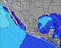 | ||||||||||||
Wave Height (m) Direction Period (s) | SW 21 | SW 20 | SW 20 | SW 19 | SW 19 | SW 19 | SSW 19 | SW 19 | SW 18 | SW 18 | SW 18 | SW 18 | SW 18 | SSW 18 | SSW 18 | SSW 18 | SSW 18 | SW 16 | SSW 16 | SSW 17 |
Wave Graph | ||||||||||||||||||||
652 | 569 | 872 | 1100 | 1100 | 1100 | 1004 | 855 | 777 | 926 | 915 | 915 | 915 | 1044 | 1044 | 1199 | 1199 | 602 | 717 | 859 | |
Wind (km/h) | ||||||||||||||||||||
Wind State on-shore cross-onshore cross-shore cross-offshore off-shore glassy | on | cross-on | cross-on | cross | cross | glassy | glassy | on | on | on | glassy | glassy | glassy | glassy | cross-on | cross-on | on | on | glassy | glassy |
High Tide | 7:06PM2.01m | 9:19AM1.44m | 7:45PM2.09m | 9:44AM1.48m | 8:21PM2.16m | |||||||||||||||
Low Tide | 12:48PM1.19m | 2:37AM0.30m | 1:31PM1.14m | 3:08AM0.23m | 2:09PM1.08m | |||||||||||||||
— | — | — | — | — | 5:58 | — | — | — | — | — | — | — | 5:58 | — | — | — | — | — | — | |
— | 7:50 | — | — | — | — | — | — | — | 7:49 | — | — | — | — | — | — | — | 7:47 | — | — | |
mm | — | — | — | — | — | — | — | — | — | — | — | — | — | — | — | — | — | — | — | — |
Temp °C | 24 | 23 | 21 | 22 | 21 | 20 | 22 | 24 | 25 | 24 | 21 | 21 | 21 | 21 | 22 | 25 | 25 | 24 | 22 | 21 |
Feels °C | 25 | 24 | 23 | 23 | 23 | 22 | 24 | 25 | 27 | 25 | 23 | 23 | 23 | 23 | 24 | 26 | 25 | 25 | 24 | 22 |
Swell 1 Height (m) Direction Period (s) | WNW 7 | SW 20 | SW 20 | SW 19 | SW 19 | SW 19 | SSW 19 | SW 19 | SW 18 | SW 18 | SW 18 | SW 18 | SW 18 | SSW 18 | SSW 18 | SSW 18 | SSW 18 | WNW 8 | SSW 16 | SSW 17 |
89 | 569 | 872 | 1100 | 1100 | 1100 | 1004 | 855 | 777 | 926 | 915 | 915 | 915 | 1044 | 1044 | 1199 | 1199 | 146 | 717 | 859 | |
Swell 2 Height (m) Direction Period (s) | SW 21 | WNW 7 | WNW 7 | WNW 7 | WNW 7 | WNW 8 | WNW 8 | WNW 7 | WNW 8 | WNW 8 | WNW 8 | WNW 8 | WNW 8 | WNW 8 | WNW 8 | WNW 8 | WNW 8 | SW 16 | WNW 8 | WNW 8 |
652 | 70 | 68 | 68 | 78 | 83 | 58 | 73 | 99 | 102 | 110 | 113 | 89 | 87 | 85 | 107 | 146 | 602 | 149 | 146 | |
Swell 3 Height (m) Direction Period (s) | S 10 | S 10 | SSW 12 | SSW 12 | S 12 | SSW 9 | SSW 11 | S 10 | SSW 11 | SSW 11 | S 9 | SSW 11 | SSW 11 | SSE 9 | SSE 9 | S 9 | S 9 | SSW 19 | SSW 20 | SSW 12 |
47 | 48 | 107 | 107 | 99 | 26 | 71 | 18 | 47 | 24 | 26 | 47 | 48 | 17 | 17 | 15 | 14 | 329 | 151 | 13 | |
Wind waves Height (m) Direction Period (s) | — | — | — | — | — | — | — | — | — | — | — | — | — | — | — | — | — | — | — | — |
— | — | — | — | — | — | — | — | — | — | — | — | — | — | — | — | — | — | — | — | |
Nearest Offshore or Glassy | ||||||||||||||||||||
Distance (km) | 234 | 69 | 17 | 20 | 20 | 0 | 0 | 90 | 374 | 69 | 0 | 0 | 0 | 0 | 21 | 21 | 21 | 292 | 0 | 0 |
Best forecast wave conditions in Baja Norte | ||||||||||||||||||||
Best forecast wave conditions in Mexico | ||||||||||||||||||||
Header Global | ||||||||||||||||||||
- Map Icons:
 Break
Break Live Wave Height (m)
 Live Wind Speed (km/h)
 Surf Rating (10 Max)
 Ocean Swells (m)
- Wind Speed (km/h)


FREE! Surf-Forecast.com widget for your website
The surf report / weather widget below is available to embed on third party websites free of charge and provides a summary of our Dunes surf forecast. Simply grab the html code snippet that we provide and paste it into your own site. You can choose your preferred language and metric/imperial units for the surf forecast feed to suit users of your site. Click here to get the code.
 Nearest